Skip to Content
Streetsblog Los Angeles home
Log In
bicycle lanes

Central L.A. Bike Lane Update: 6th St., Ave.19, Union Station, and Missed Opportunity on N. Spring

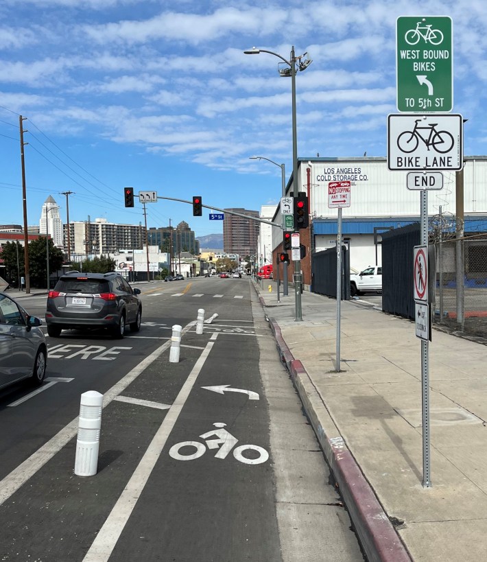
New protected bike lane on 6th Street in downtown L.A. Photos by Joe Linton/Streetsblog

LongBeachize_Ad_Concepts
This article is supported by Los Angeles Bicycle Attorney as part of a general sponsorship package. All opinions in the article are that of the author and do not necessarily reflect those of LABA. Click on the ad for more information.

Streetsblog brings you brief updates on three new bikeways and one missed opportunity.

Sixth Street Bridge connection in Skid Row and Arts District

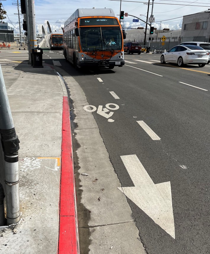
In recent months, the city Transportation Department (LADOT) completed connections between the new Sixth Street Viaduct and the 5th and 6th Streets protected bike lane couplet.
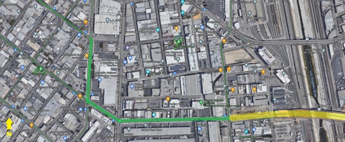
New 6th Street bike lanes (green) connect to the recently opened Sixth Street Viaduct (yellow)

The connection is mostly conventional unprotected bike lanes on 6th Street, but also includes a couple of new blocks of protected bikeway on 6th and on Central Avenue (and one block of one-way sharrows at a pinch point - eastbound on 6th between Mill Street and Mateo Street).
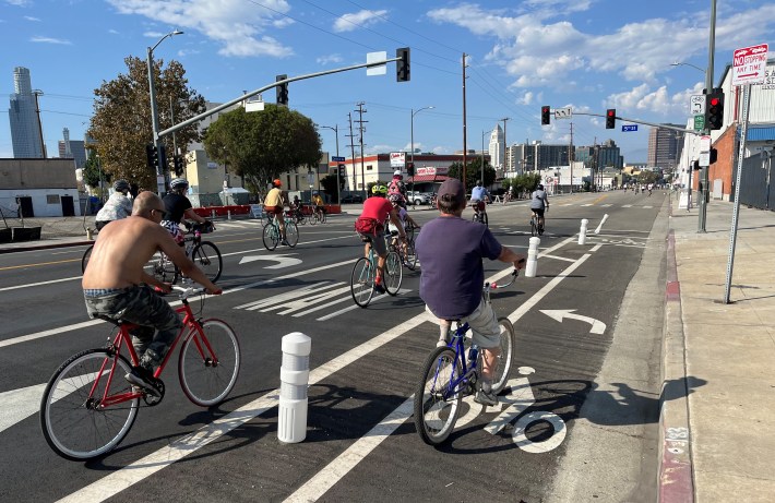
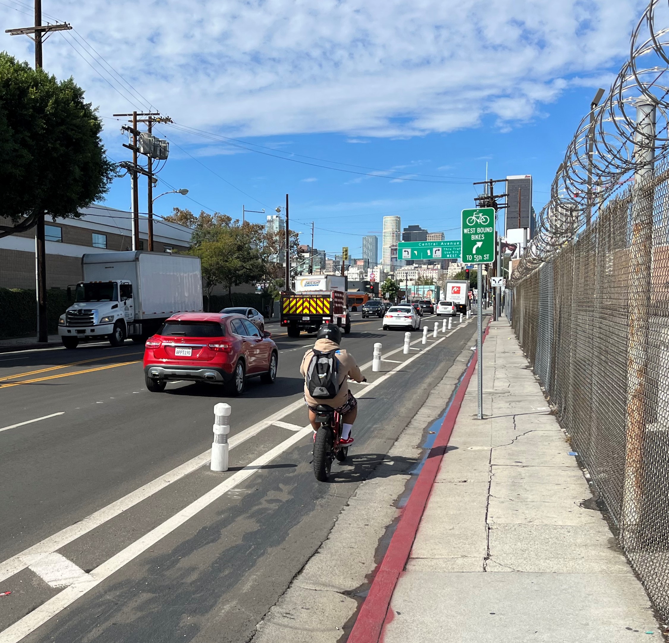
New Central Avenue protected bike lane during October's Heart of L.A. CicLAvia
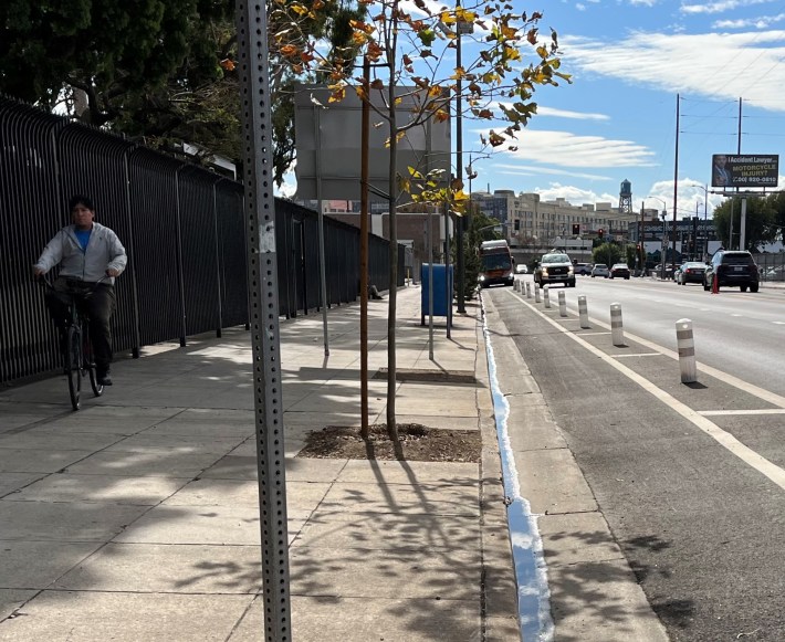
Some cyclists still feel safer riding on the sidewalk, compared to plastic post protection
On Central Avenue, some cyclists still choose riding on the sidewalk, compared to plastic post protection in the street
Some cyclists still feel safer riding on the sidewalk, compared to plastic post protection
On Central Avenue, bikeway signage to get cyclists onto the 5th/6th one-way couplet
New bike lane on 6th Street, with new viaduct in the background

Ramirez Street/Center Street/Santa Fe Avenue in Arts District

Twitter's @multimodalLA spotted preliminary markings for new bike lanes on Santa Fe Avenue, Center Street and Ramirez Street. This has long been a fairly quiet route used by cyclists to get from Union Station into downtown, avoiding heavily trafficked Alameda Street in front of the station.

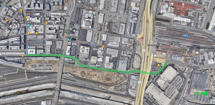
Ramirez-Center-Santa Fe bikeway aerial

The new bikeway will extend about two thirds of a mile - from the back of Union Station to the 4th Street bike lanes which connect into downtown via the recently extended 3rd Street bike lanes. Addendum 11/9/2022 - The Ramirez/Center/Santa Fe lanes are done - and extend past what SBLA originally noted. They extend south, past 4th Street to Mateo Street.
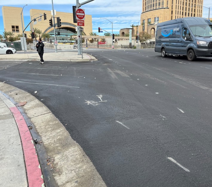
Preliminary bike lane markings on Ramirez Street, directly behind Union Station
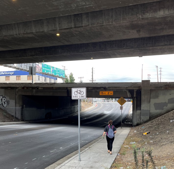
The relatively quiet Ramirez Street crosses under the 101 Freeway. Preliminary bike lane markings and new bike lane sign visible.
The relatively quiet Ramirez Street crosses under the 101 Freeway and El Monte Busway. Preliminary bike lane markings and new bike lane sign visible.
The relatively quiet Ramirez Street crosses under the 101 Freeway. Preliminary bike lane markings and new bike lane sign visible.
Bike lanes (preliminary markings visible) continue on Center Street, which really needs a sidewalk on the left. On the right is Metro construction for the Division 20 Portal Widening and Turnback Facility Project, and new emergency operations center.
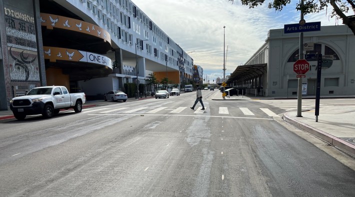
Ramirez/Center/Santa Fe bikeway ends at 4th Street, next to SCI-Arc (Southern CA Institute of Architecture) and One Santa Fe.
Ramirez/Center/Santa Fe bikeway (preliminary marking in foreground) ends at 4th Street, next to SCI-Arc (Southern CA Institute of Architecture) and One Santa Fe.
Ramirez/Center/Santa Fe bikeway ends at 4th Street, next to SCI-Arc (Southern CA Institute of Architecture) and One Santa Fe.

Avenue 19 in Lincoln Heights

LADOT and the Bureau of Street Services (StreetsLA) recently announced (for the second time) that they will implement the long-overdue Avenue 19 bikeway. Avenue 19 is an important place to connect the all-ages L.A. River bike/walk path to L.A. State Historic Park. Avenue 19 is part of Mayor Eric Garcetti's BLAST initiative (Bike Lane Acceleration and Safety Team).
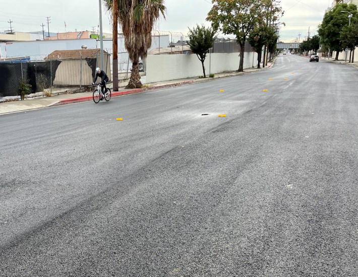
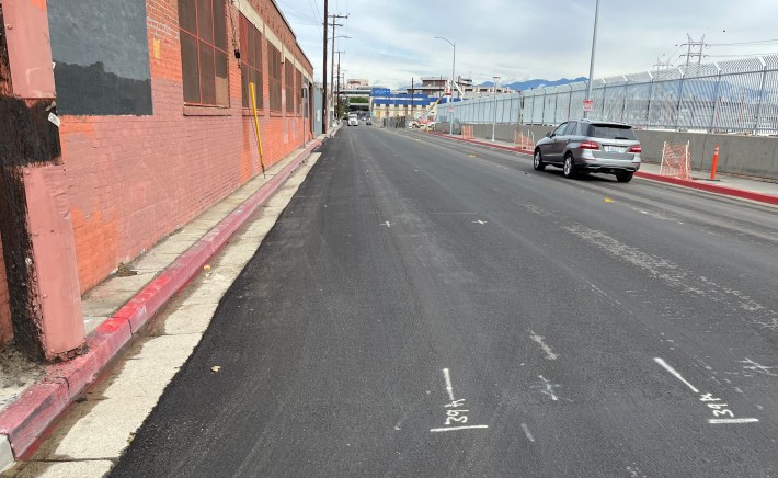
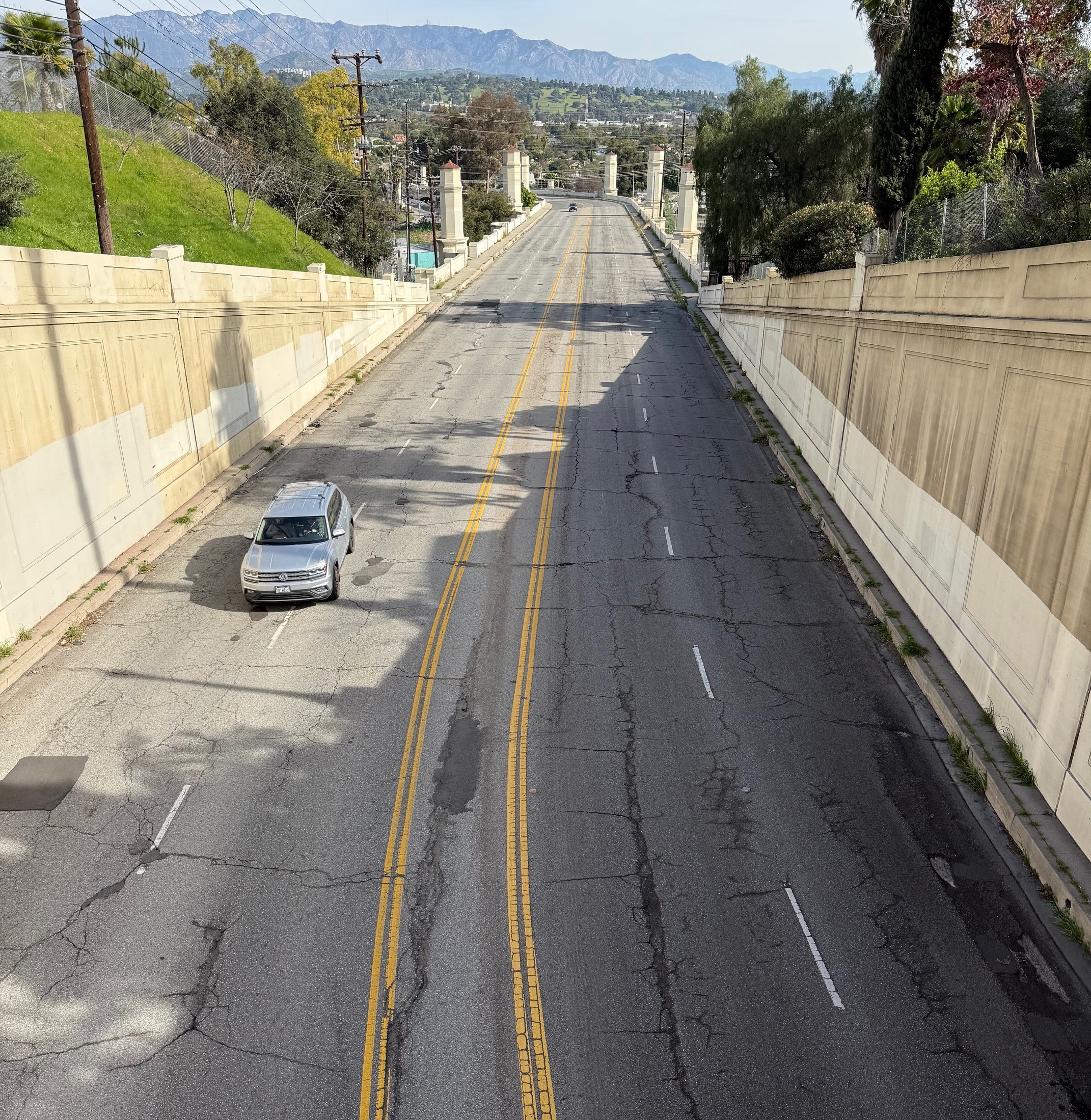
Avenue 19 was recently repaved, including next to the old Lincoln Heights Jail

In the past few days, StreetsLA repaved Avenue 19 between the Arroyo Seco confluence and Pasadena Avenue, so some kind of bikeway should be coming there very soon. Hopefully it will be the two-way protected bikeway that Streetsblog recommends there. Don't bet on it.
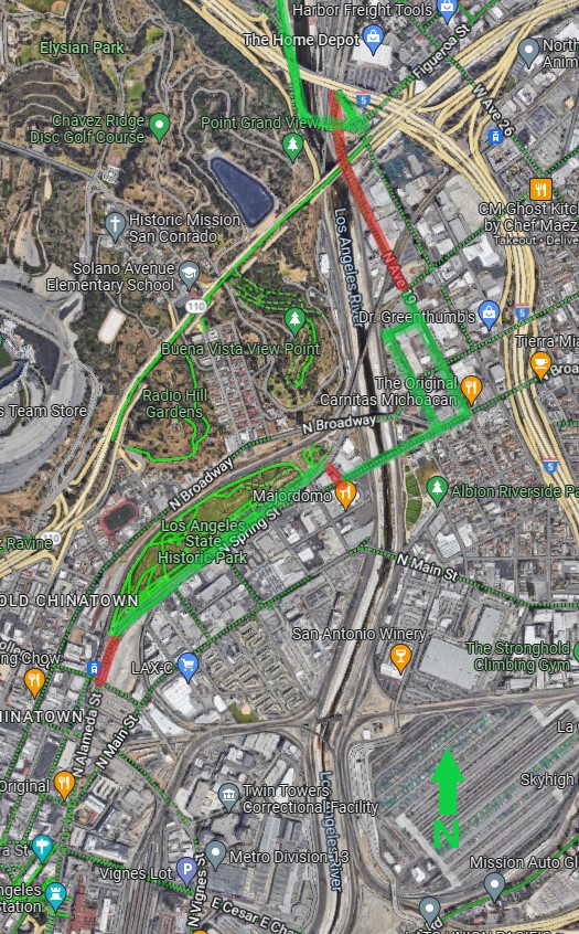
Avenue 19 and N. Spring Street are key connections to bring the river path into downtown Los Angeles. Existing bikeways are green; gaps are red.

North Spring Street in Chinatown

When Metro built the Gold Line (now the L Line) twenty years ago, the city of L.A. forced the project to include widening the street in front of the Chinatown Station. (Two decades later, Metro and L.A. are still doing wrongheaded road widening at stations and in most of the city, but that's another story. And, no, L.A. Times and Steve Lopez, these widenings have never had anything to do with bike lanes or even sidewalks - they are all for car capacity.) North Spring Street was widened from four lanes to six lanes, right in front of the station. Really.

In 2015, the city of L.A. approved its multimodal Mobility Plan 2035, which designates this part of N. Spring to receive bike lanes. North Spring (along with Avenue 19 above) is another key network connection for bringing the River bike path into downtown. Cyclists using the path in front of L.A. State Historic Park should have an on-street connection at least to nearby Chinatown Station, preferably further into Union Station.

In the past couple of weeks the StreetsLA resurfaced Spring, which would have been a good time to add those approved bike lanes. That implementation would be required under Healthy Streets L.A. (or even the alternative version pushed by disgraced former Councilmember Nury Martinez). But the city decided to ignore its own approved plans and just re-striped the same old car-centric configuration. The street is more than 80 feet wide but the city can't find space for anything other than driving.
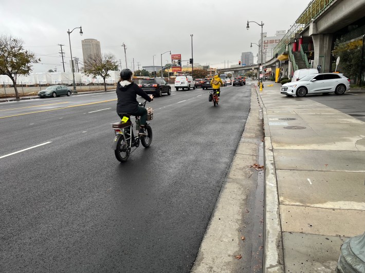
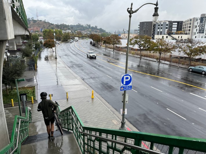
StreetsLA recently repaved N. Spring Street in Chinatown
Just north of the Chinatown Station, N. Spring Street widens to six car lanes, plus parking. The street is more than 80 feet wide and the city can't seem to find an inch to support the safety of bicyclists.
Just north of the Chinatown Station, N. Spring Street widens to six car lanes, plus parking. Despite being approved in 2015, there are no bike lanes.
Just north of the Chinatown Station, N. Spring Street widens to six car lanes, plus parking. The street is more than 80 feet wide and the city can't seem to find an inch to support the safety of bicyclists.

The good news is that, starting this December, Councilmember-Elect Eunisses Hernandez takes office, sending bike-hostile and scandal-ridden councilmember Gil Cedillo packing. N. Spring is one street where Hernandez can center people instead of just drivers.

Thanks to @multimodalLA on Twitter for tipping SBLA off to this story.
Stay in touch

Sign up for our free newsletter

More from Streetsblog Los Angeles

Metro Updates: 25 Months of Ridership Growth, and More

Metro ridership is growing steadily, plus Metro 605/5/10/60/105 Freeway expansion, Metro Micro, bus electrification, C Line, and Metro wildfire response

January 18, 2025

SGV Connect 132: A Fond Farewell to Melanie Curry

This week’s SGV Connect Podcast features the entire Streetsblog in California team saying goodbye to the Streetsblog California editor, Melanie Curry, as she heads into retirement.

January 16, 2025
See all posts