Skip to Content
Streetsblog Los Angeles home
Log In
Bicycle Boulevards

Eyes on the Street: Santa Monica’s New Michigan Avenue Greenway Extension

The 1/8-mile-long Michigan Avenue Neighborhood Greenway (MANGo) extension includes two short bike/walk paths and one block of two-way protected bike lanes

Santa Monica’s new MANGo extension walkway/bikeway. Photos by Joe Linton

The city of Santa Monica's 20th Street Bike and Pedestrian Improvements Project opened about a month ago. Today, Streetsblog got a chance to bike there and take photos.

City map of 20th Street bike/ped improvements project

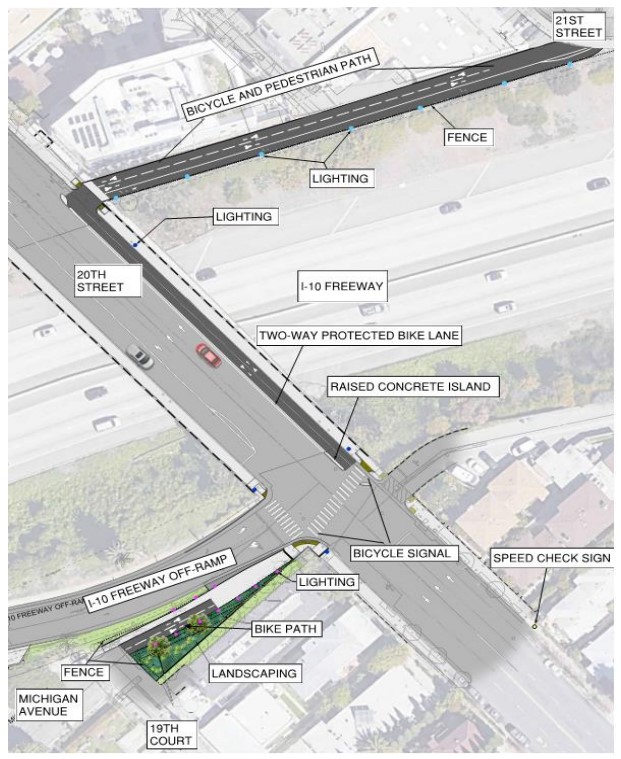
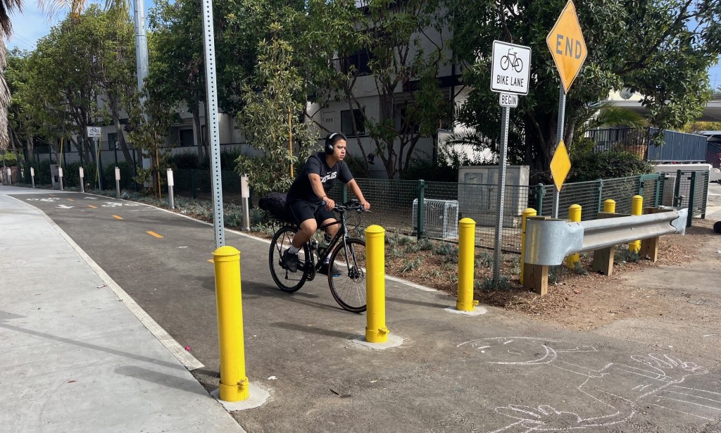
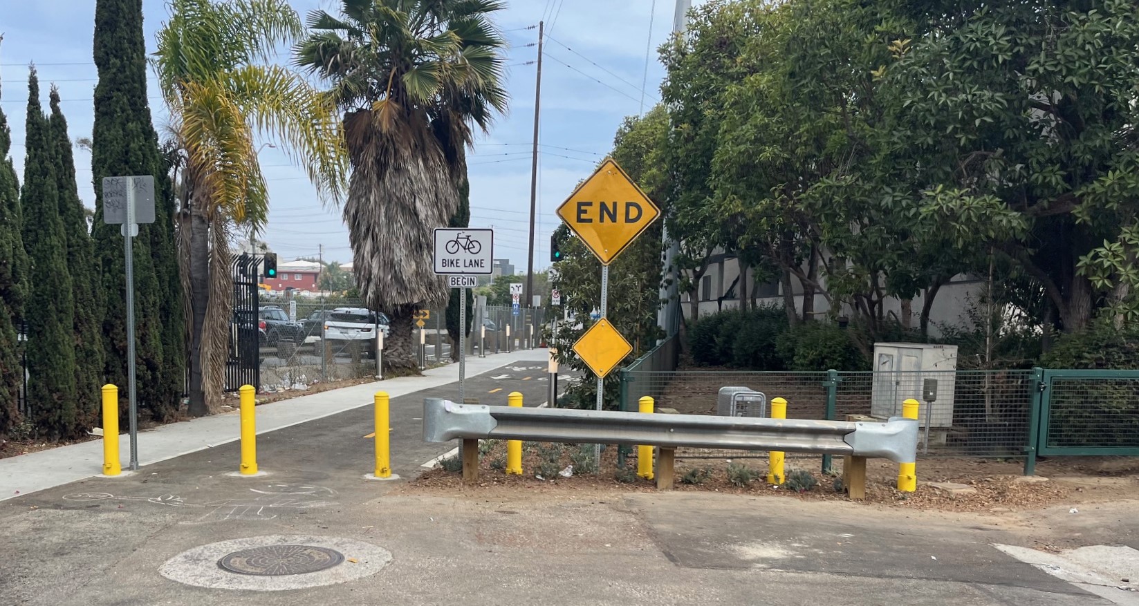
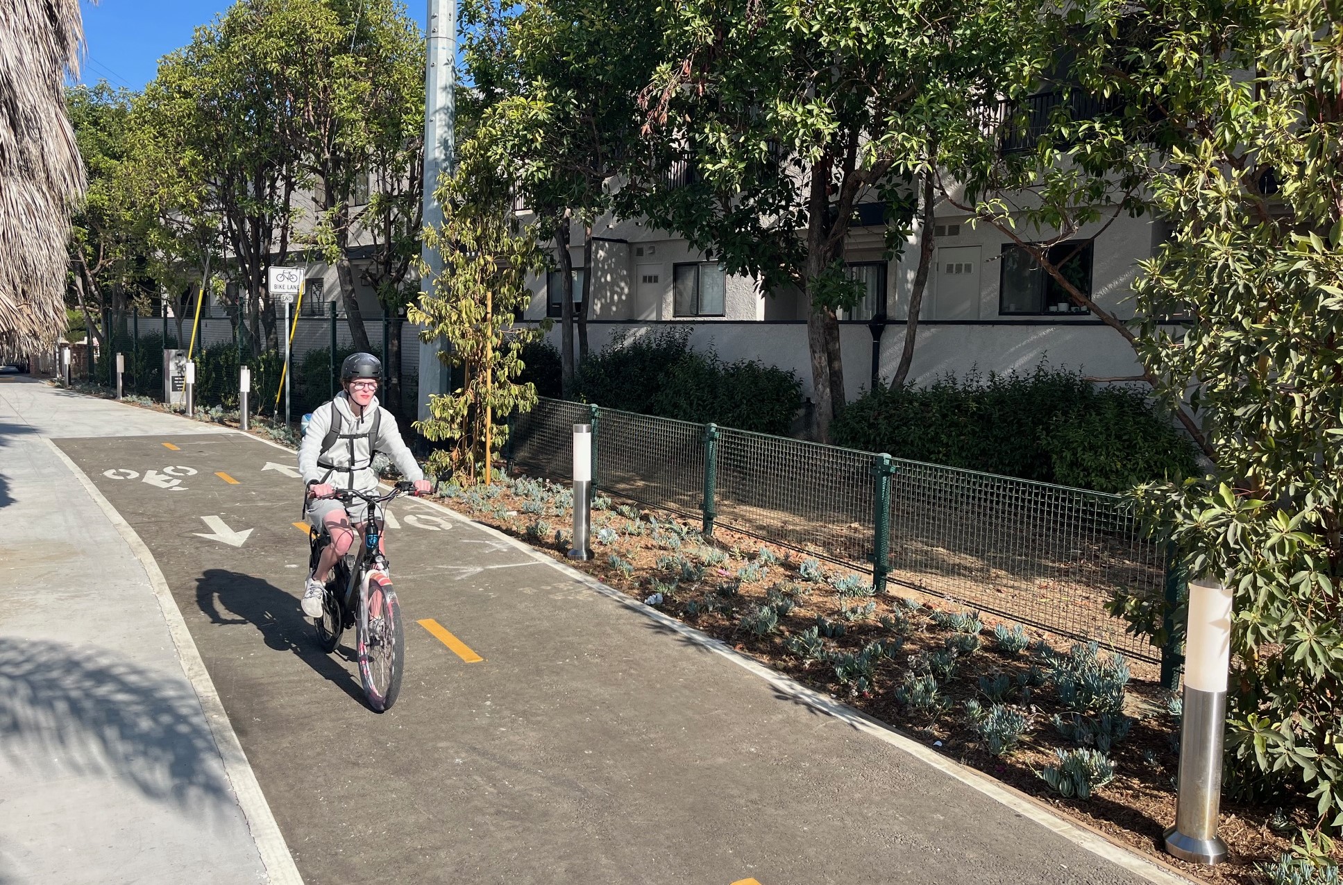
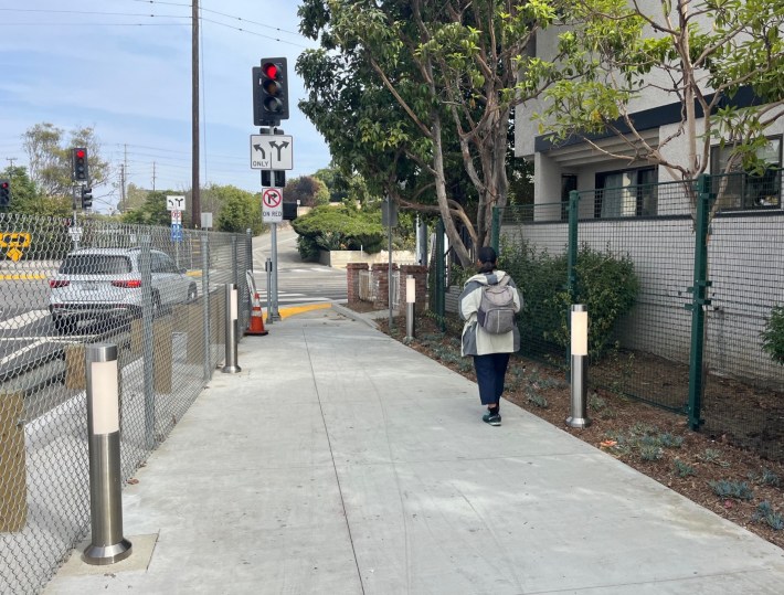
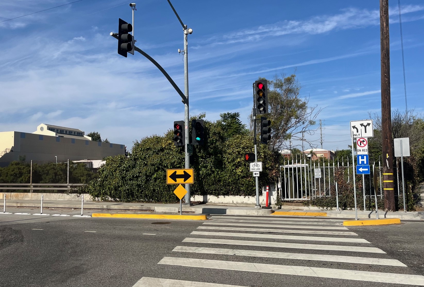
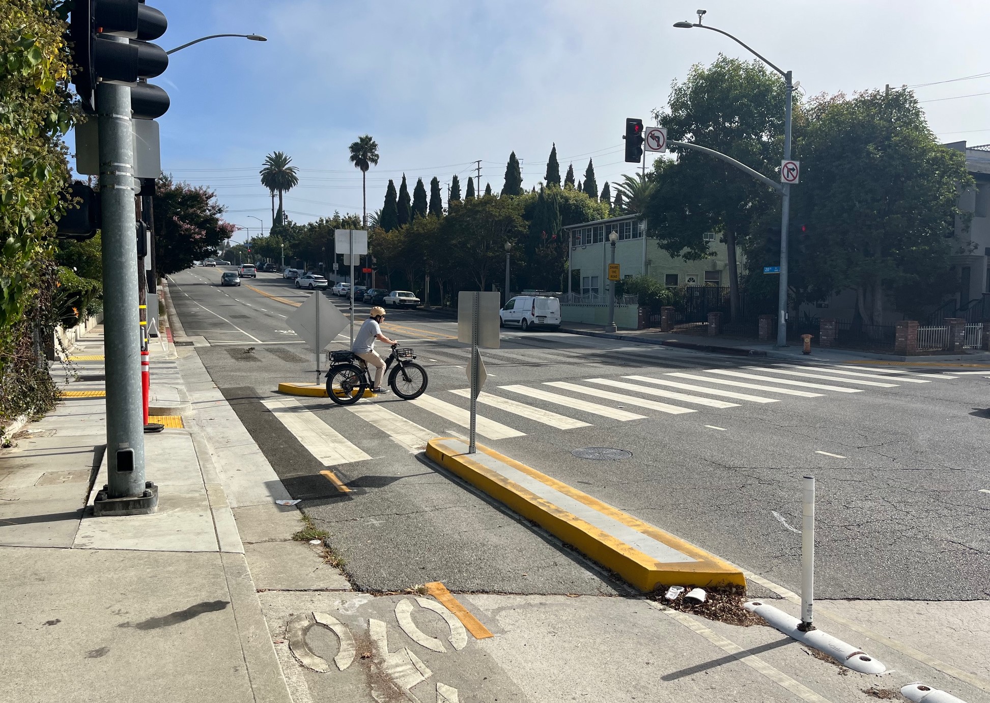
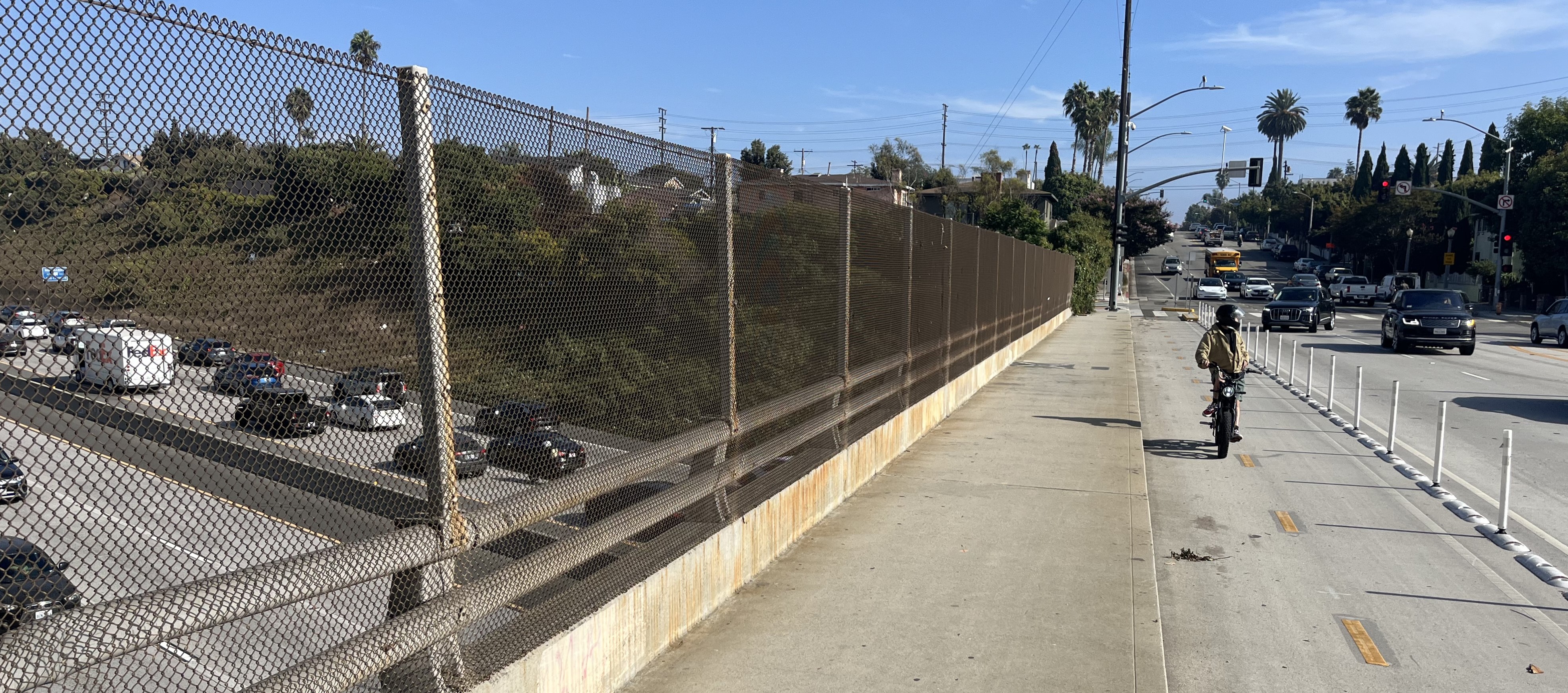
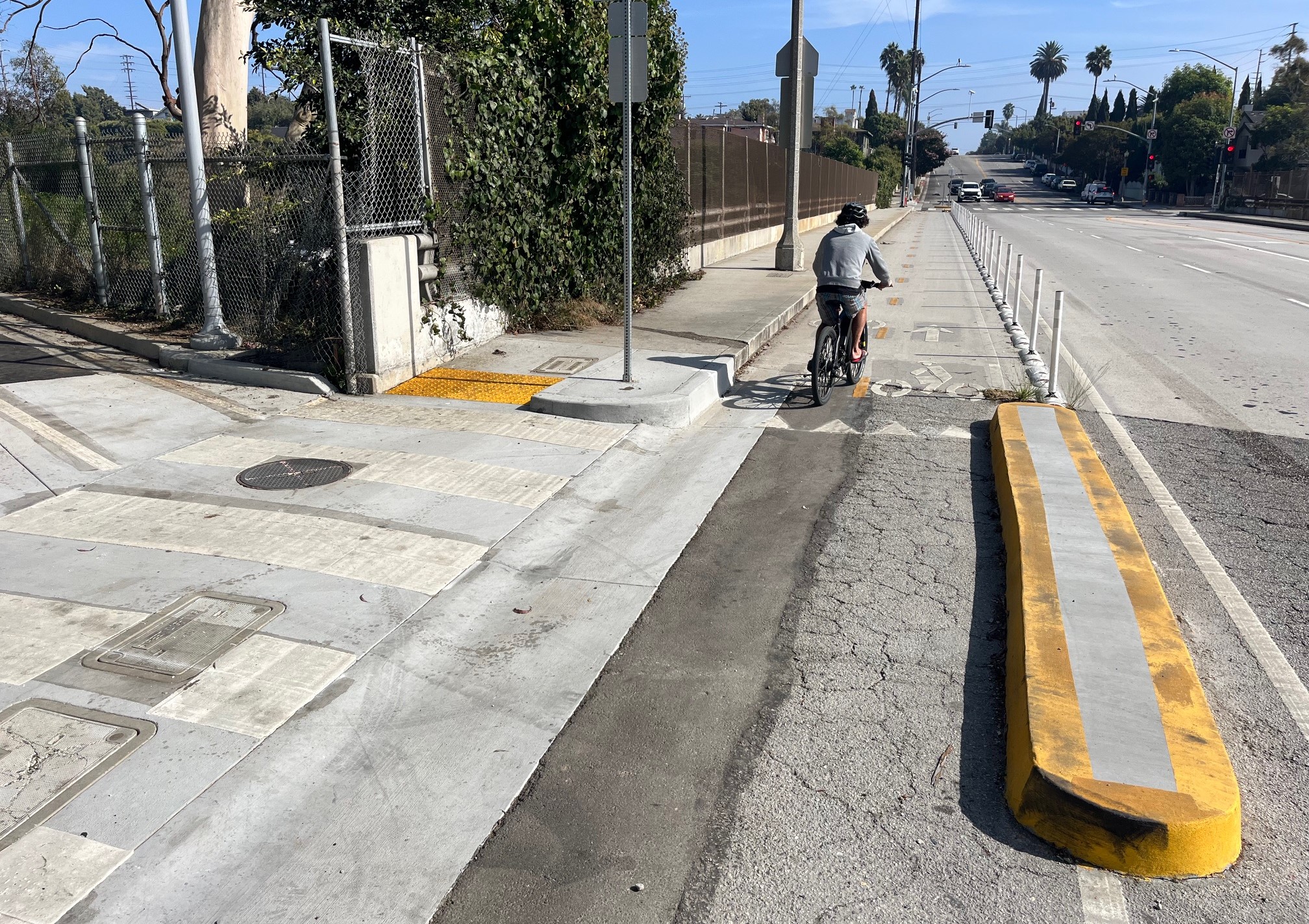
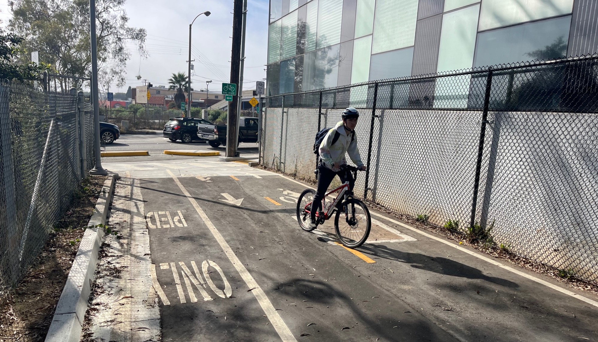
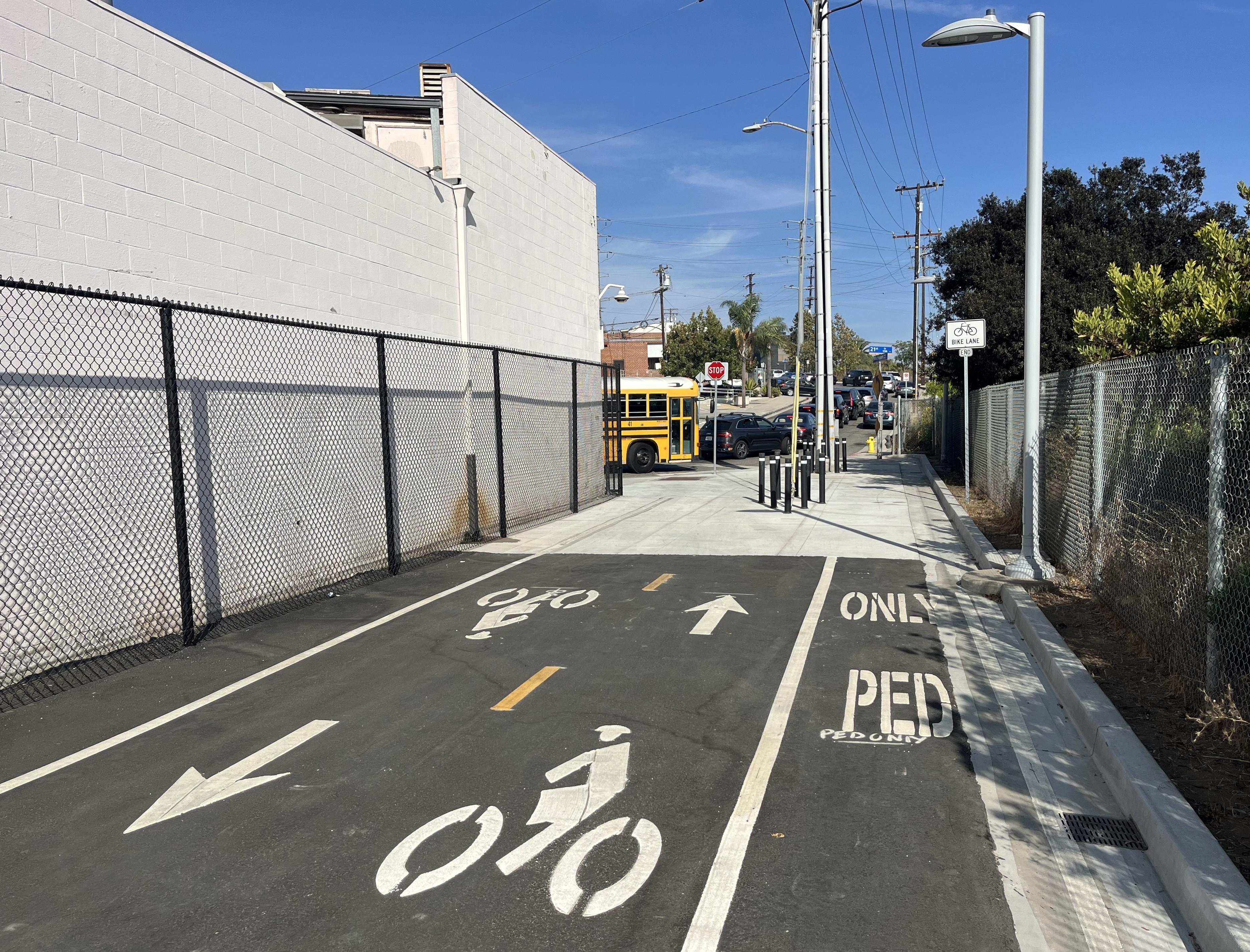
The 1/8-mile-long Z-shaped facility is an extension of the city's Michigan Avenue Neighborhood Greenway, called MANGo. The project includes two short bike/walk paths and one block of two-way protected bike lanes.

The new bike/walk facility is smart and strategic, aptly extending an existing low stress bikeway across a barrier - the 10 Freeway. The design and execution are very good, though the proximity to the freeway and its off-ramps means that the area remains full of car traffic. It can be a pretty loud place, especially for people on foot or on bike waiting for the light to cross 20th Street.

Below is a photo tour of the project from west to east.

The west entrance to the 20th Street bikeway/walkway at the end of Michigan Avenue
At this end the city improved a very basic walkway, adding a short bike path (about 70 feet long), lighting and landscaping. The asphalt two-way bike path runs alongside a concrete walkway.
The facility narrows near 20th, where cyclists and pedestrians briefly share the sidewalk
Pedestrians and cyclists cross 20th at a signalized crosswalk. It's difficult to make out in this photo, but the green light near the center is a bike signal.
The facility includes a block of protected two-way bike lanes along 20th, with concrete curbs at each end
The protected bike lanes along 20th Street cross the 10 Freeway
Immediately north of the freeway, the facility turns east
The east end of the facility is a roughly 320-foot-long bike/walk path running between Crossroads schools and the 10 Freeway
The bikeway/walkway currently ends at Michigan and 21st Street, about half a mile ride or walk to the E Line Bergamot/26th Station

Find more MANGo project information at SBLA coverage last November and in April.

Stay in touch

Sign up for our free newsletter

More from Streetsblog Los Angeles

Pasadena Seeks Input for Transit Service Overhaul

Several lines could be condensed on the north side of town, a new line is proposed from Huntington Hospital to JPL, and Dial-A-Ride could give same day service.

March 17, 2026

Tuesday’s Headlines

Record heat, Santa Monica, LAX people mover, Culver City, westside bus lanes, K Line, Griffith Park, MacArthur Park, car-nage and more.

March 17, 2026

This Week In Livable Streets

Metro NoHo-Pasadena BRT meeting in Burbank tonight, Westside safety project meetings, Metro board committees, SGV bike rides, and more.

March 16, 2026

Eyes on the Street: Short New Protected Bike Lane on Pacific Avenue

Installed as part of Downtown Long Beach's Resa mixed-use development, the northbound protected bike lane extends for one block, immediately south of the Metro A Line Pacific Avenue Station

March 16, 2026

Monday’s Headlines

ICE, record heat, LAPD, Pasadena 710 plans, Long Beach parklet, carpool cheat, Seal Beach e-biker injures ped, car-nage, gas prices, and more

March 16, 2026

Rosemead Creates Subcommittee on Bus Rapid Transit with Neighboring Cities

After a contentious city council meeting, the motion passed.

March 13, 2026
See all posts