Eyes on the Street: Santa Monica Extending Michigan Greenway
Construction is well underway on Santa Monica’s 20th Street Bike and Pedestrian Improvements project, which is extending the city’s Michigan Avenue Neighborhood Greenway (MANGo) eastward a couple blocks, including getting it over the 10 Freeway.
The small Z-shaped project includes two short stretches of bike path connected by a block of two-way protected bikeway. Construction got underway last June and is expected to be complete next March.
Neighborhood greenways, sometimes called bike boulevards, are streets shared by people in cars, on foot and on bike – with features to calm traffic in order to prioritize safe and convenient walking and bicycling.
According to Santa Monica Spoke Director Cynthia Rose, this new MANGo extension has been more than ten years in the making, initially dreamed up by cyclists, then made a reality the city.
“It took a tremendous amount of inter-agency work, plus the cooperation of property owners” noted Rose, “it could not have been more bureaucratic.” In the end though, Rose expressed that she’s “ecstatic the project is reaching fruition.”
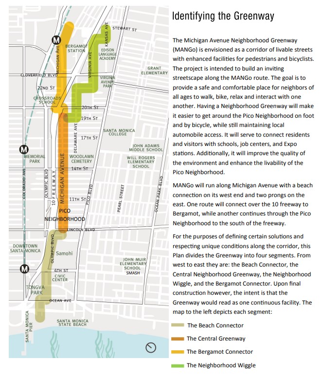
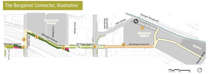
The city’s MANGo concept plan includes a greenway/bikeway west to the beach, and east via two forks: Bergamot Connector (to the Metro 26th Street/Bergamot E Line Station) and Neighborhood Wiggle (to Stewart Street).
An initial “Central Greenway” phase of Santa Monica’s MANGo opened in 2015. Michigan was already a fairly quiet street. Ambitious early proposals were scaled back due to resistance from, according to Rose, mainly one vocal neighbor. To date, the MANGo project calmed traffic a bit by installing a half-dozen small traffic circles, plus some modest bulb-outs/curb extensions.
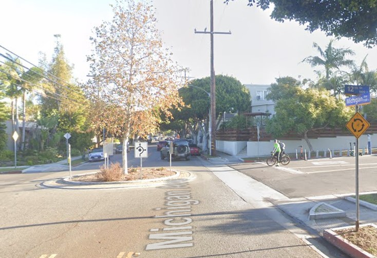
MANGo currently connects to bike lanes along Santa Monica High School connecting across Pico Boulevard. The middle of the greenway intersects the curb-protected bikeway on 17th Street that opened this year. (That project added a few new MANGo features, mainly two traffic circles.)
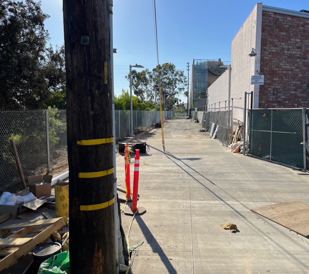
The under construction 20th Street project is only about 700 feet (about a tenth of a mile) of bikeway. Though it’s not a long distance, it makes significant connections. The new bikeway gets MANGo across the 10 Freeway, connecting it to Crossroads schools, and getting cyclists within a couple blocks of the Metro Station.
Here’s a run-through of the project from west to east.
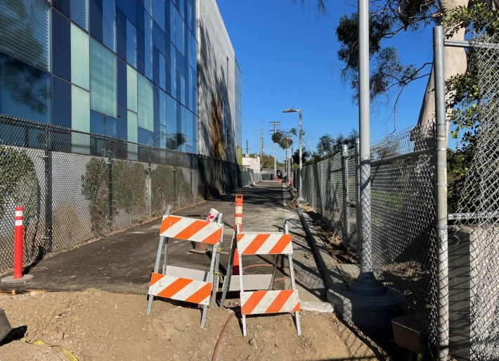
The west end of the project is located at a small triangular parcel immediately south of the 20th Street freeway off-ramp. People on foot or bike could already pass along the triangle via a narrow existing walkway. According to Rose, the triangle was and is owned by the city, but it had been fenced off by an adjacent property owner.
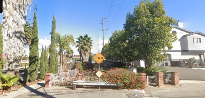
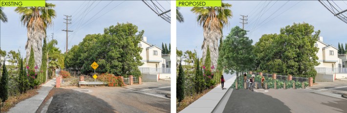
The city worked with the neighbors and with Caltrans (owner of the 10 Freeway including its ramps) to reconfigure the space to include a wider walkway and bike path (about 150 feet long) as well as landscaping, lighting, and new fences.
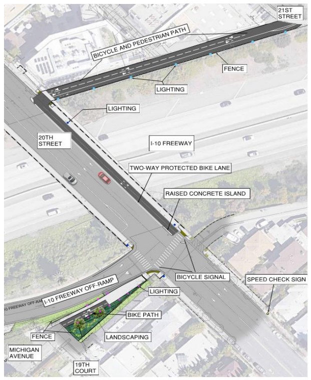
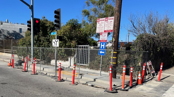
From there, eastbound cyclists will cross 20th Street at the existing crosswalk, then travel north on a new two-way protected bikeway, along the sidewalk on the bridge.
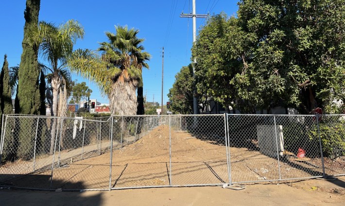
After crossing the 10 Freeway, eastbound cyclists will turn right onto another short stretch (about 400 feet) of bike path along the freeway, between 20th and 21st Streets.
Rose explained that this stretch was even more difficult, as it straddles two owners. About half of the right-of-way belongs to Caltrans (it was formerly a fenced-off small concrete drainage channel). The other half belongs to Crossroads school. When Crossroads approached the city to permit campus remodeling, the city required the school to dedicate a sliver of land for the future path, which will serve students arriving by bike.
The city cobbled together the Caltrans land and the school land (much more difficult than it sounds) to obtain a dozen-foot-wide right-of-way that is now a walk/bike path under construction.
The east end of the new bikeway will be at 21st Street and Michigan. At that point, cyclists are at Crossroads schools, and only a couple low-traffic blocks away from the Metro station and the Expo bike path.
The city has conceptual designs to continue further east on Michigan.
Santa Monica’s 20th Street project isn’t long or expensive, but it is very strategic bike infrastructure that closes a gap, crosses a bridge, and builds a network. The city was smart, strategic, and patient in planning and executing this project.
Rose and Santa Monica Spoke applaud all the parties that collaborated to get this bikeway built, especially the city, Caltrans, and the adjacent property owners.
Post updated on November 2 to include city rendering and refined expected completion date.

Streetsblog has migrated to a new comment system. New commenters can register directly in the comments section of any article. Returning commenters: your previous comments and display name have been preserved, but you'll need to reclaim your account by clicking "Forgot your password?" on the sign-in form, entering your email, and following the verification link to set a new password — this is required because passwords could not be carried over during the migration. For questions, contact tips@streetsblog.org.