Puente Hills Landfill Park has been a “dream project” for Megan Horn, principal at Studio-MLA.
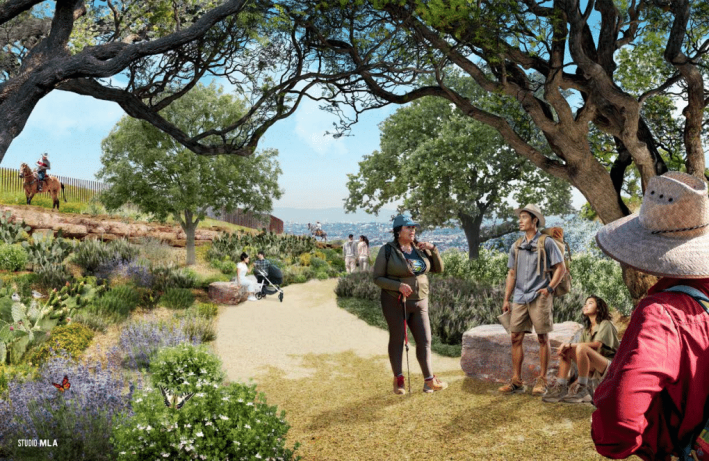
“The design itself is really this nice combination of big, wide, open space with these small interventions,” says Horn. “And that's part of the narrative we're trying to tell is that nature and the city can coexist and really create something beautiful for the community.”
But this park isn’t just Horn’s dream. It enjoys robust county support as Supervisor Hilda Solis’ major legacy project. Puente Hills Landfill Park will be L.A. County’s first new regional park in decades, providing much needed greening in the La Puente Valley, which has a legacy of industrial contamination.
The immediate area is home mostly to working class Latinos and Asian Americans living in what Metro terms "Equity Focus Communities." These neighborhoods are beset upon by poor air quality, industrial land use, and emissions from the 60 and 605 Freeways, Valley Boulevard, and Union Pacific Railroad. Despite all of this, many residents retain a version of the region's historic agrarian way of life, with the few nearby parks used heavily.
The Puente Hills Landfill Today
The roughly 1,300-acre Puente Hills Landfill site is located along the southern edge of the San Gabriel Valley, just southeast of the Whittier Narrows Recreation Area (close to the 60/605 Freeways interchange). Rio Hondo College and Rose Hills Memorial Park (the largest cemetery in North America) are adjacent, immediately south of the landfill site.
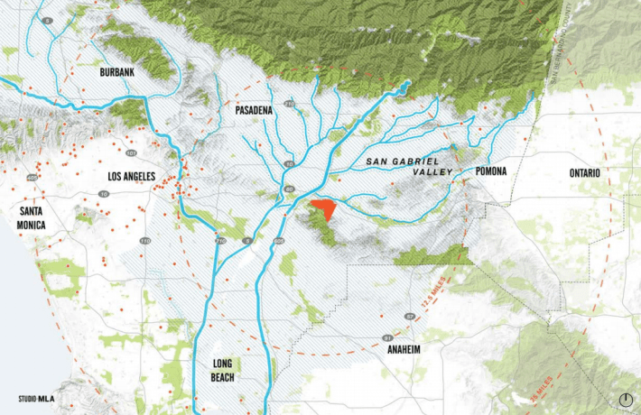
The Puente Hills Landfill was the second largest landfill in the United States. It operated from 1957 to 2013 and is storing 150 million tons of garbage. But Streetsblog didn’t smell or see any walking around the site last week. The top layer of soil is seven to fourteen feet deep, and the L.A. County Sanitation District remains on site to monitor for any issues, including any cracks that would need to be capped.
Much of the present landfill site is vegetated terraced slopes, which the Sanitation District irrigates to keep the top layer intact.
There are also lots of surface clues as to what is beneath.
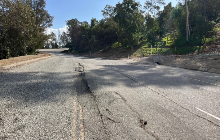
There are extensive irrigation pipes and concrete drainage channels. Many of the repeatedly repaired paved roads are bumpy and uneven due to settling ground. There is also a nearly ubiquitous system of large pipes that collect off-gassing methane, feeding it to a small power plant onsite, where it is converted to energy.
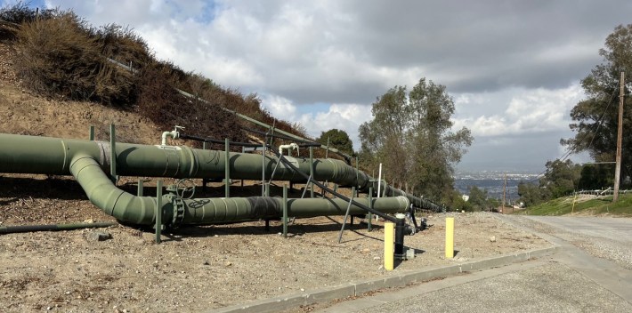
In 75+years, the park is expected to extend to those then-settled slopes, but for now, the initial phases will focus on about 142 acres, some near the entrance (see below) and most at the top.
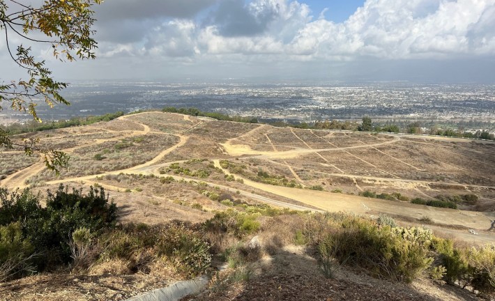
And the top is spectacular. The views are amazing.

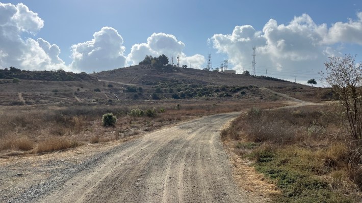
Despite the fact that Nike Hill - the peak of the landfill and a former rocket test pad - is frequented by plenty of hikers, Horn says “some people don't even know this is here.”
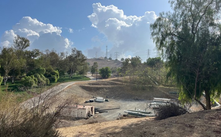
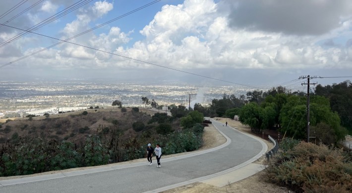
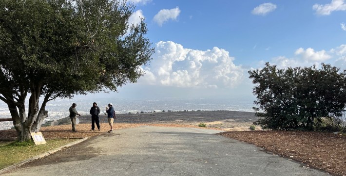
“All of our community outreach has really been site-focused, and getting people out here so they can kind of see the opportunity and just realize that these are just things in the landscape that are required.” says Horn. “It helps that the site's already publicly accessible.” (See access instructions below)
Standing atop Nike Hill, the park’s potential is easy to see, and it should fit well with the Puente area’s make-the-best-of-what-you’ve-got ethos.
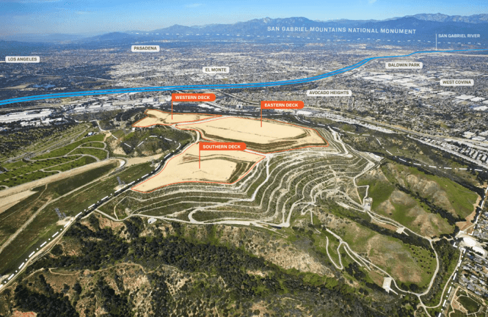
The upper portion of the landfill site, north and east of Nike Hill's peak, has three relatively flat "deck" areas, comprising more than a hundred acres.
Future Puente Hills Landfill Park Plans
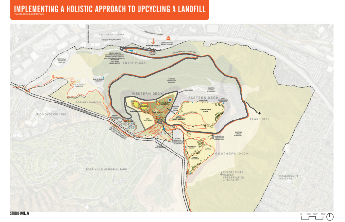
The park will be divided into three decks uphill, and an Environmental Justice Center below. These will be connected by a loop road and multi-use trail.
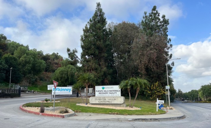
Located just inside the Crossroads Parkway entrance will be a new ~15,000-square-foot building housing the park's Environmental Justice Center which will serve as a Visitors Center.
The EJ Center will feature classrooms, a maker space, raptor rescue, solar panels, rotating exhibits, and a podcast studio. Permanent displays will educate visitors on community advocacy, the waste stream, and redlining.
The EJ Center location, called the Entry Plaza, is an existing non-fill area that is already paved and previously served as a weigh station for trucks.
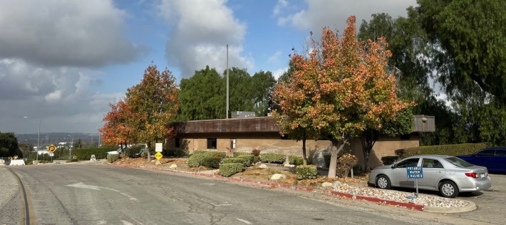
The Entry Plaza site will include car parking and a shuttle stop. Visitors will connect to the rest of the park via a shuttle, walk/bike trails, or drive on the park loop road.
More detailed EJ Center plans are expected to be made public in January.
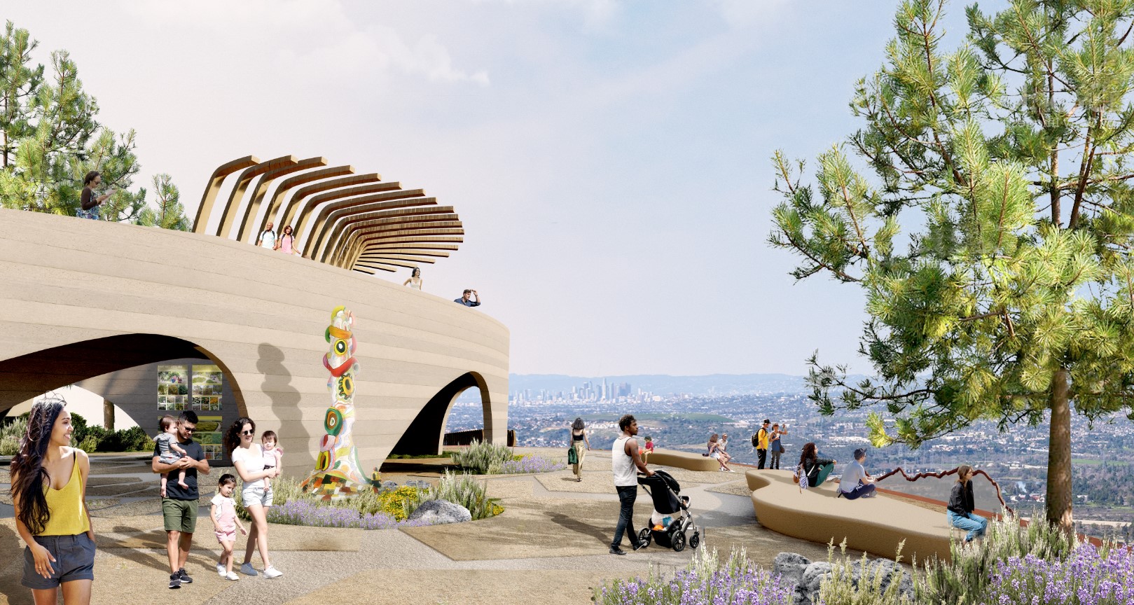
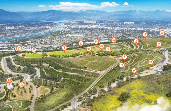
From the plaza, visitors can proceed up to the large park at the top of the hill, which (as shown above) spreads out over three existing flat 'decks.'
The “Western Deck” is the 40-acre centerpiece of the project. This “chihuahua head” shaped area will be the only section of the park to have any substantial installations, as the ground here is more settled than in other areas.
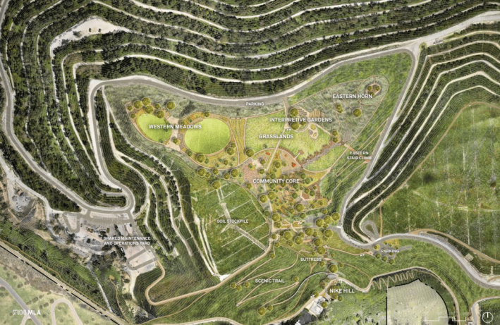
The Western Deck will include playgrounds, interpretive gardens, oak groves, meadows, slides for all ages, a running loop, a bike skills course, an amphitheater, a “ceremonial space,” and the fully ADA-compliant “skywalk” – a rattlesnake/freeway inspired elevated walking path.
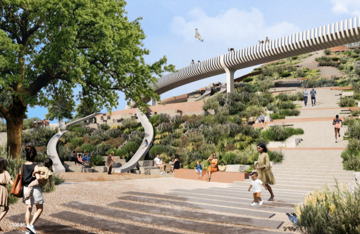
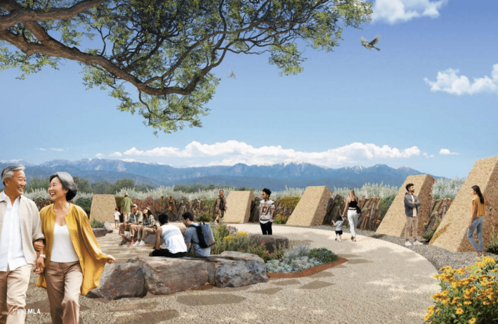
The Eastern and Southern Decks are later phases. These will be large nature park spaces, including trails for pedestrians, cyclists, and equestrians. Plans also call for a native plant nursery, a bird observation outlook, and plenty of coastal sage scrub.
The Southern Deck and Nike Hill are located along the existing 29-mile Schabarum-Skyline Trail which connects to Schabarum Park and Turnbull Canyon.
Park construction is being split into a few phases, which still somewhat in flux:
- The EJ Center and Entry Plaza are phase 1A of the project. Construction for this phase is expected to begin in Spring 2025 and finish in 2026.
- Phase 1B will most likely be the loop road, Nike Hill, and some portion of the Western Deck.
- Phase 1C will likely finish remaining deck park spaces
Note that phases 1A-1C combined will take up roughly ten percent of the landfill’s entire area. Additional future phasing is anticipated for “enhancing and broadening up other areas of the landfill,” says Waqas Rehman, Director of Infrastructure and Economic Development for Supervisor Solis.
The county has already secured $134 million dollars to fund the project, with an application pending for $20 million more from the Environmental Protection Agency. The full phase 1 price tag is estimated at $200 million.
“We feel very confident with what we have in the bank right now that we can build a significant portion of what the community envisioned as part of that first phase,” says Horn. “We want to keep that design intact. So right now, it's about phasing it and not pulling anything out. If we're unsuccessful, we may change and just have more big open space and less built stuff.”
There will only be one vehicular entrance on Crossroads Parkway, but Rehman tells SBLA that efforts are underway to bolster multimodal access through bike lanes and transit connections.
“This is going to rival some of our other large parks in the area, and it's exciting that it's here,” says Horn. “I also think it's great leadership from the county to be converting these sorts of sites into open space, particularly in the areas where people need it - where they lack open space.”
For more park plans, renderings, and ways to stay informed, visit the Puente Hills Landfill Park website.
How to Get There Today
Today there are two ways to access the upper portions of the Puente Hills Landfill site, called Nike Hill. The panoramic views are highly recommended, especially on clear days. Go see it for yourself. Really.
For the shortest route, start at the Schabarum-Skyline Trailhead at 3301 Workman Mill Road (near the intersection with Peck Road). The trailhead is next to Rio Hondo College, served by Metro, Foothill and Norwalk buses. It's a one-mile bike ride (on Peck Road) from the San Gabriel River bike path. It also features a good sized unpaved parking area.
From the trailhead, walk uphill about two miles to summit Nike Hill.

The Schabarum-Skyline Trail continues south, then east. To access from the south/southeast/east, it's a longer hike that starts anywhere along the Schabarum trail, including about a three mile hike starting up Turnbull Canyon from Whittier.
Streetsblog’s San Gabriel Valley coverage is supported by Foothill Transit, offering car-free travel throughout the San Gabriel Valley with connections to the Gold Line Stations across the Foothills and Commuter Express lines traveling into the heart of downtown L.A. To plan your trip, visit Foothill Transit. “Foothill Transit. Going Good Places.”
Sign-up for our SGV Connect Newsletter, coming to your inbox on Fridays!
