SGV Hikes and Bikes: Turnbull Canyon
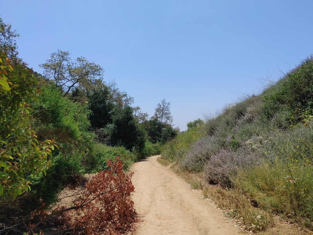
Turnbull Canyon is a hot spot for downhill cycling and drifting. It also has tons of urban legends associated with it. We, however, enjoy it for its network of trails and sweeping views… regardless of whether it’s a gate to hell.
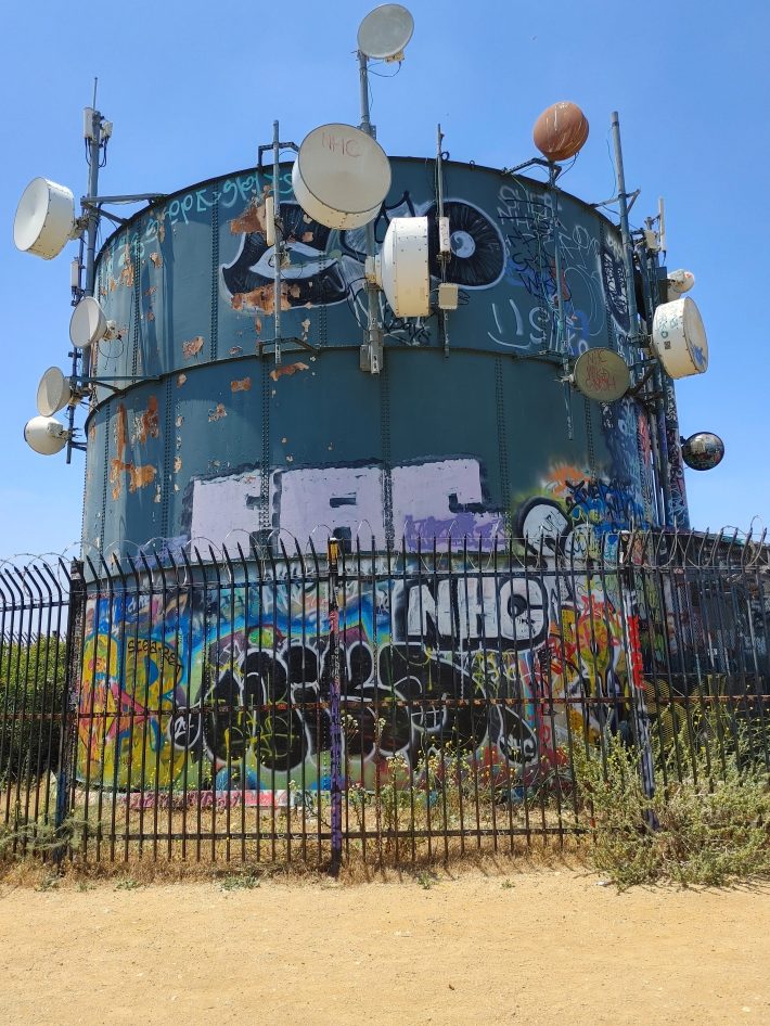
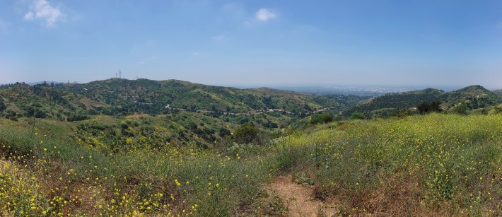
With Lucifer’s favorite (?) canyon in full bloom, now’s the time to go. There are multiple trailheads leading in around the Puente Hills: Hacienda Hills, Puma, Skyline Drive, Sycamore Canyon, Hellman Park, the Fire Roads (Skyline and Rose Hills) and the Elderberry Trail. Any of these starting points could connect you to the peak with its splendid 360 degree vista and cool graffiti-covered water tower.
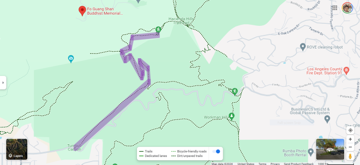
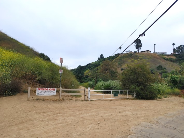
For our purposes, let’s just begin at the main entrance on Turnbull Canyon Road near Beverly Hills Road, which is in northeast Whittier 90601. From here we’ll only come across three forks in the path and about four steep inclines. This four mile loop should take no more than an hour each way.
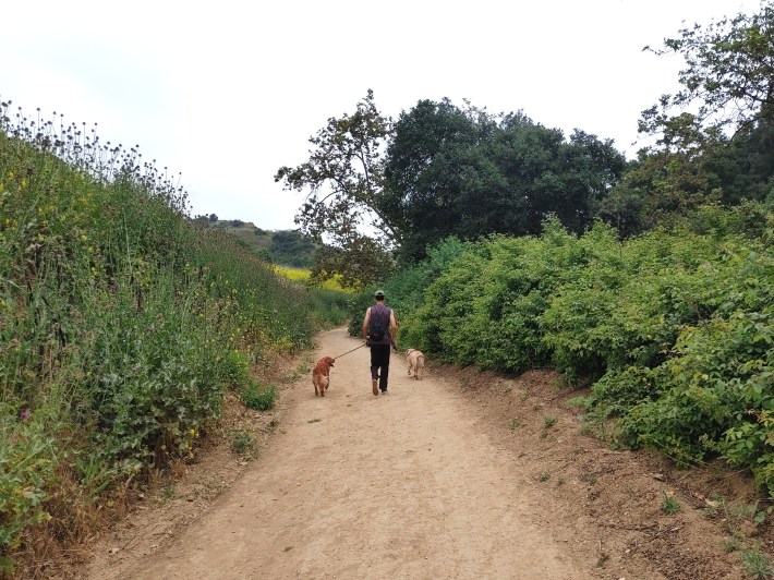
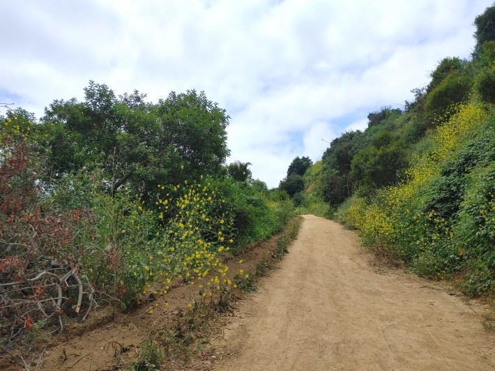
The first leg of the trail is about 3000-or-so feet of straight away with a very slight incline. Note that when SBLA last visited, we sighted a rattlesnake on the side of the trail here, so be aware.
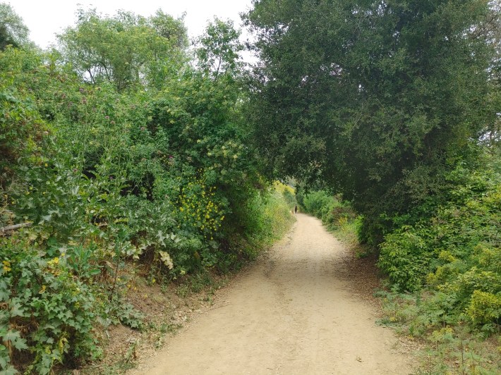
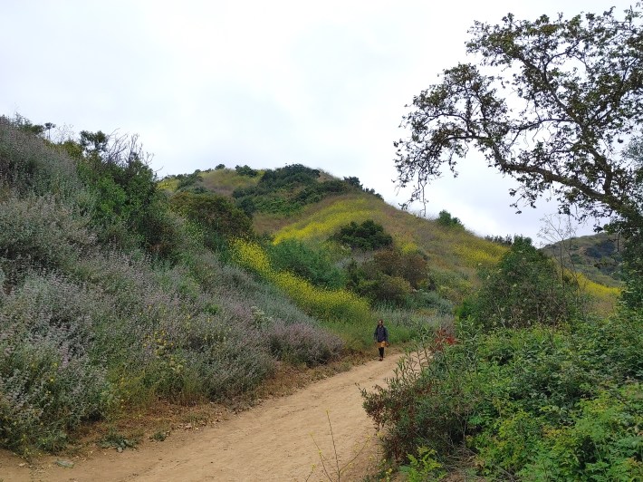
You’ll come across a fork to the right which continues the Turnbull Canyon Trail. Going that way, you’ll find a fairly well maintained uphill mountain bike path with great jumps for the way back down. Staying straight at the fork – as we did – you’ll find yourself on the Sumac Trail, heading steeper uphill through a few switchbacks and a rough concretized section.
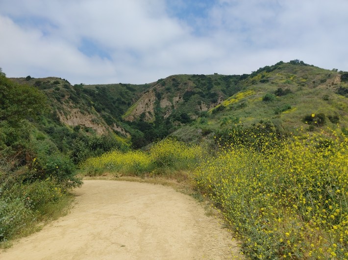
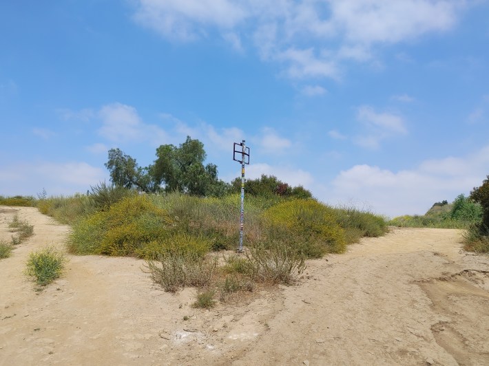
After a bit less than a mile, you’ll find yourself at this fork. Listen to the creepy whispering voice on the wind, and go right.
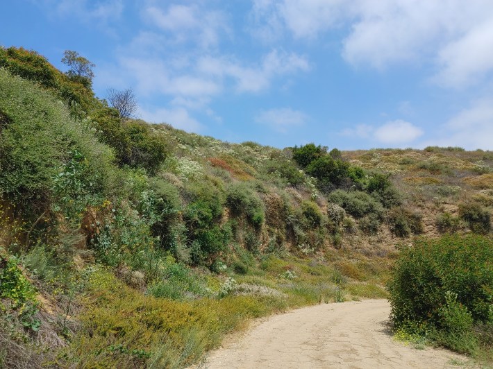
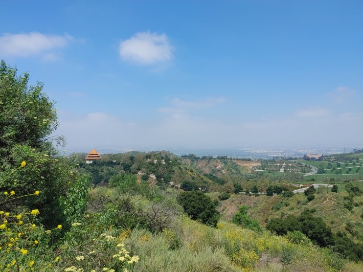
At this point you’ll be on Rose Hills No. 1 Fire Road. This too forks. To the right, it’s steeper, but a shorter distance to the water tower, some 2000 feet. Along this last leg of the hike, you’ll have an impressive view of the massive Rose Hills Cemetery from the back side, including the iconic pagoda of the Fo Guang Shan Buddhist Memorial. Be careful going up these last few inclines, they’re gravelly.
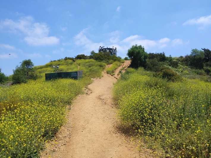
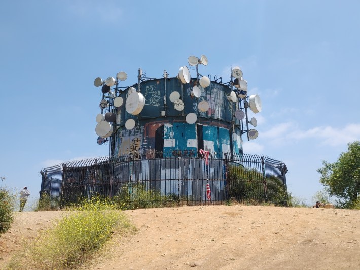
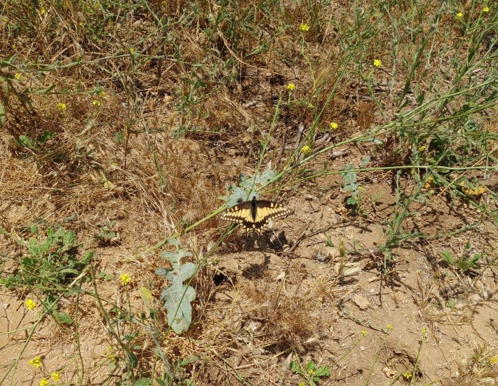
And now you’re there. Hopefully it’s not noon yet, because shade is scarce at the top. Enjoy the graffiti, butterflies, and panoramic views. Take a selfie to prove you were brave enough to hike Turnbull.
If you come by car, we recommend doing so on a weekday. There’s very limited parking within close proximity to the trailhead. The neighborhood has permitted parking for the nearby blocks, and if you come on a Sunday, you’ll see why. The Canyon is a major draw for Whittier and Hacienda locals. We also suggest you make your necessary pit stops before hiking in. There are no facilities of any kind; just the remains of that insane asylum that burned down in the 1940’s. The trail closes at 6 p.m.
Streetsblog’s San Gabriel Valley coverage is supported by Foothill Transit, offering car-free travel throughout the San Gabriel Valley with connections to the Gold Line Stations across the Foothills and Commuter Express lines traveling into the heart of downtown L.A. To plan your trip, visit Foothill Transit. “Foothill Transit. Going Good Places.”Sign-up for our SGV Connect Newsletter, coming to your inbox on Fridays!

Read More:
Streetsblog has migrated to a new comment system. New commenters can register directly in the comments section of any article. Returning commenters: your previous comments and display name have been preserved, but you'll need to reclaim your account by clicking "Forgot your password?" on the sign-in form, entering your email, and following the verification link to set a new password — this is required because passwords could not be carried over during the migration. For questions, contact tips@streetsblog.org.