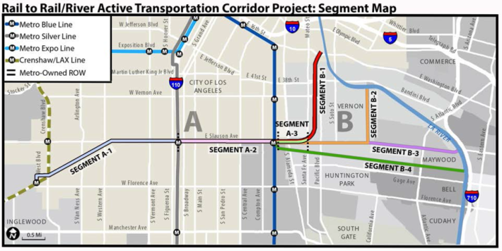
"They've started work on that bike path!" a South Central bike shop owner announced excitedly after noticing mounds of dirt piled up in the rail right-of-way (ROW) at Slauson and Normandie.
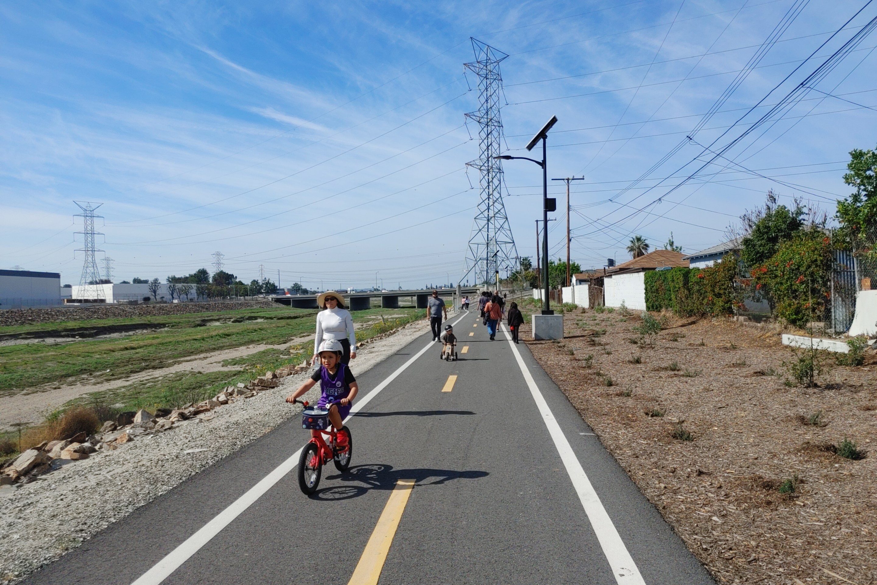
He couldn't wait for it to be finished, he said. The Rail-to-River path - a bike and pedestrian path that would cut across South Central from the Crenshaw corridor all the way to the Southeast Cities of Huntington Park and Maywood using the Slauson ROW - would give him an easier way to get to work and a place he could teach his young son to learn to ride a bike.
Unfortunately, what he had seen was dirt and debris generated by the construction of the Crenshaw Line. It had been hauled to the ROW to await recycling.
"I hate to break it to you," I said, "but they're only in the environmental analysis and design phase right now. Construction is still a ways off."
One of the young fixie riders who regularly hangs out at the shop shook his head and said he wouldn't be surprised if it was never built. It took the city forever to do nice things for the community, he lamented.
But the Rail-to-River project is actually chugging along, albeit slowly. The community meeting I was told would be held this fall to discuss the design of Segment A (running the 6.4 miles between Crenshaw and Santa Fe) has been pushed back to the new year. The team working on the project wanted to have preliminary engineering and a draft design to present to the community, I was told, so that they had something of substance to engage people on.
In the meanwhile, Metro is looking to hear from the community on what they would like to get out of the project, and they've sent out a brief survey to be shared with area stakeholders. Because technology does not always make our lives easier, however, the October 21st email with said survey ended up in my spam folder and I did not find it until this morning. Which is very unfortunate, as the deadline to answer it is Wednesday (tomorrow). So, I apologize for being late in sharing it with our South L.A. readers.
Still, the survey is brief and can be found here (English) and here (Spanish) I have copied and pasted most of it below, in the event that the links are hard to follow or you wish to send your feedback to Metro via regular email (instead of the PDF doc): R2R@metro.net.
How will you use the path?

How frequently do you think you would use it?

Do you have any apprehensions about the path?

Finally, and perhaps most importantly, what can we do to make it welcoming and what is your vision for the corridor?

The reason that this last set of questions seems so important to me is that South Central does have a unique vision of community and a unique set of aspirations.
Decades of disinvestment, disenfranchisement, denial of opportunity, and suppressive policing have meant that residents have had to forge community in private spaces. The public space was often too insecure.
Sadly, outsiders to communities like South Central have tended to translate the absence of what they consider to be a "vibrant" public space as a sign that "people need to be taught to see their streets as sites of recreation" because "there is nothing there" and "they clearly don't care about their environment." Which is why the "reclaiming streets for people" for said outsiders has tended to mean reclaiming space from vehicles, not creating a welcoming environment that is grounded in relationships and trust-building, catering to the multi-generational and multicultural realities of the surrounding neighborhoods, or celebrating the resilience of communities that have long been denied so much.
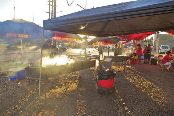
This is a perfect opportunity to do the latter.
Making the Slauson corridor welcoming and comfortable for the community could entail any number of things, but are more likely to be fruitful if they are anchored in building genuine relationships with residents and stakeholders: working with area artists and schools on creating public art pieces reflecting the history of the community; working with the two major health clinics the path connects with to create a fitness circuit and walking/biking clubs; working with the local food vendors - many of whom live nearby, have been there for years, who depend on that income, and who help make the corridor inviting already - to help keep the path active, safe, and a place for families; working with local bike advocates to run bike tune-up clinics and classes teaching residents to ride; or (to steal an idea from the awesome Street Beats project) working with local musicians and innovators to set up interactive stations where youth can create beats that reflect the spirit and sounds of their neighborhood, to name just a few possibilities.
South Central doesn't get that many projects that are expressly for the community.
Too often when amenities arrive, it is on the heels of major investments that have already resulted in the displacement of the very folks who needed those amenities the most. This is not yet the case along the Slauson corridor. Which means this is a chance to see this project be tailored to the community, its needs, and its aspirations.
I hope you'll take the survey and pass it on to a neighbor.
***
Again, the survey - due Wednesday, October 26 - can be found here (English) and here (Spanish). Feedback can be sent directly to Metro, here: R2R@metro.net. More about the project can be found on Metro's project website, here. We've followed to progress of this project for the last three years. That coverage and background on the project can be found below:
- December, 2013: Dear Santa, Please Bring Us an Active Transportation Corridor Along Slauson, but Don’t Forget the Community in the Process (background on the plan; lack of outreach)
- March, 2014: Feasibility Study on Rail-to-River Project Takes Another Step Forward (plan begins to come together; outreach still a major problem)
- October, 2014: Motion to Move Forward on Rail-to-River Bikeway Project up for Vote Thursday (breaks down the feasibility study in more detail, costs, timeline)
- May, 2015: Planning and Programming Committee Recommends Metro Board Take Next Steps on Rail-to-River ATC (more on costs, timelines)
- October, 2015: The Rail-to-(Almost)-River Gets Boost with $15Mil TIGER Grant (yay, actual money!)
- May, 2016: Metro Awards Contract for Environmental Study and Design of Phase I of Rail-to-River Bike Path (OMG it is actually happening; request that outreach finally be meaningful)
- August, 2016: Metro Explores Alternative Rail-to-River Routes Through Southeast Cities


