Feasibility Study on Slauson Corridor Rail-to-River Project Takes Another Step Forward
How are you going to get community input?
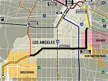
It was a question asked by one of the few community members who had shown up to Metro's Rail to River meeting last week on the potential conversion of 8.3 miles of the rail right-of-way along Slauson Ave. into an active transportation corridor.
He and a friend were looking at one of the boards illustrating the neighborhoods the corridor ran through and speaking with Ryan Johnson, a planner with the Alta Planning & Design team working on the feasibility study for the project.
I told him that was a good question.
I had heard from several people involved in the project that Metro had been reluctant to do too much community engagement at this point because they are still studying the feasibility of the project. Getting the community excited about a project they are not sure they can bring to fruition hadn't seemed prudent.
And while that makes sense, to a degree, if feasibility involves projections of who will use the space and how, knowing how residents currently use the space, their concerns, their aspirations for it, and insight into elements that would entice them to use it would seem important.
Their input would also matter with regard to routes. With regard to the question of whether Metro should invest first in extending the Slauson path along Randoph St. to the river or follow it north toward downtown and Vernon, for example, locals who work in either of those areas might have very different perspective than those who were looking to use the bike facilities for recreation.
With that in mind, I told the young man and his friend, I had spent the weekend prior to the meeting engaging vendors and other folks along the corridor about the meeting and stuffing flyers into their hands.
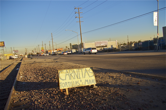
The neighbors -- all of whom unequivocally viewed Slauson as a dangerous, largely inaccessible, and unfriendly space -- had been thrilled to hear about the potential for a park-like zone.
All of the vendors remembered me from when I had interviewed them a few months ago and were eager for updates. As before, they were interested in the potential conversion of the space, but apprehensive about what it might mean for them. Most lived in the area and had been vending there on the weekend for several years. They did it because they needed the income. But, they also felt that their presence helped make the area safer -- without them, there are few eyes with vested interests in the area looking out onto a street dominated by industrial structures.
Despite their concerns, they were reluctant to commit to attending.
Proclaiming their presence, many felt, might bring unwanted attention and result in their being shut down. Back on November 6th of last year, Councilmembers Jose Huizar and Curren Price introduced a motion asking for the City Council to draft a report and a proposal for the legalization of street vending within 90 days. The Council has yet to make a move in that direction, and the vendors are aware that their presence remains precarious.
I could go to the meeting, the vendor of miscellaneous tools and appliances set up at the corner of Main St. had affirmed in Spanish, but I am a little afraid. I have a permit to vend and I pay taxes -- I always have -- but I am afraid to speak up.
Why don't you just come to listen, so you will know what's going on? I asked. If you have any questions, I can ask them for you so you won't have to worry.
I could go, he repeated, nodding and folding up the flyers and putting them in his pocket. I will think about it.
He didn't show up, unfortunately.
Nor did the others.
Even so, I was genuinely over the moon to see that Metro had included both the acknowledgement of the community's interest in things like having space for vendors or for recreation (i.e. fitness equipment) and the fact that the space was more likely to be regularly used by pedestrians (who would likely be locals) than cyclists in their presentation.
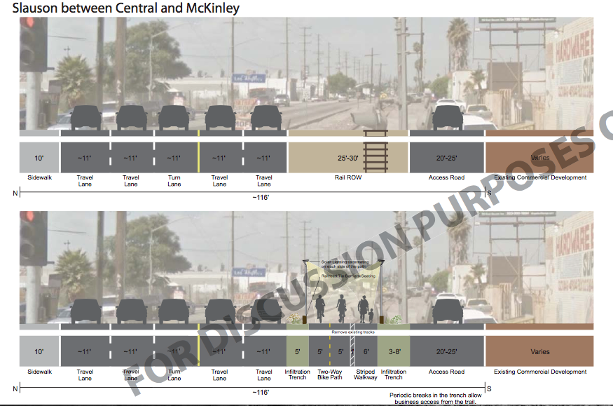
Also new and exciting was the discussion of the removal of the train tracks in order to create space for the bike and pedestrian paths.
They would have to go anyways, attendees were told, because any future light rail project would use different tracks, rendering the existing tracks obsolete.
While that made sense, at the last meeting, it hadn't been made completely clear (at least not to me and a few of the other attendees) that the existing tracks would be removed.
The recognition of community needs and the added space that would now be available along whatever bike/ped paths were installed made me optimistic for the possibility of more community-specific interventions and innovative partnerships along the route.
I'm not sure that means that they'll be able to put in the fish pond and other water features I saw a woman request on one of the boards, but one can always dream, I suppose.
The draft plan should be finalized in April, according to planners. For some of the documents presented for discussion on the project, please click here.
Stay in touch
Sign up for our free newsletter
More from Streetsblog Los Angeles
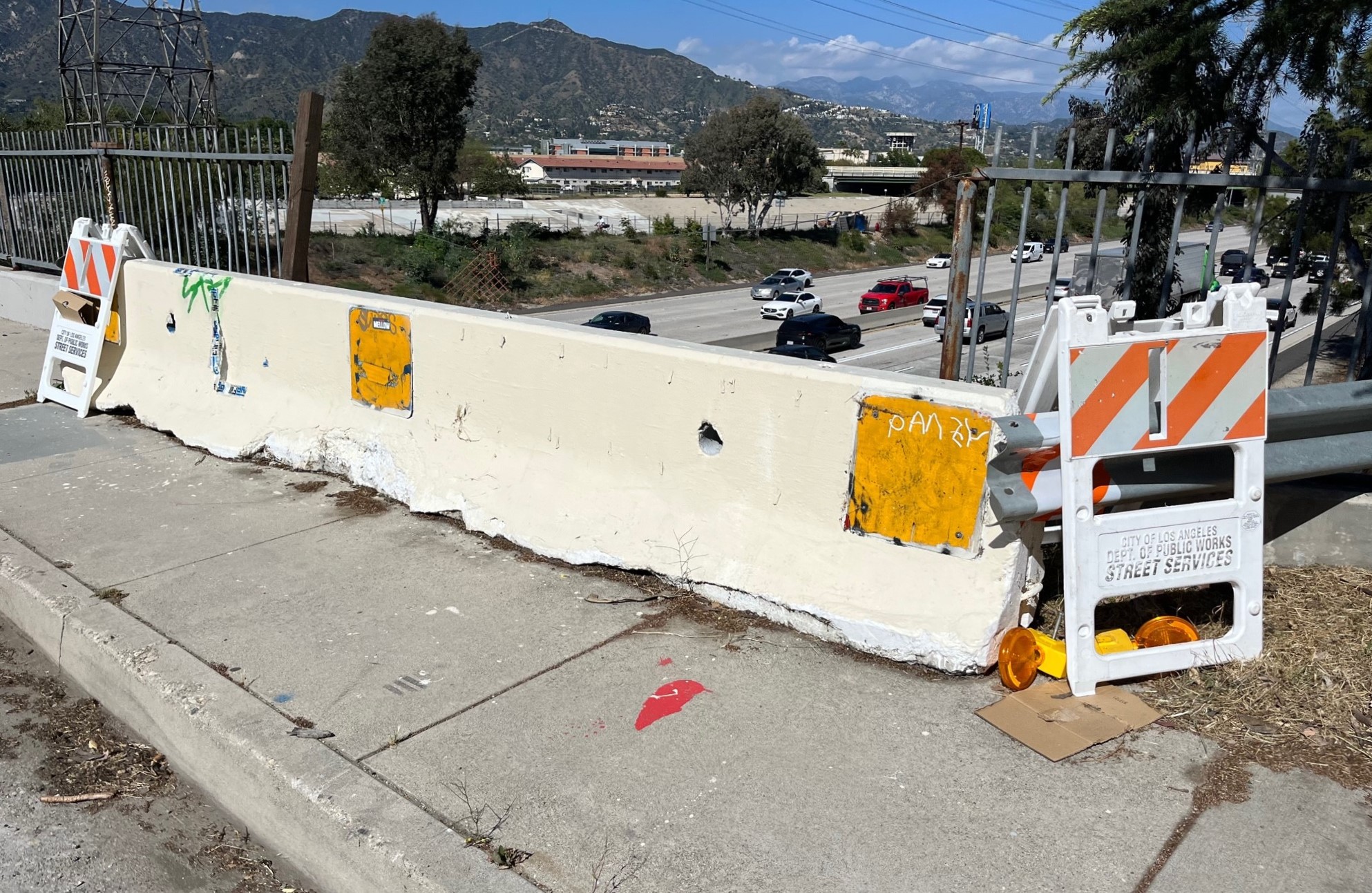
Freeway Drivers Keep Slamming into Bridge Railing in Griffith Park
Drivers keep smashing the Riverside Drive Bridge railing - plus a few other Griffith Park bike/walk updates

This Week In Livable Streets
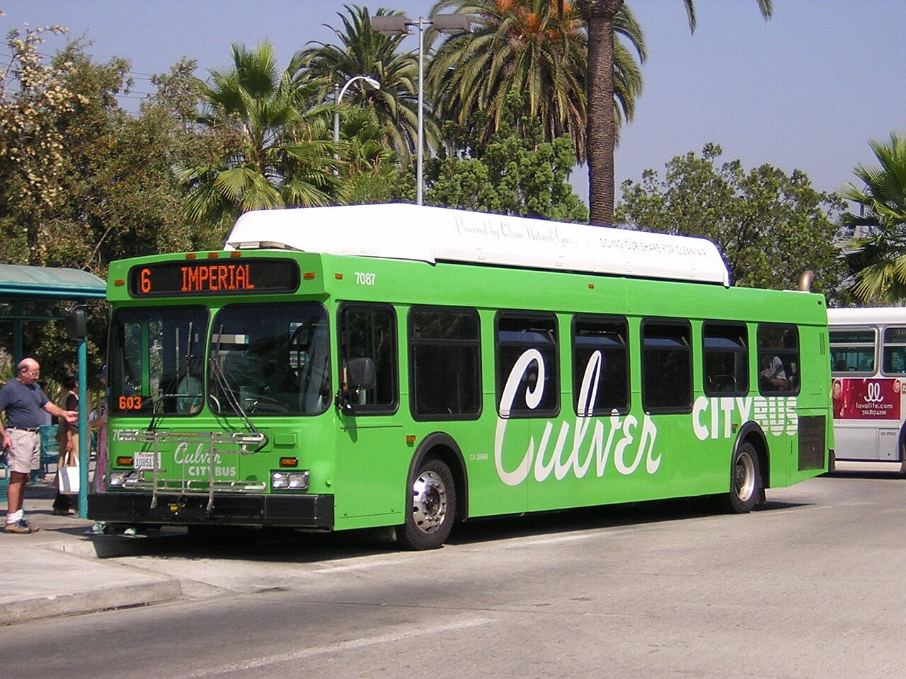
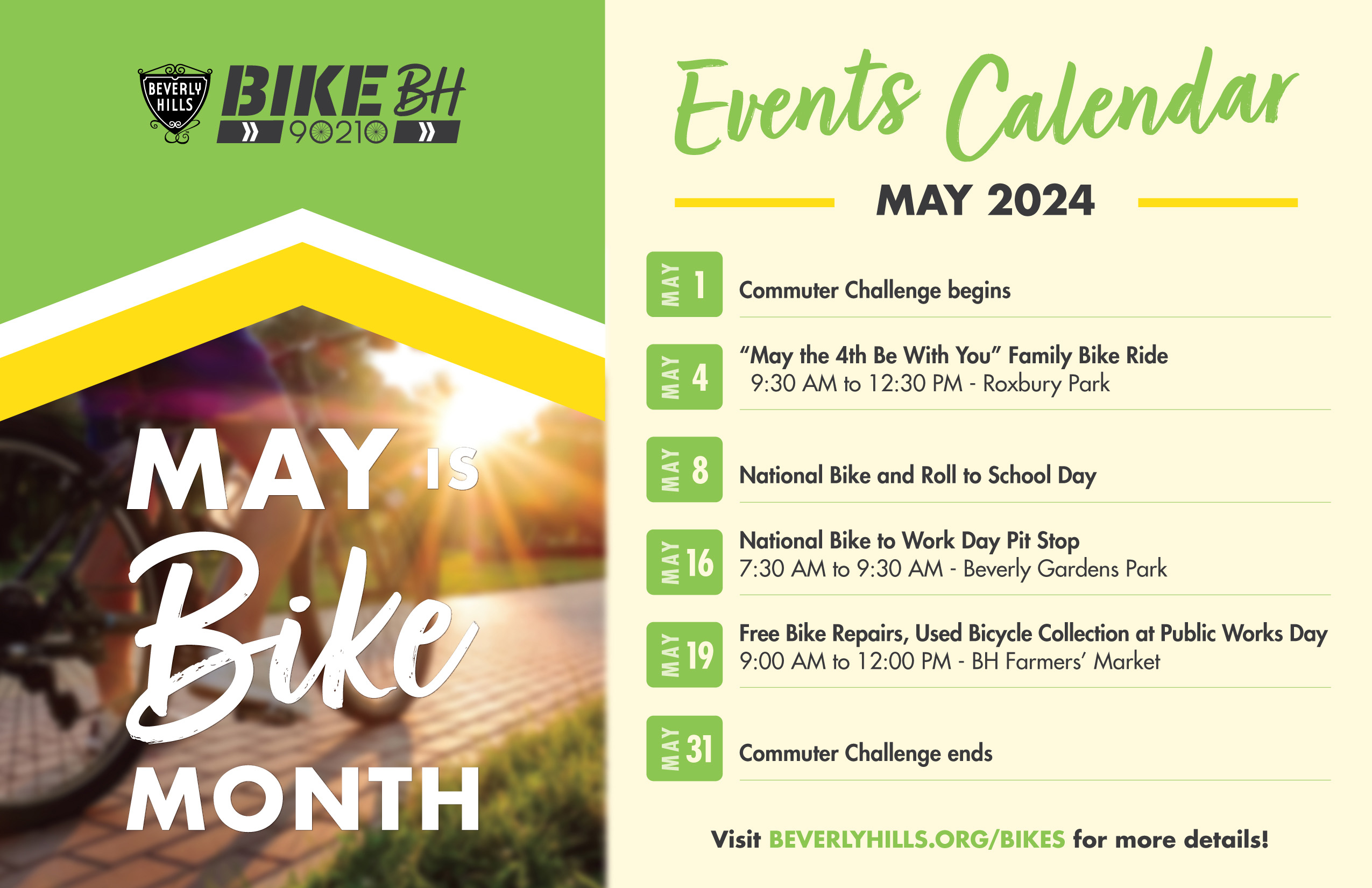
Bike Month, Hyperion street safety, Eastside rail plans, Pasadena transit, CicloIRVINE, Culver City bus service, and more
Active Streets Mission-to-Mission – Open Thread
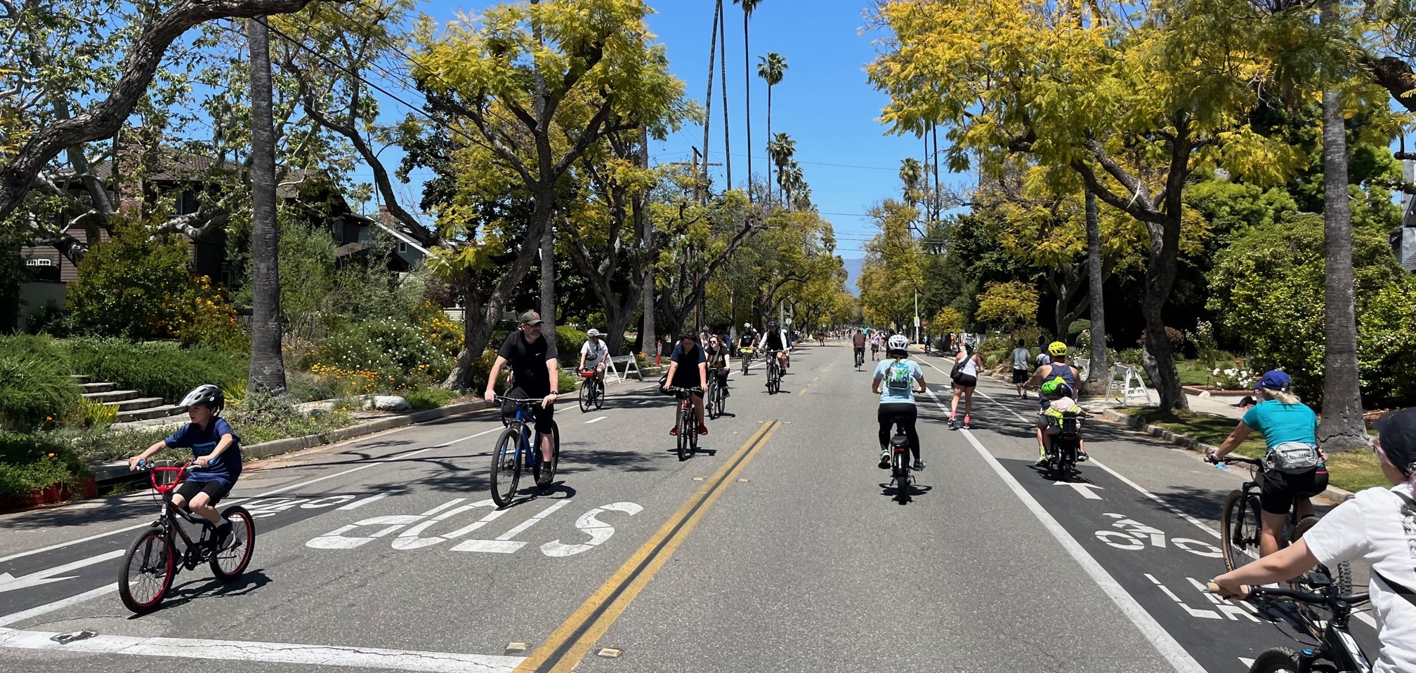
Tens of thousands of participants biked, walked, skated and scootered on car-free streets through San Gabriel, South Pasadena and Alhambra