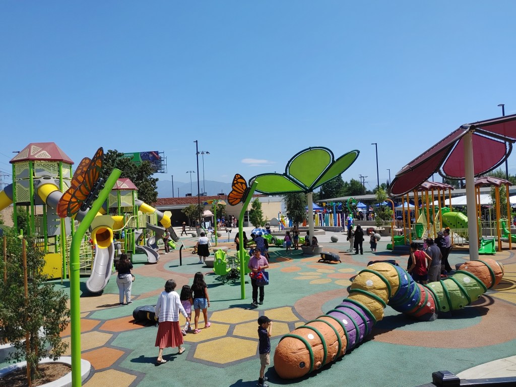
Pomona North Metro Station to get Protected Bike Connection
On Monday the city of Pomona voted unanimously to proceed with designing a protected bikeway along its entire stretch of Arrow Highway.
This first-last mile connection for the Metro A Line seemed to be a no-brainer for Pomona City Council, despite the project being a little underfunded currently.
The bike route must be completed by early 2027 in order to use Metro Active Transport (MAT) funds directed toward project tied to the 2028 Olympic games, part of which are taking place in Pomona.
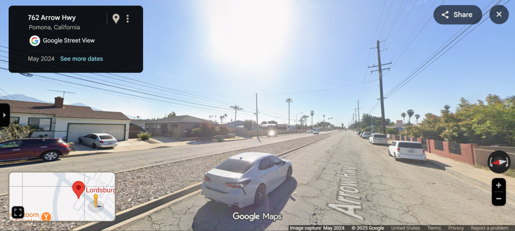
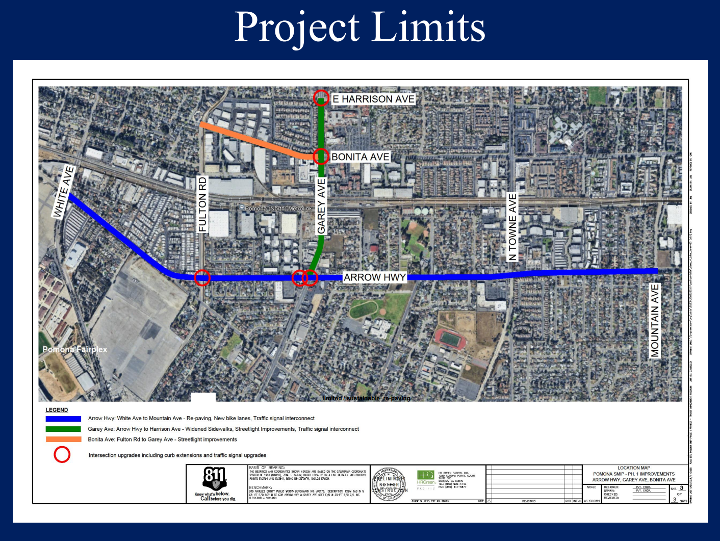
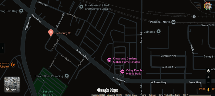
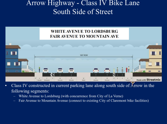
The two-way protected bikeway would run along the south side of Arrow Highway. The sticking point – which didn’t end up being that sticky – was whether or not to save a stretch of parking spaces for residents along the south side of Arrow between Lordsburg Court and Fair Avenue.
What made this a seemingly easy decision is that not saving the parking spaces would have required temporary access easements to build bulb-outs for cyclists and pedestrians to get around telephone poles on the south side of Arrow.
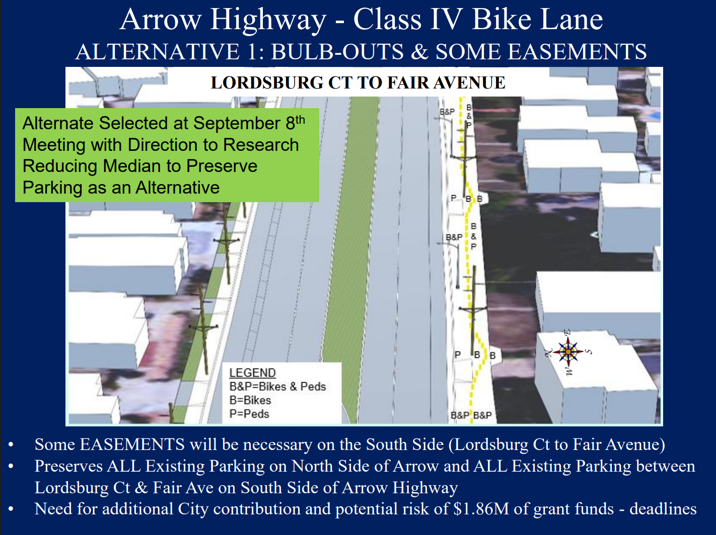
Getting that done could have been dicey with the looming Olympics deadline. If they did it on time, the project would cost $1.2 million over what’s already funded ($13.9 million, mostly from the San Gabriel Valley Council of Governments). If they were late, it would have been about $3 million more after returning Metro’s money… Plus, a few pissed off residents missing their parking.
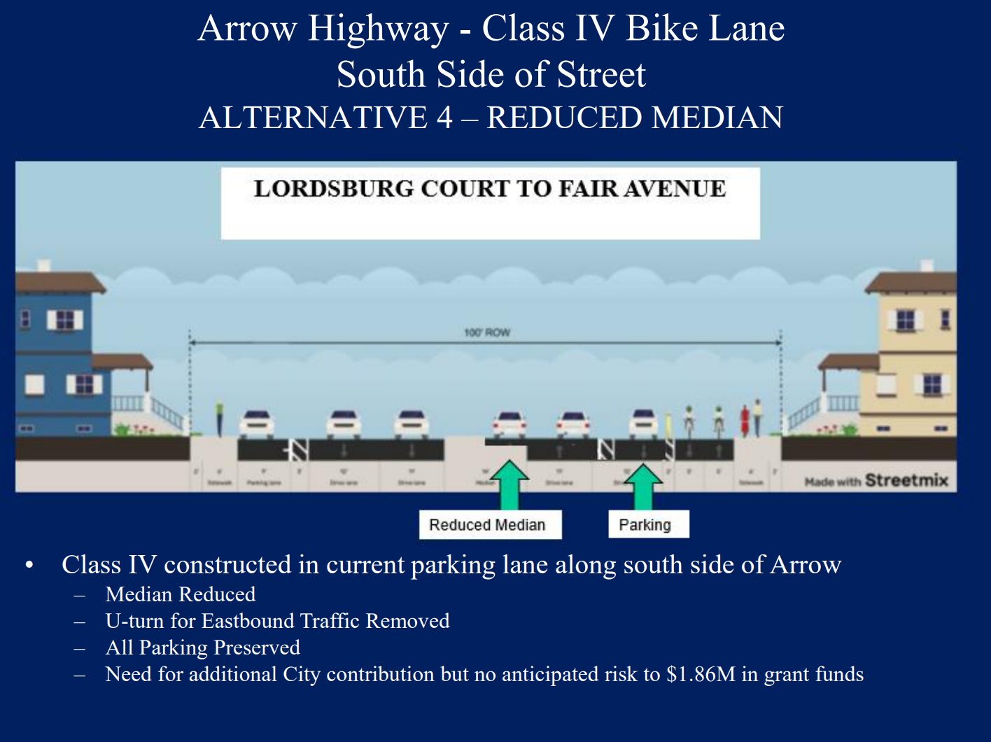
Instead, the city is going with an option that will put costs at $2.2 million over their current purse.
In “Alternative 4,” parking is saved and easements are avoided by trimming down a wide median. This would be done for about a half mile, from White Avenue (in La Verne) down to Fulton Road, and it would remove a u-turn for eastbound traffic.
Pomona’s Director of Public Works Meg McWade told the council that this was by far the more feasible option, though she stressed that this cross-section is not to scale.
On Monday, McWade stressed that the project is a high priority, because it fits into multiple regional initiatives (Arrow Highway Multimodal Corridor Plan, the San Gabriel Valley Greenways Plan, Metro’s First/Last Mile Plan, Pomona’s Capital Improvement Program).
Indeed, the city council seemed less concerned with how they would cover the funding gap, and more interested in making the safest, most appealing bike lanes possible. Several council members said they’d like to see cement barriers rather than delineators to protect cyclists in the final design, and greenery and public art were mentioned too.
Streetsblog’s San Gabriel Valley coverage is supported by Foothill Transit, offering car-free travel throughout the San Gabriel Valley with connections to the A Line Stations across the Foothills and Commuter Express lines traveling into the heart of downtown L.A. To plan your trip, visit Foothill Transit. “Foothill Transit. Going Good Places.” Sign-up for our SGV Connect Newsletter, coming to your inbox on Fridays!

Read More:
Streetsblog has migrated to a new comment system. New commenters can register directly in the comments section of any article. Returning commenters: your previous comments and display name have been preserved, but you'll need to reclaim your account by clicking "Forgot your password?" on the sign-in form, entering your email, and following the verification link to set a new password — this is required because passwords could not be carried over during the migration. For questions, contact tips@streetsblog.org.