
Eyes on the Street: Vincent Bikeway is Coming Together
Los Angeles County Public Works is making steady progress on the Vincent Community Bikeway. The project broke ground in 2023.
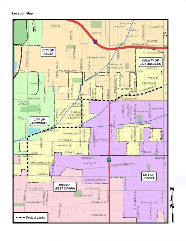
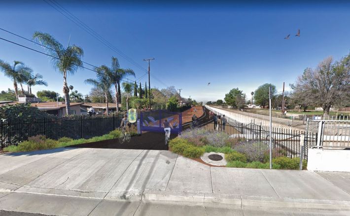
The under construction facility will be a three mile long bikeway and walkway, located in the unincorporated Vincent area adjacent to Covina and Irwindale. About half of the route will run east and west as a multi-use path along the Big Dalton Flood Control Channel. Off-street path segments will be connected by on-street protected bike lanes on Irwindale Avenue, Lark Ellen Avenue, and Arrow Highway.
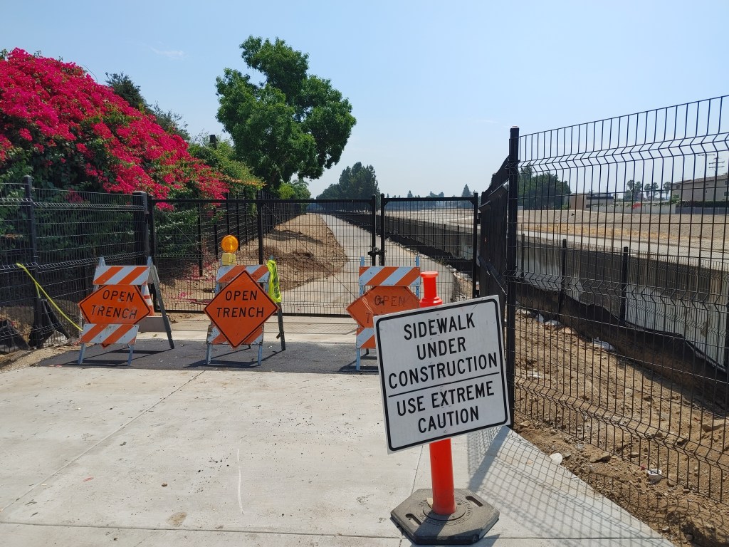
The blacktop has been set along the waterway portions of the path, and new gates and fencing have been installed. The concrete edges of the ADA ramps for the path have been put in too.
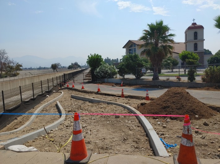
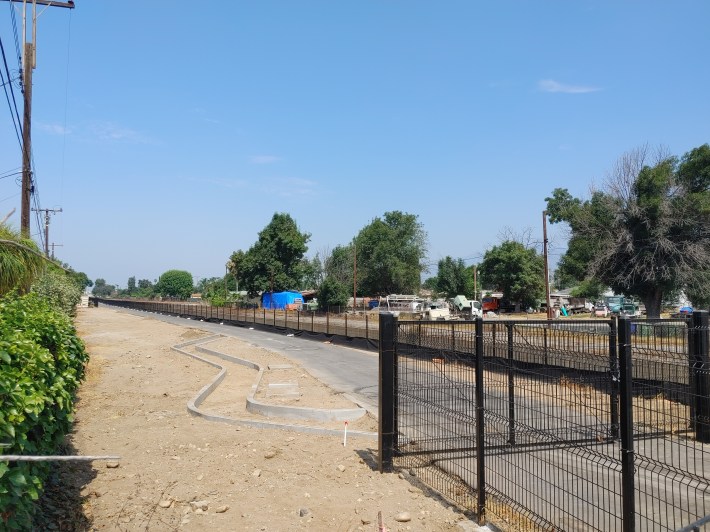
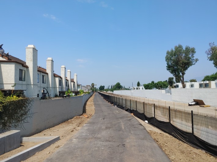
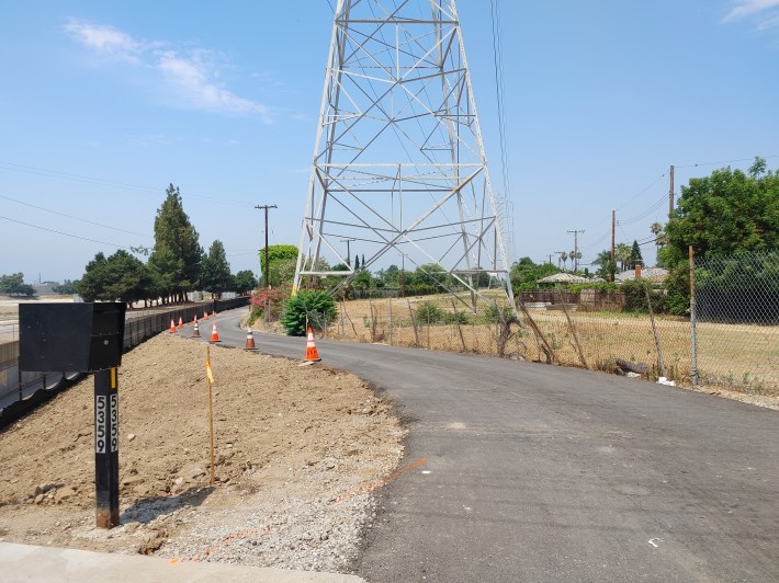
What remains to be done on the waterway includes striping, landscaping, parklets, and a decorative gate.
On-street installations haven’t begun yet, but there will be crosswalk enhancements and bike lanes protected by bollards. Completion, originally anticipated to be Spring of this year, is now expected by the end of 2024.
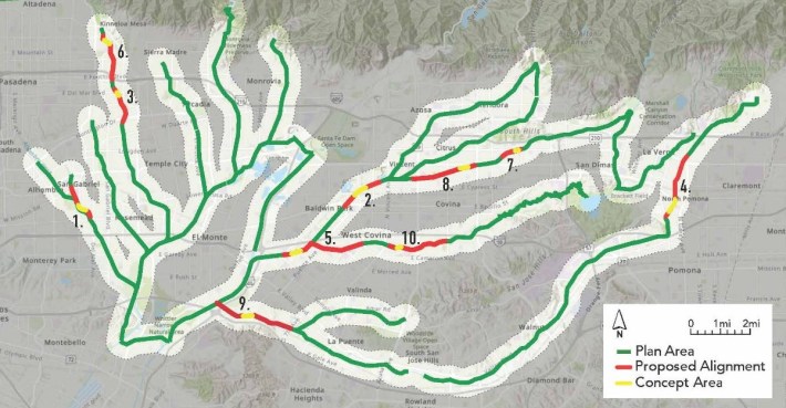
This project is part of the County’s SGV Greenways initiative: 130 miles of trails based around the region’s waterways, connecting to the San Gabriel River path. Greenway paths are also gradually coming to the Alhambra Wash, Eaton Wash, Thompson Creek, Walnut Creek, San Dimas Wash, San Jose Creek, and Puente Creek.
The $8.1 million project was funded by a state Active Transportation Program (ATP) grant, L.A. County Public Works, Prop C, and the cities of Azusa, Irwindale, Covina, and West Covina.
Los Angeles County Public Works spokesperson Gabrielle Barber wrote of the Vincent project that her department is “particularly proud that our flood control infrastructure is being used to connect cities, neighborhoods, and communities.”
Streetsblog’s San Gabriel Valley coverage is supported by Foothill Transit, offering car-free travel throughout the San Gabriel Valley with connections to the Gold Line Stations across the Foothills and Commuter Express lines traveling into the heart of downtown L.A. To plan your trip, visit Foothill Transit. “Foothill Transit. Going Good Places.”Sign-up for our SGV Connect Newsletter, coming to your inbox on Fridays!

Read More:
Streetsblog has migrated to a new comment system. New commenters can register directly in the comments section of any article. Returning commenters: your previous comments and display name have been preserved, but you'll need to reclaim your account by clicking "Forgot your password?" on the sign-in form, entering your email, and following the verification link to set a new password — this is required because passwords could not be carried over during the migration. For questions, contact tips@streetsblog.org.


