Eyes on the Street: Safe Routes to School Improvements in Koreatown
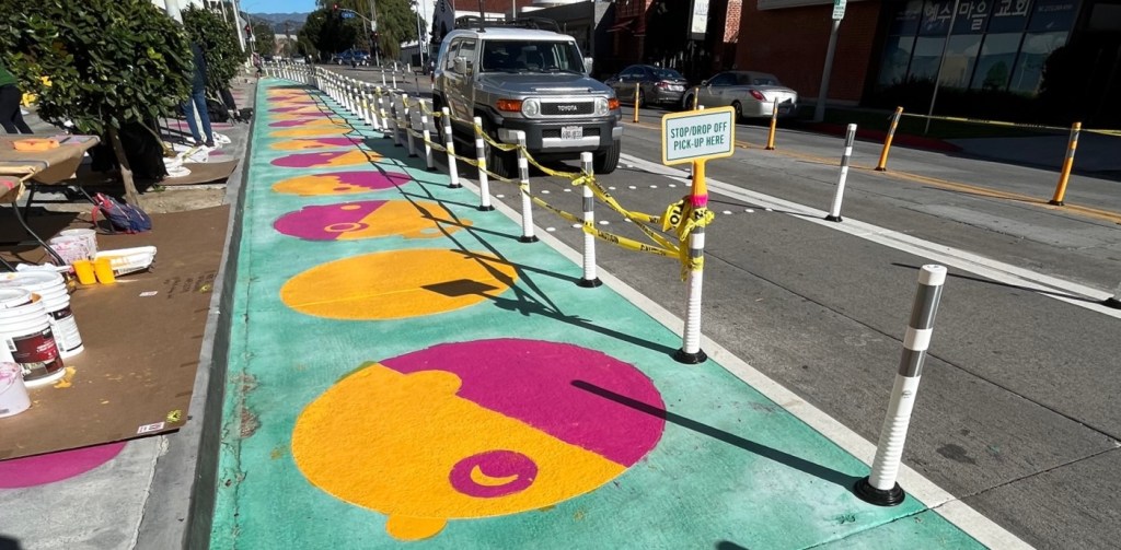
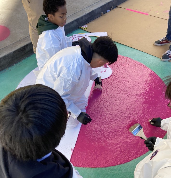
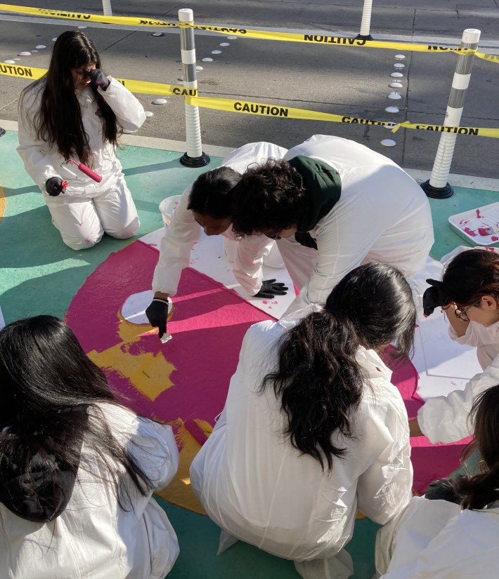
This week, students at Koreatown’s Young Oak Kim Academy got the chance to paint the street to improve safety in front of their school. The activity was part of L.A. City Department of Transportation (LADOT) implementing Safe Routes to School (SRTS) improvements to calm traffic to help make it safer for students arriving on foot.
Young Oak Kim middle school is located next to the Metro B Line Wilshire/Vermont Station in Ktown, one of most population-dense and most diverse neighborhoods in the city of Los Angeles. The improvements are located on Shatto Place, behind the station, in front of the school.
According to David Mariscal, Associate Planner with the city’s consultant KOA, the project supports students “taking the Metro bus system to school, and a lot of kids walking, taking the train, some skateboarding and riding their bikes.”
But, even in population-rich transit-rich Koreatown, lots of kids are driven to school.
“We noticed there were a lot of issues with heavy traffic on the street,” Mariscal noted “especially during pick-up and drop-off.” KOA, LADOT, and urban design firm HERE (which led an early demonstration version) worked with the school and other nearby stakeholders to design and implement features that “organize traffic better” especially a “dedicated pick-up and drop-off lane [that] helps reduce through traffic lanes to slow down traffic” and “prevent double parking.”
The project was funded by a $250,000 state Active Transportation Program (ATP) Quick Build grant in 2020.
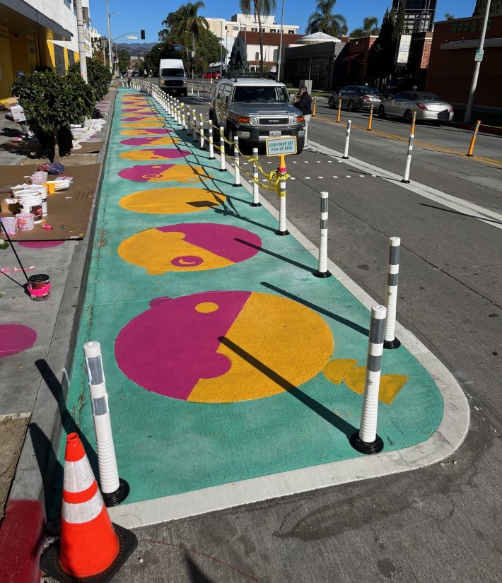
The design eliminated a block-long center turn lane and narrowed the remaining lanes. This made space for a dedicated drop-off/pick-up lane (“valet lane”) and an extended painted curb extension “kids space” cordoned off from the street by plastic bollards.
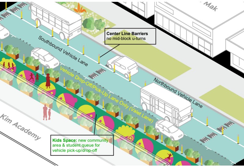
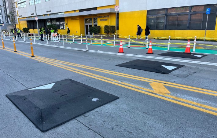
The design also includes two sets of “speed pillow” or “speed cushion” plastic speed humps. LADOT Safe Routes to School Director Margot Ocañas notes that these are the first use of this feature in an L.A. city project.
The project improves safety at the one block of Shatto Place between Wilshire Boulevard and Sixth Street, though it doesn’t extend beyond there. It feels more like controlling a chaotic drop-off situation, which is needed. But it doesn’t go far enough to address more of the unsafe streets kids move through on their full trips to and from school. More wide-ranging safe routes projects (for example, on Culver City’s Elenda Street) extend well beyond the school block, but that’s probably a lot to ask from the limited quick build budget.
(Streetsblog has called for bikeways on nearby over-wide streets north and east of the school – including Shatto and 5th Street. That could improve safety for routes to both school and Metro station. Added 1/12: Shortly after publication, Ocañas informed SBLA that LADOT will extend safety improvements north on Shatto, as part of a recently awarded state ATP grant for SRTS Center City Project. Between 4th and 6th Streets, DOT will eliminate the center turn lane and install bike lanes.)
The Shatto Place improvements are already bearing fruit. “While the street is a little bit narrower, we’re seeing a lot more kids getting to and from the school in a lot more safe and organized fashion,” Mariscal noted.

Streetsblog has migrated to a new comment system. New commenters can register directly in the comments section of any article. Returning commenters: your previous comments and display name have been preserved, but you'll need to reclaim your account by clicking "Forgot your password?" on the sign-in form, entering your email, and following the verification link to set a new password — this is required because passwords could not be carried over during the migration. For questions, contact tips@streetsblog.org.