
Eyes on the Street: Pasadena’s New Cordova Street Bike Lanes
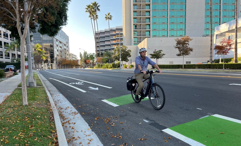
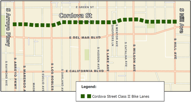
The city of Pasadena recently installed new bike lanes on Cordova Street. Pasadena’s 1.5-mile long Cordova Street Complete Streets Project includes about 0.9 mile of new bike lanes from Lake Avenue to Arroyo Parkway where Cordova ends – about a block from Metro’s Del Mar A (former Gold) Line Station. Space for the new bike lanes was freed up by reducing the number of car lanes, called a road diet.
The $2.7 million Cordova project also features road resurfacing, curb extensions at eight intersections, five new traffic signals, zebra crosswalks, sidewalk and ramp repair/replacement, and more.
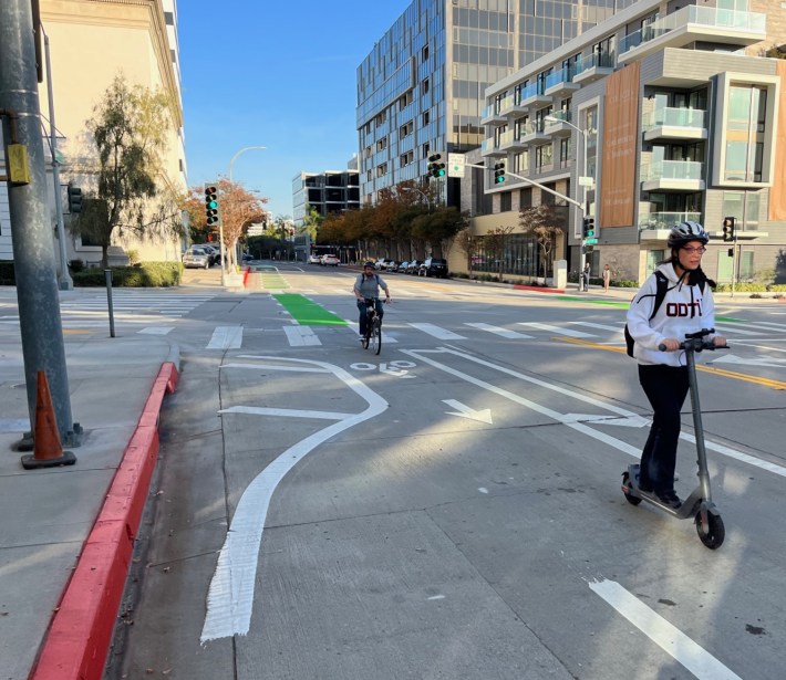
The unprotected Cordova bike lanes are not quite as high quality a facility as Pasadena’s recently completed two-way protected Union Street bikeway; the Cordova lanes are unprotected, with a buffer throughout and green pavement at conflict zones, including through intersections. With green paint, buffers, smooth pavement, and fewer car lanes to contend with, the Cordova lanes are about as nice as unprotected bike lanes get.

Thanks to Colin Bogart of the Pasadena Complete Streets Coalition for the heads ups on these new bike lanes.
Streetsblog’s San Gabriel Valley coverage is supported by Foothill Transit, offering car-free travel throughout the San Gabriel Valley with connections to the Gold Line Stations across the Foothills and Commuter Express lines traveling into the heart of downtown L.A. To plan your trip, visit Foothill Transit. “Foothill Transit. Going Good Places.” Sign-up for our SGV Connect Newsletter, coming to your inbox on Fridays!

Read More:
Streetsblog has migrated to a new comment system. New commenters can register directly in the comments section of any article. Returning commenters: your previous comments and display name have been preserved, but you'll need to reclaim your account by clicking "Forgot your password?" on the sign-in form, entering your email, and following the verification link to set a new password — this is required because passwords could not be carried over during the migration. For questions, contact tips@streetsblog.org.


