
Eyes on the Path: Metro Posts First Look at Slauson Corridor Bike/Walk Path Ahead of Tonight’s Construction Update
Tonight, Metro will host a construction update on the 5.5-mile Rail-to-Rail walk/bike path that will run along the neglected Slauson corridor right-of-way (ROW) between the Fairview Heights and Slauson Metro rail stations. The agency has posted a number of photos touting the work being done on the path ahead of the 6 p.m. meeting (join in via Zoom).
Tangible progress has been a long time coming.
The “Rail-to-River”project was first proposed in 2012 by then-Metro boardmembers Mark Ridley-Thomas and the late Gloria Molina with the goal of converting a blighted ROW into a community asset. They believed a nearly 10-mile-long “green ribbon” could be transformative in such an intensely park-poor section of South Central and Southeast Los Angeles.
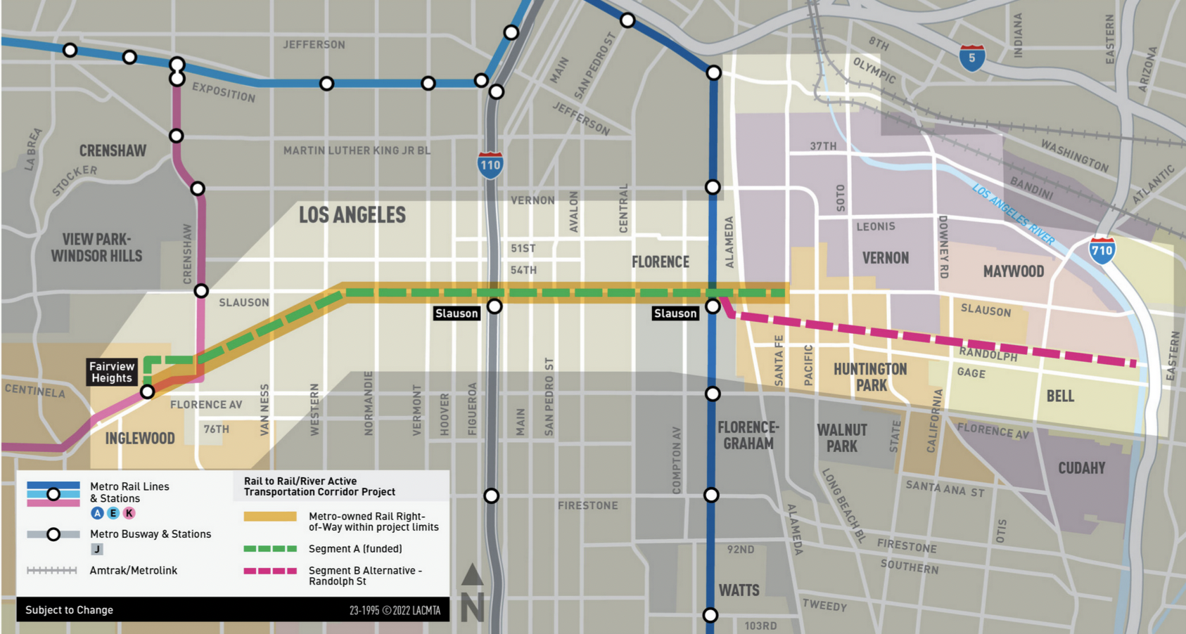
Metro had originally expected to break ground on the western segment back in 2018. After a number of delays, the project quietly broke ground last July. Construction began in October, at 67th St. and 11th Ave. [The Southeast segment that runs from the Blue Line to the river will be constructed separately; it is still in the planning stages.]
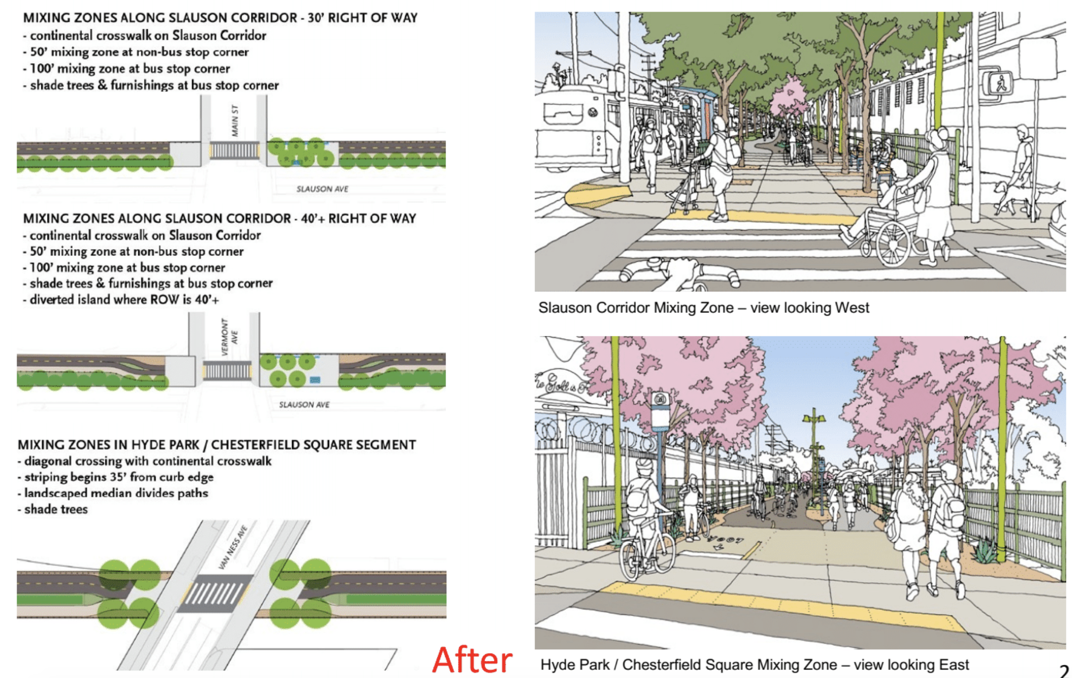
The dedicated bike/walk path (where users are safely separated from motor vehicles) will feature shade trees, drought-tolerant landscaping, lighting, improvements at bus stops, and improved crossings at intersections.
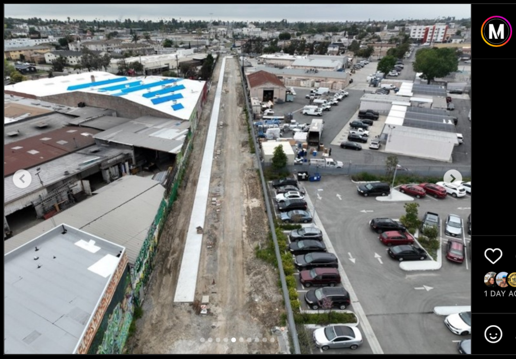
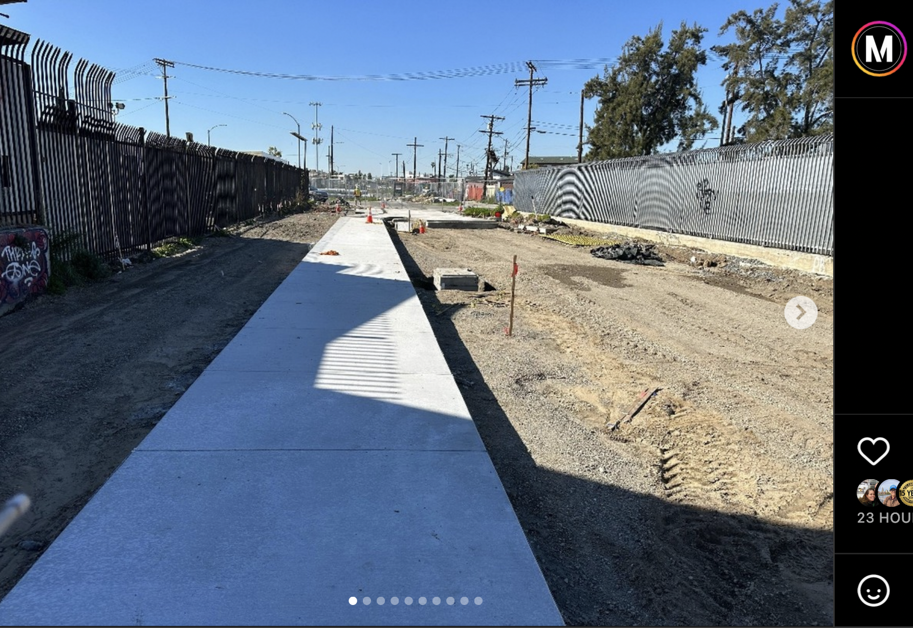
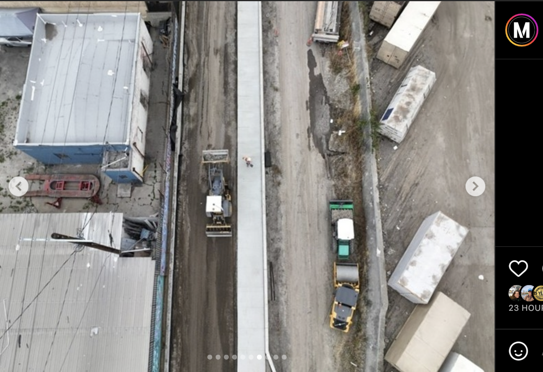
The images Metro posted to Instagram show the progress being made on the western end of the project after the old tracks were ripped out.
The shot below is of an under-construction “mixing zone,” where the pedestrian and bike paths converge as the route approaches an intersection (as seen in the rendering above). The cement path that extends from it is the sidewalk; the bike path alongside it will be wider and made of asphalt.
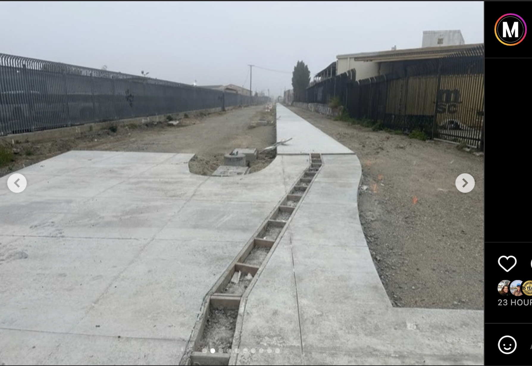
The approach to a mixing zone/intersection in Hyde Park via a freshly poured sidewalk.
The Hyde Park section of the path cuts through a mix of residential and industrial zones. The image below is of where it will cross 4th Ave.
Residents will be able to access the path via a number of entry points along the route, both for ease of use and for safety. And because the path is sometimes cut off from street view in this section, Metro plans to add additional security lighting and emergency phones.
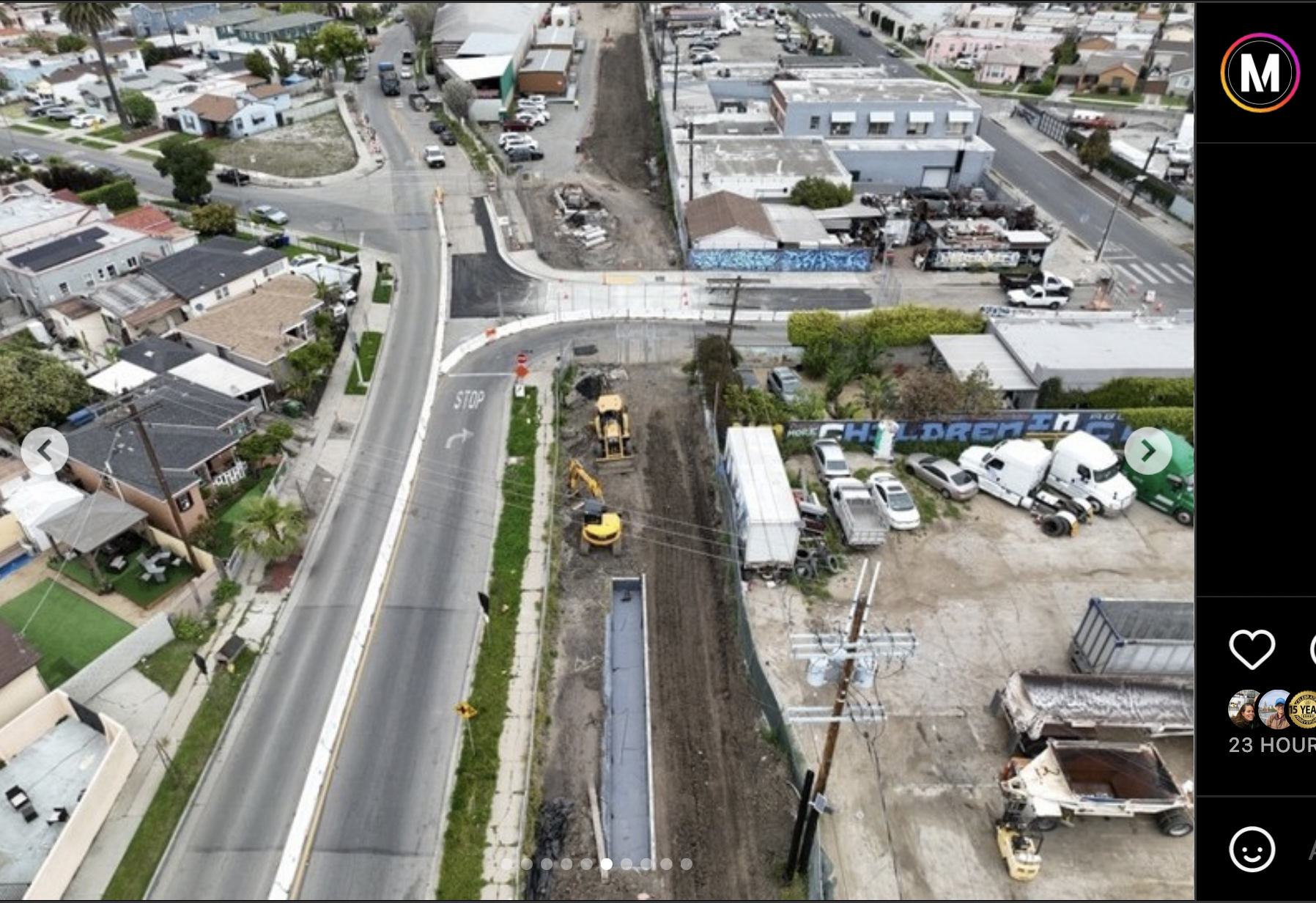
Here the sidewalk heads toward 4th Ave from Van Ness.
Per Metro’s post, the project seeks to provide safe passage for the “nearly 4,300 pedestrians and 2,500 cyclists [who] use the corridor each day.” Completion is expected in 2024.
Learn more about the project from Streetsblog’s reporting (below), Metro’s project page, here, or join in the meeting tonight to get an overview and construction progress update at 6 p.m. via Zoom.
- December, 2013: Dear Santa, Please Bring Us an Active Transportation Corridor Along Slauson, but Don’t Forget the Community in the Process (background on the plan; lack of outreach)
- March, 2014: Feasibility Study on Rail-to-River Project Takes Another Step Forward (plan begins to come together; outreach still a major problem)
- October, 2014: Motion to Move Forward on Rail-to-River Bikeway Project up for Vote Thursday (breaks down the feasibility study in more detail, costs, timeline)
- May, 2015: Planning and Programming Committee Recommends Metro Board Take Next Steps on Rail-to-River ATC (more on costs, timelines)
- October, 2015: The Rail-to-(Almost)-River Gets Boost with $15Mil TIGER Grant (yay, actual money!)
- May, 2016: Metro Awards Contract for Environmental Study and Design of Phase I of Rail-to-River Bike Path (OMG it is actually happening; request that outreach finally be meaningful)
- August, 2016: Metro Explores Alternative Rail-to-River Routes Through Southeast Cities (where we learn Metro and the Southeast Cities do not play together well)
- October, 2016: Metro Asks South L.A. Stakeholders: How Would You Use Rail-to-River Bike/Pedestrian Path?
- December, 2016: Rail-to-River Route Through Huntington Park, Bell Emerges as Best Candidate; Community Meeting December 8 (The Randolph Street option emerges as the favorite while also the most expensive and most complicated option; Community Advocates demand Metro handle outreach better and incorporate walking into plans better)
- December, 2016: Preview Some of the Design Options for the Slauson Segment of the Rail-to-River Bike/Pedestrian Path (self-explanatory)
- January, 2017: Metro Seeks Input on Design Options for Segment A of Rail-to-River Bike/Pedestrian Path
- July, 2017: Metro Offers Update on Rail-to-River Bike/Ped Path Design; Project to Break Ground Mid-2018
- December, 2019: Rail-to-Rail Bike/Ped Path along Slauson Delayed but Moving Forward
- February, 2021: Metro Relaunches Rail-to-River Engagement Process to Choose New Southeast Cities Route
- July, 2022: Rail-to-Rail Bike/Walk Path Breaks Ground on Slauson; Officials Speak to Its Significance for Corridor

Read More:
Streetsblog has migrated to a new comment system. New commenters can register directly in the comments section of any article. Returning commenters: your previous comments and display name have been preserved, but you'll need to reclaim your account by clicking "Forgot your password?" on the sign-in form, entering your email, and following the verification link to set a new password — this is required because passwords could not be carried over during the migration. For questions, contact tips@streetsblog.org.


