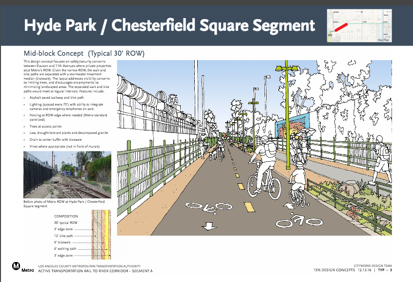
Preview Some of the Design Options for the Slauson Segment of the Rail-to-River Bike/Pedestrian Path
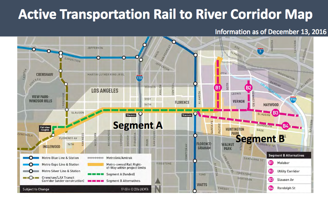
Segment A of the Rail-to-River bike and pedestrian path will run along the Slauson corridor (in green), between the Crenshaw and Blue Lines. Source: Metro
I am currently working my way through Metro's design concepts for Segment A (above) of the Rail-to-River project and will explore some of them more fully in a longer story ahead of next month's meeting in South Central. But, in a year that has been mostly terrible from start to finish, it is nice to end on a positive note with happy drawings of how a blighted corridor might be transformed in a deserving neighborhood.
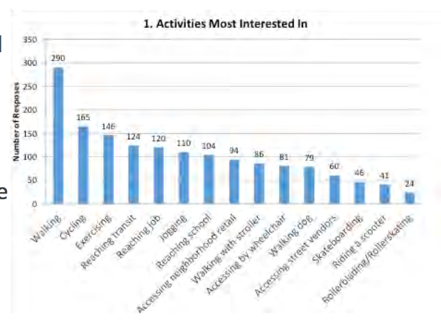
One of the more interesting things to note is that a survey Metro distributed this past fall (and we wrote about here) found that respondents would most likely use the path for walking and were much less likely to use it for biking or to connect to transit.
The survey was far from scientific, of course, and while many of the respondents live in South L.A. or are advocates for the area, the bulk of respondents were not necessarily folks that live along Slauson itself or ones that commute to work or school along the corridor.
Even so, such a finding does actually support the case I've made in previous articles for the project to be designed with South Central families in mind. Meaning that adequate space for walking, amenities (like benches, art, lighting, and fitness equipment), and even for the vendors who have been working along that corridor for a decade or more (as a way to help activate the space and make it feel welcoming and safe) will be key to making the project successful and community-centric.
The importance of making the path welcoming to those on foot was also something that was raised at the Community Advisory Committee meeting I attended about a month ago, and something Metro agreed to take more seriously in its planning going forward.
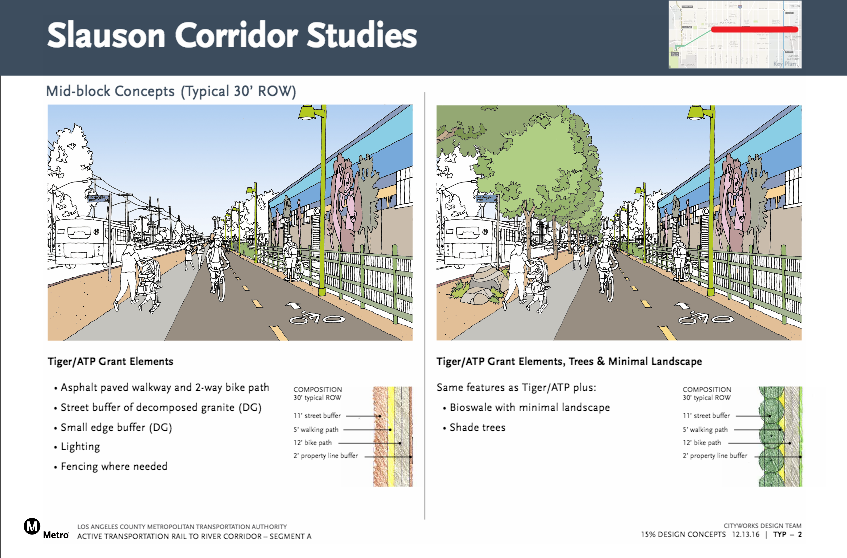
Right now, the challenge to doing so lies in the fact that the width of the rail Right-of-Way (ROW) the path will follow changes quite a bit along the corridor.
Where it is 30 feet wide and runs between private properties (where it diverges from Slauson and snakes diagonally toward Crenshaw on the west end) there is ample room for separate biking and walking paths, and possibly other amenities.
Where the ROW is 30 feet wide along the central segment (along Slauson proper), the designers appear to have prioritized putting a buffer in between the users of the path and the heavy flow of trucks and cars that rumble through the corridor at all hours.
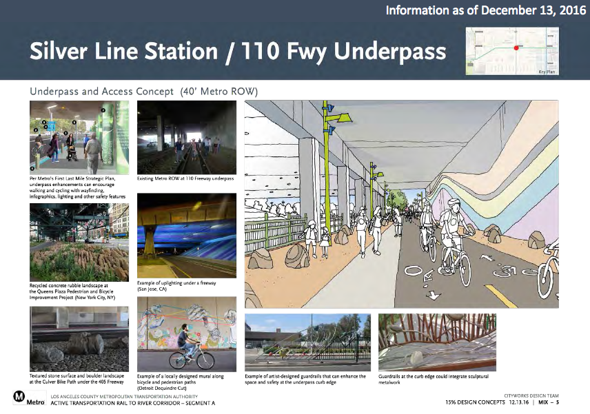
Underneath the 110 Freeway, the path could look like the image below. It would represent a significant improvement to the area, and a much needed one, considering how isolated and unwelcoming that section of Slauson can feel to those on foot, especially in the evenings.
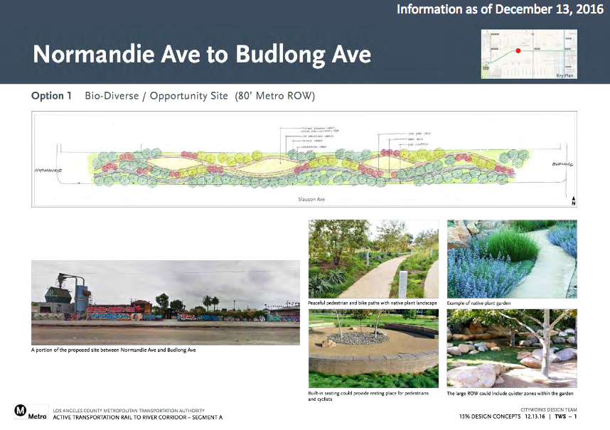
Where the ROW is as wide as 80 feet, like between Normandie and Budlong, there is space for creative landscaping and, hopefully, amenities like benches or fitness equipment that will help bring families out to exercise and play together.
As noted above, these are only some of the options for the corridor. And, importantly, nothing has been finalized as yet. There will be a public meeting on the Segment A on January 26, 2017, at the Hubert H. Humphrey Comprehensive Health Center, 5850 S Main St, Los Angeles, CA 90003, to get feedback from the community on what they would like to see.
We will have a more in-depth story on the potential plans in the new year.
Until then, happy holidays and safe travels through the public space to you and yours.
***
We've covered the evolution of the Rail-to-River project for a few years now. For more background on the project, see Metro's website, here, or check out our past coverage:
- December, 2013: Dear Santa, Please Bring Us an Active Transportation Corridor Along Slauson, but Don’t Forget the Community in the Process (background on the plan; lack of outreach)
- March, 2014: Feasibility Study on Rail-to-River Project Takes Another Step Forward (plan begins to come together; outreach still a major problem)
- October, 2014: Motion to Move Forward on Rail-to-River Bikeway Project up for Vote Thursday (breaks down the feasibility study in more detail, costs, timeline)
- May, 2015: Planning and Programming Committee Recommends Metro Board Take Next Steps on Rail-to-River ATC (more on costs, timelines)
- October, 2015: The Rail-to-(Almost)-River Gets Boost with $15Mil TIGER Grant (yay, actual money!)
- May, 2016: Metro Awards Contract for Environmental Study and Design of Phase I of Rail-to-River Bike Path (OMG it is actually happening; request that outreach finally be meaningful)
- August, 2016: Metro Explores Alternative Rail-to-River Routes Through Southeast Cities (where we learn Metro and the Southeast Cities do not play together well)
- December, 2016: Rail-to-River Route Through Huntington Park, Bell Emerges as Best Candidate; Community Meeting December 8 (The Randolph Street option emerges as the favorite while also the most expensive and most complicated option; Community Advocates demand Metro handle outreach better and incorporate walking into plans better)
Stay in touch
Sign up for our free newsletter
More from Streetsblog Los Angeles
Eyes on the Street: New Lincoln Park Avenue Bike Lanes
The recently installed 1.25-mile long bikeway spans Lincoln Park Avenue, Flora Avenue, and Sierra Street - it's arguably the first new bike facility of the Measure HLA era


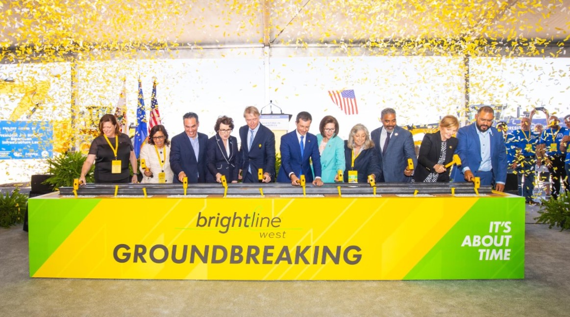
Brightline West Breaks Ground on Vegas to SoCal High-Speed Rail
Brightline West will be a 218-mile 186-mile-per-hour rail line from Vegas to Rancho Cucamonga - about 40 miles east of downtown L.A. - expected to open in 2028
This Week In Livable Streets
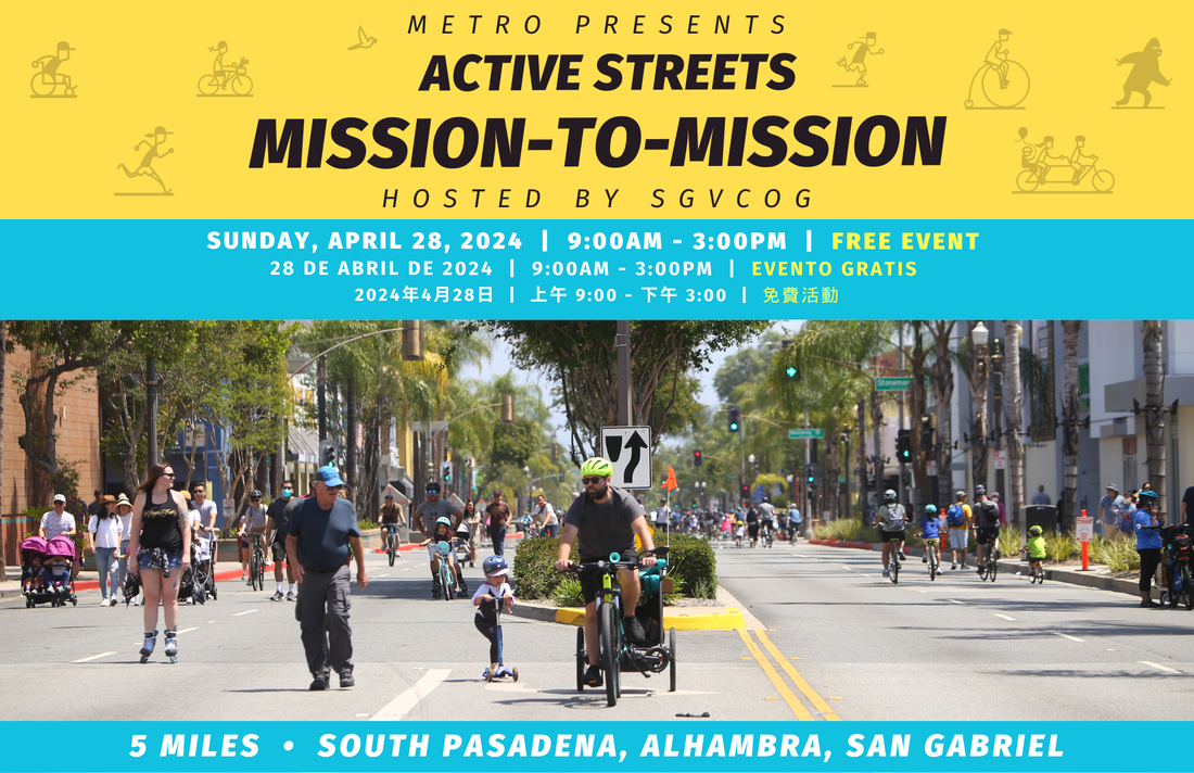
Active Streets Mission-to-Mission, LAPD reports on its use of force in 2023, Pasadena Transit plans, Metro subway construction, and more