Metro Seeks Input on Design Options for Segment A of Rail-to-River Bike/Pedestrian Path
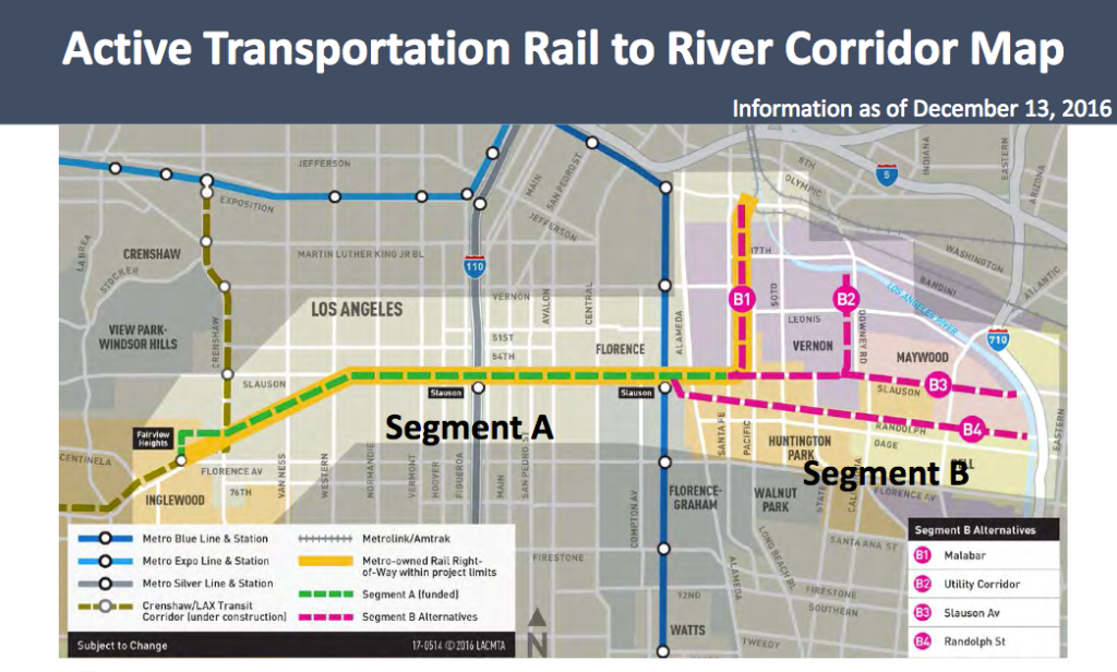
Last month, I posted a preview of some of the potential design elements for Segment A of the Rail-to-River bike and pedestrian path. The project to convert the Slauson corridor’s blighted rail right-of-way (ROW) into an amenity connecting South and Southeast Los Angeles communities to transit, schools, jobs, the L.A. River, and each other is moving along at a rather rapid pace. Deadlines attached to federal monies mean that Segment A of the project should be finished by mid-2019. [Segment B is still in the alternatives analysis phase.]
As part of this process, last Thursday, Metro and Cityworks Design held two meetings to lay out the design options for Segment A for the community and to solicit feedback.
Before we dive into some of the key aspects of the project, please note the full power-point presentation highlighting the opportunities for the community to shape the final look and feel of Segment A can be found here. The design is said to be only 15 percent complete at this point; Cityworks Design says they aim to have 30 percent of the design work completed by the end of the year. Those interested in having their say to shape the next design phase are invited to fill out a survey form, found here. [The archived livestream of last night’s meeting and other materials are not yet available on the project website, but a brief overview of the project is available here. If you need more background on the project, please see the past coverage listed at the bottom.]
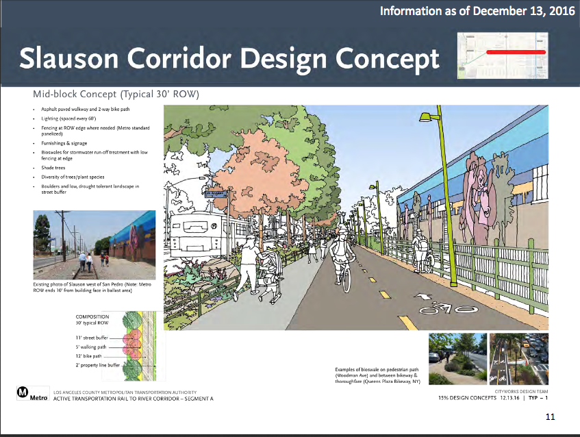
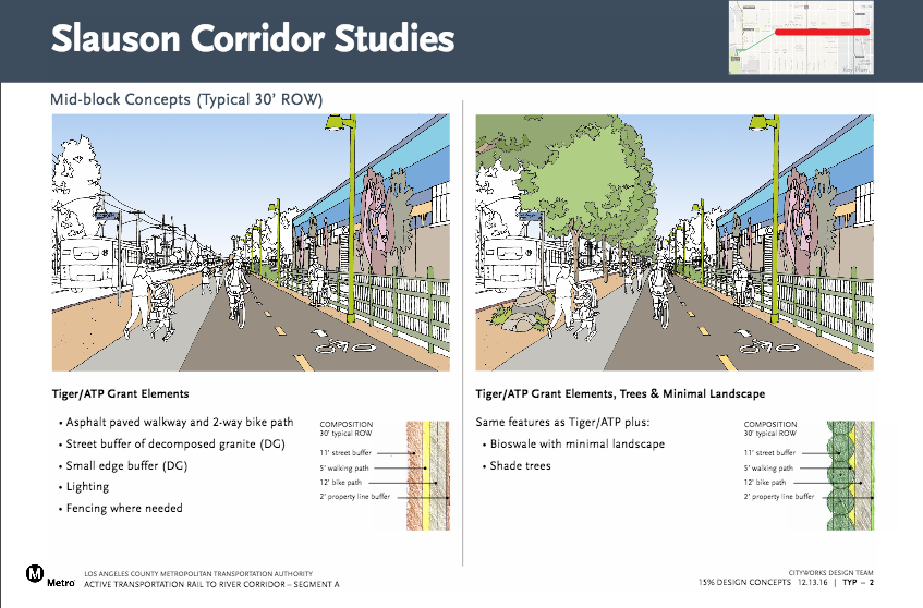
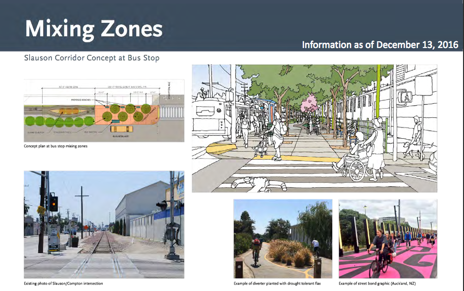
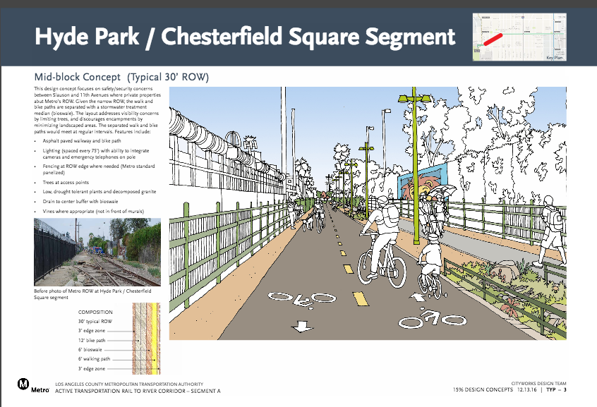
First, the 30-foot wide ROW along the Slauson corridor, above.
The intention is to have separate lanes for biking and walking, and to have both separated from the heavy traffic that barrels along Slauson via landscaping.
The way in which that space between the path and the street will be filled in is up for discussion, as are safety measures to ensure that there is as little conflict as possible between those biking and walking.
Given that the majority of those surveyed last fall said they would be likely to use the path for walking and that the area is mainly comprised of multi-generational families, ensuring that the path is safe and welcoming for elders, small children, the disabled, and anyone in between is paramount. Shade trees, ample lighting, benches, trash cans, water fountains, community-specific art pieces, and occasional placards (and equipment, where space is available) indicating exercises people can stop and do along the way would do much to make the path inviting to those families.
Care should also be taken to ensure that there is a clear demarcation between the walking and biking paths, perhaps using signage and other design elements to remind people to go slow and look out for each other. Collisions between pedestrians and cyclists along the L.A. River bike path, as pedestrian advocate Deborah Murphy has repeatedly stated, underscore the importance of using design to ensure that both can utilize the space safely.
One way to make that delineation clear could be to use different materials for the walking path. There are few jogging trails in the area, and making the walking path a bit softer – perhaps like a cinder track* – might both encourage exercise and discourage cyclists from weaving into pedestrian space. [*Only if this would not inhibit disabled users.]
If different materials can’t be used, paint or thermoplastic design elements might also help make those delineations clearer. Hopscotch courts and other playground-game markings would remind users to share the path with families, while making it tons more fun for kids.
At intersections, Cityworks Design suggested that the best way forward might be to have raised crosswalks that would be level with the path. Such a design would make transitioning between path and road easier for those in wheelchairs, with walkers or strollers, or on bikes.
A raised surface would also help keep cars from encroaching into the crosswalk, especially those waiting to turn right. At present, the tracks keep most drivers from edging forward toward the corner. Without some other sort of barrier to replace the tracks, the temptation to creep (or take a fast right turn) through the crosswalk might be too great.
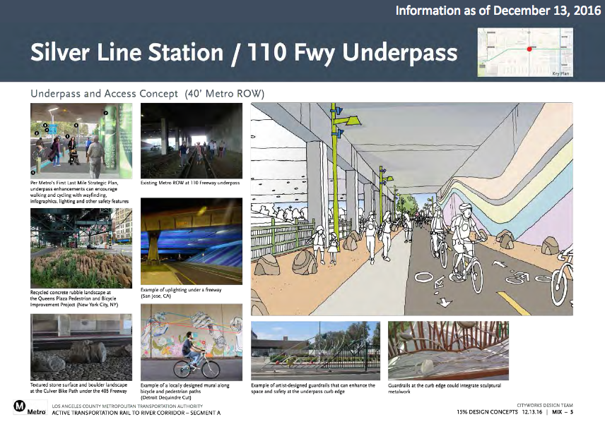
Because of the limits on the landscaping that can be done under the 110 freeway, Cityworks raised the possibility of using art to beautify the space along the walls (below). Twenty-four-hour lighting was suggested, with emergency phones and cameras to monitor the space, as well.
Two new crosswalks will be striped to link users to destinations along Figueroa and Broadway more easily, and a guardrail would also likely be implemented to discourage pedestrians from cutting across Slauson under the freeway.
Along the entirety of the corridor there are several spots Metro has dubbed “Opportunity Sites.”
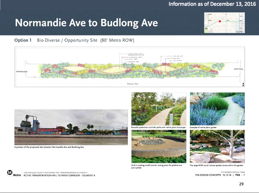
One such site is located between Normandie and Budlong Avenues, where the ROW widens to 80 feet, giving Metro room to create spaces for landscaping, seating, or activities. Other opportunity sites are much smaller, but still represent opportunities to carve out space for activities or relaxation.
Option 1, above, envisions a more passive green space with shade trees, seating, and a meandering walking path.
Option 2, below, envisions a more active space by dedicating room for community activities – a farmer’s market, vending, neighborhood events, play, fitness, etc.
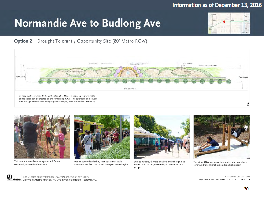
My own leanings are toward the second option, with a vehement caveat that no opportunity sites be designed without significant community consultation.
It is important to have a sense of the kinds of community events and activities the space would host ahead of time so that it gets maximum usage, that it gets maximum usage by the existing South Central community, and that those uses are sustainable. A food truck event, as suggested in the rendering, for example, might draw people from outside the area, but do little to benefit the local community or enhance residents’ connection to the space.
Things like a community-centric bike-library, where people who can’t afford their own bikes could check one out to ride on the path, fitness equipment, open-air fitness, gardening, or other health classes (if grants could be found to hire and train residents to lead walking or other health-focused groups), drum circles, open-air arts classes, a showcase of local vendors on the weekends, picnic facilities, game tables, and the occasional rail for skateboarders might cater better to local residents’ needs.
Given that so many of the opportunity sites are so close together (below) and the ones furthest west will be on the part of the path that runs between buildings, creation of a fitness course might help keep the spaces active and inviting to families, make them accessible to all ages, and provide residents of all fitness levels with health amenities that are scarce in South Los Angeles.
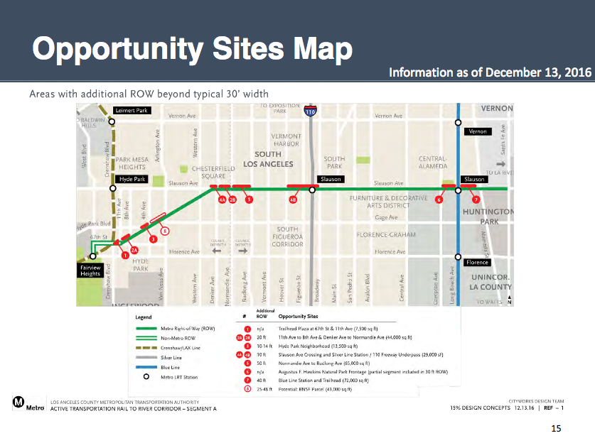
CityDesign is looking to design the opportunity sites across the street from the Slauson Blue Line station to invite visitors into the Augustus Hawkins Natural Park – a quiet and lovely watershed park located at Compton and Slauson.
Right now, the park is completely enclosed – minus the Compton entrance – and is actually quite hard to see into, because of the stone fencing, gates, and high vegetation. The installation of a long-overdue new [signalized, I hope?] crosswalk linking the park and the path to the train station would hopefully inspire the opening of another of the park’s shuttered gates.
The site may also be ideal for the placement of maps and information about the path, the community and area resources, upcoming health-related or other events, and Augustus Hawkins and other nearby park spaces. If a bike-library was indeed to be created for path users, this would be an ideal spot to put another hub.
Unfortunately, the shortage of opportunity sites between the 110 and the Blue Line suggests that the handful of local vendors that have worked that section of the corridor for many years are likely to have their livelihoods disrupted. How Metro plans to handle addressing this issue remains unclear – the Q&A portion of the meeting ended before Metro answered my question regarding any plans to notify the vendors, work with them to keep the corridor active, or help them transition to another area, if necessary. Considering that some of the food vendors have been there for approximately a decade, and one gentleman has been selling tools at Main and Slauson for nearly three decades, it is safe to assume that construction of the path will be very disruptive for them. Metro needs to begin reaching out to them now.
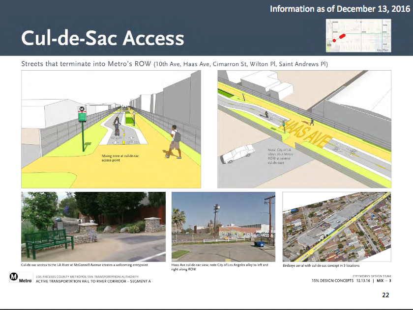
Moving westward to the Hyde Park/Chesterfield section of the path – the portion that will cut diagonally towards the future Fairview Heights station of the Crenshaw Line, above – there is enough space to separate the bike and pedestrian paths, minimizing the likelihood of collisions.
Running largely between windowless buildings and the occasional residence, the long distances between path openings mean the design challenge here is to ensure that the path feels safe. Ample lighting was one suggestion. Other suggestions included emergency phones, cameras, limiting the trees along the path to the intersection areas (in order to keep sightlines open), and creating gates at the five cul de sacs that butt up against the path to allow for greater access for area residents (and create more entry/exit points).
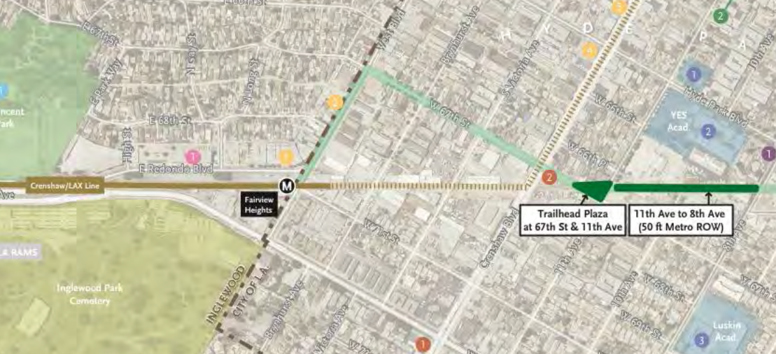
It is not yet clear what the final plan is to get path users from the trail to the Fairview Heights station and the Crenshaw Line.
At present, it is expected that path users will exit at 11th Street and travel along 67th, using sharrows or bike lanes, and then move south on West to the station, using a bike lane (light green route, below). According to Cityworks Design, they are still working with Metro and the cities of L.A. and Inglewood to work out the safest option to get people to the station, the path, and surrounding destinations.
Finally, something which was not up for comment but which merits comment anyways was the new graphic Metro artists created to generate excitement about the project.
The graphic represents a valiant and sincere effort on the part of Metro to respond to critiques from the Community Advisory Committee, which complained that the shot of a bike wheel on a generic bike path didn’t speak much to the potential diverse uses of the path or the community that would be using it.
When the new graphic arrived in my inbox, I could see that Metro had worked hard to bring in many of the elements we asked for, and I appreciated that very much.
What I did also think, however, was that it didn’t look anything like the South L.A. community I know and love.
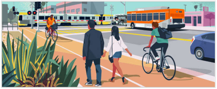
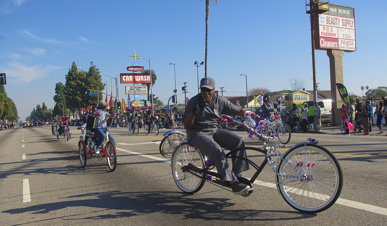
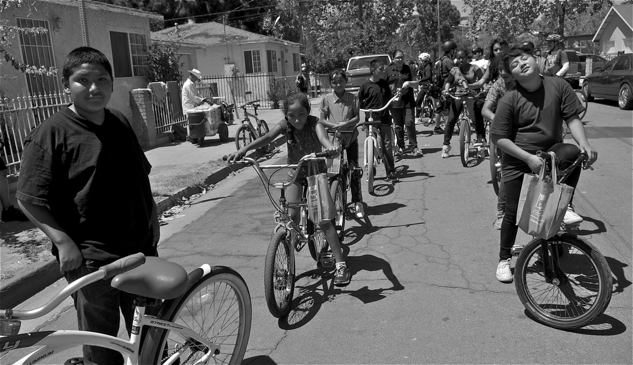
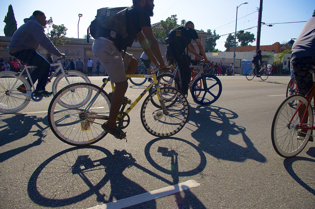
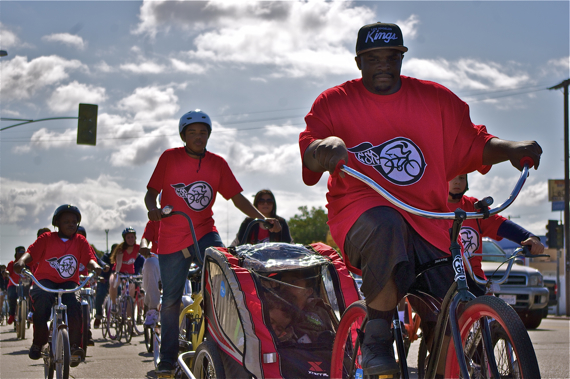
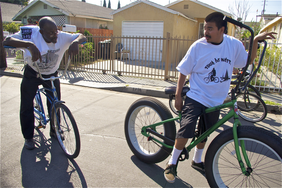
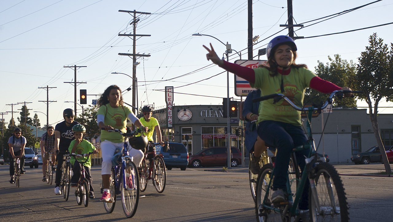
The South L.A. riders I know have colorful fixies, creative cruisers, incredible low-riders, bikes that are barely held together, and everything in between. I have absolutely nothing against blondish kids on road bikes, but I honestly can’t tell you when the last time was that I saw one riding along Slauson.
This may seem like a small thing, but it isn’t.
Gentrification is on the tip of many folks’ tongues these days. And lower-income communities of color are increasingly aware of the links between public infrastructure projects and private investment. Bicycle projects, in particular, tend to raise a lot of eyebrows. When communities are denied the infrastructure fixes they have clamored for for years and then are told they will be getting an “improvement” that neither addresses those long-standing needs nor seems to fit a demand of the existing residents, they have a lot of questions about who this project may be for and what the city’s designs on their community might be. While it is clear the Rail-to-River project was conceived out of a desire to benefit the South and Southeast Los Angeles communities, if the messaging that surrounds it seems to suggest otherwise, it can fuel distrust among those it is intended to benefit.
If Metro can find it in their hearts and their budget to represent the community more accurately, that could help allay fears as the project moves forward. Some images of local riders that could serve as inspiration are below.
We’ve covered the evolution of the Rail-to-River project since 2013. For more background on the project, see Metro’s website, here, or check out our past coverage. If you have questions about why this corridor is not being considered for rail, please see the first few articles which reference the Harbor Subdivision study and the robust discussion you will find in those stories’ comments sections:
- December, 2013: Dear Santa, Please Bring Us an Active Transportation Corridor Along Slauson, but Don’t Forget the Community in the Process (background on the plan; lack of outreach)
- March, 2014: Feasibility Study on Rail-to-River Project Takes Another Step Forward (plan begins to come together; outreach still a major problem)
- October, 2014: Motion to Move Forward on Rail-to-River Bikeway Project up for Vote Thursday (breaks down the feasibility study in more detail, costs, timeline)
- May, 2015: Planning and Programming Committee Recommends Metro Board Take Next Steps on Rail-to-River ATC (more on costs, timelines)
- October, 2015: The Rail-to-(Almost)-River Gets Boost with $15Mil TIGER Grant (yay, actual money!)
- May, 2016: Metro Awards Contract for Environmental Study and Design of Phase I of Rail-to-River Bike Path (OMG it is actually happening; request that outreach finally be meaningful)
- August, 2016: Metro Explores Alternative Rail-to-River Routes Through Southeast Cities (where we learn Metro and the Southeast Cities do not play together well)
- December, 2016: Rail-to-River Route Through Huntington Park, Bell Emerges as Best Candidate; Community Meeting December 8 (The Randolph Street option emerges as the favorite while also the most expensive and most complicated option; Community Advocates demand Metro handle outreach better and incorporate walking into plans better)
- December, 2016: Preview Some of the Design Options for the Slauson Segment of the Rail-to-River Bike/Pedestrian Path (self-explanatory)

Read More:
Streetsblog has migrated to a new comment system. New commenters can register directly in the comments section of any article. Returning commenters: your previous comments and display name have been preserved, but you'll need to reclaim your account by clicking "Forgot your password?" on the sign-in form, entering your email, and following the verification link to set a new password — this is required because passwords could not be carried over during the migration. For questions, contact tips@streetsblog.org.