South El Monte is only 2.3 square miles large. It has some 21,000 residents, 2,400 businesses, and soon it will have 44 upgraded crosswalks near its nine school campuses. On Wednesday (February 8), the city will close its Request For Proposals (RFP) for engineering and design services for its Safe Routes To School project. This is funded with a $1,637,000 grant from the state Active Transportation Program (ATP) Cycle 5.
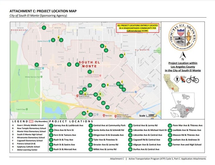
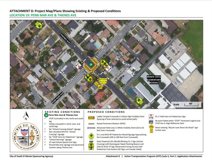
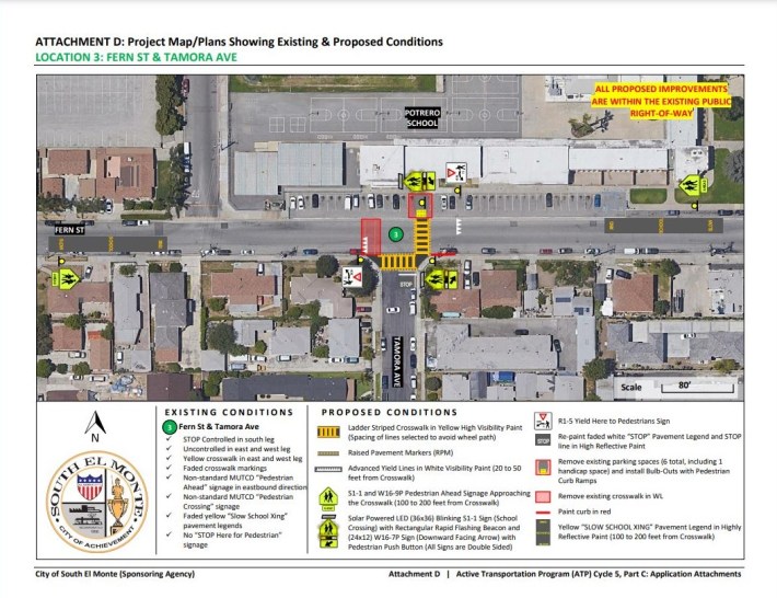
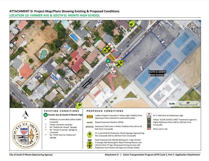
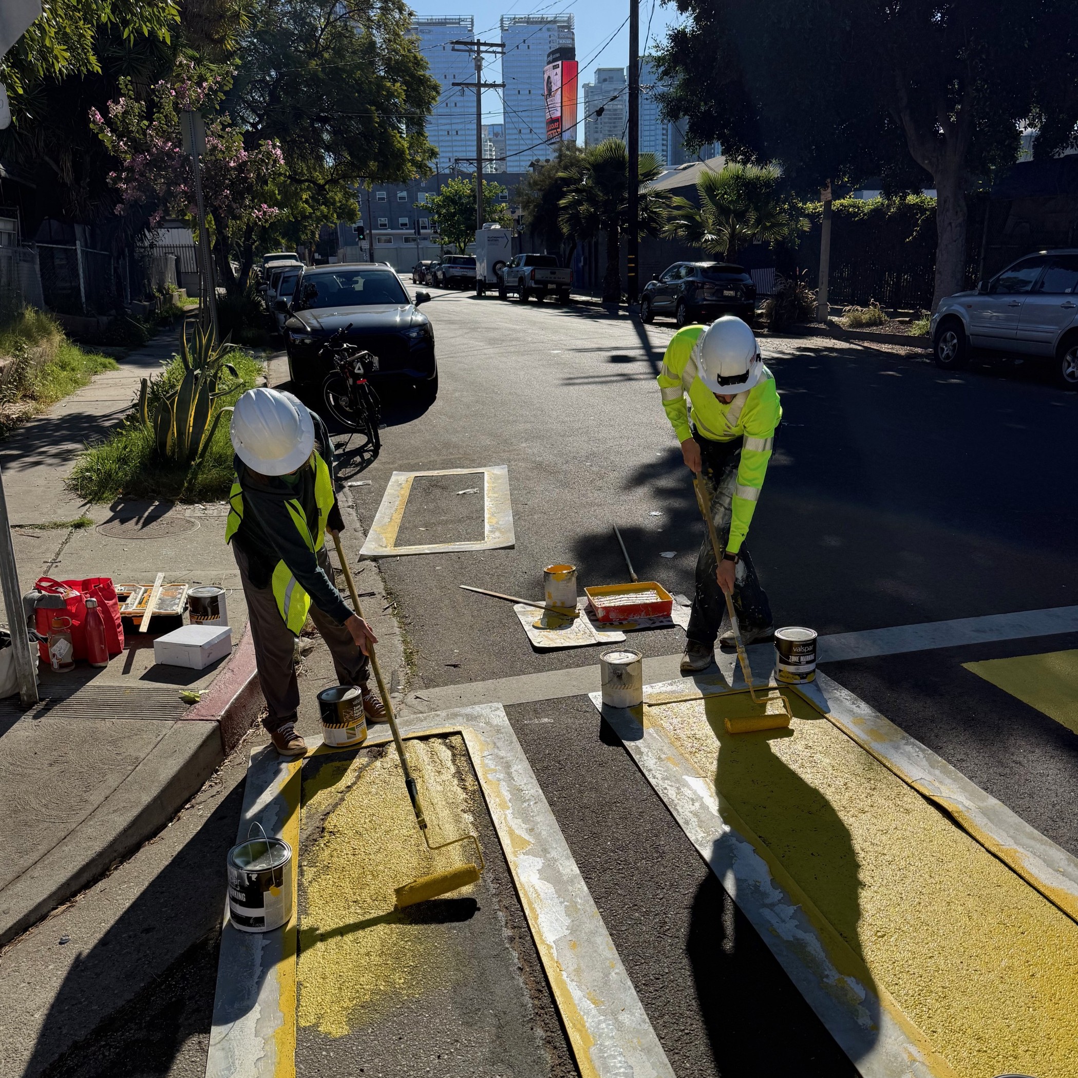
23 sites across the city will have a mixture of crosswalks restriped, new signage installed (some with flashing beacons), added pedestrian countdowns, raised pavement markers, new overhead signals, and touched up pavement legends. The project maps of all the sites can be seen starting on page 77 of the RFP.
SBLA visited the sites adjacent to the three schools with the highest enrollments in the city: Monte Vista Elementary (614), Potrero K-8 School (835), and South El Monte High School (1,198).
Monte Vista Elementary is located on Thienes Avenue. One neighbor said improvements, especially stop signs and flashing beacons, are needed on Thienes. “People just haul ass here all the time, because we connect the two major [north-south running] streets [Durfee Avenue and Santa Anita Avenue].” Three sets of restripings are planned along Thienes (at Penn Mar Avenue, Leafdale Avenue, and Maxson Road), with flashing beacons at both ends of the trio. Right in front of the school, Thienes at Leafdale, stop legends will be repainted.
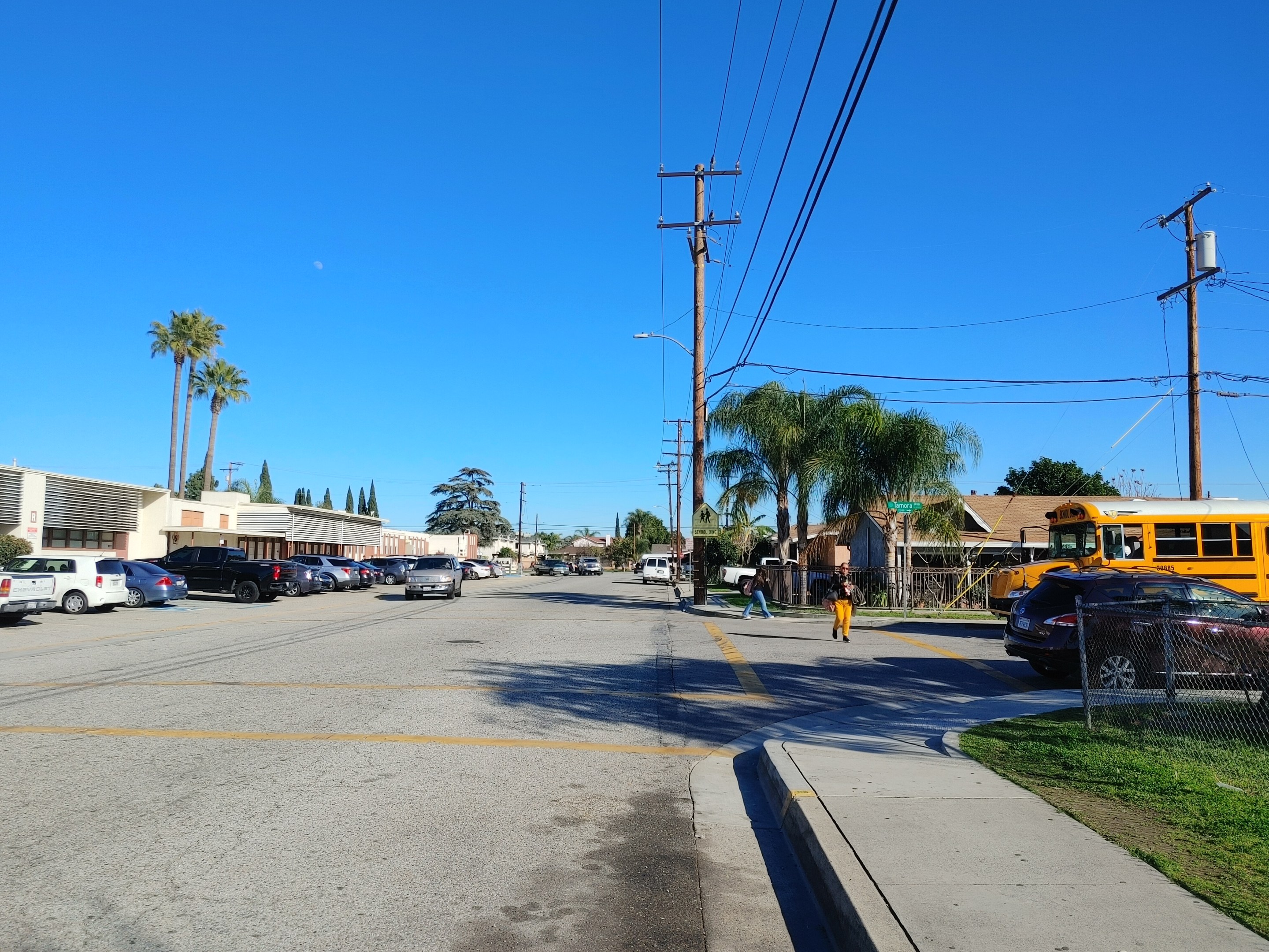
Up at the city’s north end, Potrero K-8 School will have two restriped yellow ladder crosswalks painted immediately in front of it on Fern Street and Tamora Avenue. This is away from the school’s busy pickup/drop-off area on Potrero Avenue; the crosswalks will connect to the staff parking lot. Six parking spaces will be removed to make room for bulb-outs and pedestrian curb ramps. At the time of SBLA’s visit (2:30-2:45 p.m.), students were getting out, but there was no crossing guard stationed at this intersection.
South El Monte High School had some of the more curious sites selected for the project. Rather than planning any traffic calming measures along busy Durfee Avenue (where the school’s main entrance is) or on Peck Avenue or Santa Anita Avenue where they cross the 60 Freeway, improvements are set for the small neighborhood beside the school’s back gate. These include a set of flashing beacons on the stop signs on Andrews Street (which connects to Santa Anita via Lexington-Gallatin Road) and a re-striped crosswalk with flashing beacons coming out the back gate on Farmer Avenue.
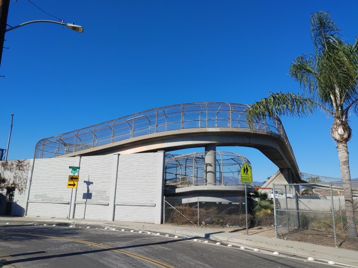
However, these small residential streets do lead to a pedestrian overpass for the 60 at the corner of Lexham Avenue and Fawcett Avenue. A passerby told SBLA that though they take the overpass often, they never see any crossing guards stationed on it for the high school students.
As is stated on the project map, “All project locations entirely located in a disadvantaged community per CalEnviroScreen score.” In Santa Monica, crossing guards are stationed throughout the city as part of its Safe Routes To School program. It remains to be seen if the El Monte Union High School District will staff more crossing guards as part of this effort.
Streetsblog’s San Gabriel Valley coverage is supported by Foothill Transit, offering car-free travel throughout the San Gabriel Valley with connections to the Gold Line Stations across the Foothills and Commuter Express lines traveling into the heart of downtown L.A. To plan your trip, visit Foothill Transit. “Foothill Transit. Going Good Places.”
Sign-up for our SGV Connect Newsletter, coming to your inbox on Fridays!
