Where All of L.A.’s Protected Bike Lanes Are
5:23 PM PST on December 19, 2019
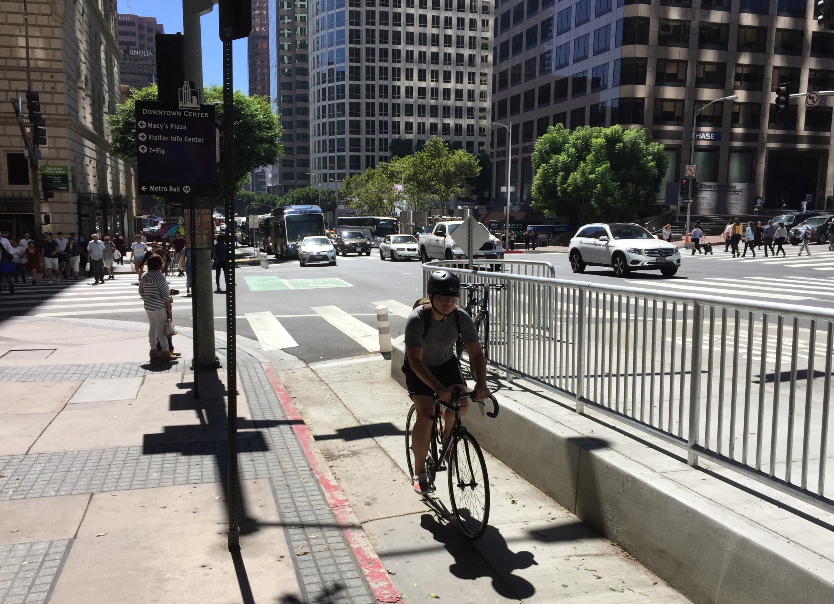
Protected bike lane on Figueroa Street in downtown L.A. – all photos by Joe Linton/Streetsblog L.A. excepts as noted otherwise

Los Angeles has protected bike lanes. Few and far between. But they are here. (Updated 12/20 - added Anaheim Street in Harbor City - updated totals)
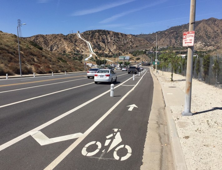
For the uninitiated, protected bike lanes (sometimes called cycletracks) are European-style on-street bikeways that include some separation between bicycles and cars. Protected bikeways are safer than conventional bike lanes that put cyclists next to fast-moving cars. Conventional bike lanes tend to favor more confident, intrepid cyclists, while protected lanes are considered appropriate for everyone from "8 to 80" - essentially all ages.
L.A. opened its first parking-protected bike lanes in Northridge in 2015. Prior to then, city transportation engineers stuck to state and federal design standards that in effect prohibited these facilities, which are common in Europe and were beginning to take hold in several large North American cities.
The city's first two-way protected facility opened this year.
The city of L.A. currently has just eleven protected bike facilities, totaling 10.4 center-line miles (or 19.4 lane miles - view spreadsheet.) These facilities are worthwhile, but they represent a drop in the bucket for a city the size of Los Angeles - and nowhere near approaching a protected network.
For comparison, New York City has about 126 lane-miles of protected bike lanes, and is currently installing about twenty new miles each year. San Francisco (about a tenth of the area of L.A.) has nineteen lane-miles and is expecting to install about twenty new miles over the next two years. San Jose built ten new lane-miles of protected bikeways last year. Chicago has roughly 25 center-line miles of protected bike lane. (Some additional city data at this SBSF post.)
Below is a list of all eleven L.A. City protected bikeways as of December 2019. Facilities are listed in alphabetical order.
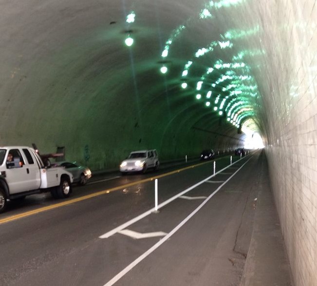
2nd Street (tunnel)
- 0.4 miles: Hill Street to Figueroa Street in downtown Los Angeles (map, street view)
- features: essentially one long block of two one-way protected bike lanes, protected by plastic bollards
- implemented December 2013
- notes: The Second Street tunnel protected bike lanes were L.A. City's first protected bike lanes, though implemented without much city fanfare at the time. The lanes connect westward with a half mile of conventional bike lanes on Glendale Boulevard from Figueroa to Toluca Street. Circa late 2016 (apparently as part of U.S. Courthouse construction), the facility was partially extended eastward, with one block of westbound protected lane added on 2nd Street between Broadway and Hill Street.
- coverage: SBLA December 2013
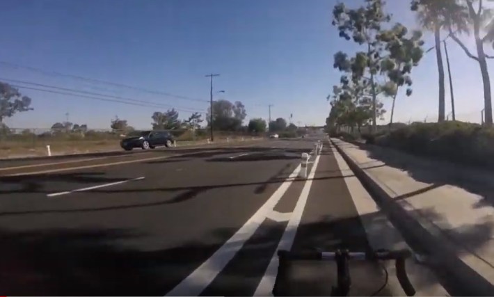
Anaheim Street (added 12/20)
- 0.6 miles: near I Street to near Vermont Avenue/Gaffey Street, in Harbor City (map, street view)
- features: plastic-bollard-protected lanes
- implemented mid-2019
- notes: LADOT included this facility in a list of bikeways to be implemented in FY 2019-20
- coverage: mentioned SBLA July 2019
Balboa Boulevard
- 1.1 miles: Woodley Avenue/Lisette Street to Balboa Road (connector to San Fernando Road) in Granada Hills (map, street view)
- features: protected by plastic bollards
- implemented circa June 2019
- notes: The Balboa Boulevard bollard-protected bike lanes appear to serve mostly to narrow the street to transition between a seven-lane-wide segment that narrows to three lanes on the bridge over the 5 Freeway. The area is suburban, hilly, and not especially conducive to everyday bicycling.
- coverage: mentioned SBLA July 2019
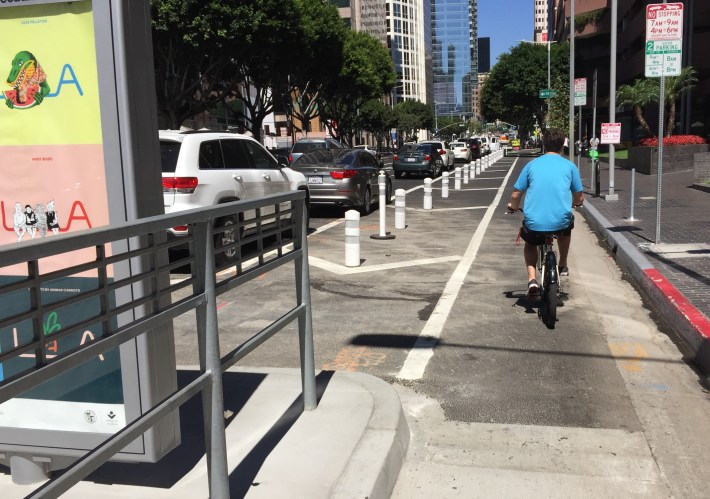
Figueroa Street (MyFigueroa)
- 2.6 miles: Exposition Boulevard to Wilshire Boulevard in downtown Los Angeles (map, street view)
- features: MyFigueroa varies quite a bit. It is mostly parking-protected, with stretches of plastic-bollard-protected and unprotected buffered bike lanes. The facility has bike signals, green pavement, bus islands, and a northbound bus-only lane (from 22nd Street to 5th Street.) There are protected bike lanes on both sides of the street from Exposition to 11th Street (2.0 miles) and 0.6 miles of one-way northbound protected bike lane lane from 11th Street to Wilshire. MyFigueroa also features an additional half-mile of unprotected bike lanes extending from Exposition to Martin Luther King Boulevard
- implemented August 2018
- notes: The 5.5-mile "MyFigueroa" project was anticipated to be a shining example of a walkable downtown. The project faced legal challenges. After nearly a decade of legal and construction delays, a watered-down facility barely limped across the finish line, only to be hampered by design flaws and scofflaw drivers.
- coverage: SBLA August 2018
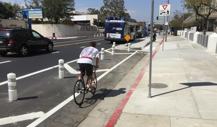
Los Angeles Street
- 0.5 miles: Alameda Street to First Street in downtown L.A. (map, street view)
- features: bike lanes, bus islands, bike signals
- implemented June 2017
- notes: The Los Angeles Street protected bike lanes had the first bike signals and first bus islands in L.A. LADOT GM Seleta Reynolds billed the short facility as a laboratory for new features that the department planned to implement elsewhere.
- coverage: SBLA June 2017
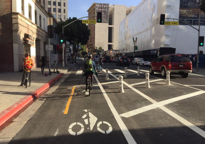
Main Street (couplet with Spring Street)
- 1.5 miles: César E. Chávez Avenue to 9th Street in downtown L.A. (map, street view [at press time, too recent to appear] )
- features: 2-way parking-protected bikeway on one-way street
- implemented November 2019
- notes: see Spring Street below
- coverage: SBLA November 2019
Monterey Road
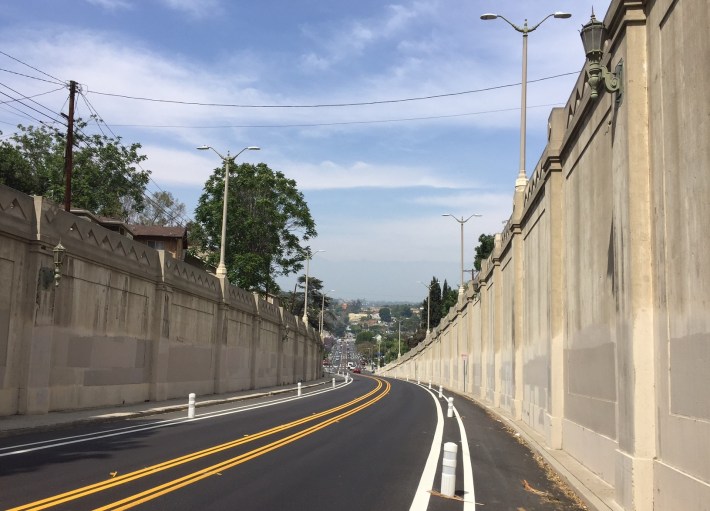
- 0.3 miles: Pullman Street to near Debs Park Road in Monterey Hills (map, street view)
- features: plastic-bollard-protected pass road - part of a 1.8-mile mostly just buffered bike lane
- implemented circa April 2017
- notes: Protection is located in the hilly Monterey Road Pass, sometimes called the "upside down bridge."
- coverage: SBLA May 2017
Reseda Boulevard
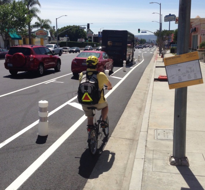
- 1.0 mile: Plummer Street to Parthenia Street in Northridge (map, street view)
- features: parking-protected bike lanes
- implemented April 2015
- notes: Implemented as part of Mayor Eric Garcetti's Great Streets Initiative under City Councilmember Mitch Englander, Reseda Blvd is L.A. City's first protected bike facility longer than a single block - and its first parking-protected bike lanes. A 2019 John Lee council motion threatens to remove the protected lanes.
- coverage: SBLA April 2015
Spring Street (couplet with Main Street)
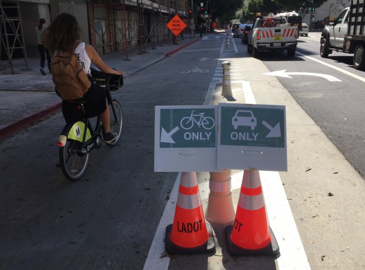
- 0.8 miles: 3rd Street to 9th Street in downtown L.A. (map, street view)
- features: two-way parking-protected bikeway on one-way street
- implemented April 2019
- notes: Spring Street’s right-side buffered bike lane was converted to a left-side parking-protected lane which opened in October, 2018. That one-way lane was converted to two-way in April, 2019. Spring's northbound complement, Main Street, underwent a similar transition, opening in November 2019.
- coverage: SBLA April 2019
Van Nuys Boulevard
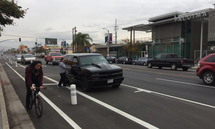
- 0.8 miles: from Laurel Canyon Boulevard to San Fernando Road in Pacoima (map, street view)
- features: parking-protected southbound lane only, with buffered bike lane northbound
- implemented December 2016
- notes: Implemented as part of the mayoral Great Streets Initiative under City Councilmember Felipe Fuentes
- coverage: SBLA December 2016
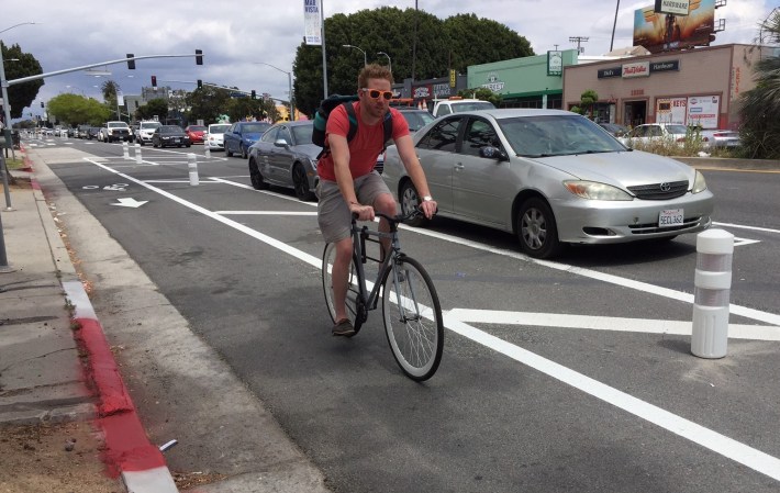
Venice Boulevard
- 0.8 miles: Inglewood Boulevard to Beethoven Street in Mar Vista (map, street view)
- features: parking-protected bike lanes, part of project that included new mid-block crossings, leading pedestrian intervals, and upgraded crosswalks
- implemented May 2017
- notes: Implemented as part of the mayoral Great Streets Initiative under City Councilmember Mike Bonin, Mar Vista's protected lanes have been criticized by some. LADOT data confirmed that they have made the street significantly safer.
- coverage: SBLA May 2017
That is all eleven.
(A handful of very short stretches have been omitted from the list. Those omissions include two one-block facilities [westbound 7th Street from Hope Street to Flower Street, and eastbound 3rd Street between Main Street and Spring Street] and bike lanes that have only a few bollards here and there - for example Venice Boulevard near Redondo Blvd. Together, all these omissions constitute less than half a lane-mile. There are more short unprotected stretches counted as protected in the facilities listed than the total of these omissions.)
In addition to these facilities in the city of L.A., there are another eight or nine additional protected bikeways in other L.A. County cities, including several in Long Beach, several in Santa Monica, one in Temple City, and one nearly completed in Claremont.
Stay in touch
Sign up for our free newsletter
More from Streetsblog Los Angeles
Metro Board Funds Free Student Transit Pass Program through July 2025
Metro student free passes funded another year - plus other updates from today's Metro board meeting
Eyes on the Street: New Lincoln Park Avenue Bike Lanes
The recently installed 1.25-mile long bikeway spans Lincoln Park Avenue, Flora Avenue, and Sierra Street - it's arguably the first new bike facility of the Measure HLA era
