Metro Offers Update on Rail-to-River Bike/Ped Path Design; Project to Break Ground Mid-2018
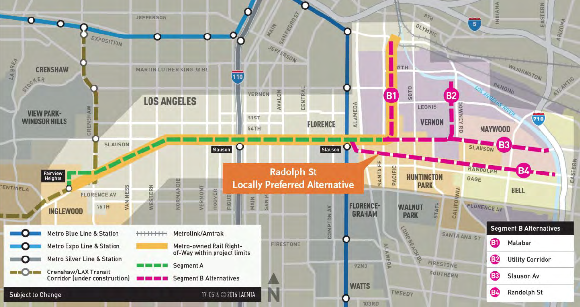
Segment A of the Rail-to-River bike and pedestrian path will run along Slauson between the Crenshaw and Blue Lines; Segment B will run along Randolph towards the river. Source: Metro
On June 29, Metro held a public update on the Rail-to-River bike and pedestrian path project slated for the Slauson corridor in South L.A.
The update was to showcase the design progress on Segment A (in green, above) thus far, get feedback on the proposed design, and advise the community of next steps.
For those unfamiliar with the project, the Rail-to-River project is an Active Transportation Corridor planned for the Metro-owned rail right-of-way (ROW) along Slauson Avenue in South Los Angeles. The 6.4 mile stretch of Segment A was planned to facilitate transit users' movement between the Crenshaw, Silver, Blue, and local bus Lines, while Segment B (in pink) would connect South L.A. with the Southeast Cities and, eventually, the L.A. River, expanding the regional bicycle network.
Because Metro must negotiate with Union Pacific to access the ROW along Randolph Street (the route chosen for Segment B) and work out plans with the cities the route will pass through, planning for Segment A has moved at a much quicker pace. Metro expects to see the preliminary (30 percent) design completed shortly and to hire a design/build construction contractor to finish the plans and break ground by mid-2018.
The project would be completed in late 2019, around the time that the Crenshaw/LAX Line would be opening.
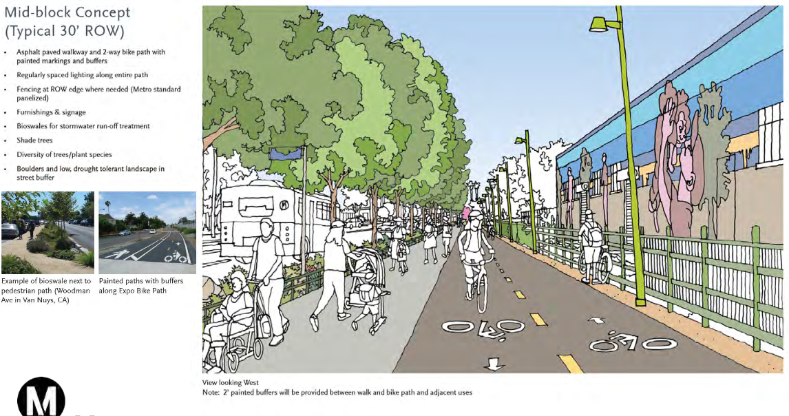
While the project is still considered an "active transportation corridor" aimed at facilitating connections, at the community advisory committee meetings, many of the participants (myself included) have emphasized the importance of ensuring the project is community-serving.
People will likely use the bike/pedestrian path to connect to transit and commute to work or school, but it's far more likely that it will be a place for residents to walk with their families and friends, to teach their kids to bike, and as a jogging path and fitness course.
Metro has tried to incorporate those uses into the design.
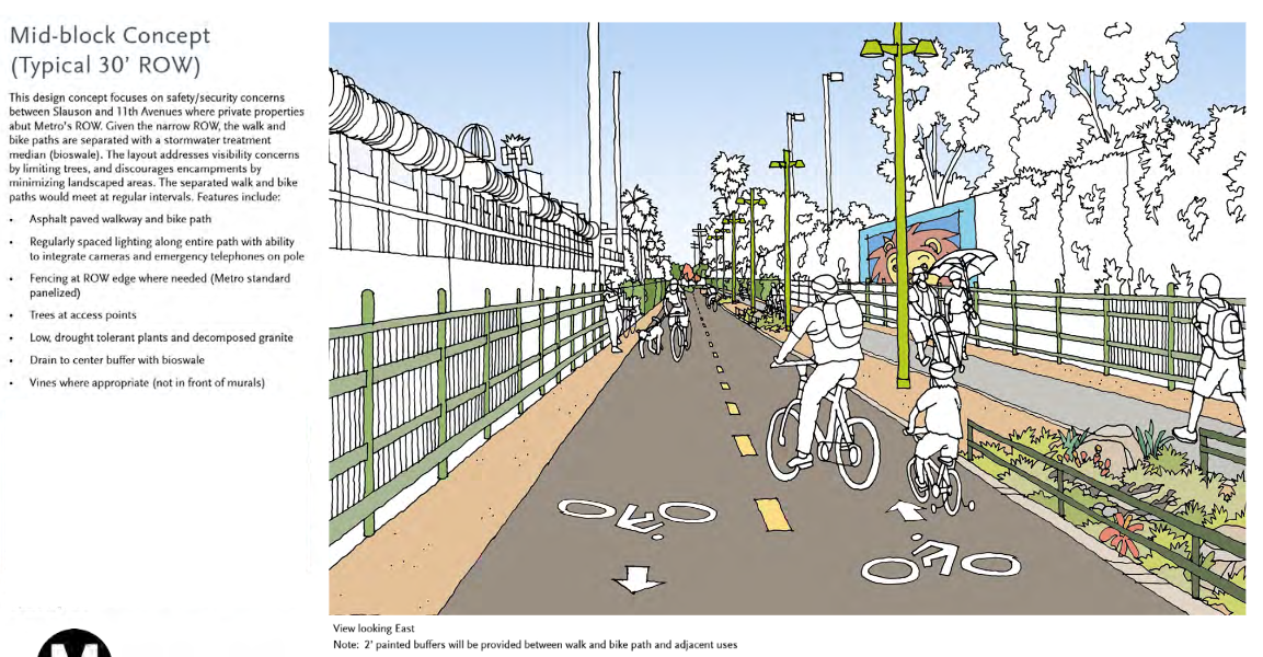
Where there is room, plans are to separate the walking and biking paths by diverting the walking paths through landscaping, zones with fitness equipment, game tables, benches, and other amenities. Between Normandie and Budlong (below), for example, where the ROW widens significantly, current plans call for game tables (orange), a community event space (blue), fitness equipment (red), a natural park (yellow), and a play area (purple) alongside the walking path (beige), which meanders parallel to the bike path.
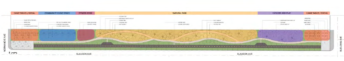
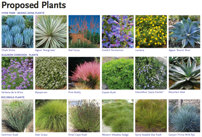
The windowless industrial buildings butting up against much of Slauson give the corridor an abandoned feel, despite the fact that many people work there and the neighborhoods on either side of it are densely populated and bustling with multi-generational families. The arrival of colorful and fragrant flowering plants would offer residents and curious kids a welcome respite.
Shade trees and lighting along the pedestrian path and an emphasis on safety at "mixing zones" - where pedestrians and cyclists cross paths with each other and motor vehicles at intersections - are also integral to the plans.
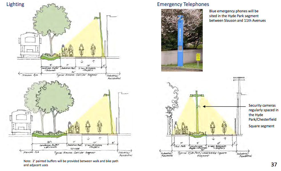
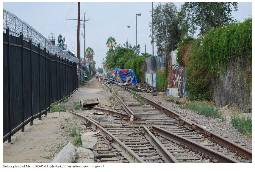
In the Hyde Park/Chesterfield Square segment (the section that turns southwest), the path moves between buildings and out of view from the street. As such, lighting, visibility, and safety will be prioritized. Emergency phones, graffiti abatement, and cameras were some of the suggestions aimed at making the path feel accessible to area residents (above).
The one section where the plans are not fully determined is for the path terminus.
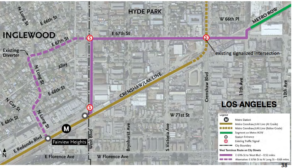
Because the Crenshaw/LAX Line will resurface along the ROW just south of 67th Street as it heads into Inglewood, the path will come to an end at a rather tiny triangular space at 67th and 11th Avenue.
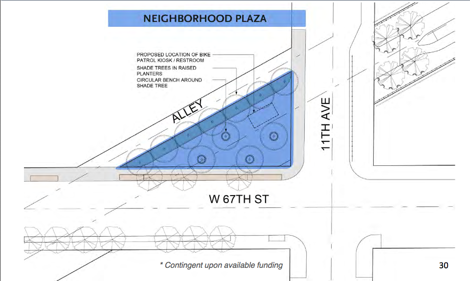
Because the intention of the path was to connect users to transit, the assumption underlying the plans has been that path users will want to connect to the Fairview Heights station. So, potential routes were devised to move folks safely there - either along 67th to West Blvd. or a along more circuitous route via Long Street.
But if the path is used by residents, they are more likely to wish to connect with other local assets - the Inglewood Cemetery, Edward Vincent Jr. Park, the Forum, the new stadium, Van Ness Recreation Center, Harvard Park, or area schools or shopping centers.
Connections to area assets have not yet been a significant component of discussions around the path, but I hope they will be as the design continues to move forward.
In their presentation from last week, Metro notes that it does not yet have funding secured for things outside the core elements of an active transportation project. Essentially, the landscaping and amenities planned for between Normandie and Budlong, the mini-park planned for the path terminus on 67th, improvements that would connect users to the Blue Line more safely, and improvements slated for Hyde Park - things that would make an active transportation path more accessible and more appealing - are not guaranteed just yet.
You can find out more about the project on Metro's project page: Metro.net/projects/R2R. The presentation meeting attendees saw can be found here. Boards attendees were able to view and offer feedback on can be found here. Our past coverage on the project is compiled in a list below.
- December, 2013: Dear Santa, Please Bring Us an Active Transportation Corridor Along Slauson, but Don’t Forget the Community in the Process (background on the plan; lack of outreach)
- March, 2014: Feasibility Study on Rail-to-River Project Takes Another Step Forward (plan begins to come together; outreach still a major problem)
- October, 2014: Motion to Move Forward on Rail-to-River Bikeway Project up for Vote Thursday (breaks down the feasibility study in more detail, costs, timeline)
- May, 2015: Planning and Programming Committee Recommends Metro Board Take Next Steps on Rail-to-River ATC (more on costs, timelines)
- October, 2015: The Rail-to-(Almost)-River Gets Boost with $15Mil TIGER Grant (yay, actual money!)
- May, 2016: Metro Awards Contract for Environmental Study and Design of Phase I of Rail-to-River Bike Path (OMG it is actually happening; request that outreach finally be meaningful)
- August, 2016: Metro Explores Alternative Rail-to-River Routes Through Southeast Cities (where we learn Metro and the Southeast Cities do not play together well)
- December, 2016: Rail-to-River Route Through Huntington Park, Bell Emerges as Best Candidate; Community Meeting December 8 (The Randolph Street option emerges as the favorite while also the most expensive and most complicated option; Community Advocates demand Metro handle outreach better and incorporate walking into plans better)
- December, 2016: Preview Some of the Design Options for the Slauson Segment of the Rail-to-River Bike/Pedestrian Path (self-explanatory)
- January, 2017: Metro Seeks Input on Design Options for Segment A of Rail-to-River Bike/Pedestrian Path
Stay in touch
Sign up for our free newsletter
More from Streetsblog Los Angeles
This Week In Livable Streets
CicLAvia returns to Venice Boulevard, Metro board committees, L.A. City Council Transportation Committee, Metro budget theater, and more
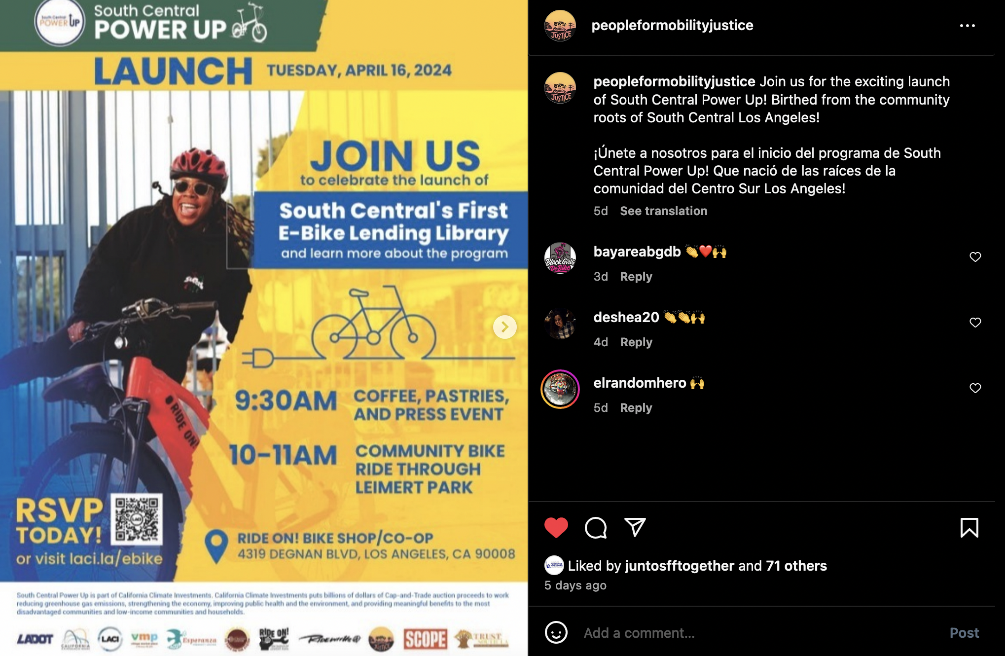
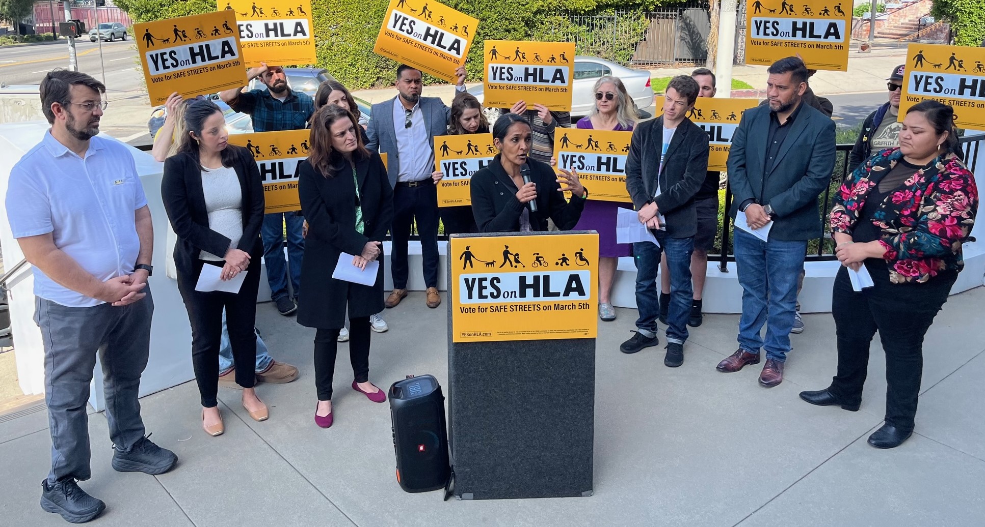

Measure HLA Is Now Officially Law for L.A. City
Check the city maps to find what bus, bike, and walk improvements are coming to streets in your neighborhood