Measure HLA, the Healthy Streets L.A. initiative, is now officially the law for the city of Los Angeles. HLA requires that, during street repaving, the city implements bus, bike, and walk improvements approved in the city's Mobility Plan 2035. The plan includes networks of new bus lanes, bicycle lanes, and pedestrian district improvements.
Measure HLA was approved with 65.50 percent of votes cast: 362,706 for and 191,020 against.
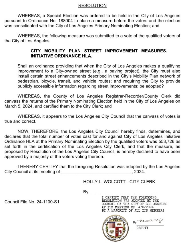
As anticipated by City Administrative Officer Matt Szabo, Measure HLA became effective five weeks after the March 5 election. Two days ago, the full City Council approved a resolution (Council File 24-1100-S1) certifying the election results, including Measure HLA passage.
Streetsblog has inquired to a couple of city department representatives, but there has been no public statement yet as to what the public should expect regarding HLA street improvements. There are some HLA council motions and departmental report-backs scheduled to be heard at the City Council Transportation Committee next Wednesday, April 17.
Right now, though, according to the text of Measure HLA, the trigger for plan implementation is "any paving project or other modification of at least one-eighth (1/8) of a mile" on city right-of-way including "street, parking strip, or sidewalk."
The city's routine street repaving segments are posted online at the Bureau of Street Services (StreetsLA) Pavement Preservation Program (PPP) online map. (For what it's worth, there are a few other repaving projects - outside of PPP - which will trigger HLA, but they are small programs, with details harder to find.)
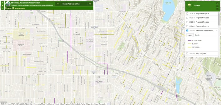
StreetsLA maps the full list of PPP segments approved, showing them by fiscal year. StreetsLA often makes small updates to the list (some projects get delayed, others get advanced), typically at the beginning of each month.
The full Mobility Plan is online at its Department of City Planning webpage.
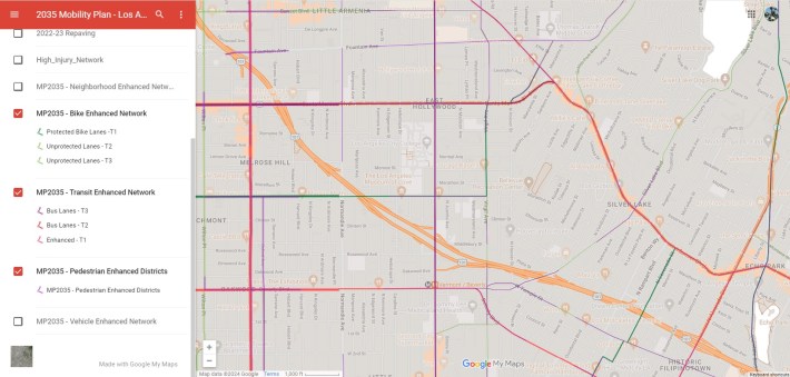
Measure HLA proponents mapped the various components of the plan on an easy to use Google Map.
You can find upcoming plan implementation segments by combining the two above maps.
Here is just one example: in East Hollywood, StreetsLA has announced repaving of Virgil Avenue between Silver Lake Boulevard and Middlebury Street, a 1,070 foot (1/5 mile) stretch. The Mobility Plan designates that full segment will have unprotected bike lanes, and south of the 101 Freeway it is a Pedestrian Enhanced District. So the city would add those improvements during the upcoming resurfacing.
Within a year, Measure HLA mandates that the city will deploy a website where the public can track HLA-mandated plan implementation.
There are still a lot of details to be worked out; Streetsblog will continue to track and report on Measure HLA progress.
