
Culver City Plans Protected Bikeway on Overland Avenue

Culver City is currently in the design phase for a project that would add protected bike lanes along Overland Avenue, Playa Street, and Hannum Avenue. Next month the city will host a community input meeting on the Overland Bike Lane Project – meeting details below.
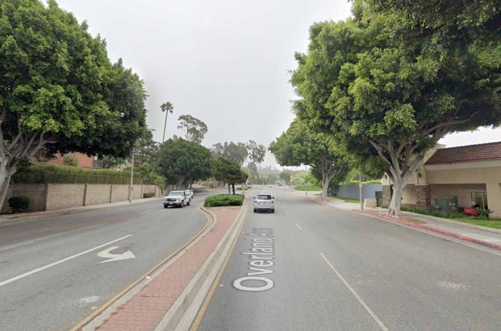
The project would extend existing bike lanes on Overland that were installed circa 2019, covering about a half-mile between Culver Boulevard and Ballona Creek. The proposed new bikeway would be about 2.5 miles long – from Overland and Venice Boulevard to Hannum and Slauson Avenue.
The design varies somewhat for different parts of Overland, Playa, and Hannum, with the lion’s share (about a mile and a half) being new protected bike lanes. The project would include about a half-mile of new unprotected bike lanes at the north end, near Venice Boulevard. It also includes a short stretch of bike route connecting to the Culver City Transit Center on Slauson near Sepulveda Boulevard.
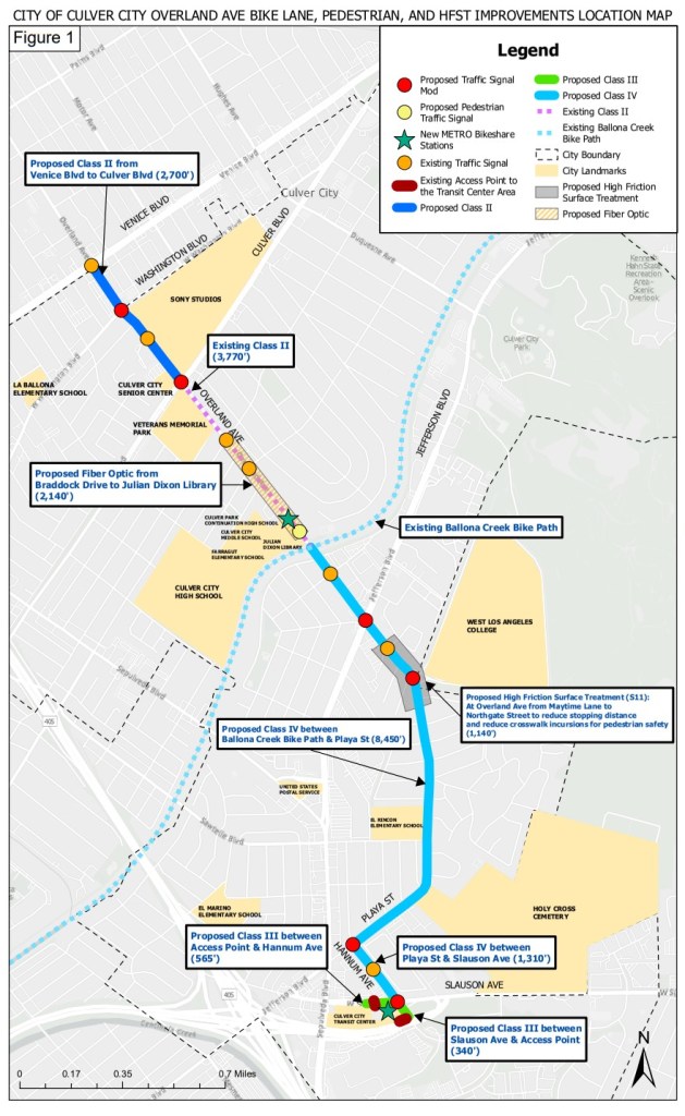
Though much of the facility fits without changing the current space allocated for car lanes or car parking, some stretches would narrow car lanes and/or reconfigure some on-street parking (including significant parking removal, mainly in areas that have off-street parking lots).
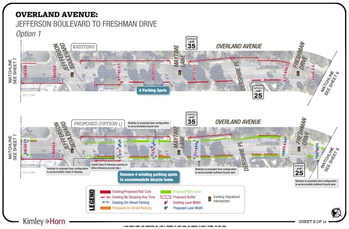
See full detailed proposed plans at the city’s project webpage.
Learn more about the proposal, and give your input, at a community meeting next month: Wednesday, September 13 from 7-9 p.m. at the Veterans Memorial Building, Rotunda Room, at 4117 Overland Avenue.

Streetsblog has migrated to a new comment system. New commenters can register directly in the comments section of any article. Returning commenters: your previous comments and display name have been preserved, but you'll need to reclaim your account by clicking "Forgot your password?" on the sign-in form, entering your email, and following the verification link to set a new password — this is required because passwords could not be carried over during the migration. For questions, contact tips@streetsblog.org.


