
Metro About to Green-Light Another Highway Mega-Project: North County 5 Freeway Widening

This week, the Metro board is slated to approve a $679 million life-of-project (LOP) budget for another 5 Freeway widening. Metro’s I-5 North Capacity Enhancements Project (staff report) would add multiple lanes to the 5 Freeway through Santa Clarita.
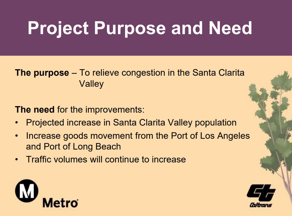
Metro promotes the North County I-5 project’s purpose as “to relieve congestion.” As many Streetsblog readers are aware, widening freeways does not relieve congestion.
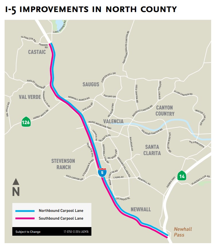
Metro’s I-5 North Capacity Enhancements Project extends along the 5 Freeway about 13.5 miles from the 14 Freeway to Parker Road, through the city of Santa Clarita (including the communities of Newhall, Saugus, and Valencia) and several L.A. County unincorporated areas: Castaic, Stevenson Ranch, and Val Verde.
Caltrans’ I-5 Roadway Rehabilitation Project repaved the same stretch of freeway from 2017 to 2019.
The new construction project will widen the 5 Freeway to:
- add northbound and southbound HOV (carpool) lanes [~26 new lane miles]
- add auxiliary lanes – additional outside lanes extending between on- and off-ramps [2.5 new lane miles]
- extend the northbound truck lane about one mile – from the Old Road (Gavin Canyon) undercrossing to the Calgrove Boulevard off-ramp [~1 new lane mile]
- add a southbound truck lane from Calgrove Boulevard to the 14 Freeway [~2.2 new lane miles]
Overall the project will add roughly 32 new lane miles. Using the UC Davis calculator, these new lanes can be expected to generate around 275 million additional vehicle miles travelled (VMT) per year, resulting in roughly 125,000 tons of greenhouse gas emissions annually.
The project will replace the Weldon Canyon bridge and widen seven bridges, including the Old Road (Gavin Canyon) undercrossing, Calgrove Boulevard undercrossing, Butte Canyon Bridge, Magic Mountain Parkway undercrossing, Santa Clara overhead, Rye Canyon undercrossing, and Castaic Creek Bridge.
The I-5 North Capacity Enhancements Project is currently anticipated to cost $679 million. Per Metro’s expenditure and funding spreadsheet, project funding is coming from a combination of sources, including federal (Surface Transportation Block Grant program [STBG], Transportation, Community and System Preservation Program [TCSPPP], and Infrastructure for Rebuilding America [INFRA]), state (S.B. 1 Trade Corridors program), and local (L.A. County Measure M and Measure R sales taxes) sources.
The funding breaks down to: local $375.6 million (55.3 percent), state $247 million (36.3 percent) and federal $56.8 million(8.4 percent).
Unlike earlier L.A. County freeway widening projects, “Metro will be responsible for managing the project budget and identifying any future funding, if required,” according to the staff report.
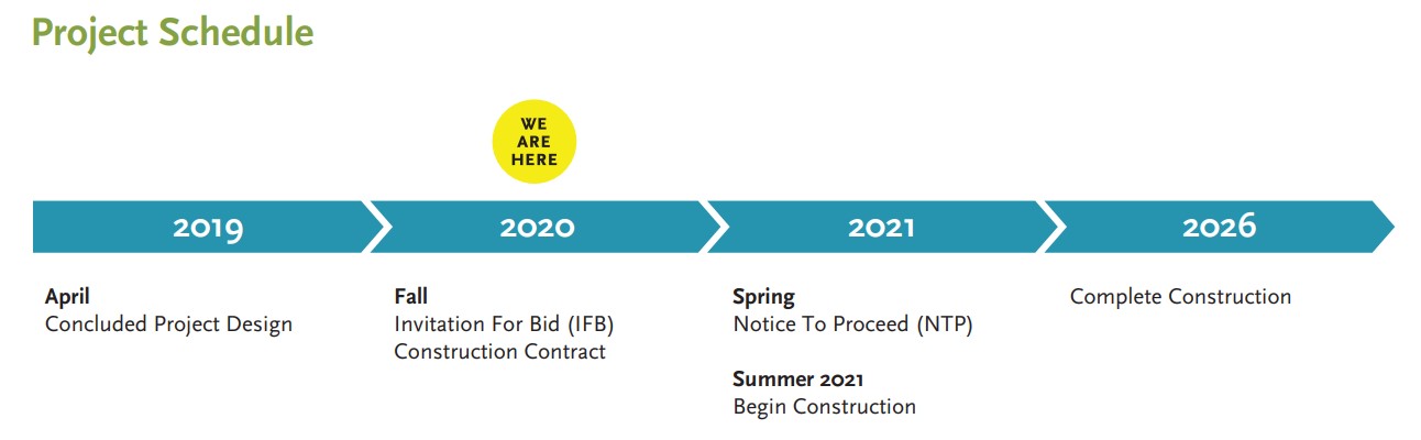
Construction is due to get underway in Summer of 2021, and is expected to be completed in Summer 2026.
The project’s final Environmental Impact Report (EIR) was approved in 2013, as an addendum to an earlier EIR approved in 2009. A lot has changed during the ensuing decade. The 2009/2013 environmental documents are based on the discredited car-centric Level of Service metric, and are full of backwards-looking highway engineer speak. For example:
- “The proposed HOT lanes would not generate traffic. It is intended to facilitate the redistribution of existing and future traffic demand…”
- “An individual project does not generate enough GHG [greenhouse gas] emissions to significantly influence global climate change.”
- “Caltrans is supporting efforts to reduce vehicle miles traveled by planning and implementing smart land use strategies: job/housing proximity, developing transit-oriented communities, and high density housing along transit corridors.”
The small comfort from the EIR is that property acquisition will be kept to a minimum: “Acquisition of two parcels would be required for additional right of way. The acquisition would be limited to one partial parcel take and one full parcel take.”

Streetsblog has migrated to a new comment system. New commenters can register directly in the comments section of any article. Returning commenters: your previous comments and display name have been preserved, but you'll need to reclaim your account by clicking "Forgot your password?" on the sign-in form, entering your email, and following the verification link to set a new password — this is required because passwords could not be carried over during the migration. For questions, contact tips@streetsblog.org.


