
Some Actionable Transportation Ideas for City Councilmember Kevin de León
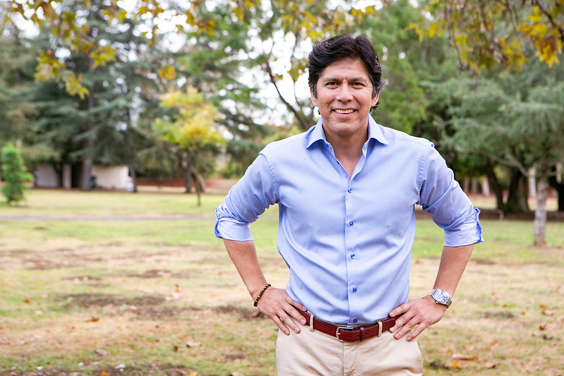
Today Streetsblog has some ideas for recently seated Los Angeles City Councilmember Kevin de León. The councilmember formerly served as State Assemblymember and State Senator, where he was the first Latino to serve as President pro Tempore. In March, de León won an outright majority in the primary election. In October, he was sworn in early, due to the departure of his scandal-plagued predecessor José Huizar.
As a state legislator, de León championed state efforts to curb climate change, including by mandating cap-and-trade projects serve disadvantaged communities. De León’s campaign platform included building affordable housing, battling climate change, fostering clean energy, and protecting immigrants. He touted “a new, creative approach that makes zero-emission transportation available for every single family” and “fix[ing] broken streets and treacherous sidewalks.” In his response to Bike the Vote L.A.’s questionnaire, de León expressed his support for downtown streets “prioritizing bikes, pedestrians, electric buses, and commercial/passenger loading” and having “DOT and Metro to look at installing both bike lanes and dedicated bus lanes.”
Alongside Streetsblog’s early piece suggesting some transportation ideas for Councilmember-elect Nithya Raman, today’s post features transportation ideas for de León. As noted in the earlier post, there is a lot that L.A.’s fifteen councilmembers do to influence citywide matters, but their biggest influence tends to be the control they exert over their own district, so that is the focus of this post. Streetsblog checked in with several L.A. transportation advocates – including Equitable Eagle Rock, Investing in Place, Los Angeles Walks, and Streets for All – and took a look at de León’s district to come up with some ideas.
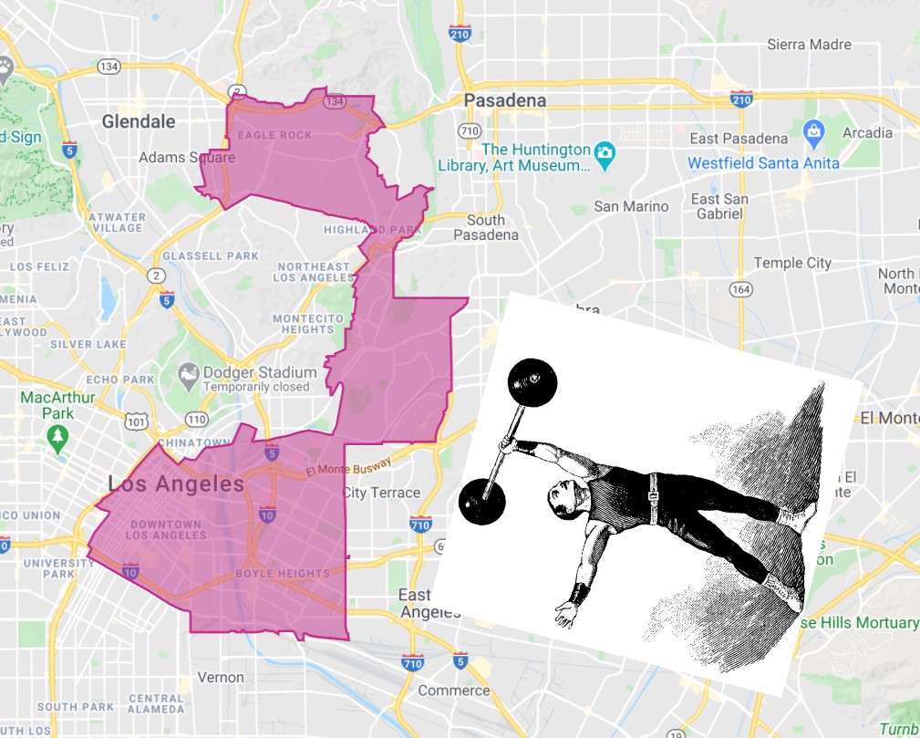
In case readers aren’t already familiar with the gerrymandered Council District 14, below is a map of the ‘barbell.’ The north end of the district includes Eagle Rock – bordering on both Glendale and Pasadena. From there is a somewhat narrow swath of Northeast Los Angeles – including El Sereno and part of Highland Park. The lower end of the district includes Boyle Heights and nearly all of downtown L.A.
BUS / RAIL
Install new bus lanes. Especially downtown, CD14 has lots of streets that serve multiple bus lines, so it’s beyond the scope of this post to determine where all CD14 high ridership corridors are.
As noted in the CD4 post, quick-build short busways have proven effective. Councilmember Mike Bonin brought LADOT and Metro together in a bus speed work group which has been installing new bus lanes downtown. The work group needs more Council support to continue to add bus lanes downtown, and expand strategically throughout the city.
Inside CD14, here are a few higher-ridership bus-only lane segments that may make sense to prioritize:
- Olive Street and Grand Avenue couplet. In May, Metro announced that it was working with LADOT to add bus-only lanes to Olive and Grand. The lanes were omitted when Streets L.A. resurfaced these streets in July. The city apparently put down temporary striping in anticipation of adding the bus lanes… but then nothing happened. The latest LADOT memo says Spring 2021. What’s the holdup?
- Arcadia Street. In September, LADOT and Metro opened the short and much-needed three-block eastbound Aliso Street bus lane. A short Arcadia bus lane could minimize the congestion that buses encounter on the westbound half of the couplet.
- Broadway and Venice Boulevard. The Mobility Plan already approved designated bus lanes on Venice and Broadway. Likely via the bus speed work group, LADOT and Metro need to study where these bus lines are encountering congestion, and make plans for installing initial bus lane segments where they would be most effective.
In the longer run, the standard for every downtown one-way street should be what is today seen on portions of 5th and 6th today: right-side bus lane, left-side protected bike lane. These streets see high levels of walking, transit ridership, bicycling and e-scooters. It’s way past time that DTLA street design actually support the ways that people already choose to get around.
Steer Metro NoHo-Pasadena Bus Rapid Transit in the right direction. Leadership means discarding Metro’s problematic designs and direct Metro to provide regional transit service to Eagle Rock in the community’s core on Colorado Boulevard (and not on a freeway that bypasses the community). De León has a community-led solution available to throw his weight behind in the “Beautiful Boulevard” proposal, a well-conceived plan that Metro is waiting for direction to adopt. If de León is serious about climate action, he simply cannot sit out the most significant transit investment in Northeast Los Angeles in a generation. He must stand up against anti-transit fear mongering, and support a growing coalition of voices within Eagle Rock demanding a complete street that balances the safety and access needs of pedestrians, cyclists, and transit riders.
Fund and build the Arts District Metro B/D Line (Red/Purple) Station. There are a lot of Metro projects that various interests are looking to accelerate; few of them are rail that serves central destinations the way a future Arts District Station would. Though Metro is planning yard improvements to be compatible with the future station, CEO Phil Washington asserted that the station will not happen short of “manna from heaven” which, in all likelihood, means funding from the federal government. Under the Biden administration, funding may well flow more easily to shovel-ready rail projects. This project needs a champion who will, right now, work to make sure that a cash-strapped Metro gets it to a shovel-ready state. Ultimately, this project could be very competitive; it will be a very cheap rail extension.
WALK / ROLL
Fund and implement pedestrian safety measures. The city budget has proposed cuts to Vision Zero outreach, sidewalks, complete streets, speed humps. These programs need support, especially the city’s legally mandated sidewalk repair program “Safe Sidewalks”, which needs to be more accountable and effective.
Create car-free spaces. Where pedestrians share space with drivers, too often drivers take over. L.A. needs car-free spaces. These can be permanent, such as People St plazas. But they can also be temporary, such as CicLAvia open streets events. Temporary closures might be more frequent than CicLAvia, such as recurring road closures like the weekly 4th Street Farmers Market downtown.
Downtown could use more pedestrian space, perhaps along the lines of quick-build reconfigurations done by Janette Sadik-Khan in New York City. A few places to start might be more spacious intersections where drivers have been allotted pedestrian-killer slip lanes to speed on through, like at Pico Boulevard and Main Street, Central Avenue and Towne Avenue, 2nd Street at Alameda Street, 3rd Street and Flower Street, 8th Street and San Pedro Street, and others. L.A.’s walkable core shouldn’t dedicate so much space to drivers.
Prioritize Pedestrians at Union Station. City departments are wrecking Metro’s plans for getting pedestrians across the street at Union Station, arguably the most central, most historic, most important pedestrian connection in Southern California. Acknowledge the importance of this place by putting people first there. Build the landmark fifty-foot-wide sidewalk-level raised crosswalk across Alameda Street that Metro had approved and billed as the centerpiece of the project until LADOT nixed it.
Encourage street vending. Vendors contribute to walkable, safe, and vibrant communities. Work with the L.A. Street Vendor Campaign (LASVC) to support vendors in CD14 and throughout the city. Eliminate vendor prohibition zones.
Re-open and maintain historic stairways. Though not ideal for some Angelenos with disabilities, public stairways are one key part of walkability in hilly areas. A few closed CD14 stairways, including the one connecting York Hill Place to Banbury Place, should be re-opened, perhaps as part of a citywide initiative to open, improve, and maintain historic stairways – ideally in partnership with local non-profits.
BIKE
Relatively easy short term
Implement some quick-build protected bike lanes. Council District 14 potential low-cost (minimal-to-no car lane or parking removal) protected bikeway sites include:
- 1st Street – from Los Angeles Street to Spring Street. Two blocks of protected bike lanes on First Street could connect three high-quality protected bikeways downtown (on Spring, Main, and Los Angeles Streets). The quick-build solution is likely adding protection on existing lanes. A longer-term re-work might add a two-way protected lane – probably on the north side of the street (along City Hall) with the eastbound lane staying in place (similar to Santa Monica’s Ocean Boulevard). This could be extended west to at least the Metro Station at Hill Street. Extending East to Judge John Aiso/San Pedro Street can done with no impact to car lanes or parking. Ideally, then, working with Little Tokyo stakeholders, the bikeway might extend to the new Little Tokyo Metro station or further.
- Eagle Rock Boulevard – from York Boulevard to Westdale Avenue, and from Fair Park Avenue to Colorado Boulevard. L.A. has Metro grant funding for “Rock The Boulevard” improvements on ERB; a fairly cheap quick-build first phase of this project could convert existing bike lanes to protected ones.
- Spring Street – from 1st Street to 3rd Street. Spring Street’s 2-way protected bikeway treatment should extend a couple blocks north, with little to no impact to drivers.
Add more conventional bike lanes. Council District 14 potential low-hanging-fruit bike lane streets include:
- 5th Street – from Hill Street to Figueroa Street. The city recently added new bus and bike lanes on 5th and 6th Street but, due to a perceived need to preserve on-street parking for a short pinch point, omitted bike lanes for about half the length of the bus lanes. Without removing any parking, the city could easily add three more blocks of bike lanes on 5th and 6th. This would keep cyclists safer, and move them to the left side of the street, getting them out of the new bus lanes.
- 6th Street – from Hill Street to Figueroa Street. See 5th above.
- Avenue 42 – from Eagle Rock Boulevard to York Boulevard. This would connect the new York bike lanes to existing bike lanes on Eagle Rock.
- Colorado Boulevard – from North Figueroa Street to Avenue 64 (Pasadena boundary). This over-wide portion of Colorado has had bike lanes planned for decades, but the most recent excuse appears to be that the city is reluctant to add them due to a 2014 cyclist crash lawsuit there caused by “uneven pavement.” The uphill eastbound portion could be a protected bike lane. (Not as easy, but it would be great to close the bike lane gap on Colorado just west of Figueroa, too.)
- Hope Street from just above 6th Street to Pico Boulevard. Hope is already relatively quiet, as it dead-ends at the central library and at the 10 Freeway. Below Pico, it was already dieted to add angled parking. The rest could be reconfigured fairly easily to prioritize biking and walking.
- Towne Avenue – from 8th Street to Central Avenue (possibly continuing further south on Stanford Avenue).
Medium term
Support livable streets efforts already underway. There are many projects already in the planning processes. Ward off efforts to water these down and make sure that they translate to on-the-ground safe, climate-friendly, walkable/bikeable streets: (apologies for any efforts left out – add them in the comments)
- 7th Street Forward: This funded project will include curb-protected bike lanes, and transit islands – upgrading the quick-build protected lanes that opened in mid-2020.
- Arts District bike and walk upgrades: The already-funded project features include pedestrian plazas, lighting, and bike lanes on Santa Fe Avenue (some protected) and Mateo Street.
- Eastern Avenue Multi-Modal Transportation Improvement Project: These partially-funded pedestrian improvements from Huntington Drive to Valley Boulevard are currently in the planning phase.
- Slow Yosemite Initiative: The Eagle Rock Association (TERA) has spent a year doing outreach, building consensus, developing a plan.
- Rock The Boulevard: A funded plan to improve much of Eagle Rock Boulevard.
- L.A. River Path: build the Metro-funded walk/bike path through downtown.
- Revive the process for safety/livability upgrades for Verdugo Road, where a hastily-conceived wimpy working group plan failed to deliver worthwhile solutions.
- Revive the process for Soto Street safety improvements, including a possible road diet. Work to ensure that improvements serve current residents, particularly pedestrians, and do not spur gentrification.
Connect the L.A. Arroyo Seco path to the South Pasadena path. Huizar got the ball rolling with this 2019 motion. It’s a very low-cost high-benefit matter to close the ~500-foot gap between L.A.’s Arroyo Seco bike/walk path and South Pasadena’s new Arroyo path. The most difficult part of the project could be administrative: coordinating rights-of-way between two cities and a county waterway.
Upgrade Sixth Street Viaduct bike lanes to protected. Early versions of the plans for the new 6th Street Bridge proposed protected bike lanes, needed to separate cyclists from freeway-speed drivers that will dominate the new widened straightened bridge. Final plans omitted the protected bikeway. Huizar hinted that this could be remedied when construction was complete. Make sure that the final viaduct contributes to multi-modal transportation and community health, and isn’t just another freeway pointed into the heart of the city.
Pilot asymmetric bikeways on hilly streets. For narrower sloped streets, many U.S. cities, including in San Francisco, allot a lane for slower-moving bicyclists going uphill and include sharrows for downhill cyclists to share a lane with drivers. L.A. has not adopted this treatment, leaving any type of bikeway off of many useful sloped streets. Some possible lane/sharrow streets in CD14:
- Avenue 51 – from York Boulevard to Townsend Avenue
- Avenue 60 – from Monterey Road to the South Pasadena border near Collis Avenue
- Avenue 64 – from Meridian Avenue to Pasadena border near Church Street. Space for bike lanes could possibly be made by removing the center turn lane. Work with Pasadena to extend them all the way to Colorado Boulevard. There was an effort to make Avenue 64 safe a few years ago, but the street still has speeding car traffic.
- Townsend Avenue – from Oak Grove Drive to Avenue 51
Reconfigure lanes to install new bike lanes. These are a couple of important not-so-easy projects that de León expressed his support for in his Bike the Vote questionnaire. As de León stated there, they will take a robust community process, perhaps some outside funding, but if leadership is committed to reducing traffic deaths and combating climate change, these will get done.
- Figueroa Street – extend MyFigueroa protected bike lanes north from Wilshire Boulevard to Alpine Street. My Figueroa currently includes a bus lane and protected bike lanes between Exposition Park and Wilshire Boulevard. LADOT is planning five more blocks of bikeway (to 2nd Street), which is worthwhile, but really these bus/bike/walk improvements should go further north through Downtown L.A.
- North Figueroa Street – implement bike lanes on North Figueroa Street from York Boulevard to Colorado Boulevard. This deadly stretch took the lives of Ervin Garcia and Manuel Alonzo in 2017. The retiming of traffic lights in this section has reduced speeding a bit, but bicycling and walking across the street remain dangerous. Safety improvements could include a road diet, probably coupled with implementation of a two-way protected bikeway.
Longer term
Roll back some freeways. Councilmember de León occasionally mentions how damaging freeways have been and continue to be to CD14. It’s going to take some heavy lifting, and some of the councilmember’s state connections, but how about doing something about it? With some federal freeway removal possibly on the horizon and Caltrans eager to make good on its own equity pledge, here are a few possibilities of places where de León might study, plan, and remove parts of urban freeways.
-
Probably the easiest CD14 Freeway removal would be to close the 110 Freeway’s hairpin-curve Bridewell Street off-ramp, located partially within the city of South Pasadena. Drivers often park on the little used off-ramp. The space could be used to expand green space in San Pascual Park, better connecting it with the Arroyo Seco – perhaps even making a walk/bike bridge connection with the Arroyo Seco path.
-
Tear out the excessively-long 134 Freeway on/off ramps to Colorado Boulevard, just leaving the smaller footprint on/off ramps at North Figueroa Street. This stub is an unneeded vestige of the a planned freeway that was canceled due to community opposition. Removing the excessive stub could expand park space at Eagle Rock Recreation Center, restore the housing the freeway demolished (preferably in the form of affordable housing), and calm Colorado Boulevard. Some portion of the right-of-way could include a walk/bike connection between Colorado Boulevard and Eagle Rock Rec Center.
- Downtown has lots of Freeway on/off ramps; there they are more concentrated than most freeway stretches throughout the region. Removing a few ramps could help to focus some streets on prioritizing transit/bike/walk. Fewer exits could mean fewer merging drivers, potentially streamlining freeway traffic flow. Some potential central L.A. ramps that could go:
– It may be possible to remove the 110 Freeway’s 5th Street on-ramps and 6th Street off-ramps. This couplet already has bus lanes and some bike lanes; over time these two streets could further prioritize green transportation. Sidewalks could be widened. Protected bike lanes could be extended and converted to two-way facilities. Portions could become car-free somewhat similar to San Francisco’s Market Street which de León has praised.
– The Flower Street on-ramp to the eastbound 10 Freeway is a site where drivers frequently crash into Metro light rail cars on the E and A Lines. The situation has been helped somewhat by Metro’s traffic gate (installed in 2018), but closing this on-ramp would eliminate train-car conflict, increasing safety and likely making the Metro lines there more reliable. (This likely overlaps with Council District 9.)
– The region’s central transit hub, Union Station, is surrounded by 101 freeway ramps, resulting in a streets that are hostile to walking and bicycling. Consider eliminating these 101 Freeway ramps: Vignes Street on/off ramps and the Los Angeles Street and Alameda Street on-ramps. These public spaces could be redeveloped as transit-oriented affordable housing. - Remove the 101 Freeway between the 10 Freeway (near Cesar Chavez and Mission Street) and the 5/60 Freeways interchange (near 7th and Soto Streets). This freeway is one of the many that sliced up Boyle Heights during the last half of the 20th century. It is essentially redundant to the parallel 10/5 Freeway. This could be huge step toward reconnecting the urban fabric of Boyle Heights. Freed-up publicly-owned urban land could create big opportunities for affordable housing and many other community needs. (Alternately, the parallel 5/10 Freeway could be removed, similarly restoring Boyle Heights grid – and removing the freeway jammed through historic Hollenbeck Park.)

Read More:
Streetsblog has migrated to a new comment system. New commenters can register directly in the comments section of any article. Returning commenters: your previous comments and display name have been preserved, but you'll need to reclaim your account by clicking "Forgot your password?" on the sign-in form, entering your email, and following the verification link to set a new password — this is required because passwords could not be carried over during the migration. For questions, contact tips@streetsblog.org.


