Community organizations have heralded Fresno’s draft Active Transportation Plan as a road map for bringing struggling neighborhoods in the south up to par with the north end of the city. But some say the plan could be stronger, and they are advocating for changes before the City Council approves it on Dec. 15.
“Overall it’s better than what I’ve seen in the past of other drafts,” said Grecia Elenes, policy advocate for Leadership Counsel for Justice and Accountability, an advocacy organization in Fresno. “They incorporated comments that I heard at workshops and comments from residents I work with.”
The draft plan calls for adding 937 miles of new bike facilities and 805 miles of sidewalks, to significantly improve safety and connectivity in Fresno in the years to come. The plan prioritizes a network that could feasibly be built in the next ten years that includes 24 miles of Class I bike paths and 55 miles of sidewalks.
The priority network is estimated to cost $124.8 million. Building out the entire network would cost a total of around $1.4 billion. The city plans to apply for state and federal grants as well as use funds from the county’s Measure C.
Elenes, who helped organize south Fresno residents to provide comments at the city’s ATP workshops, said the plan does a good job of acknowledging the bicycle and pedestrian infrastructure inequities in the city, but that the proposed solutions aren’t enough.
For instance, large sections of West and Southwest Fresno, which are mostly industry, unincorporated county land, and vast areas of vacant land suitable for development, have no multi-use bike paths planned, nor are there any that would reach some of the more populated neighborhoods nearby.
Fresno is currently drafting a Southwest Specific Plan to spur economic development and improve the quality of life in this area. The committee in charge of this plan is going to create a network of Class I bike paths, according to Elenes, but she argues that they should still be included in the Active Transportation Plan to ensure they are built, especially if the plan calls for economic development of this area.
Elenes also said she would like to see changes made to the priority network to benefit the Addams Elementary School community around McKinley and Hughes avenues. This includes creating a complete bicycle network between Addams and its feeder schools, Gaston Middle School and Edison High School five miles away.

Also, changes should be made to extend the priority network of sidewalks along McKinley, Marks, and Olive avenues. Elenes said the area around the school on Hughes and Marks avenues has a tendency to flood when it rains, and sidewalks would be beneficial.
South Fresno has a lot of unincorporated county that was left out of the plan's networks, so Elenes doesn’t understand the rationale behind one particular proposed bike path in central Fresno. In an island of unincorporated county land smack in the middle of the city, a Class I bike path is planned that would connect three schools there, but not continue on to any other part of the city.
The fact that the area, known as Old Fig Garden, is an affluent one is not lost on her.
“They willingly don’t want to be part of the city,” she said of the community’s continued opposition to annexation. “There are so many other places where they can add more—why would they add to a community that doesn’t want to be part of the city?”
Advocates describing Fresno frequently use the phrase “a tale of two cities.” The north end of Fresno—everything above Shaw Avenue—has more parks, more bike paths, and better sidewalks than areas in the south. The Active Transportation Plan acknowledges that indicators like household income, automobile ownership, eligibility for reduced price school lunches, and CalEnviroScreen scores show that “disadvantage communities are primarily located in areas south of Shaw Avenue, with the most disadvantaged areas south of SR 180.”

The ATP does plan to fill most of the sidewalk gaps in the south as part of its priority network. But the regions around Cedar, Ventura, and Kings Canyon Avenues—which the plan identifies as having some of the densest bicycle and pedestrian collisions—are only slated to receive painted bike lanes or bike route designation. Advocates say separated or protected bikeways are needed there, and would help decrease collisions and fatalities.
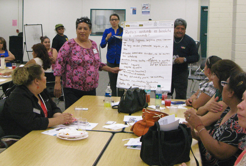
The Leadership Counsel and Cultiva La Salud, a community health nonprofit, worked with city staff to target South Fresno residents in the hopes of influencing the plan. They held joint meetings with residents on what an active transportation plan is and how it can change the neighborhood in the years to come, and encouraged residents to attend city-sponsored workshops.
“The wider community is not fully aware of the tool that the city [uses to] fund projects. This was a way to prioritize a list instead of making just a wish list,” Leticia Corona, community advocacy director for Leadership Counsel.
Esther Postiglione, program manager at Cultiva La Salud, said overall she likes the plan. She was glad to see that a key concern of South Fresno residents—loose dogs—was acknowledged in the plan as a barrier to walking and bicycling, even though there were no concrete steps outlined to address the problem other than enforcing leash laws.
“Just having this recognized is a big victory for us,” Postiglione said.
One suggestion that both advocacy organizations share is that the implementation section of the plan needs improvement. They agree that at just seven pages, out of 300-plus total in the document, it is definitely the weakest section.
The implementation plan breaks down each project’s estimated cost and identifies potential funding sources. Advocates would like it to have more detail about how the city will prioritize what will be built first, and when, as well as what criteria it will use to determine those things.
However, even with its flaws, advocates praise the plan and look forward to working with the city to improve it.
“This is a step in the right direction,” Elenes said.
The Fresno Planning Commission is scheduled to review the plan at its meeting at 6 p.m. on December 7. If approved as expected, it will then go to the City Council for approval at its regular meeting on December 15 at Council Chambers.


