Skip to content
Sponsored

Some Urban Observations from My Seattle Vacation

Photos of some Seattle bus, rail, bike, and traffic calming facilities - including some lessons applicable to Los Angeles
10:09 PM PDT on June 25, 2026
Some Urban Observations from My Seattle Vacation
Light rail subway station in Seattle. Photos by Joe Linton

I spent part of my recent vacation in Seattle. It was my first time visiting the city, and I only spent a couple days there, but I want to share some observations that I think might interest Streetsblog L.A. readers. Similar to my earlier vacation stories – about London, Barcelona, and cities in Italy and Mexico – this post doesn’t claim to tell the whole Seattle story. It’s just sharing some green transportation facilities that I observed.

Seattle has ~800,000 residents in ~84 square miles; it’s part of a four million person metropolitan area spanning about ~4,400 square miles. In comparison, the city of Los Angeles has about four million residents in a ~470 square mile area which is part of a 13 million person 30,000 square mile metropolitan area.

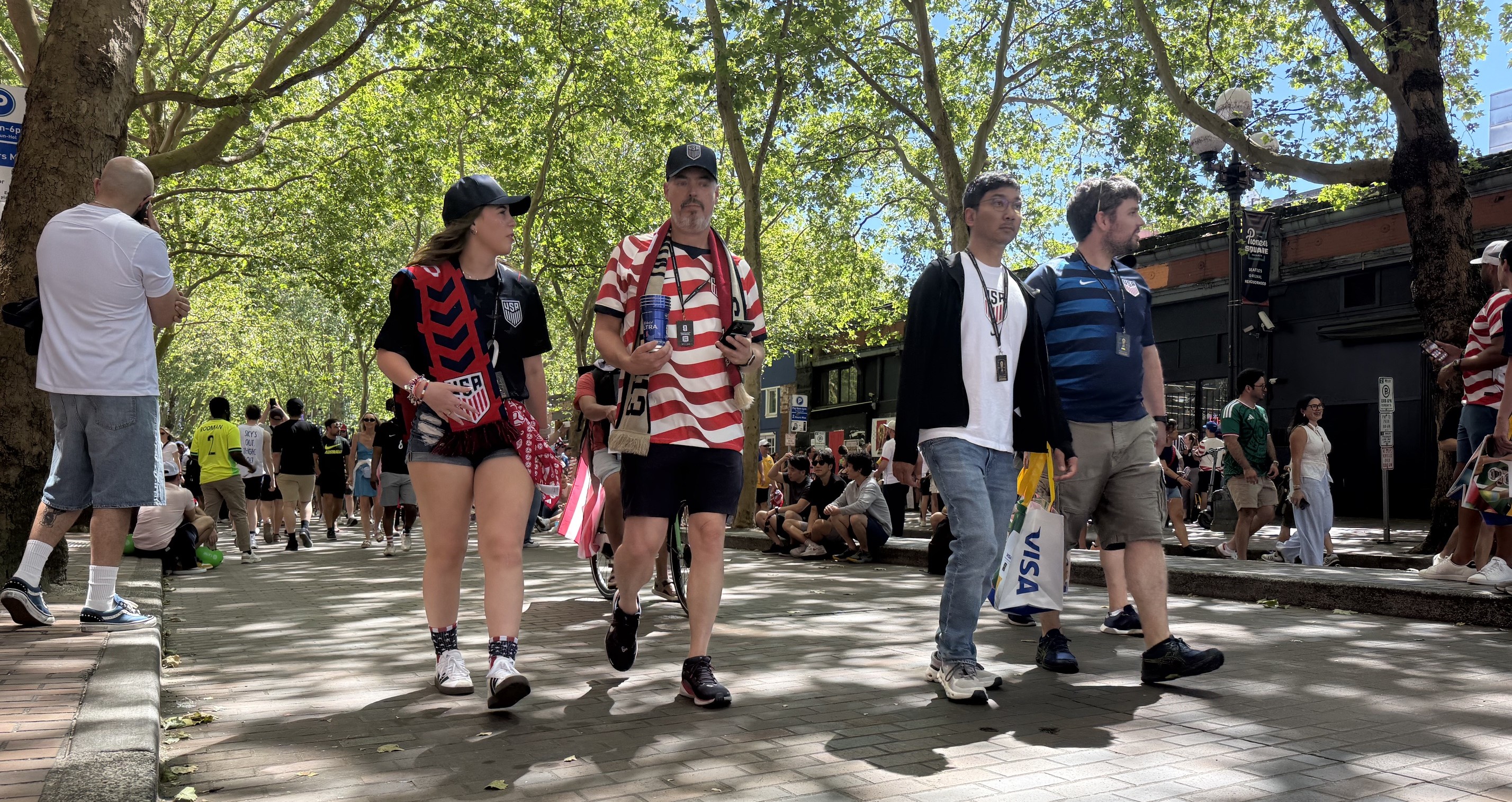
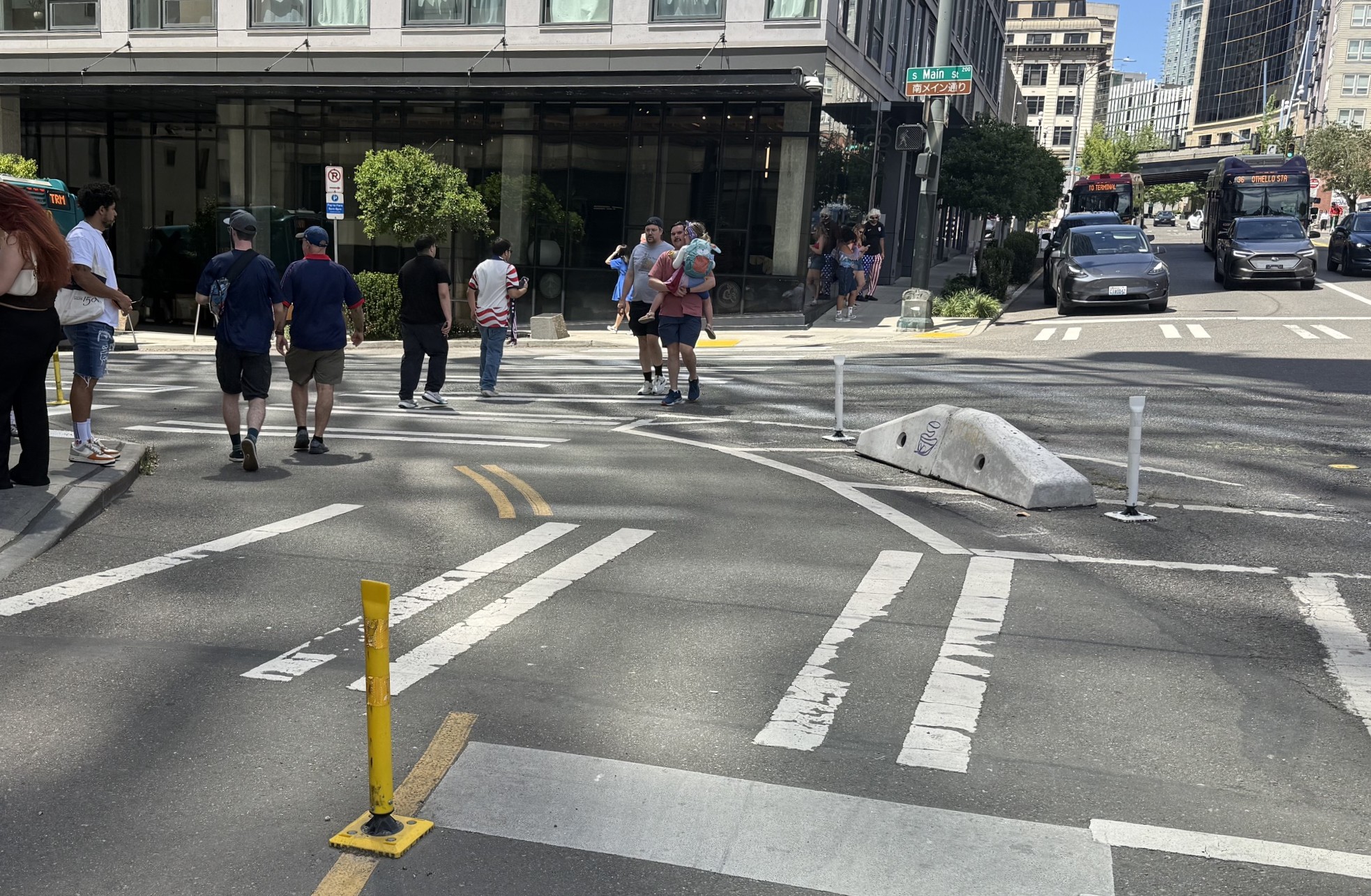
My family stayed for just a couple of days in a fairly suburban part of the city and got around via bus, rail, and walking. I observed a lot of cycling, but didn’t bike. Our visit coincided with a World Cup soccer match, featuring the U.S. national team. We didn’t attend or even watch the game, but it was hard to miss huge numbers of fans on transit and in multiple downtown streets temporarily closed off to car traffic.

Post-game soccer fans are enjoying miles of temporarily car-free streets on World Cup game days

Plentiful Seattle Transit: Light Rail, Bus and Streetcar

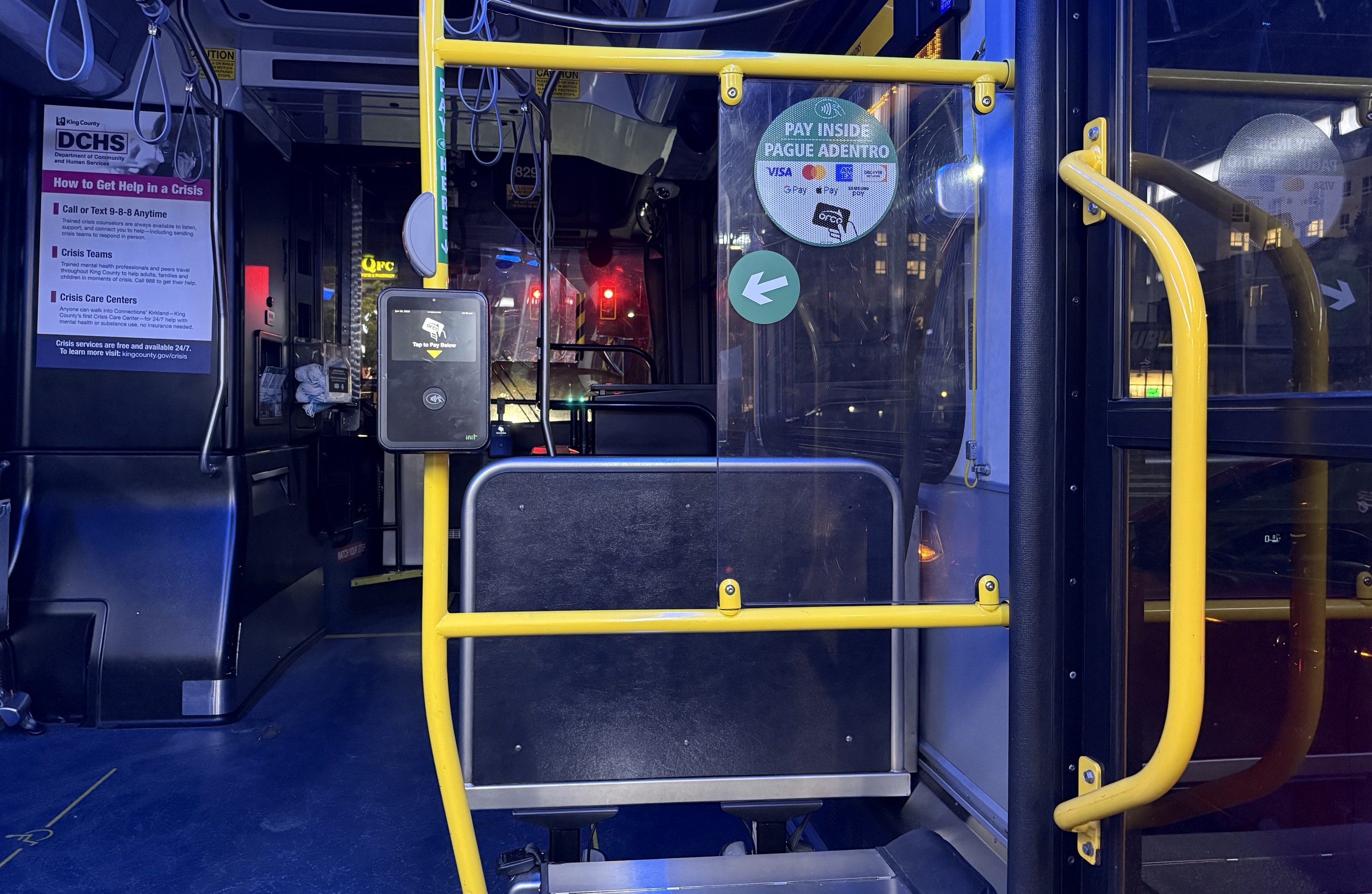
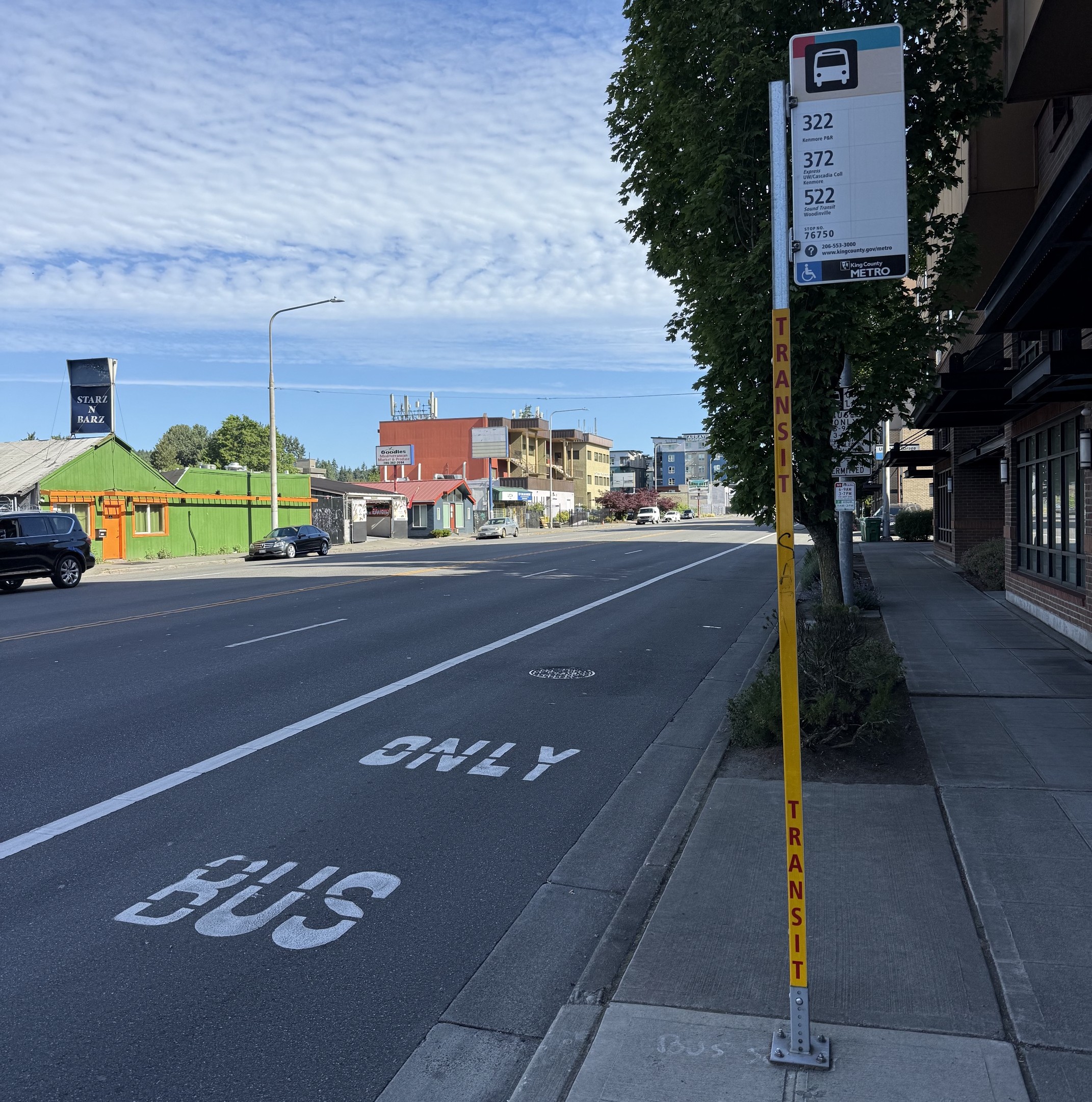
We rode the bus quite a bit. Buses were useful, clean, on-time, not crowded; operators were helpful. I didn’t spot much that made them different than buses anywhere else.

In the downtown area, many Seattle buses are electric, powered by overhead wires
Transit fare can be paid via a credit card, or an Orca Card similar to L.A. TAP card
Peak-hour bus-only lane
Sound Transit system map – click to enlarge

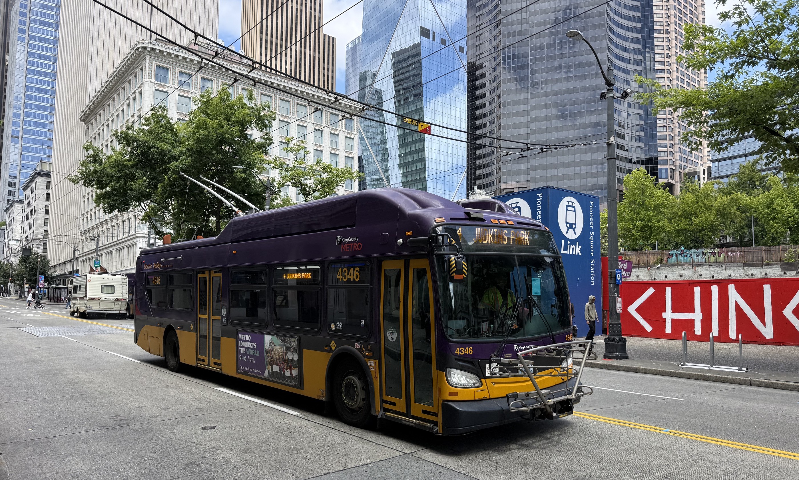
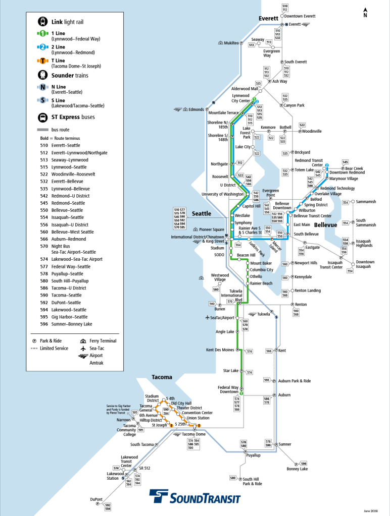
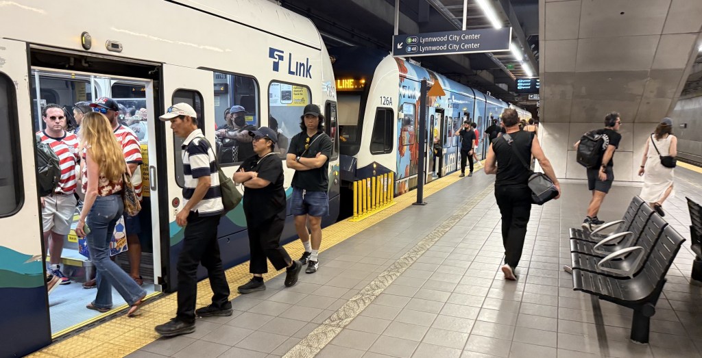
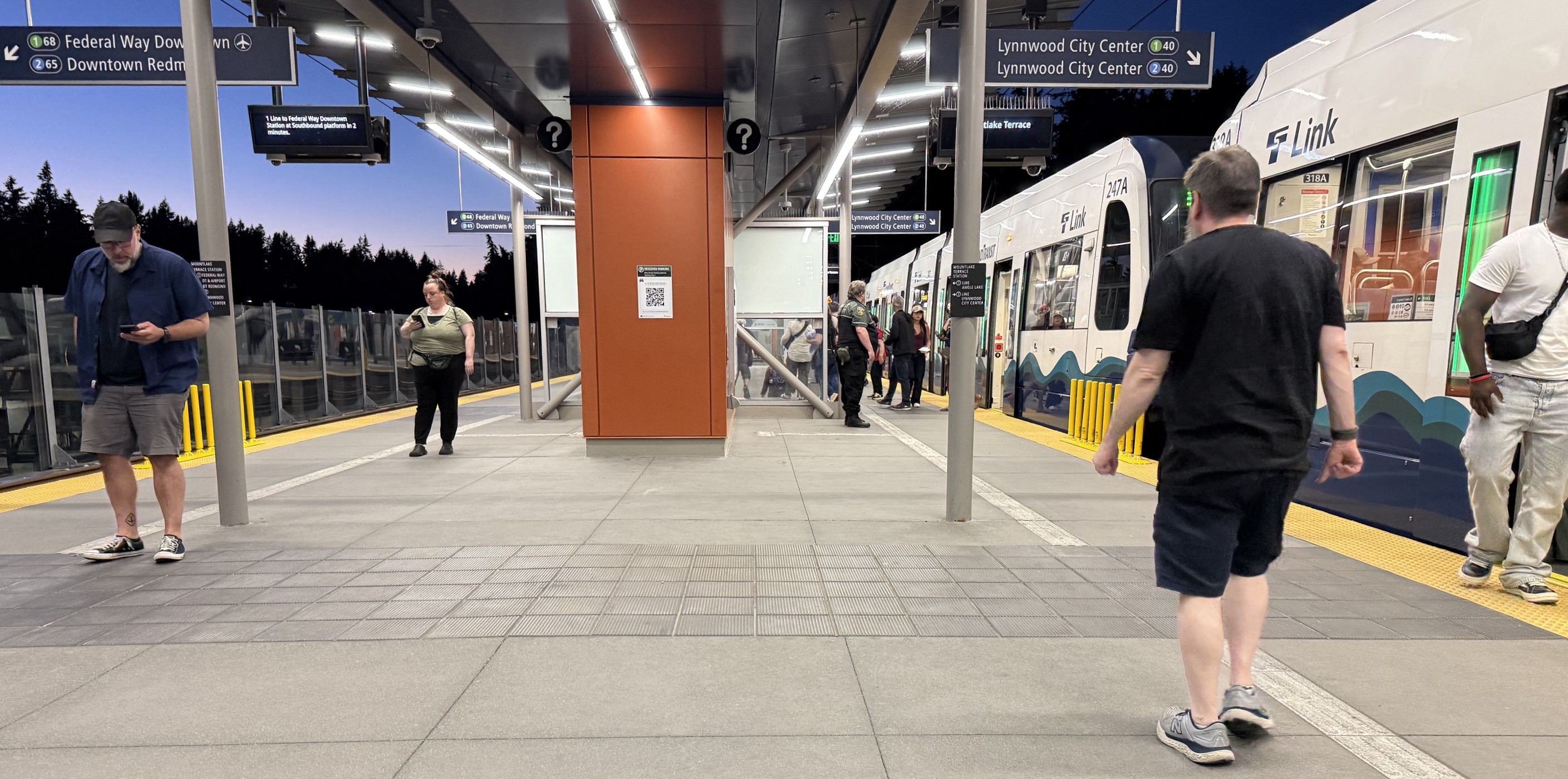
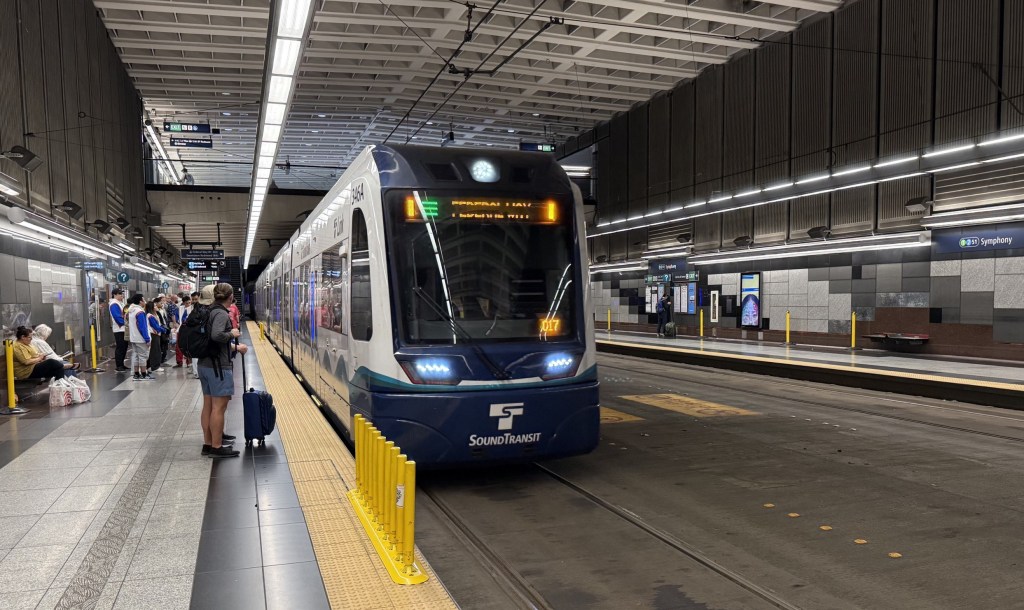
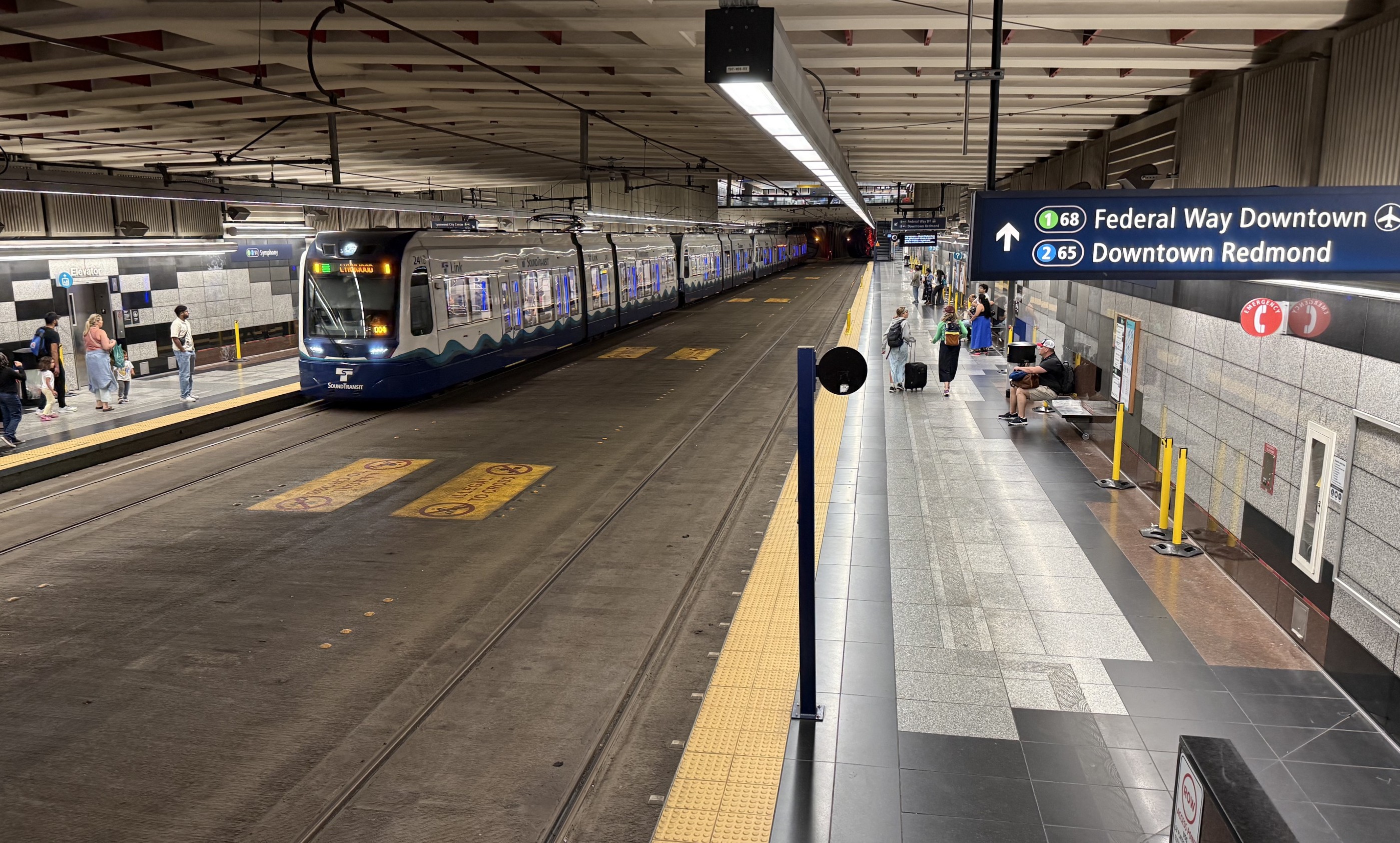
The transit spine that we rode a lot is Link light rail run by Sound Transit. In Seattle there are two Link lines: the 1 and the 2. These form a sort of Y-shape that includes about 63 miles of track and 50 stations.

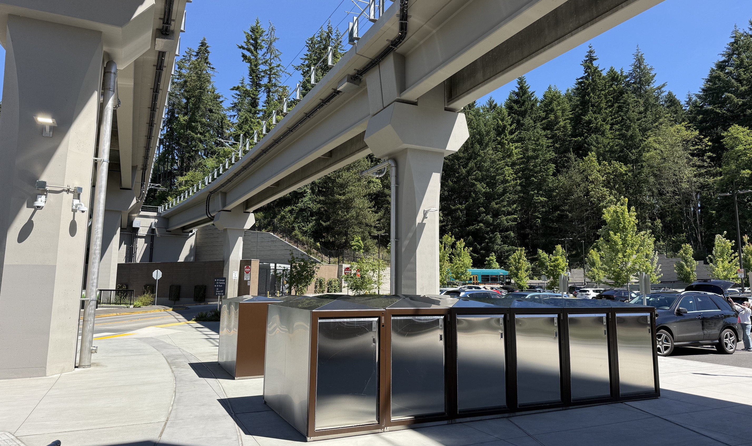
Light rail service felt frequent, even late in the day. In and around the downtown core, the light rail runs underground (somewhat similar to L.A.’s Regional Connector project). Further out the lines I took are elevated, or in roadway medians. The 1 Line makes an easy convenient connection with SeaTac airport.

Many of the Link light rail stations feel similar to Los Angeles.

Central platform elevated Link light rail station

A few underground Link stations felt different and bigger than L.A.’s underground stations, though not functionally all that different (and hence perhaps not cost-effective?). These station spaces felt fairly grand and airy.

Seattle’s Pioneer Square light rail subway station

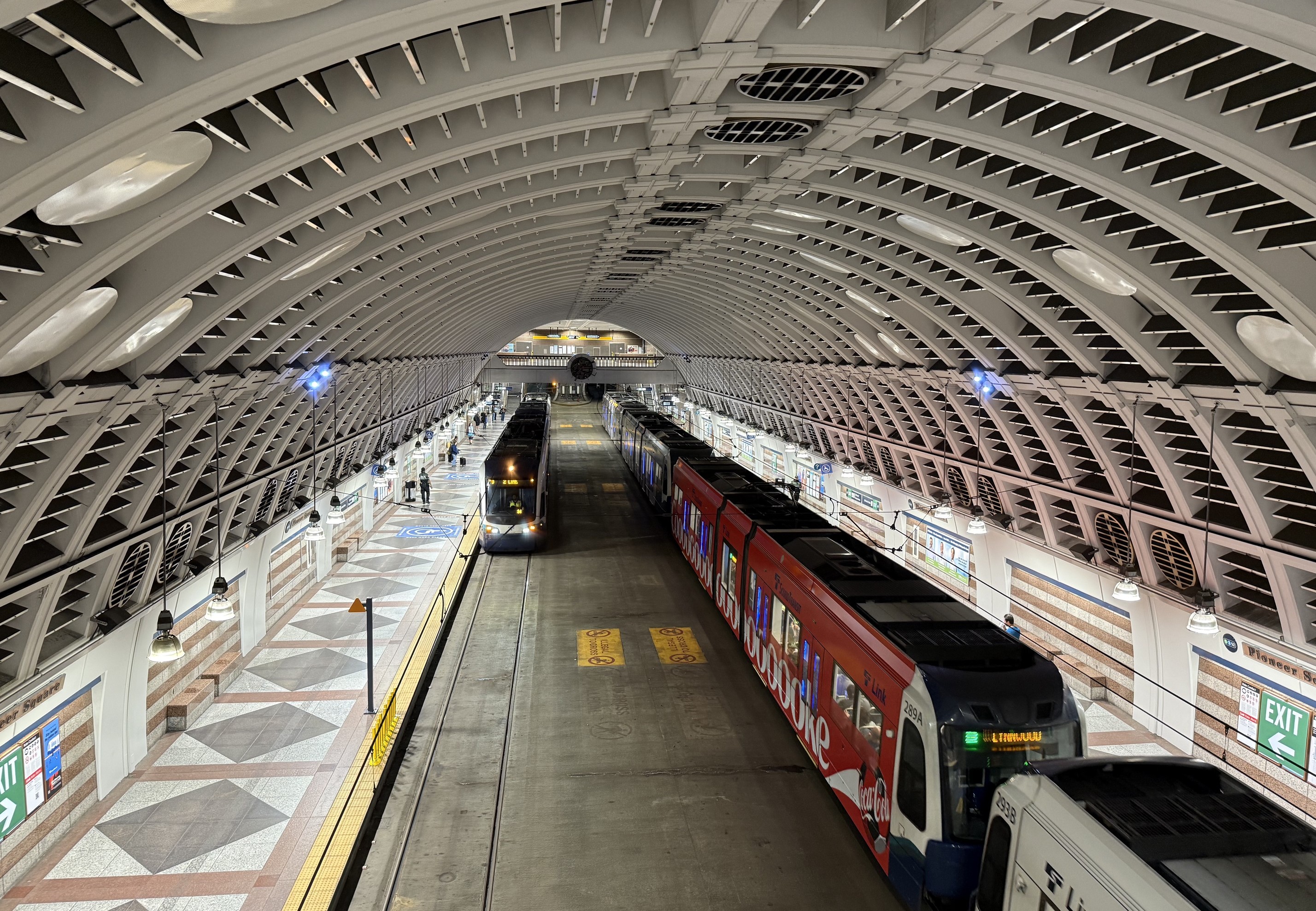
These large underground stations’ boarding platforms are outside the rail, and rail tracks are embedded in a concrete floor – all inside a fairly large station box. It’s perhaps a bit safer, as no one can fall into the track area. It felt like, in a pinch, one could run across the tracks to the other side, though lots of signs noted this was not allowed. (Rail experts can probably correct me, but I think this floor design requires some kind of low-floor rail cars – similar to streetcars – so this design would not work with L.A. light rail vehicles.)

Symphony Station
Symphony Station

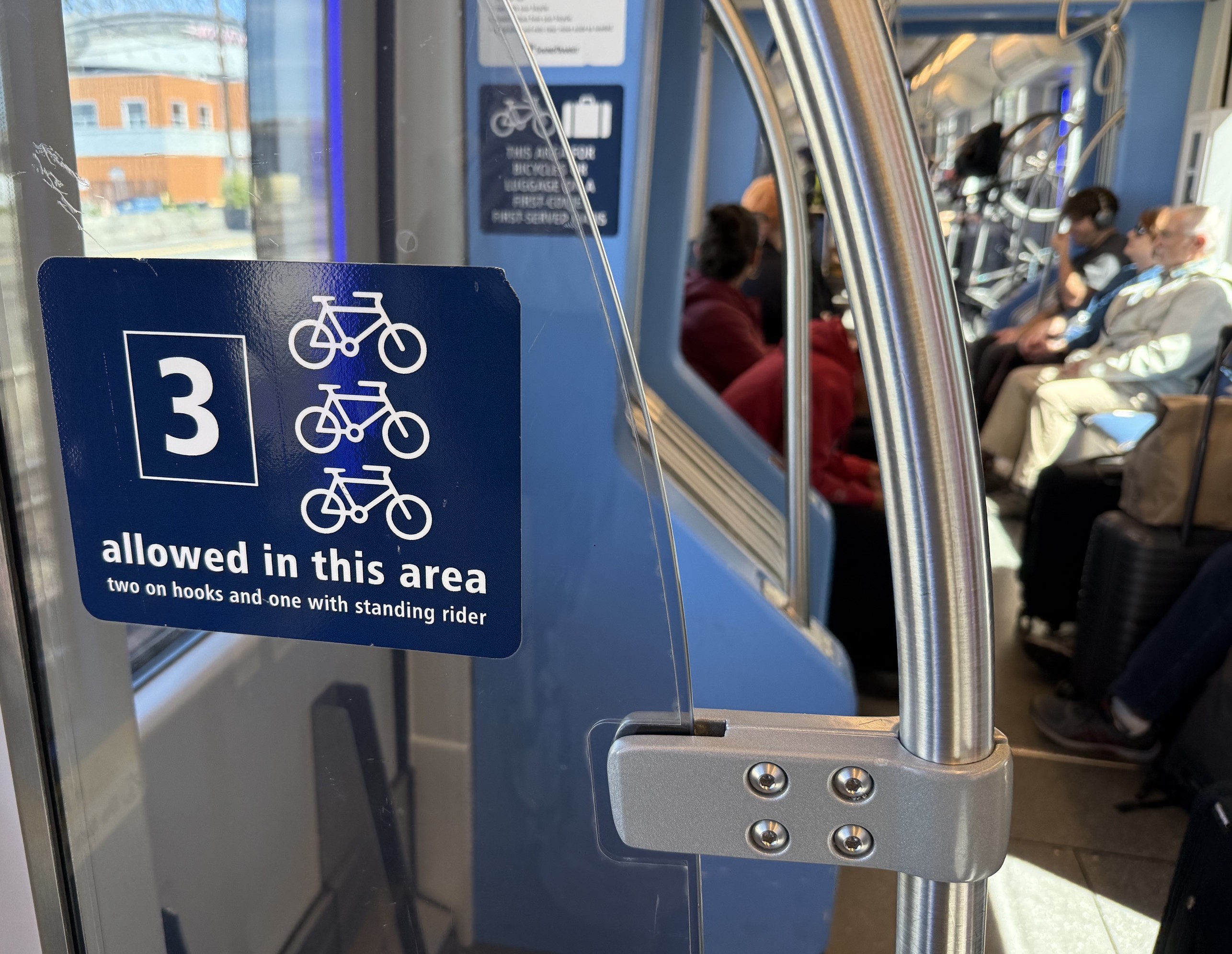
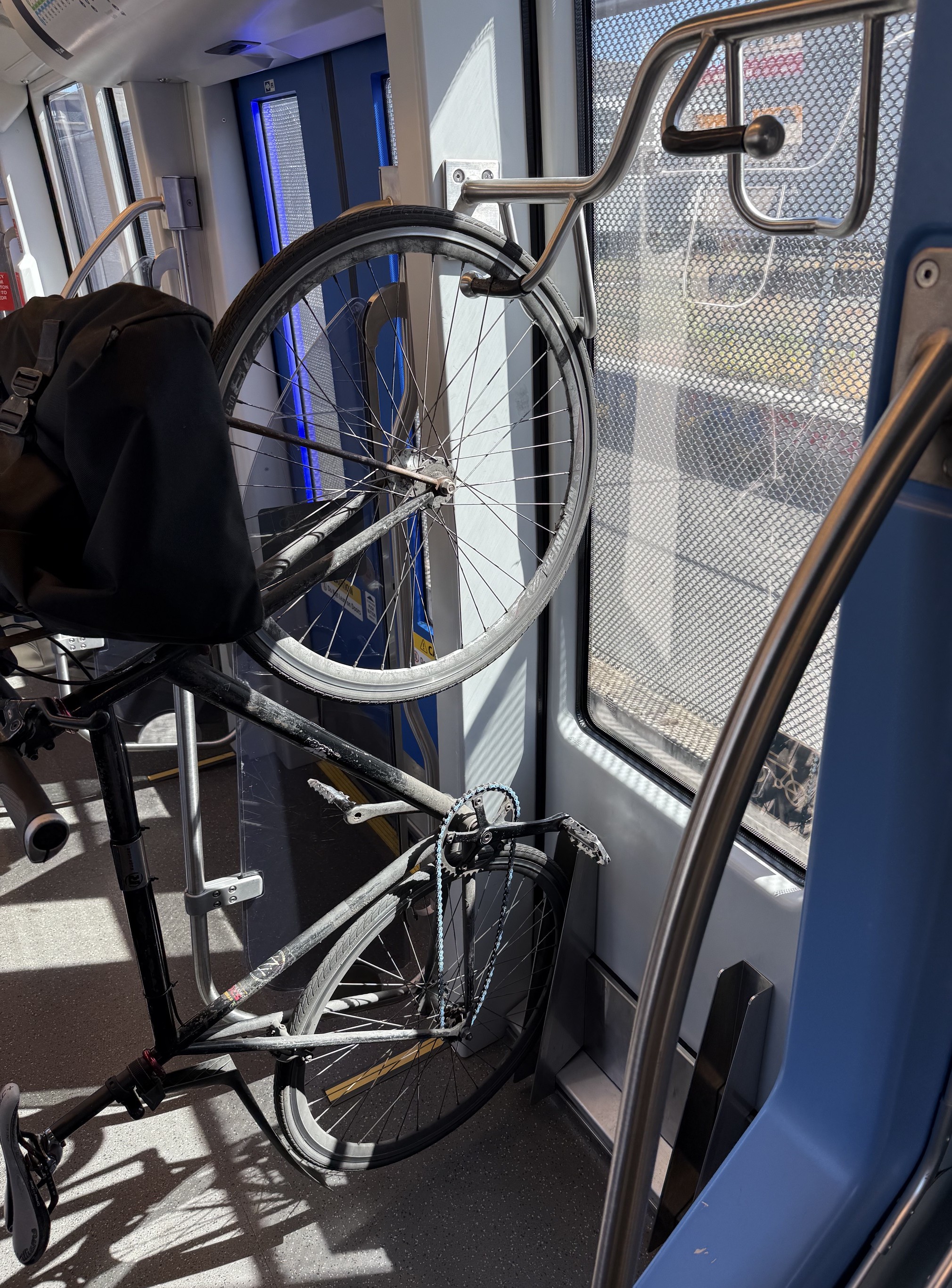
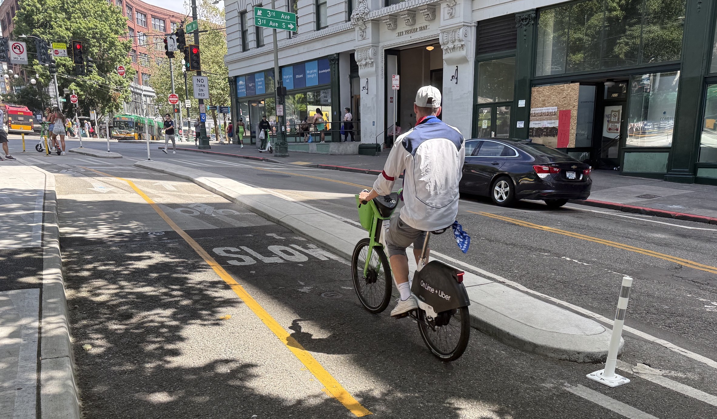
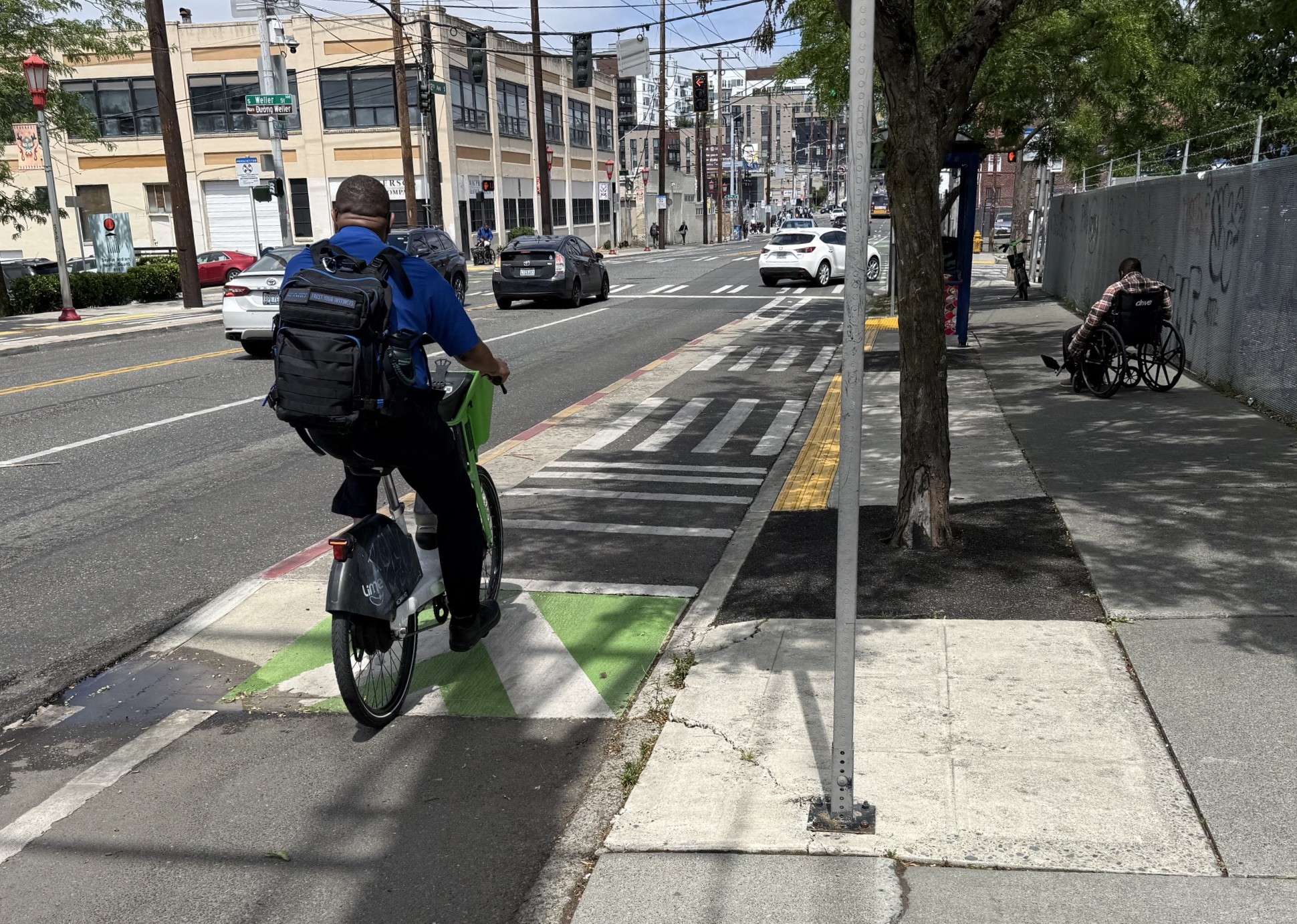
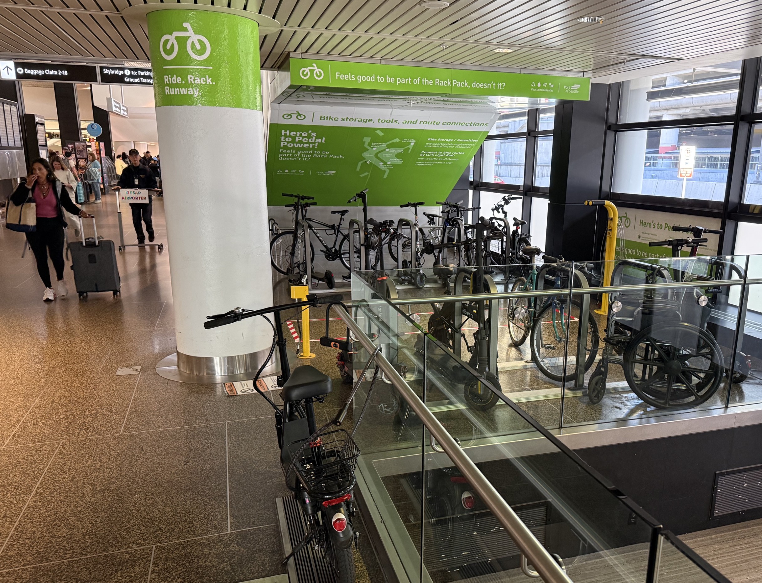
Bicycle connections with transit appeared fairly convenient. I observed several cyclists bringing bikes on-board trains.

Each Link light rail car has a small bicycle storage area, also used for storing luggage
Bicycle stored at Link light rail onboard bike rack
Similar to L.A. Metro, many Seattle rail stations have BikeLink smart lockers, especially stations farther from the core
Seattle has ads for bike lockers on-board most light rail train cars. L.A. Metro has installed a lot of lockers, but could probably promote them more.

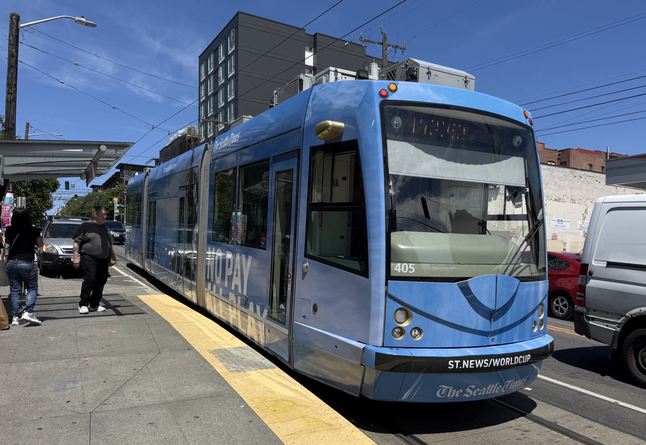
Seattle also has a couple of short streetcar lines. I took one that made sense for one trip; it worked fine but felt somewhat slow due to car traffic and a circuitous route.

Seattle Streetcar

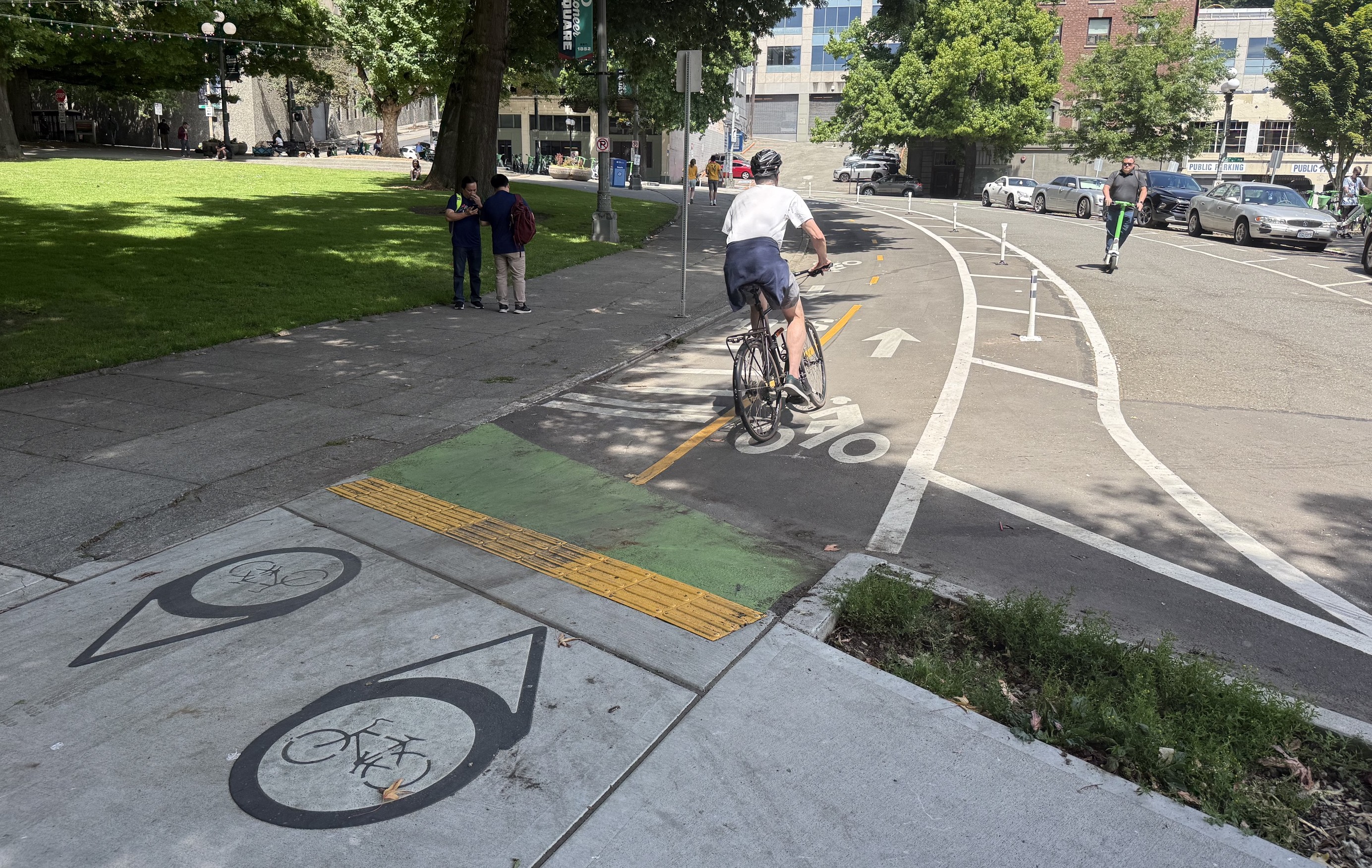
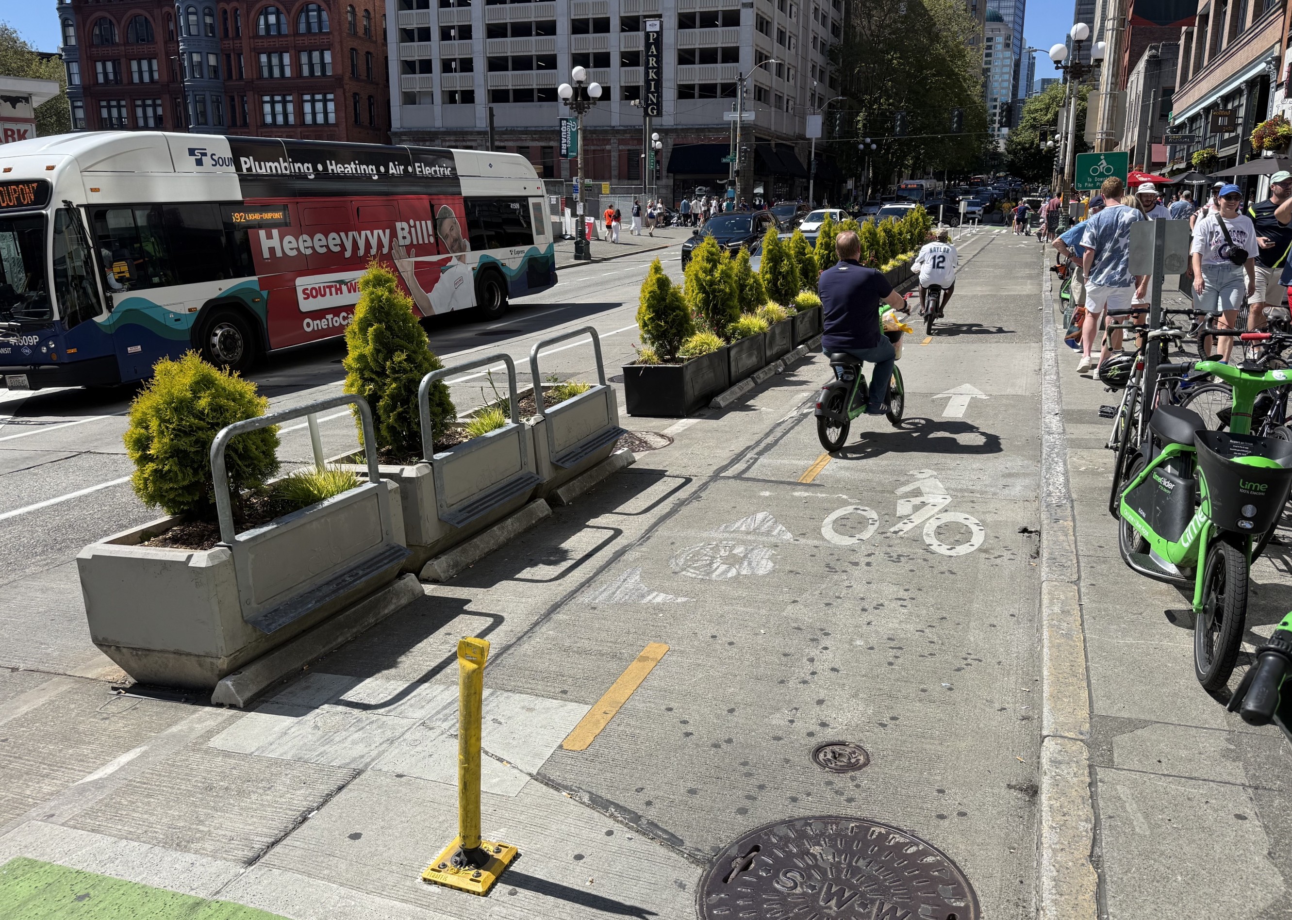
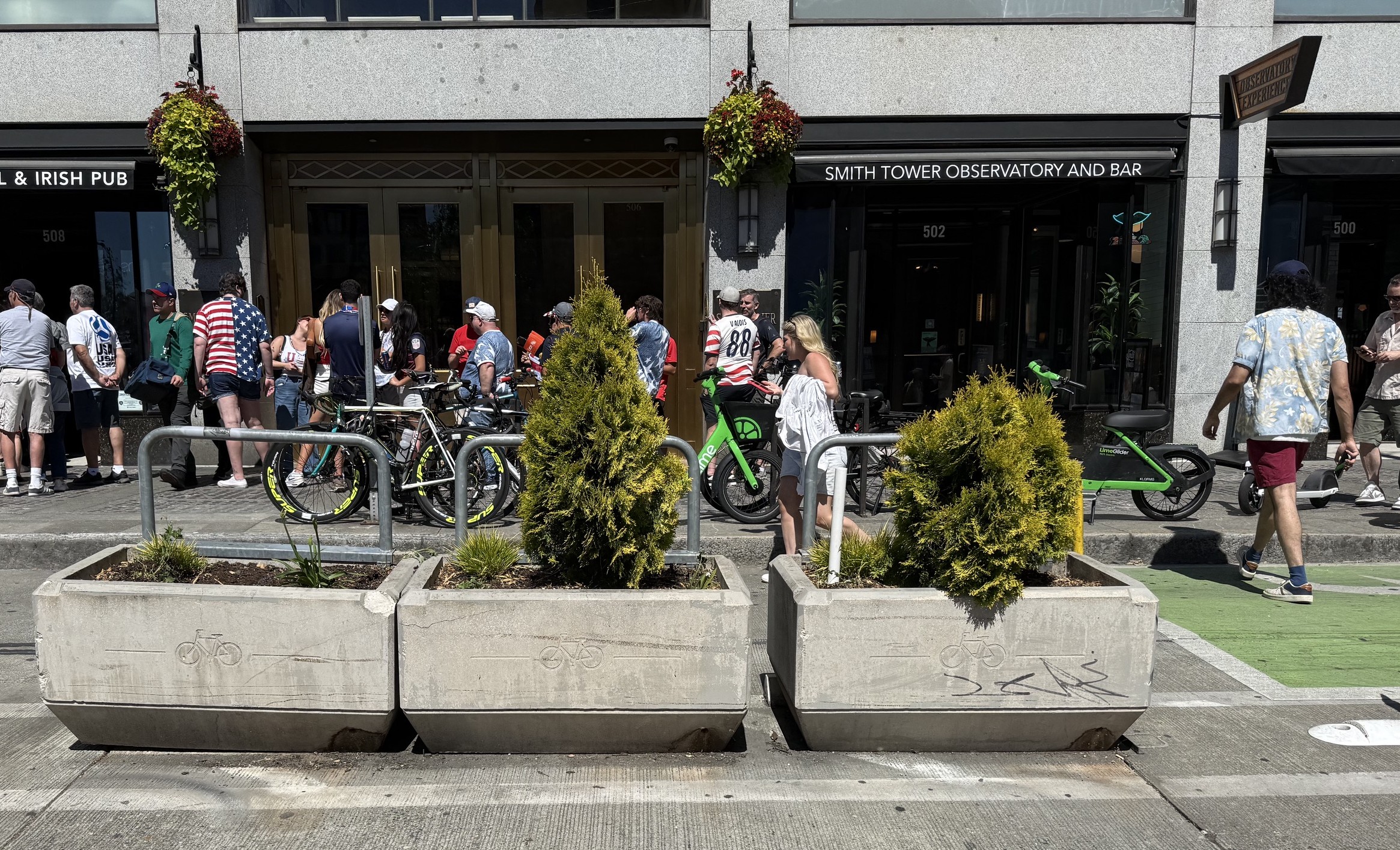
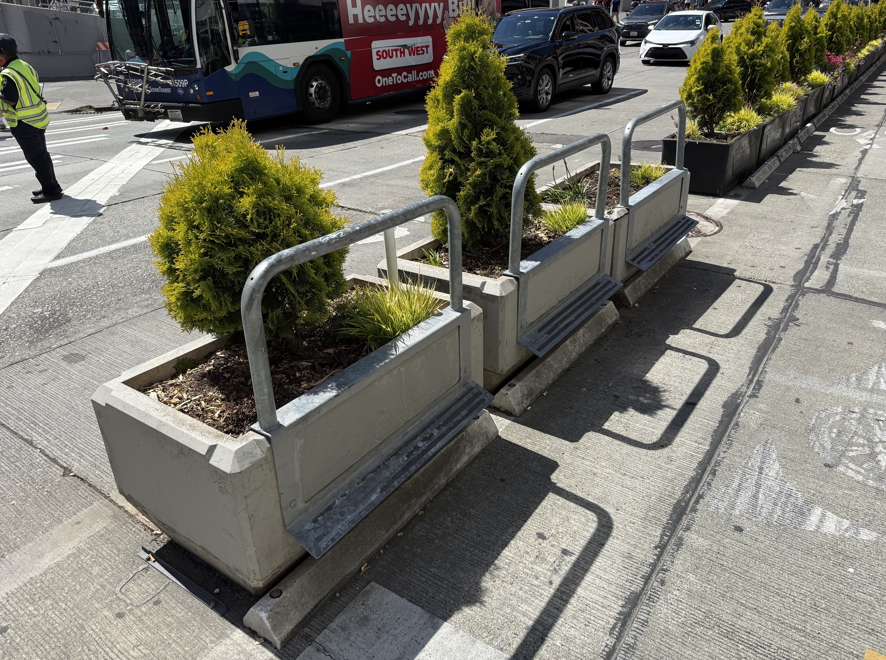
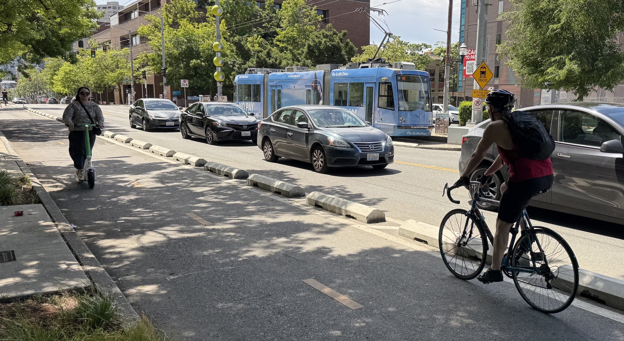
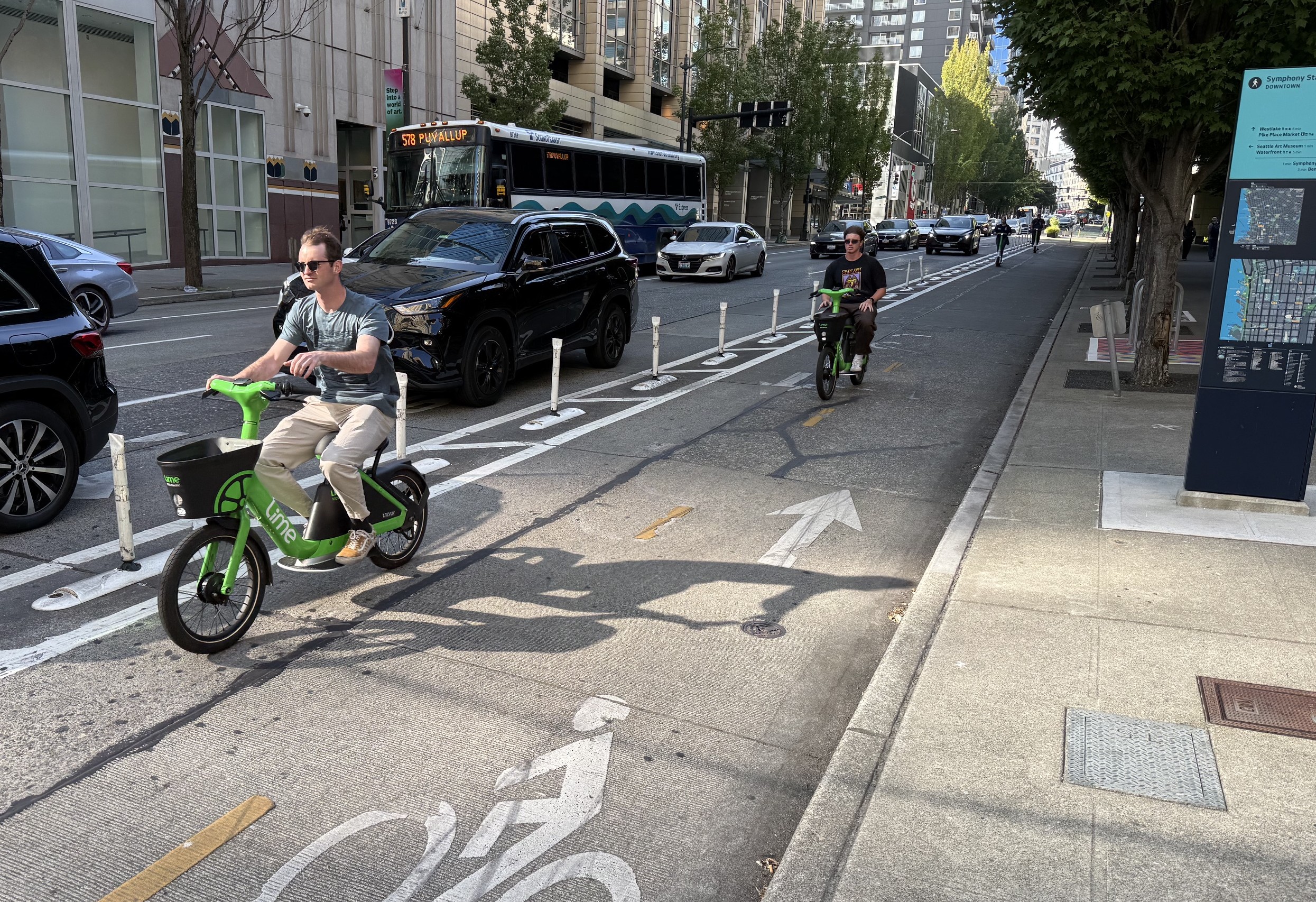
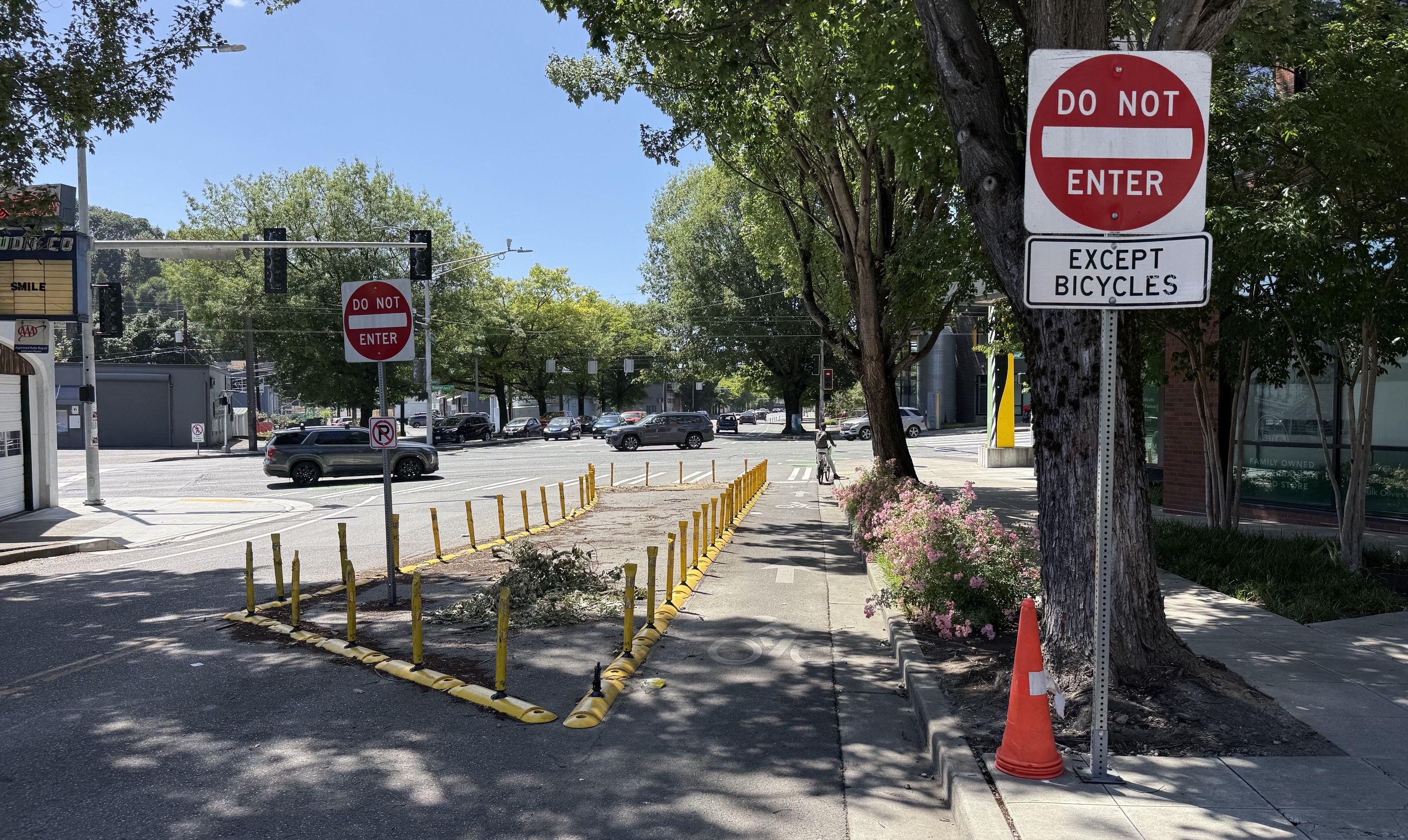
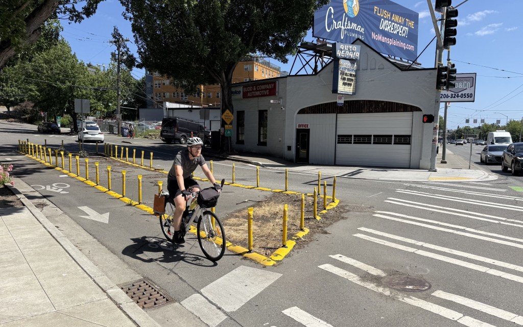
Seattle Bicycling and Traffic Calming

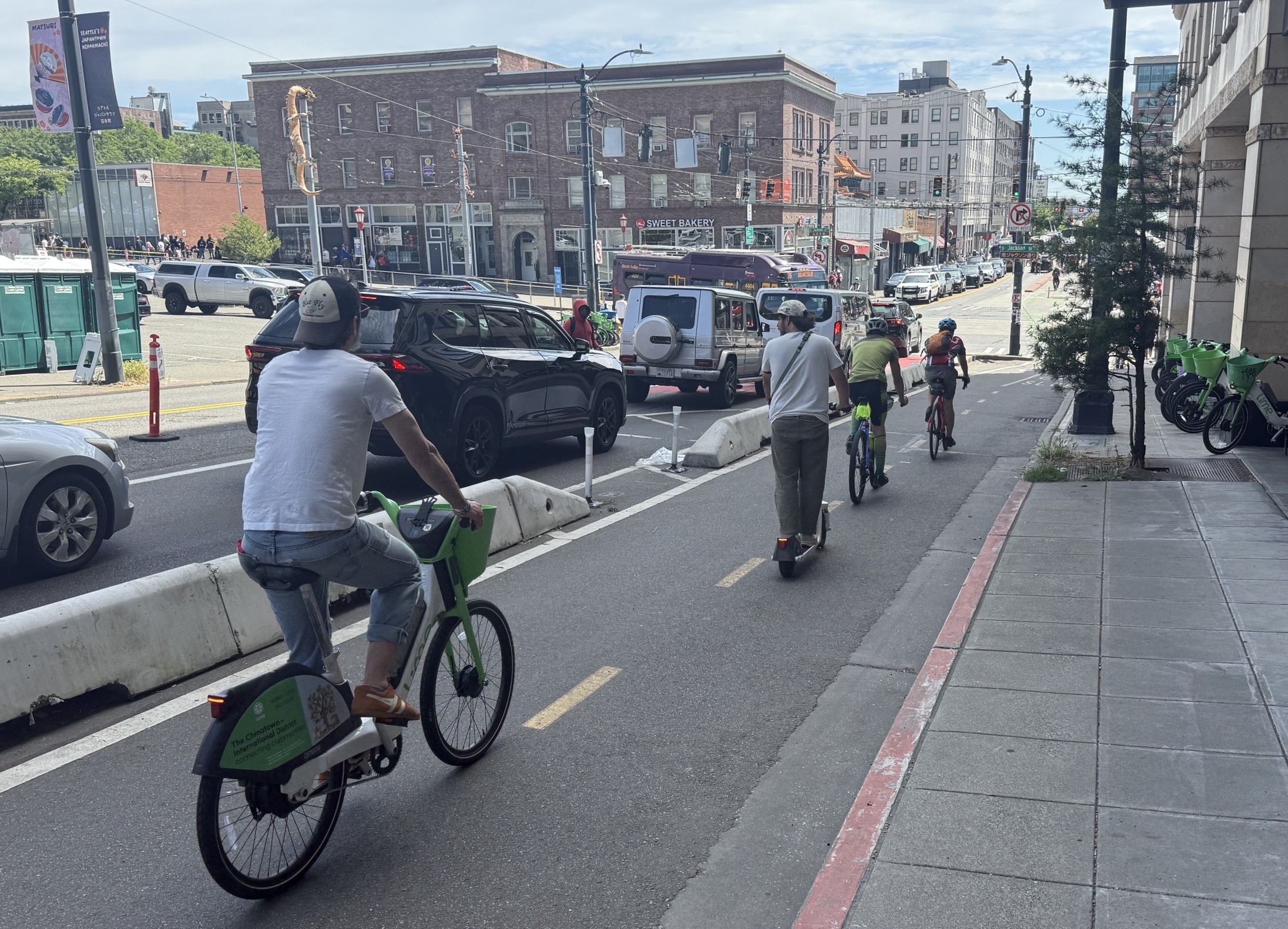
Seattle, especially in the central city, has numerous protected bikeways – featuring many types of protection, including lots of good solid concrete protection.

Low modular concrete Toronto Barriers protecting the two-way bikeway on 5th Avenue in Seattle Chinatown
Another use for Toronto Barriers: sort of “corner islands” at protected intersections. In contrast, on 7th Street the City of L.A. has done somewhat similar corner treatments but at some intersections used low plastic speed-bumps instead, which invites drivers to cut corners and turn into bike/pedestrian areas (example).
Low concrete-curb-protected bike lane in Seattle (similar to quality So Cal bikeways in Long Beach, Pomona, Santa Monica, L.A., and Culver City)
The bikeway in the prior photo crosses a pedestrian area (that appears to have been formed by closing a roadway in a complicated part of a five-way intersection). In the area shared by cyclists and pedestrians, the sidewalk includes directional bike markings. The bikeway continues with soft-hit-post protection.
I really like these planter-protected bike lanes (yes, I’m an urban bike nerd). Sturdy large-bathtub-sized concrete planters are near the intersection, with similar size plastic version mid-block. These serve as substantial barriers between cars and cyclists, but they’re not just plain gray concrete, but living green plants.
The same planters seen from the street side
Closer look at the bikeway side of the planters, where there is a bar and foot-rest for cyclists stopped at the intersection.
Two-way protected bikeway with basic concrete wheel stops, like those that are ubiquitous in parking lots. LADOT uses a lot of special hard plastic protection – including armadillo-type protection. These are good, but drivers often run over and dislodge or destroy them. It feels like these non-specialized concrete barriers are probably more durable, and perhaps less expensive to install and maintain. (Cameo by streetcar.)
Bus stop concrete curb-extension along a protected bike lane. L.A. has similar facilities, but they are temporary plastic materials (example). This Seattle example is basically the same configuration L.A. does, but full permanent concrete. (And, yes, the ideal design – with less bike/ped conflict – tends to be to run the bikeway behind the bus stop. But the above configuration works, preserves existing street trees, and I suspect is cheaper as it sort of adds to the sidewalk, instead of reconfiguring it.)
Not all Seattle bike lanes are concrete-barrier protected – many have soft-hit-post protection.
One-way soft-hit-post-protected bike lane in Seattle
I spotted one example where Seattle closed off part of a smaller street to cars, while still allowing bike traffic. These facilities tend to be called a diverter or a modal filter; they create a low stress calm-traffic corridor called a Neighborhood Greenway or a Bicycle Boulevard.

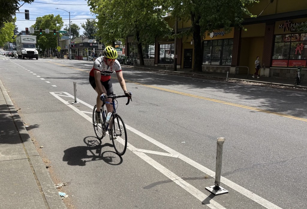
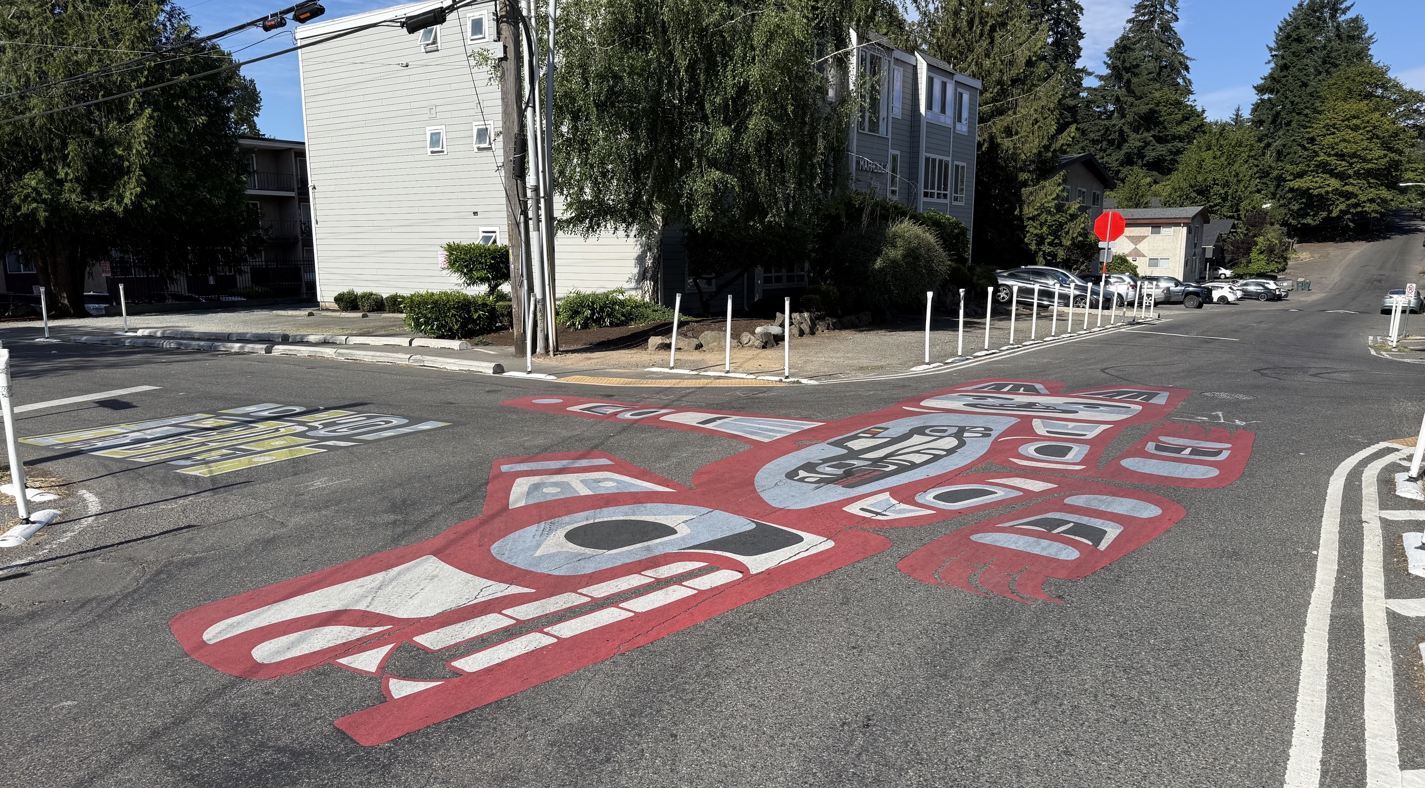
Another view of the above diverter and Neighborhood Greenway

This is a Seattle Healthy Streets installation – somewhat similar to L.A.’s anemic Slow Streets program. The city used quick-build materials to narrow the street, calming traffic and prioritizing walking. I don’t think that this is a great facility (nobody else was walking there on the weekday morning I walked through) but it feels like the lane narrowing and street mural are a few steps in the right direction.
Lastly, a photo of some of the bike parking at the Seattle airport. This parking is in a high foot-traffic area, right next to baggage claim. LAX puts wretched bike parking in out of the way areas. Seattle chose a high-visibility site, and included welcoming signage and maps. It’s an airport that doesn’t hate bicyclists – what a concept.

Streetsblog has migrated to a new comment system. New commenters can register directly in the comments section of any article. Returning commenters: your previous comments and display name have been preserved, but you'll need to reclaim your account by clicking "Forgot your password?" on the sign-in form, entering your email, and following the verification link to set a new password — this is required because passwords could not be carried over during the migration. For questions, contact tips@streetsblog.org.

More from Streetsblog Los Angeles

Thursday’s Headlines

June 25, 2026

Long Beach Mayor Rex Richardson Approved for Metro Board

June 24, 2026

Pasadena Passes Restorative Justice Elements for 710 Stub Plan

June 24, 2026

Wednesday’s Headlines

June 24, 2026

Eyes on the Street: Culver City Upgrades Elenda Street Bikeway

June 23, 2026
See all posts