Some Urban Observations From My Mexico Vacation
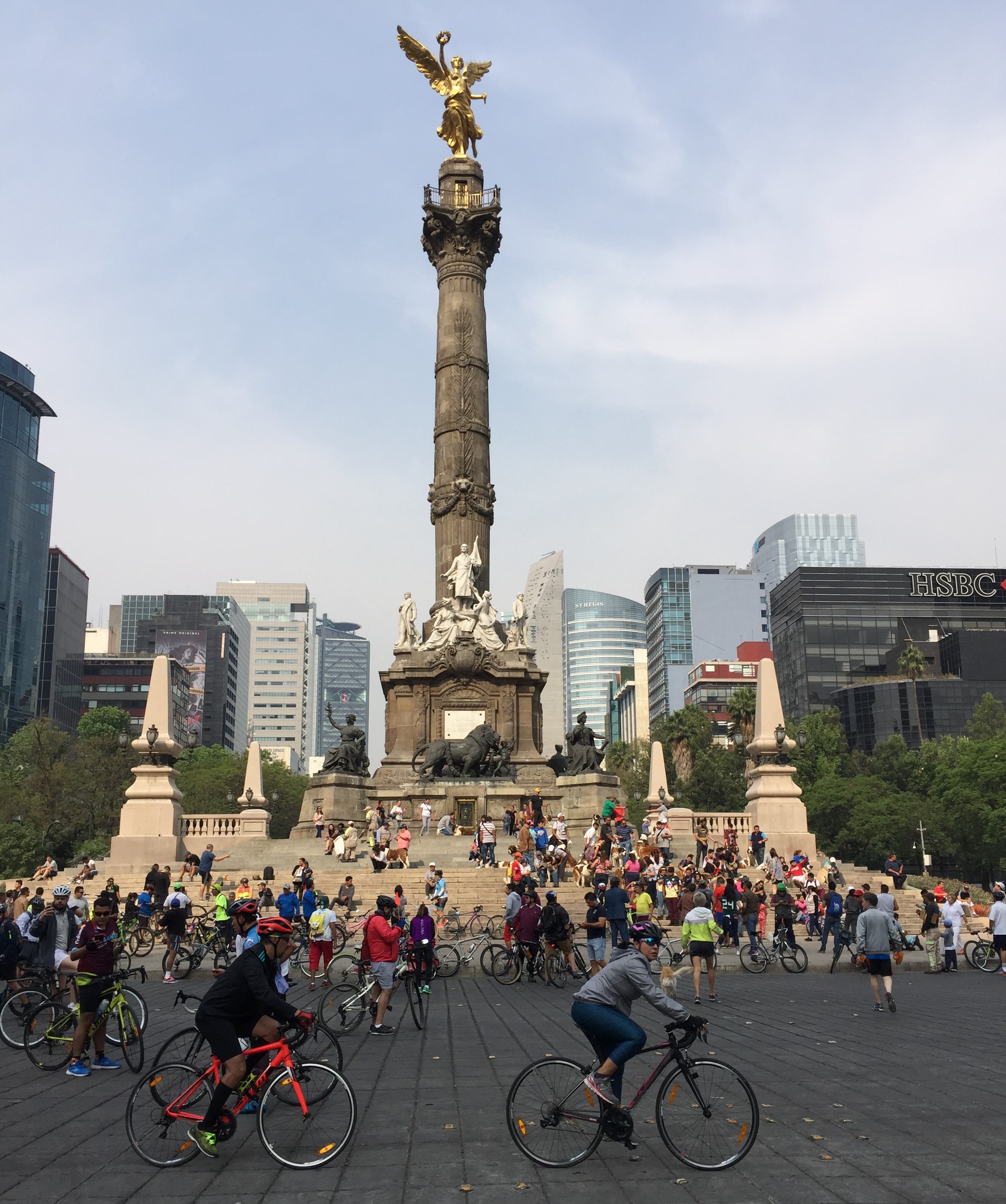
Open streets at Mexico City’s Ángel de la Independencia monument. All photos by Joe Linton/Streetsblog L.A.
My family recently spent eleven days vacationing in central Mexico. I don't claim to be an expert on Mexico or Mexican cities, but I did observe some things that I think might be interesting to SBLA readers. I am sure these tend toward the more touristy parts of these cities; they're certainly not a comprehensive survey of great practices from these places.
Similar to the way that L.A. modeled CicLAvia after similar events in Colombia and Mexico, I think that these facilities/practices are potential examples that Los Angeles could learn from as we work to become a more walkable, more livable city.
We visited several cities in central Mexico: Mexico City (population 9 million), Santiago de Querétaro (2 million), San Miguel de Allende (140,000), and Guanajuato [City] (172,000.)
To make a sweeping generalization, I saw plenty of similarities with U.S. cities like Los Angeles. In both places, though plenty of people walk, take transit, and bicycle, the car tends to dominate urban spaces. Like L.A., prioritizing cars has made for unhealthy air quality, noise, degradation of public space, and other detriments.
There are also some other fairly common differences that may be important, too, but that I don't go into detail on: Mexican streets feature more speed bumps, traffic circles, and bollards than do their U.S. counterparts.
Small Scale Is Key to Walkability
Perhaps some of this is my nostalgia for bygone eras, but exploring these various cities on foot reinforced my sense that scale is really the key to walkability.
I've written before about destructive road-widening policies that so many Southern California cities still practice. Sometimes livability advocates will support these sorts of street-widening projects when cities throw them a bone by including wider sidewalks or bike lanes. What I saw in Mexico reinforced my opinion that road-widening projects just about never make places better for walking or bicycling.
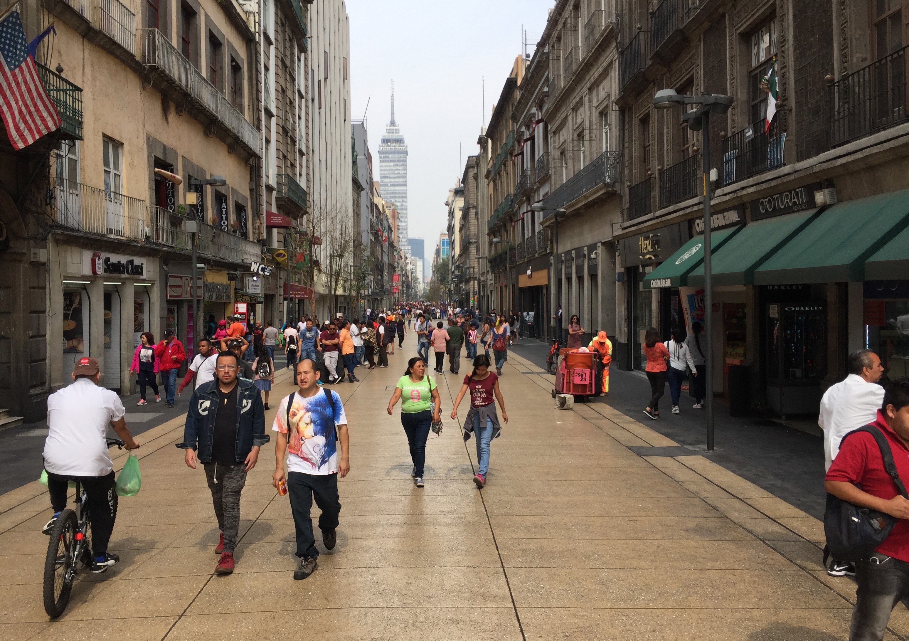
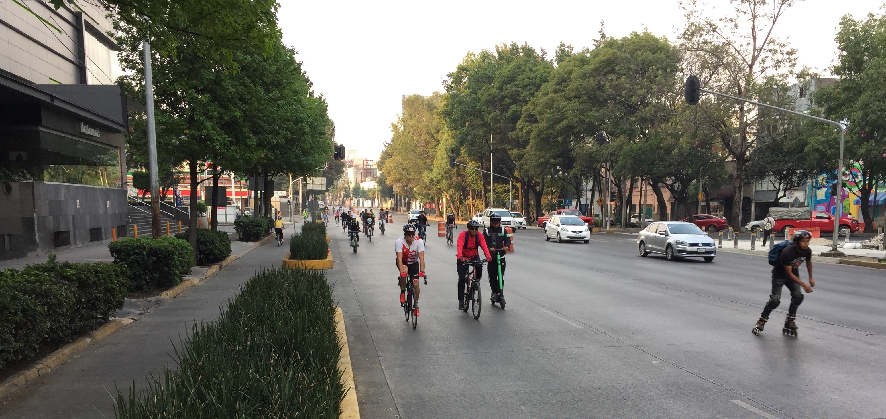
In Mexico City, there are plenty of over-wide streets. We stayed just off Avenida Patriotismo - a one-way street with five lanes for cars, a one-way protected lane for bicycling, and a sidewalk on each side. Though plenty of people were walking, there were often cars stopped or parked on the sidewalks. Overall, even with a protected bike lane, the street did not feel very conducive to biking or walking.
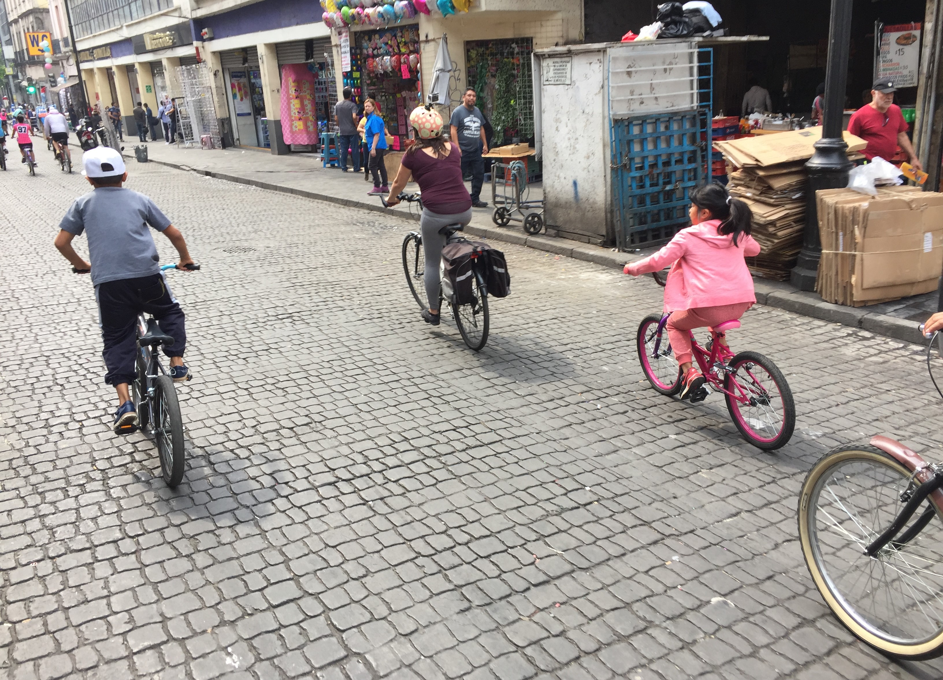
Mexico City does have plenty of smaller-scale streets, including many car-free streets in its downtown.
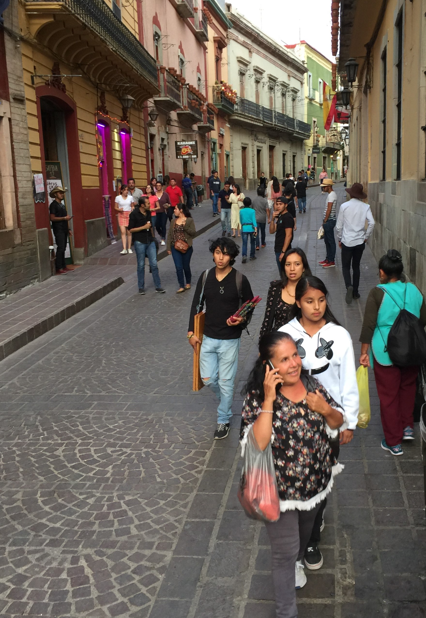
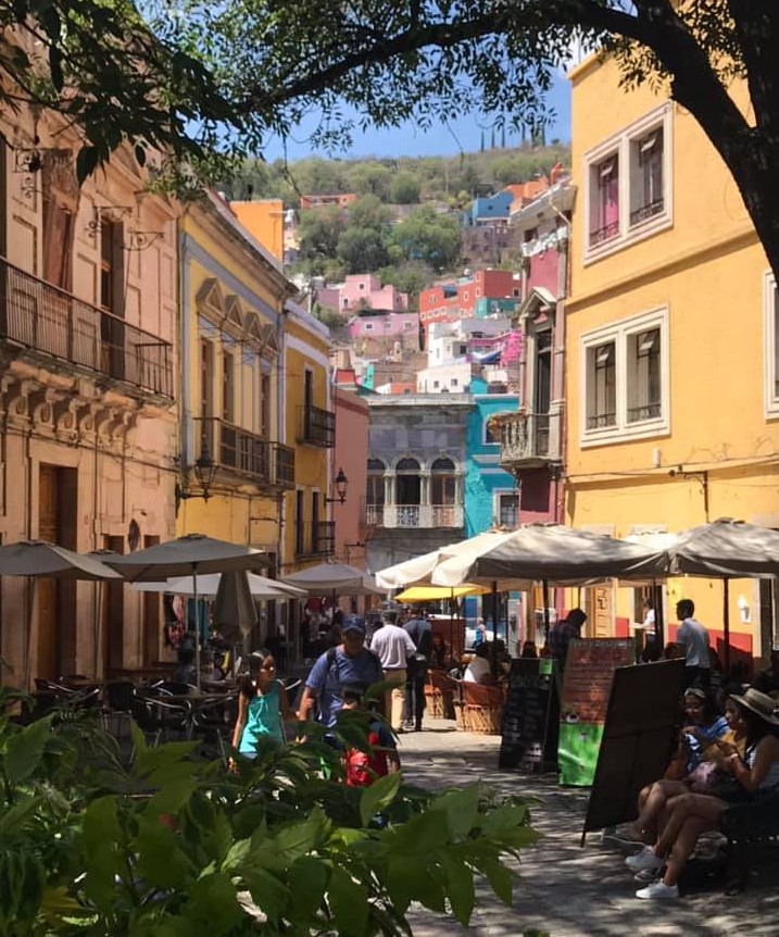
Mexico City's over-wide, car-oriented streets were a big contrast to what I saw in the city of Guanajuato. There, the early colonial street patterns have been kept intact, in part by having cars and buses bypass the city center via a network of tunnels. Leading down to the tunnel bus stops are stairways that, at the street level, resemble New York City subway entrances. The bigger main surface streets are narrow, windy, one-lane, and one-way - shared with cars, but dominated by pedestrians. The smaller surface "streets" are small alleys - really walkways - many with stairs.

We visited a famous walk street called El Callejón del Beso (the alley of the kiss). It's famous for a story of lovers who lived on opposite sides of the street, but could kiss each other from their respective balconies. That street narrows to about three feet across. It is so narrow that I had to take off my backpack to turn around.
More often the walk streets of Guanajuato are around five to ten feet wide, and widen out into plazas every half-dozen blocks. This scale is highly conducive to walking. These narrow walkways support a surprisingly large volume of pedestrians.
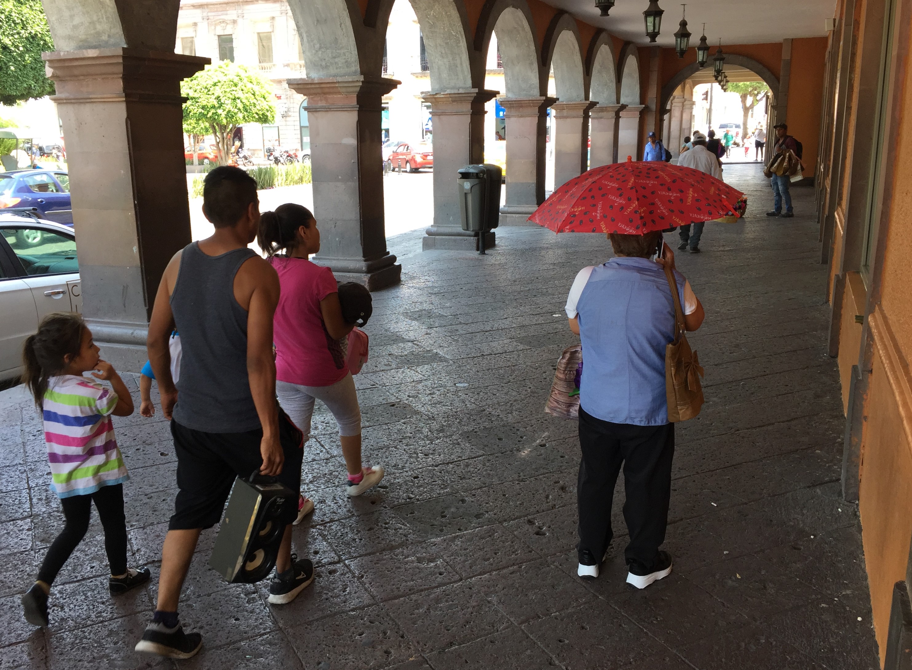
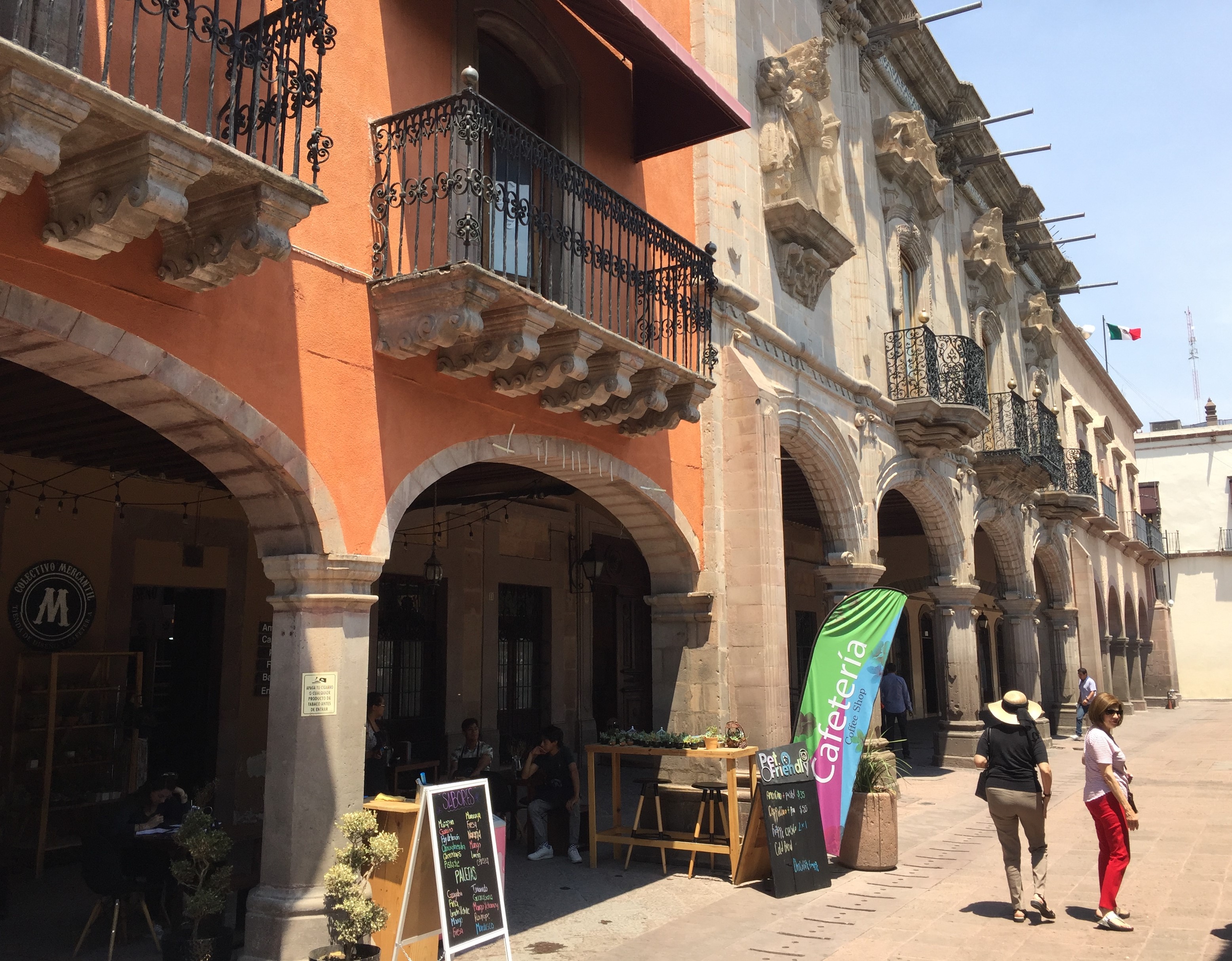
Useful Architecture: Arcades
I knew that there are plazas at the heart of Mexican cities. What I didn't really know much about are the arcades that surround nearly all of these central plazas.
Arcades are, according to Wikipedia, "a succession of contiguous arches, with each arch supported by columns, piers. Exterior arcades are designed to provide a sheltered walkway for pedestrians."
Arcades are found in various parts of the world - from Africa to Europe to South America. There are a few arcades in Venice Beach, but they're rare in Southern California.
What seems great about them (and many of our architect and urban planner readers probably studied this long ago, but I didn't) is that they form an excellent in-between space. Somewhat analogous to the way a porch adds on to a house, these arcades are semi-private spaces that serve as a transition between the public plaza and the private building.
The Mexican arcade spaces that I saw are very flexible. Some serve primarily as sidewalks, adding needed shade. Some include seating, vending, and dining. Several arcades connected across the frontage of multiple buildings.
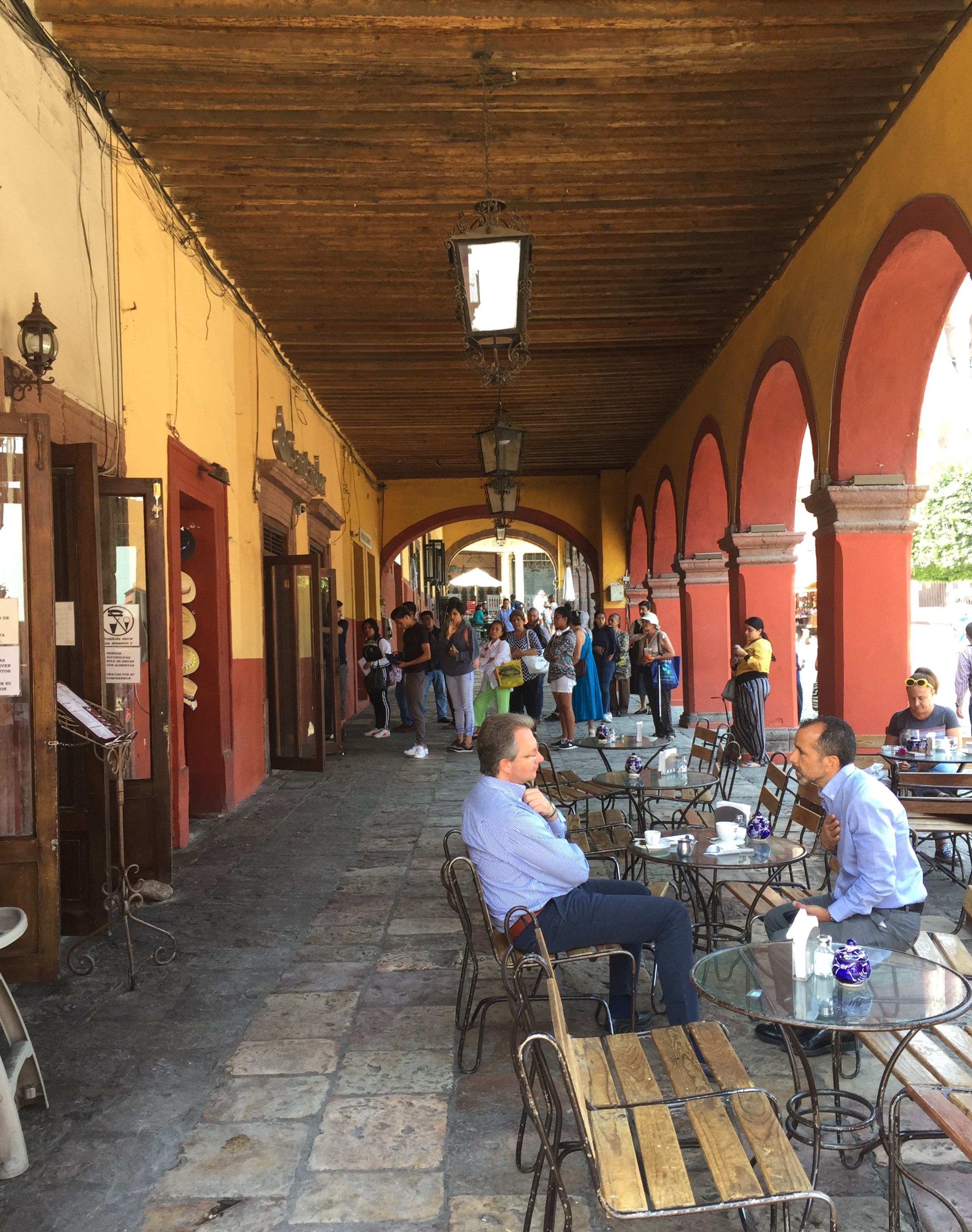
I don't know where I would recommend these arcades in Los Angeles, but they do feel like a worthwhile vernacular form that would make a lot of sense in Southern California.
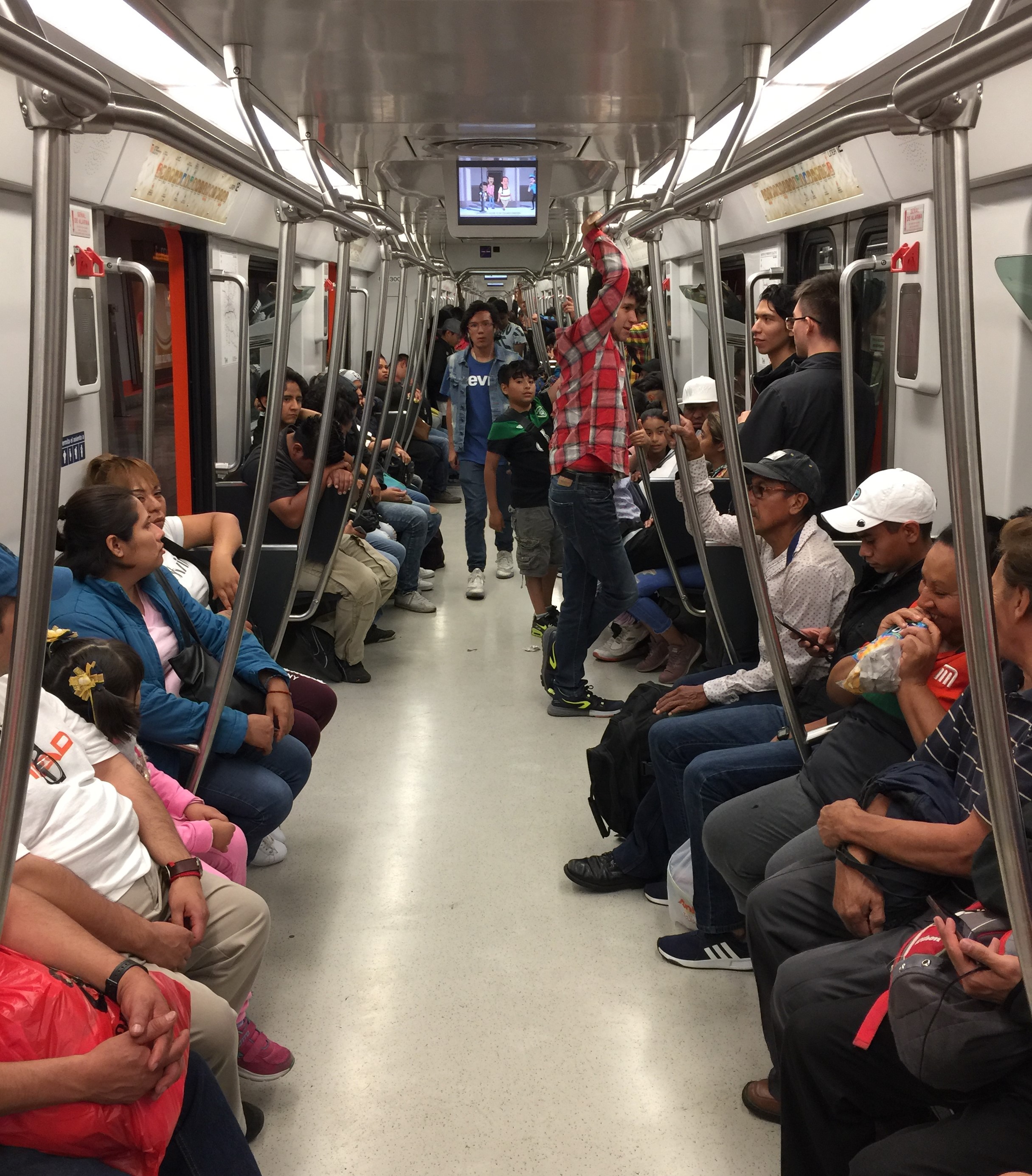
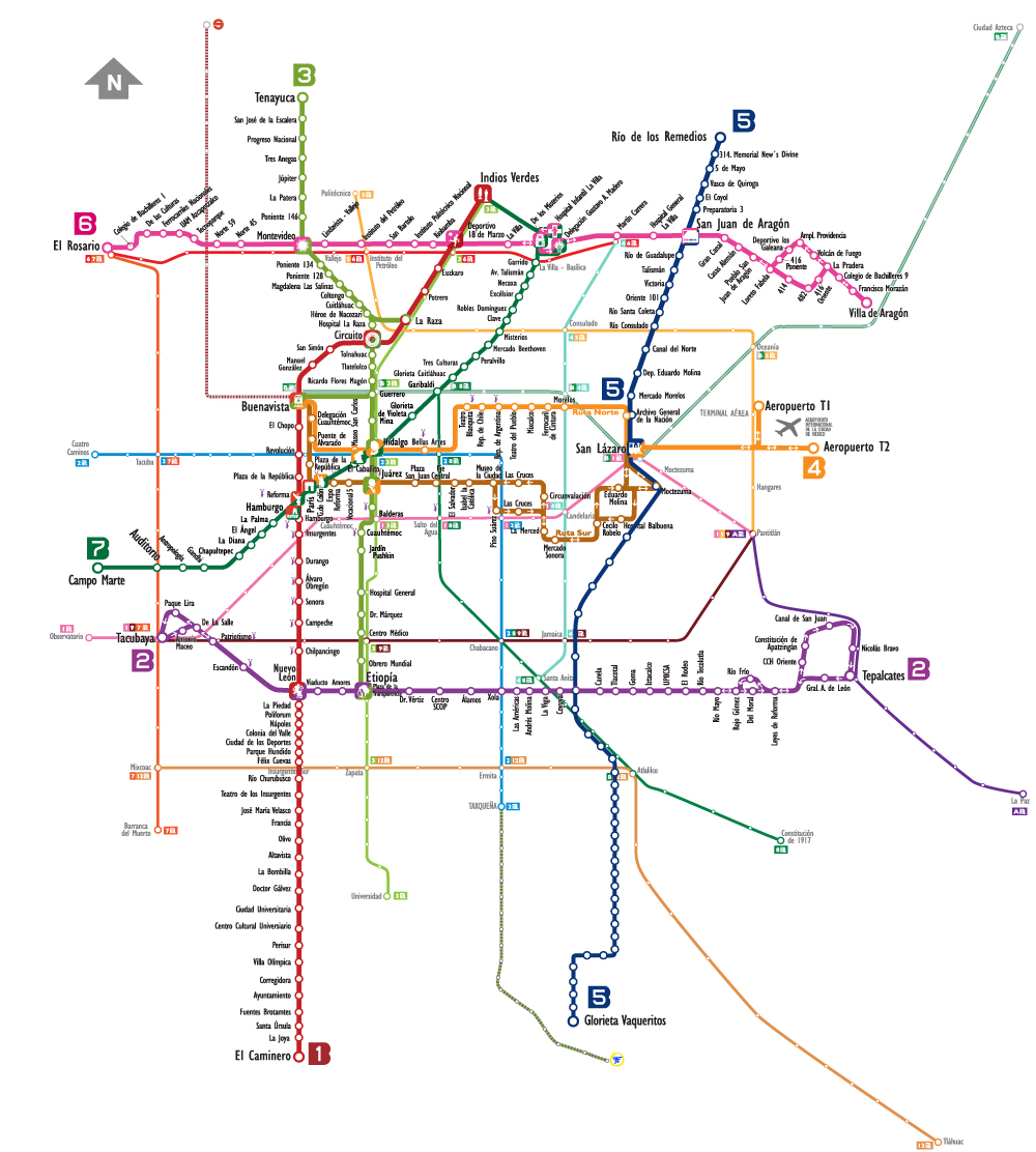
Mexico City's Rail System
I didn't get to ride a lot of transit in Mexico. Mexico City has an extensive subway system, and I only saw two stations and those were on Line 12 - the most recently built subway line.

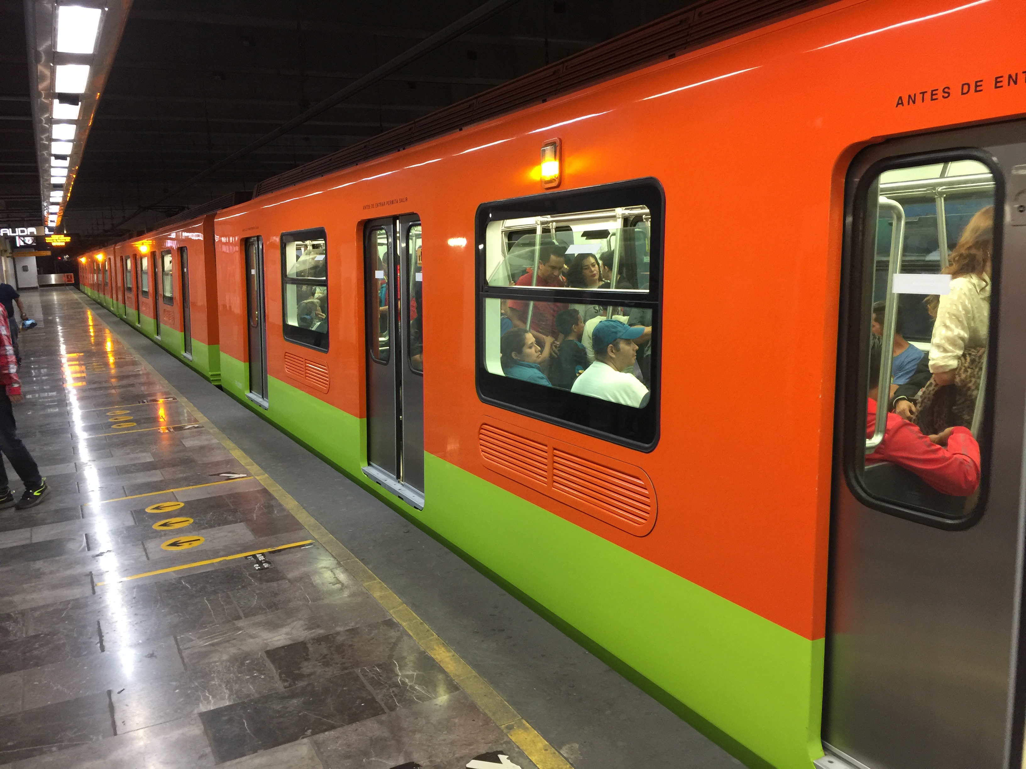
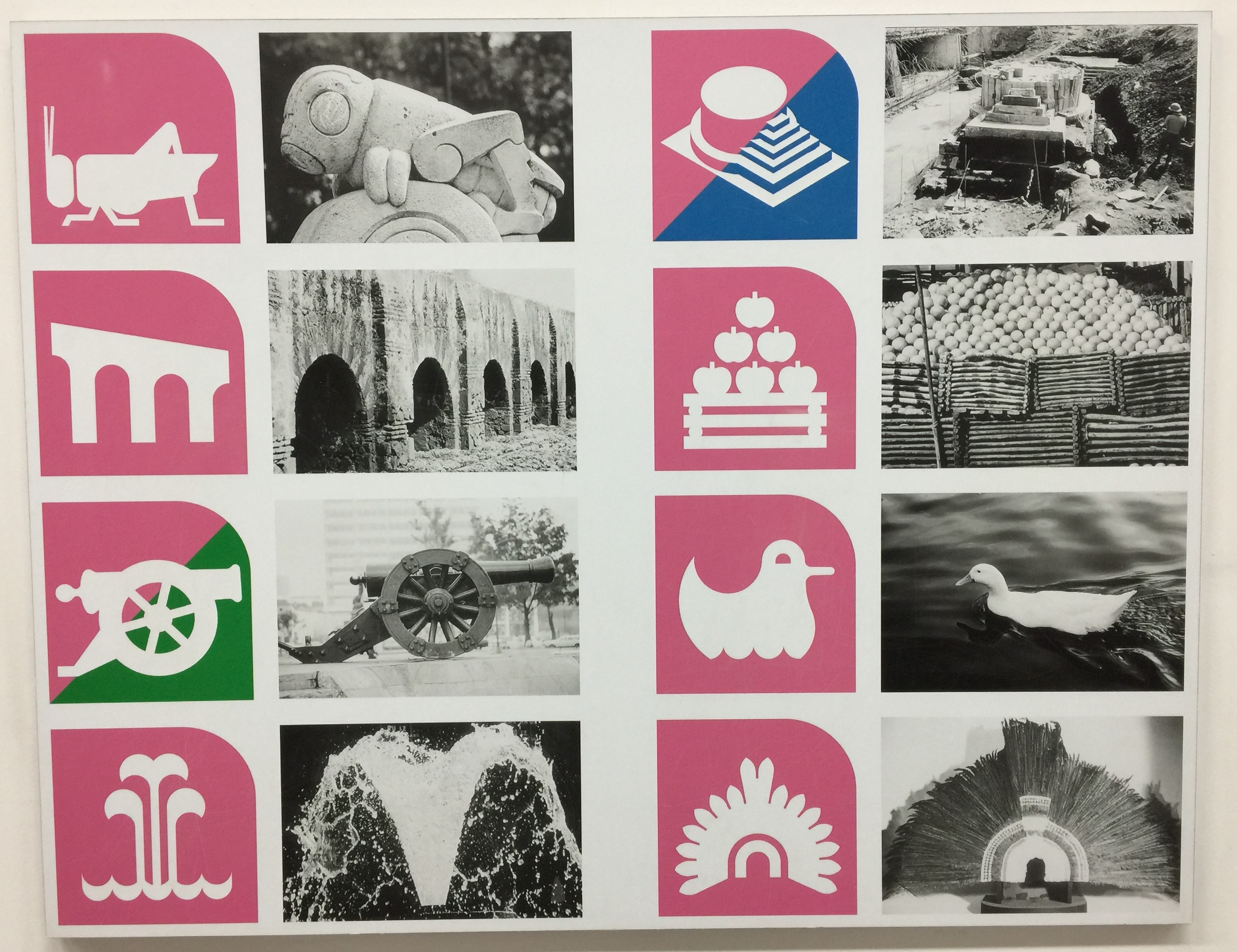
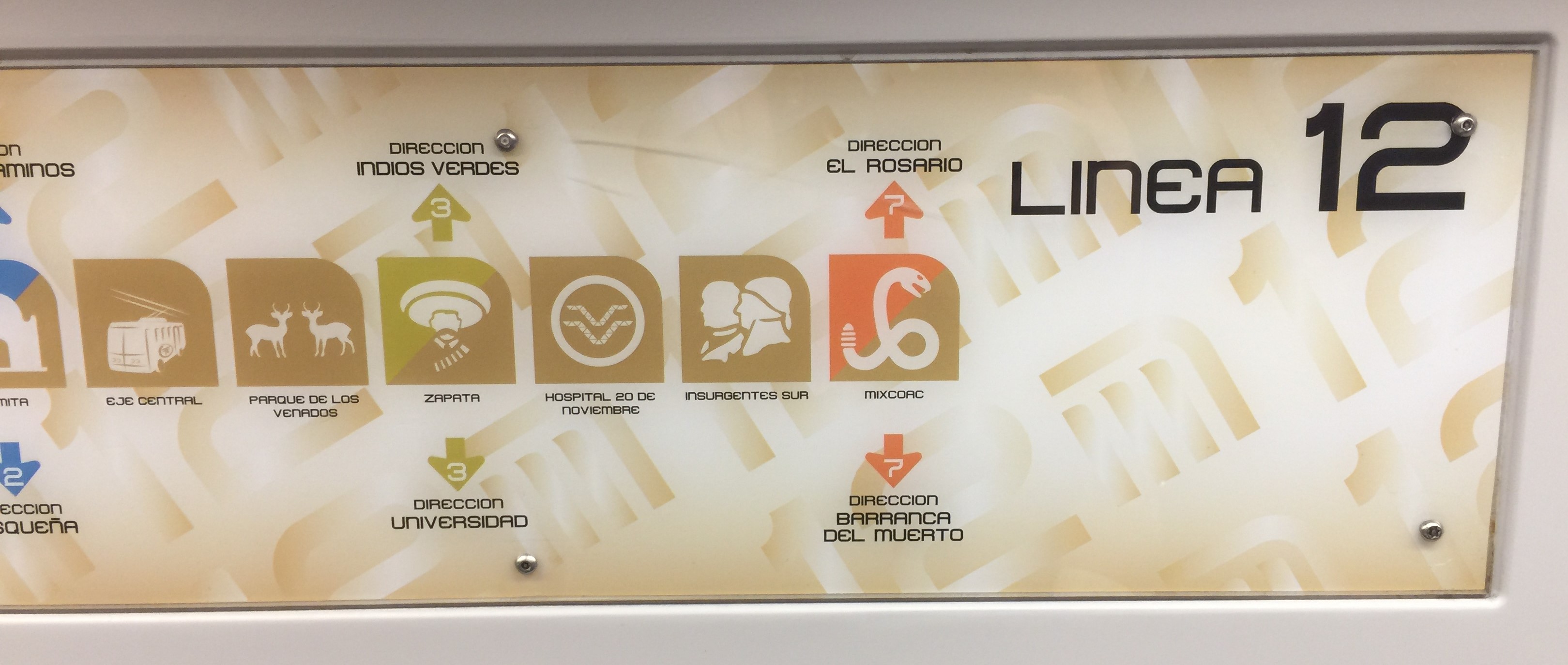
One interesting thing about the Mexico City system is that each station has a simple picture-logo, generally representing the place and/or history of the station location. For example, in the Mixcoac neighborhood, the station logo is a snake because the Nahuatl name Mixcoac means "place of the cloud serpent." The background of each logo is the color of the subway line/s that the station serves. These images were initially intended to be recognizable to riders unable to read. Today literacy is more prevalent, so this is less of an issue, but the logos still represent a strong, easily recognizable branding. They helped me as a tourist unfamiliar with the area.
In the two stations I visited, there was plenty of activation of the mezzanine space.
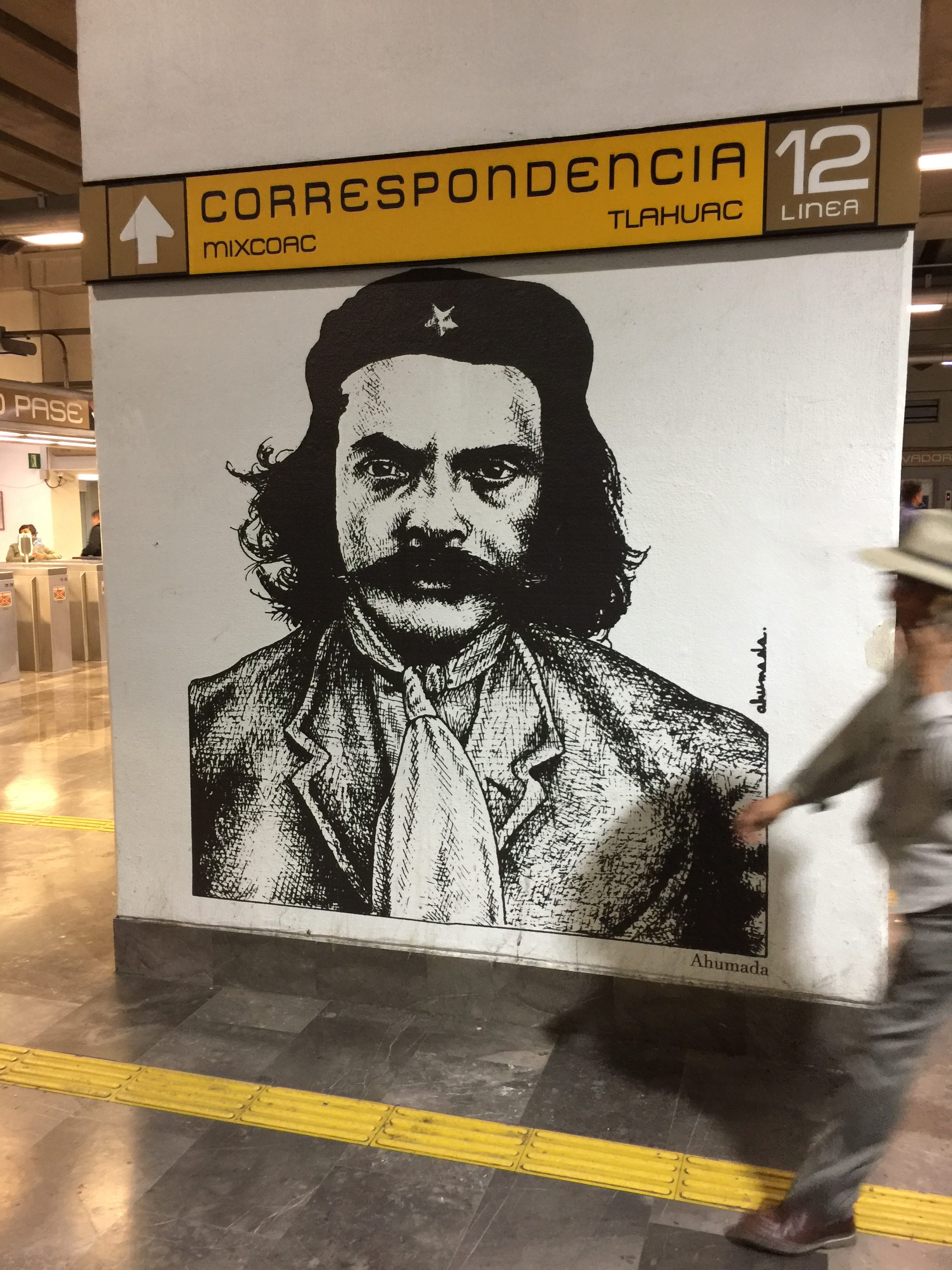
At the Mixcoac station, the small Museo del Metro commemorates the history of Mexico City's transit system. It features photos, maps, and objects relating the history of building and operating the subway system, and displaying some archaeological treasures unearthed during construction.
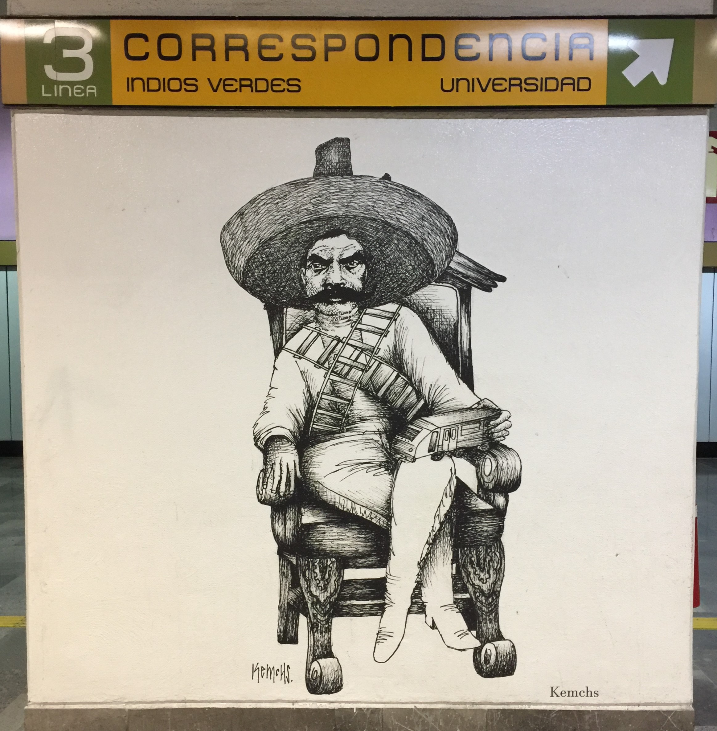
At the Zapata station, the mezzanine features a permanent display of Mexican cartoonist portrayals of revolutionary hero Emiliano Zapata, as well as a small community center that teaches cartooning.
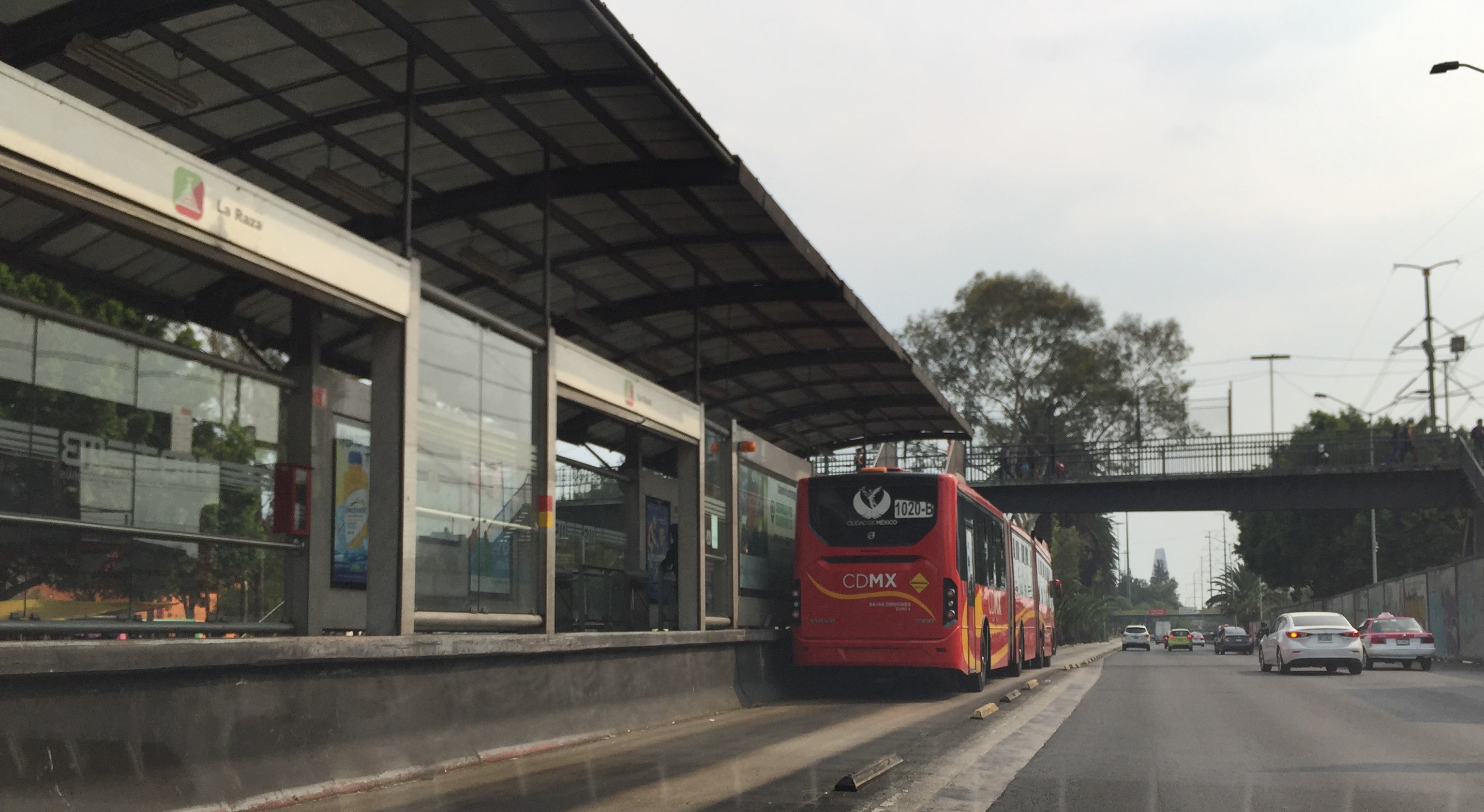
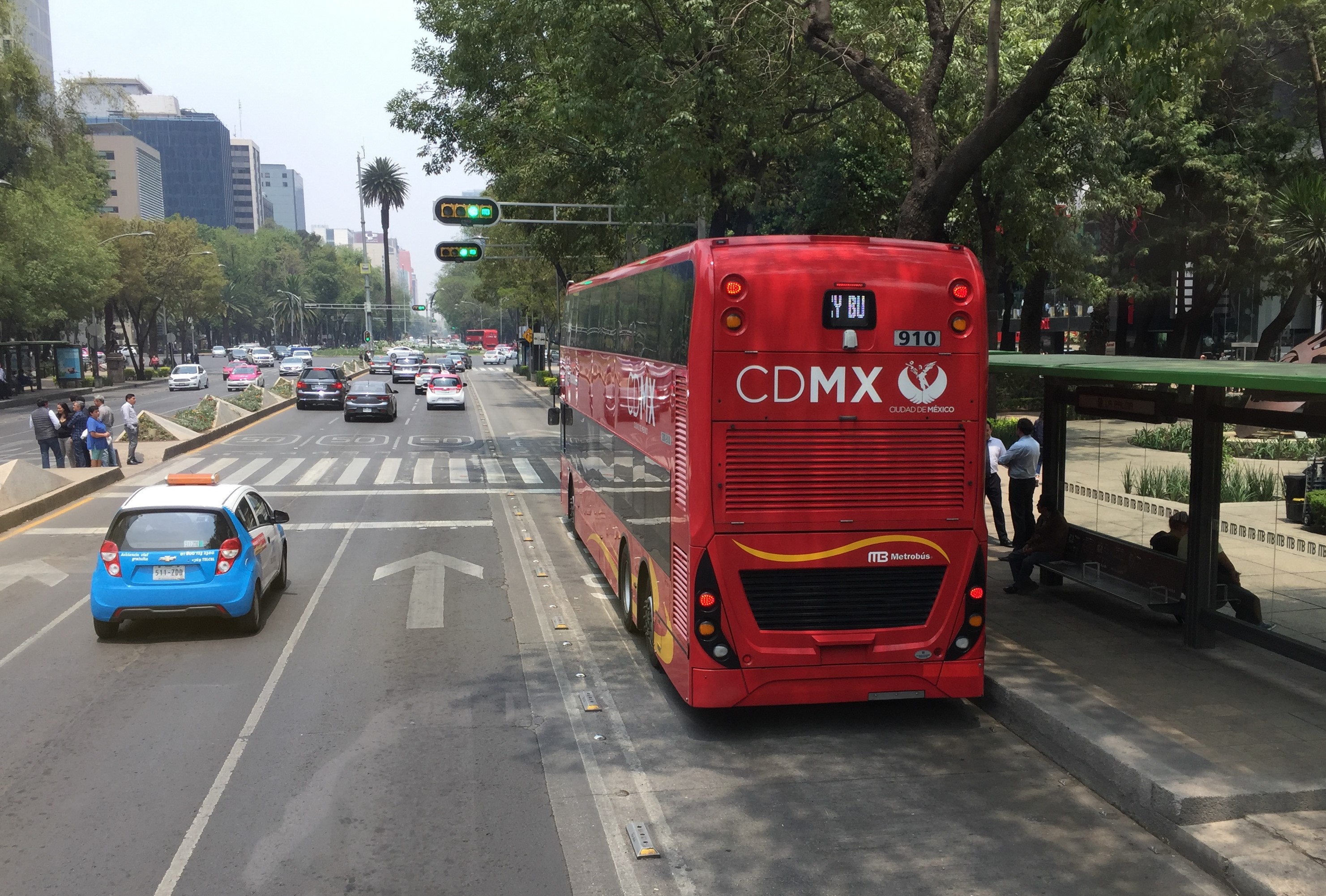
Bus Rapid Transit
Mexico City has seven lines - nearly 100 miles - of Bus Rapid Transit (BRT) called Metrobús. These BRT lines run on dedicated bus-only lanes nearly all in the center of major streets, including Avenida de los Insurgentes.
Riders pre-pay when entering Metrobús stations, which are mostly located in medians.
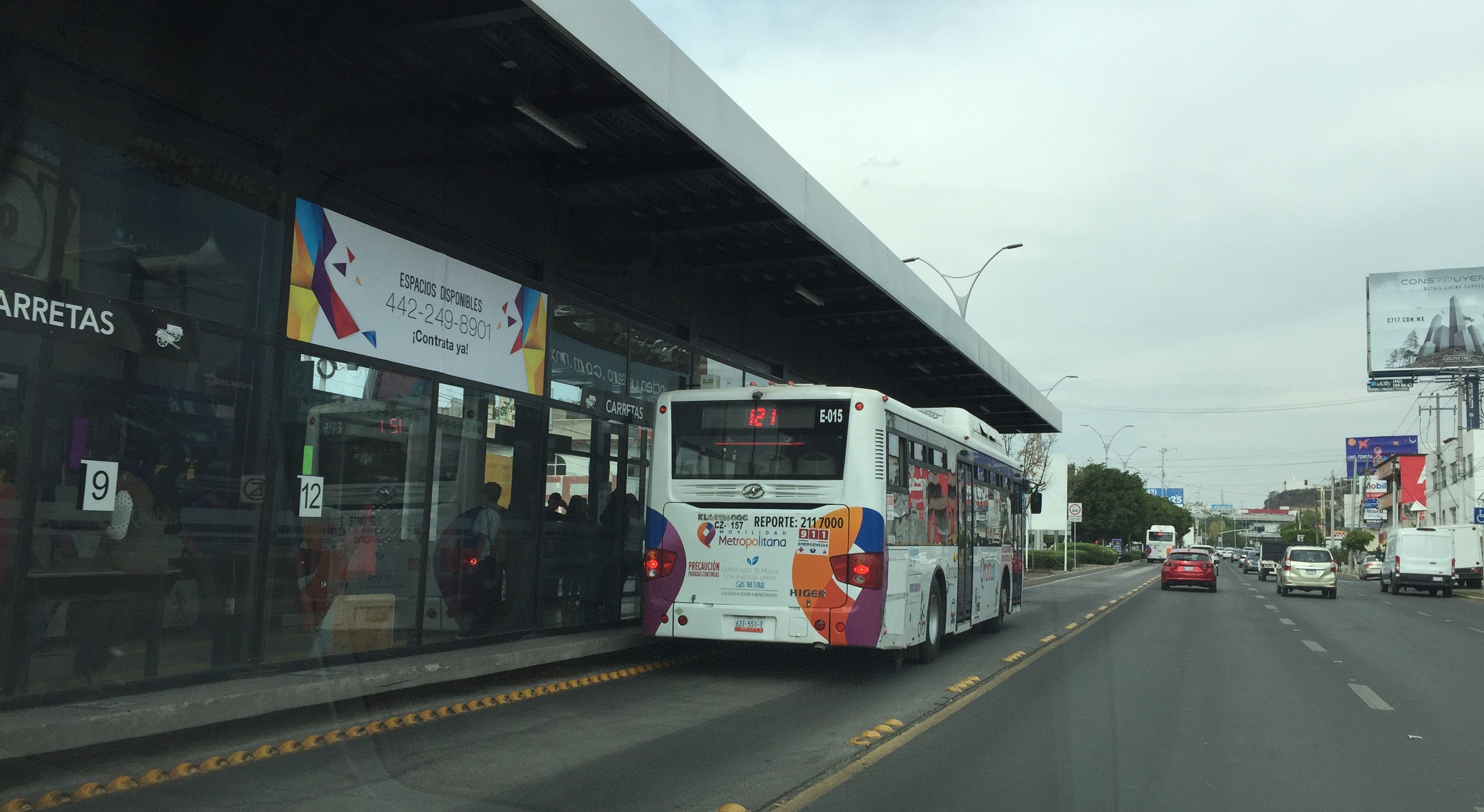
A similar center-running BRT system also serves Querétaro.
Though I didn't get a chance to ride it, my friends in Mexico City report that Metrobús is so popular that on most weekdays, many buses run with standing-room-only overcrowding.
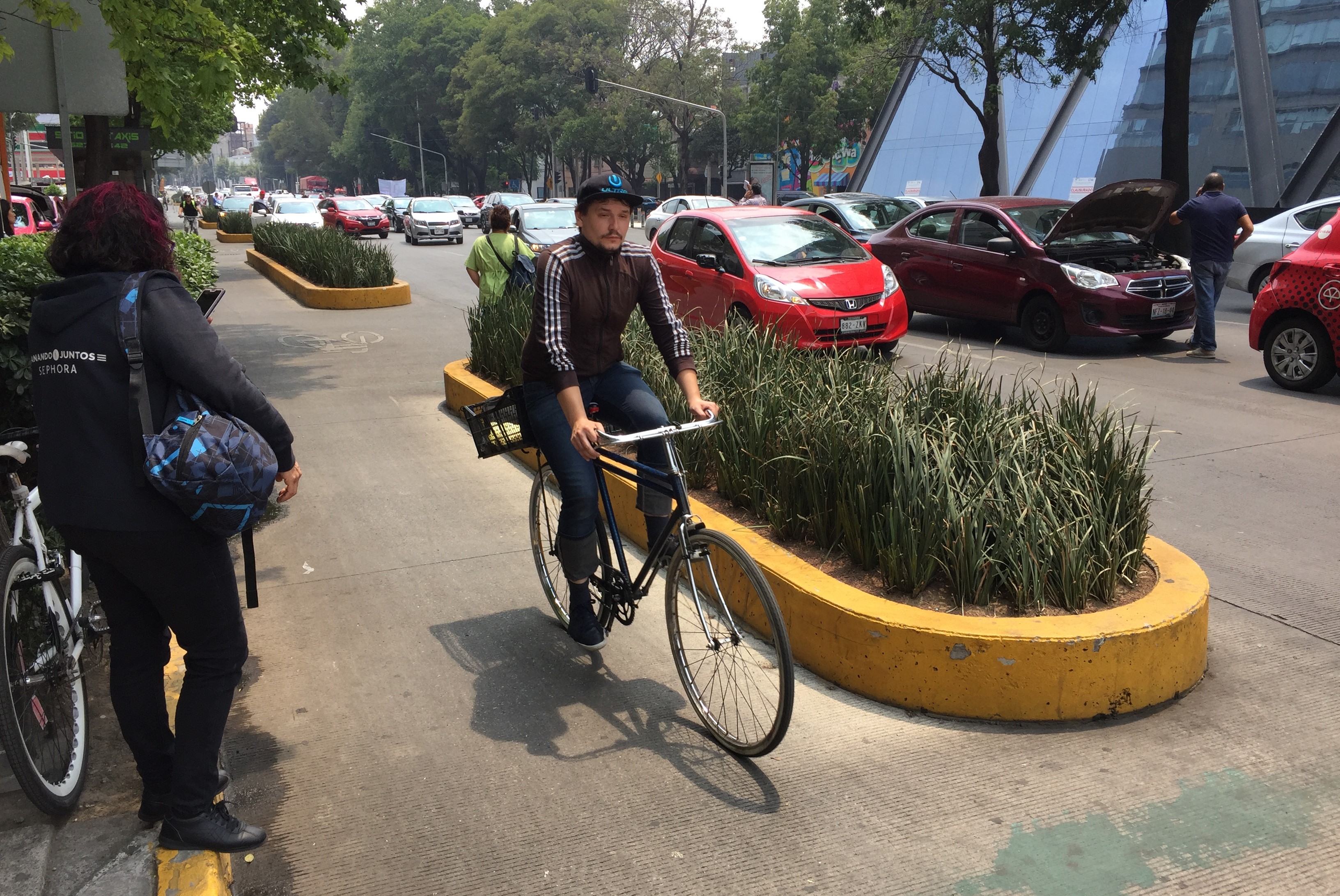
Bicycling
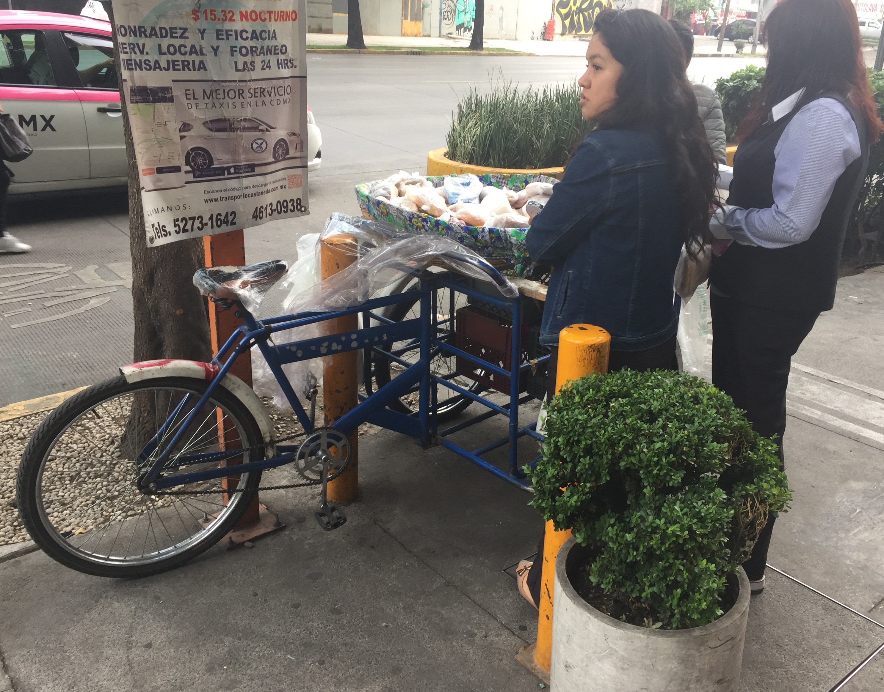
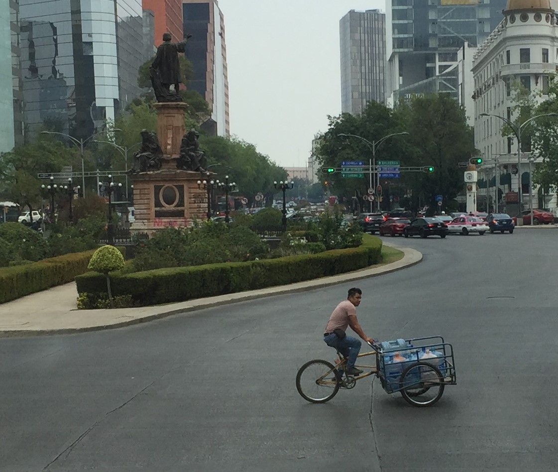
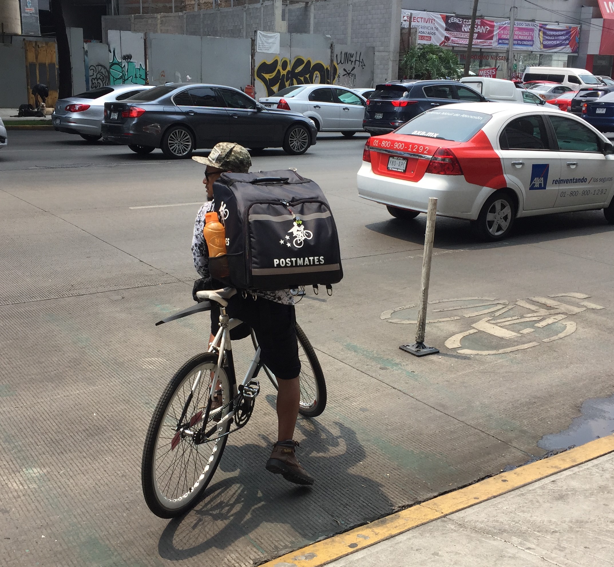
Similar to Los Angeles, though Mexico City streets are dominated by cars, there is a visible minority of cyclists. In addition to basic transportation cycling, there are plenty of working bicycles - used by vendors and messengers.
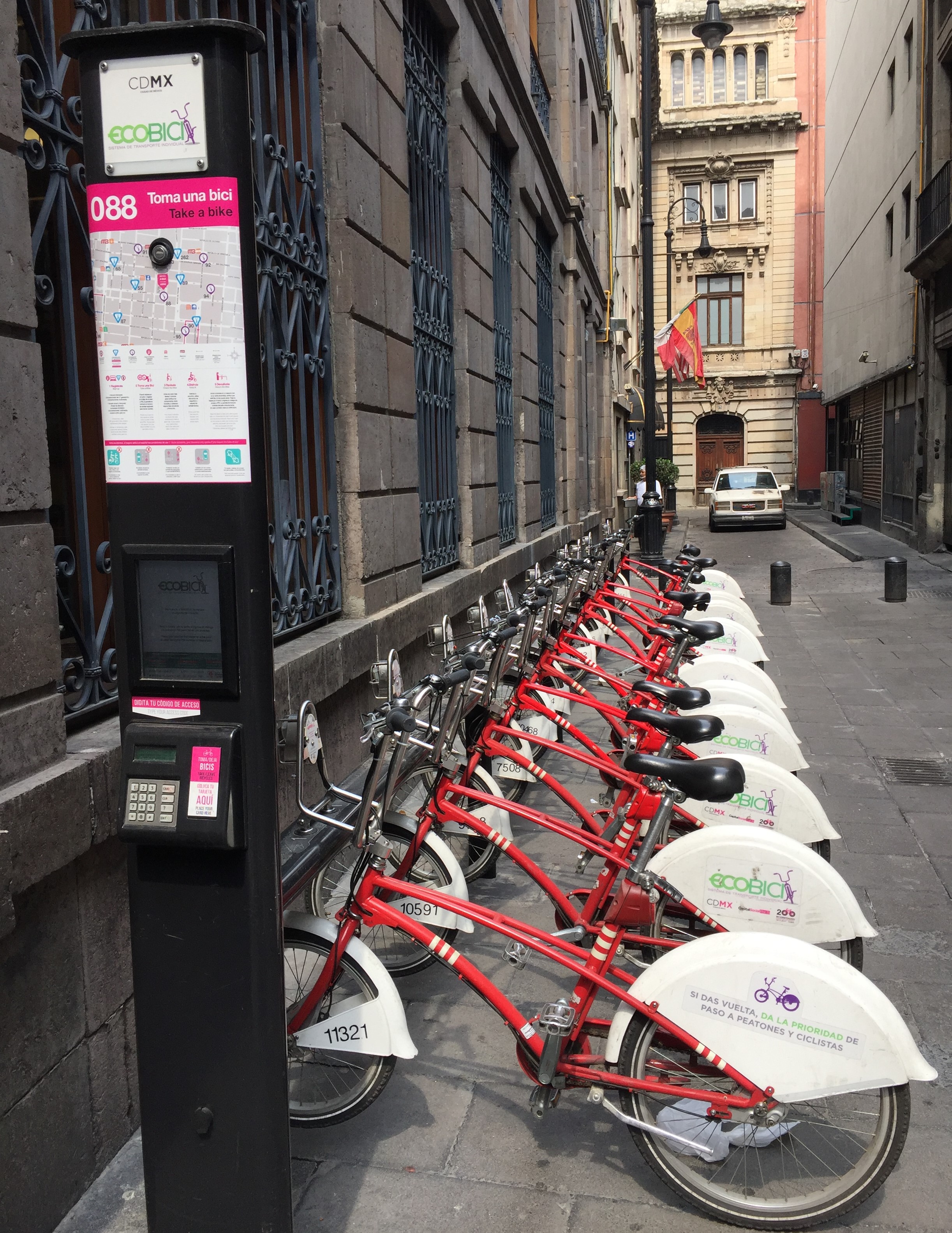
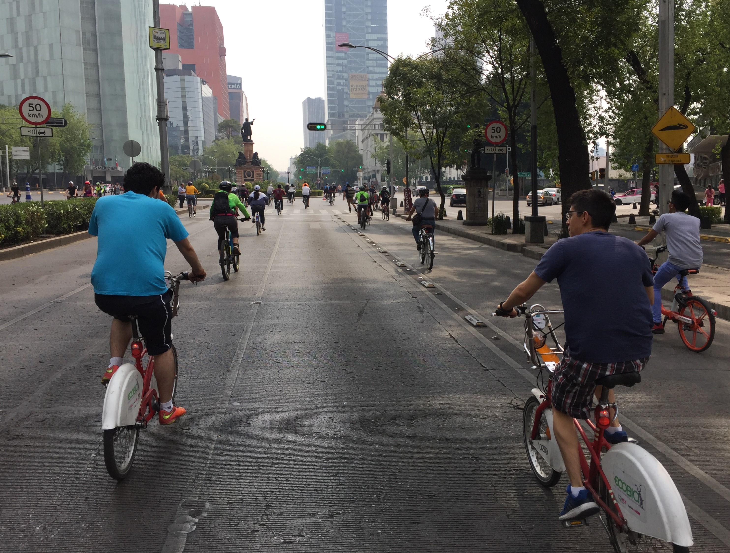
Mexico City's EcoBici bike-share system is extensive and inexpensive. The docked system includes primarily conventional pedal-powered bicycles, but there are also special docks for a separate fleet of e-bikes. In some areas there are also private dockless bike-share. Though I certainly saw people riding EcoBici bikes, similar to Los Angeles, they are a bit uncommon - at least in the areas that I visited. (They bike-share bikes were heavily in use at their open streets event - see below.)
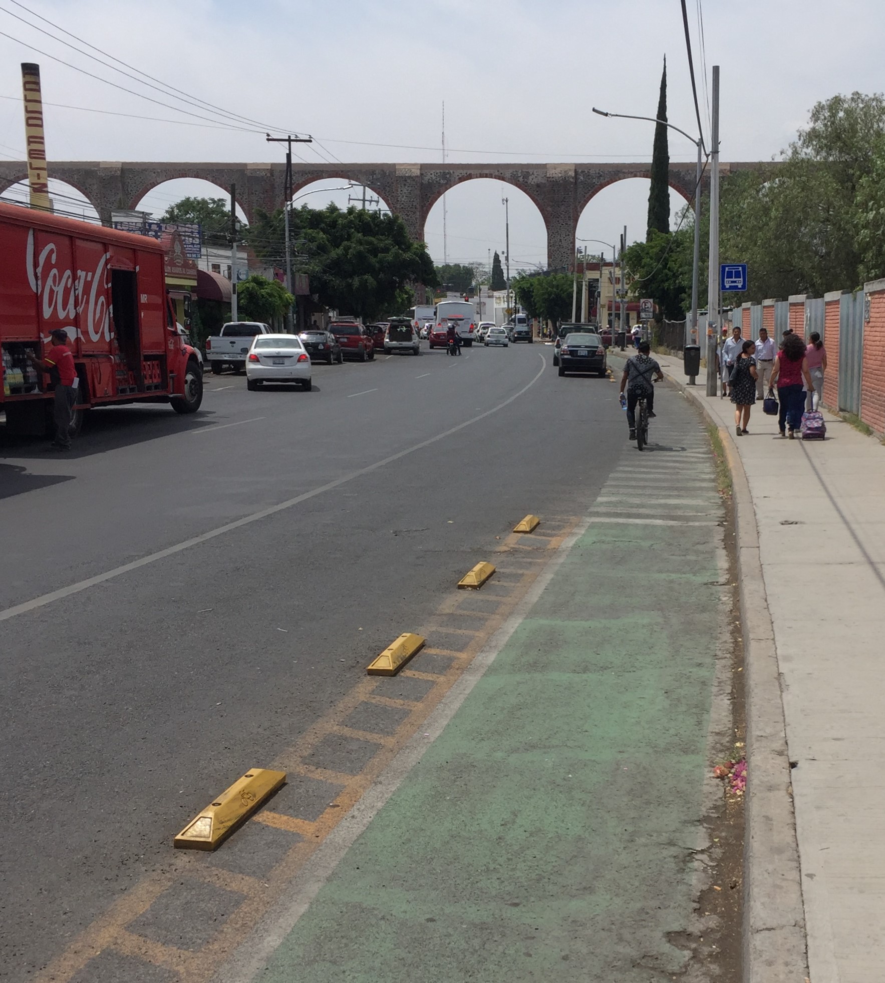
Mexico City has quite a few protected bike lanes, mainly on larger streets. Protection varies from landscaped raised medians to raised plastic bumps.
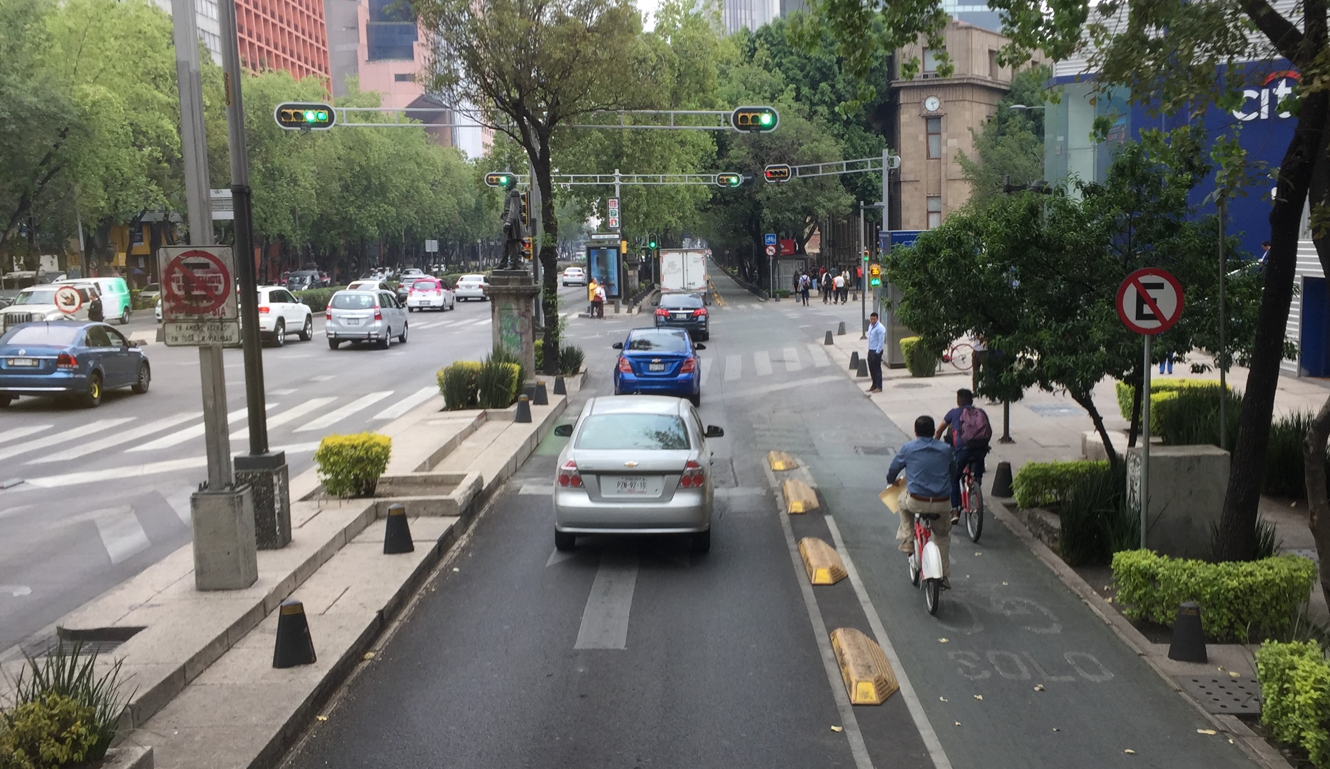
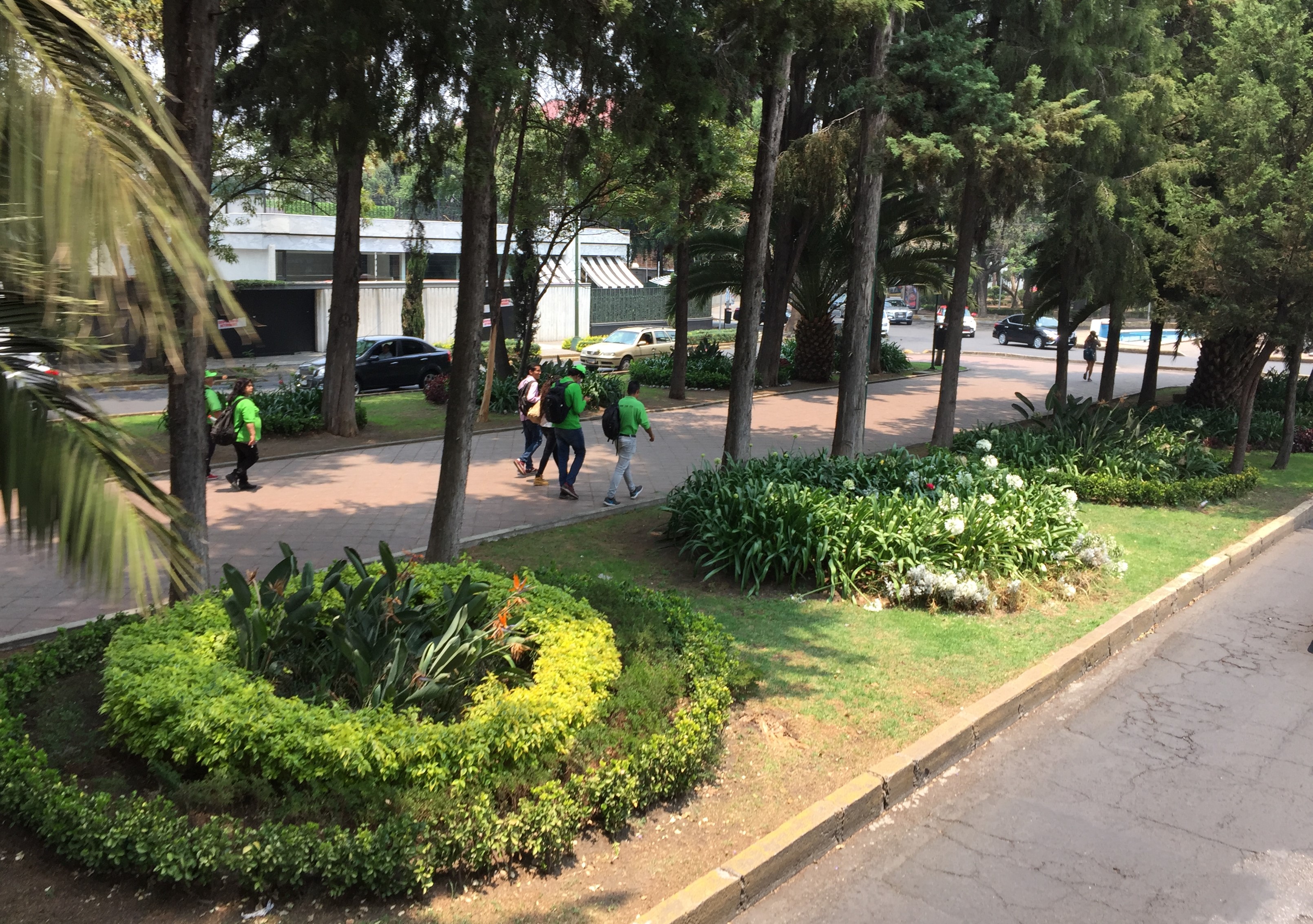
Some neighborhoods have large tree-lined medians which support walking and bicycling.
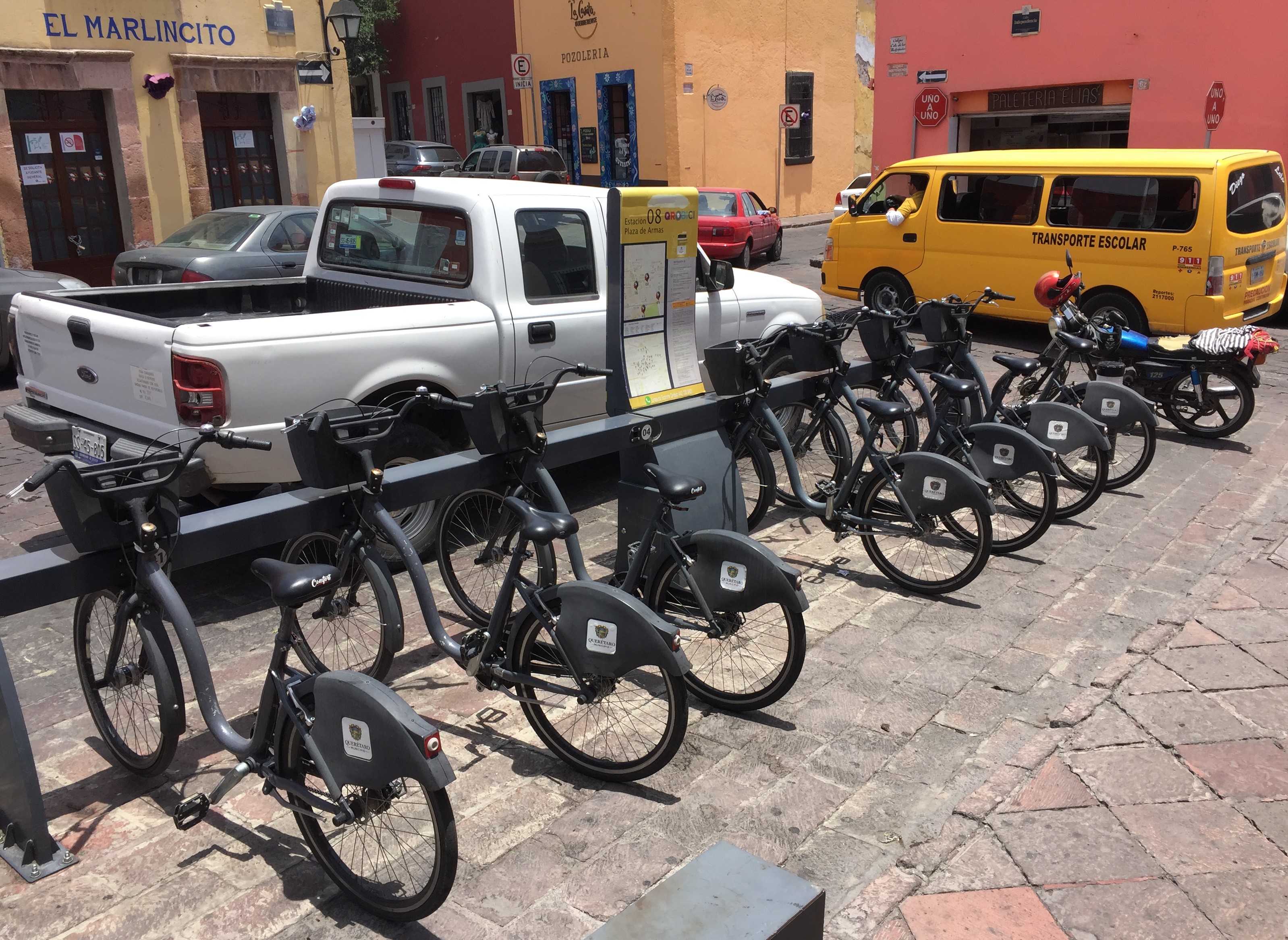
Querétaro also has its own bike-share, though I didn't spot anyone riding a bike-share bicycle.
Querétaro also has protected bike lanes, and the only sharrows I spotted in Mexico. To Querétaro's credit, the sharrows (unfortunately typically a wimpy bike facility) were used for a relatively good purpose - marking a short pinch point where the street narrowed, and a protected bike lane was temporarily dropped.
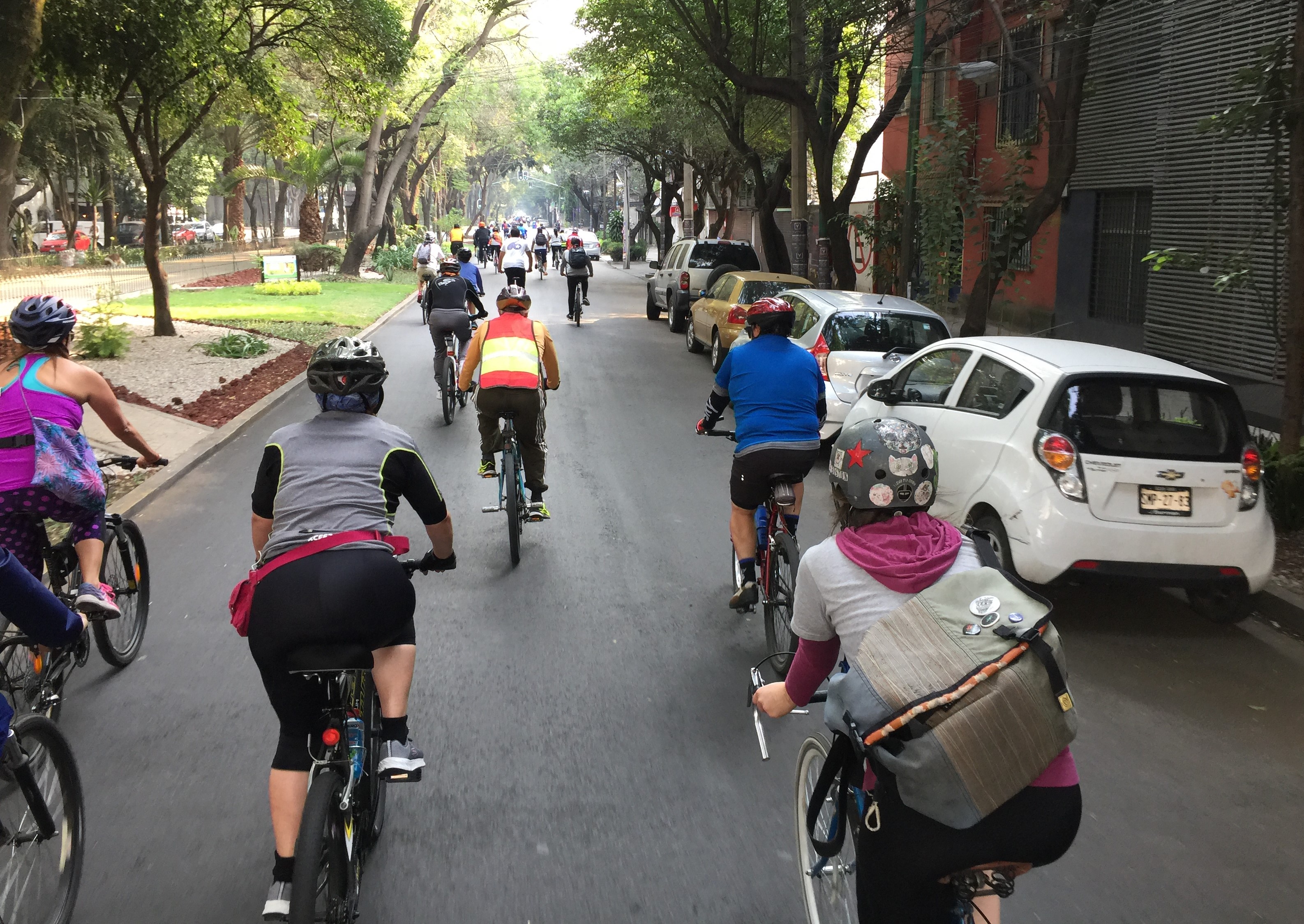
Weekly Ciclovía Open Streets: Muévete en Bici
Every Sunday - yes, every Sunday - Mexico City hosts its 55-kilometer (34-mile) ciclovía event "Muévete en Bici" (move yourself by bike.) The last Sunday of each month - as well as some holidays - they host a special, longer "Ciclotón" festival. Similar to various open streets events, the route is closed to cars, and includes activity hubs at various points along the route.
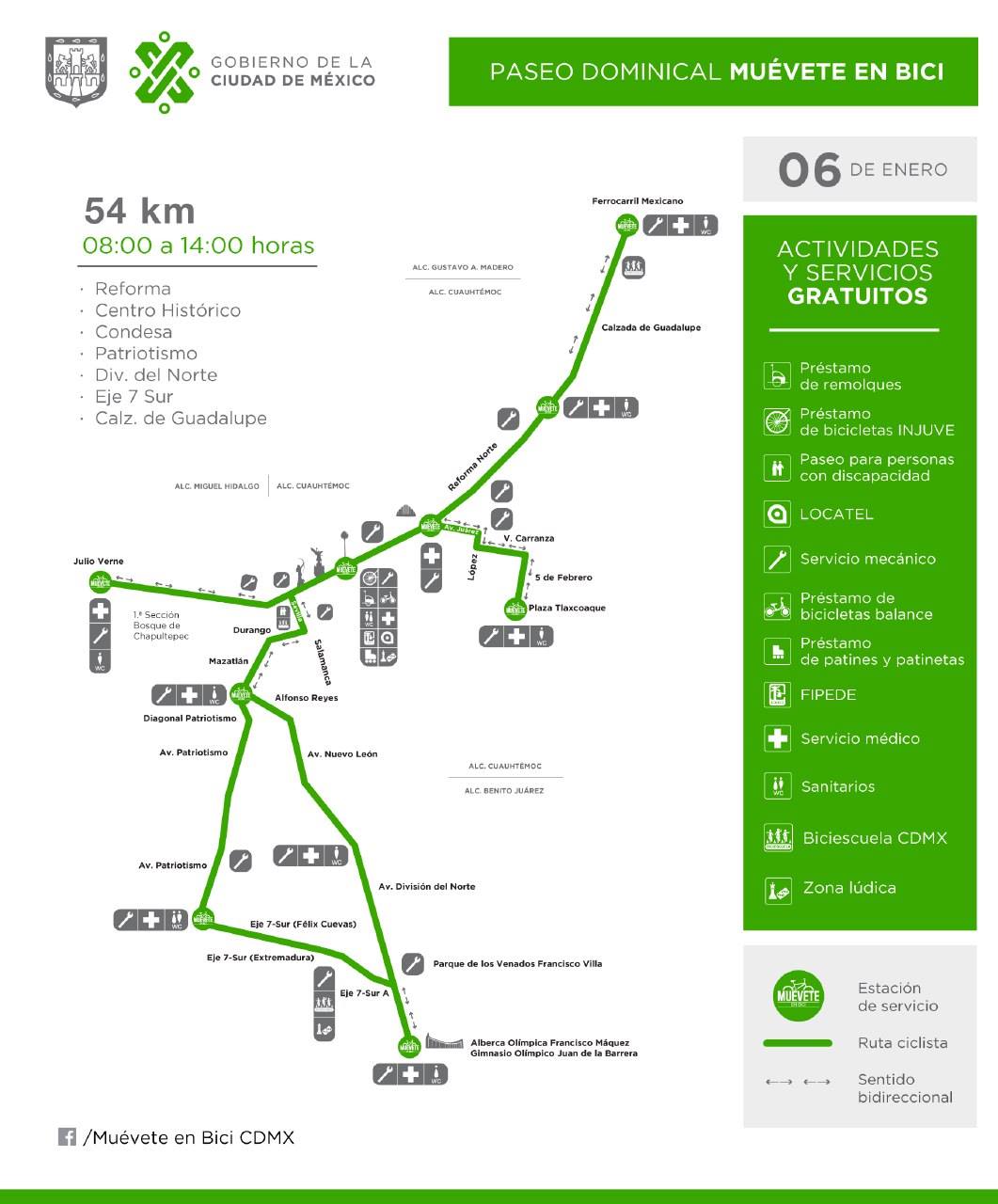
My wife and I rode EcoBici bike-share bikes at Muévete en Bici. Like CicLAvia in L.A., open streets events are a great way to see a lot of neighborhoods - as well as important landmarks; in this case including the Ángel de la Independencia monument, the Alameda Central, and the Zócalo.
For large streets, including Avenida Patriotismo (the five-lane one-way street mentioned above), the open streets event occupied the right two lanes, with temporary barrel-sized plastic bollards marking off the car-free area.
For some smaller streets with medians, Muévete en Bici occupies half the street.
Creative Use of Street Space
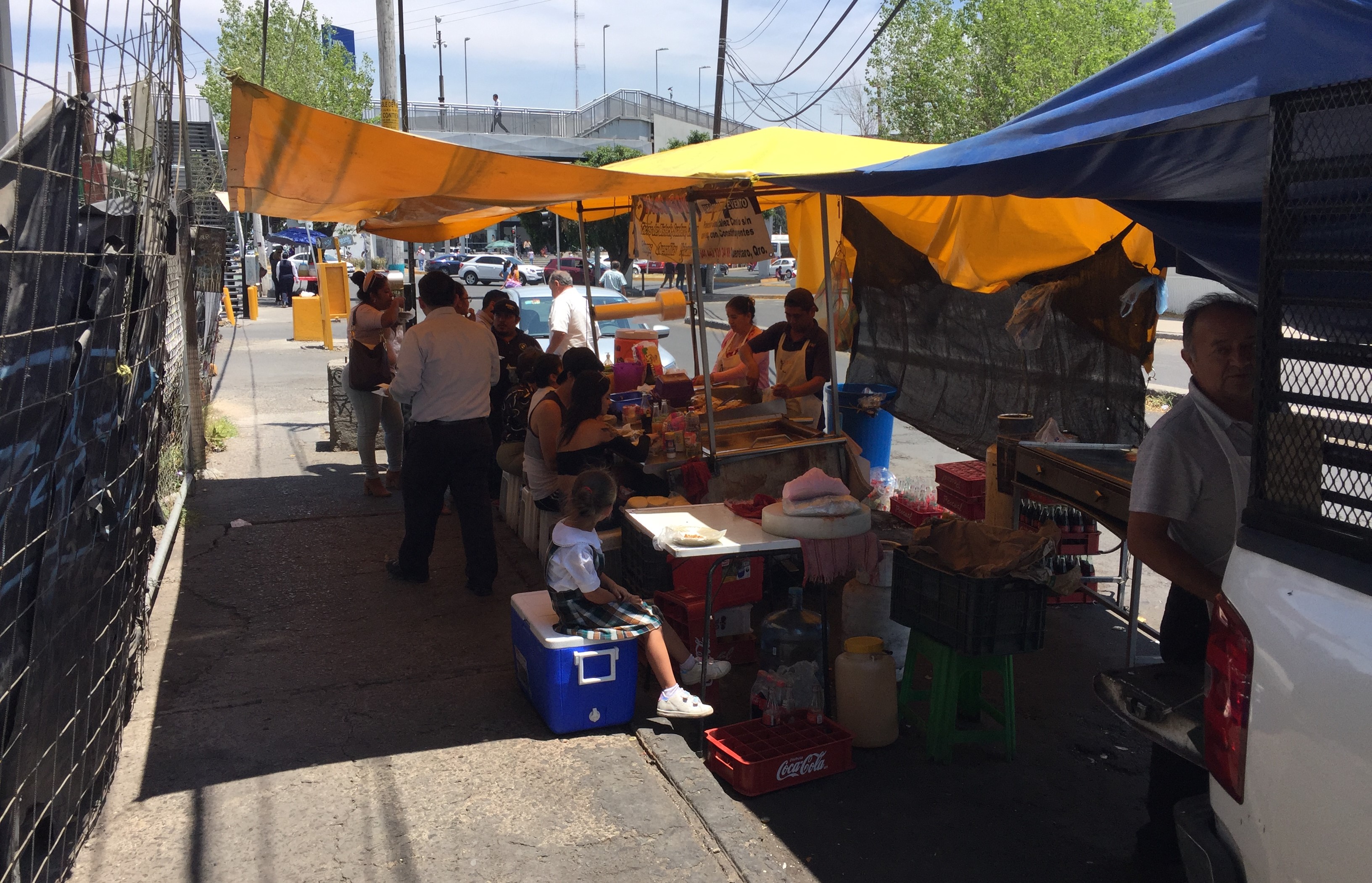
I will close with an image that reminded me of Park(ing) Day. Similar to the way street vending activates sidewalks in L.A., Mexico's streets are activated by creative use of space. This "pop-up" restaurant in Querétaro takes up a couple of parking spaces - and provides food, seating, shade for customers.
Stay in touch
Sign up for our free newsletter
More from Streetsblog Los Angeles
LAPD Was Crossing Against Red Light in Crash that Killed Pedestrian and Injured Six in Hollywood
The department says the officers had turned on their lights and sirens just before crossing. Their reasons for doing so remain unknown.

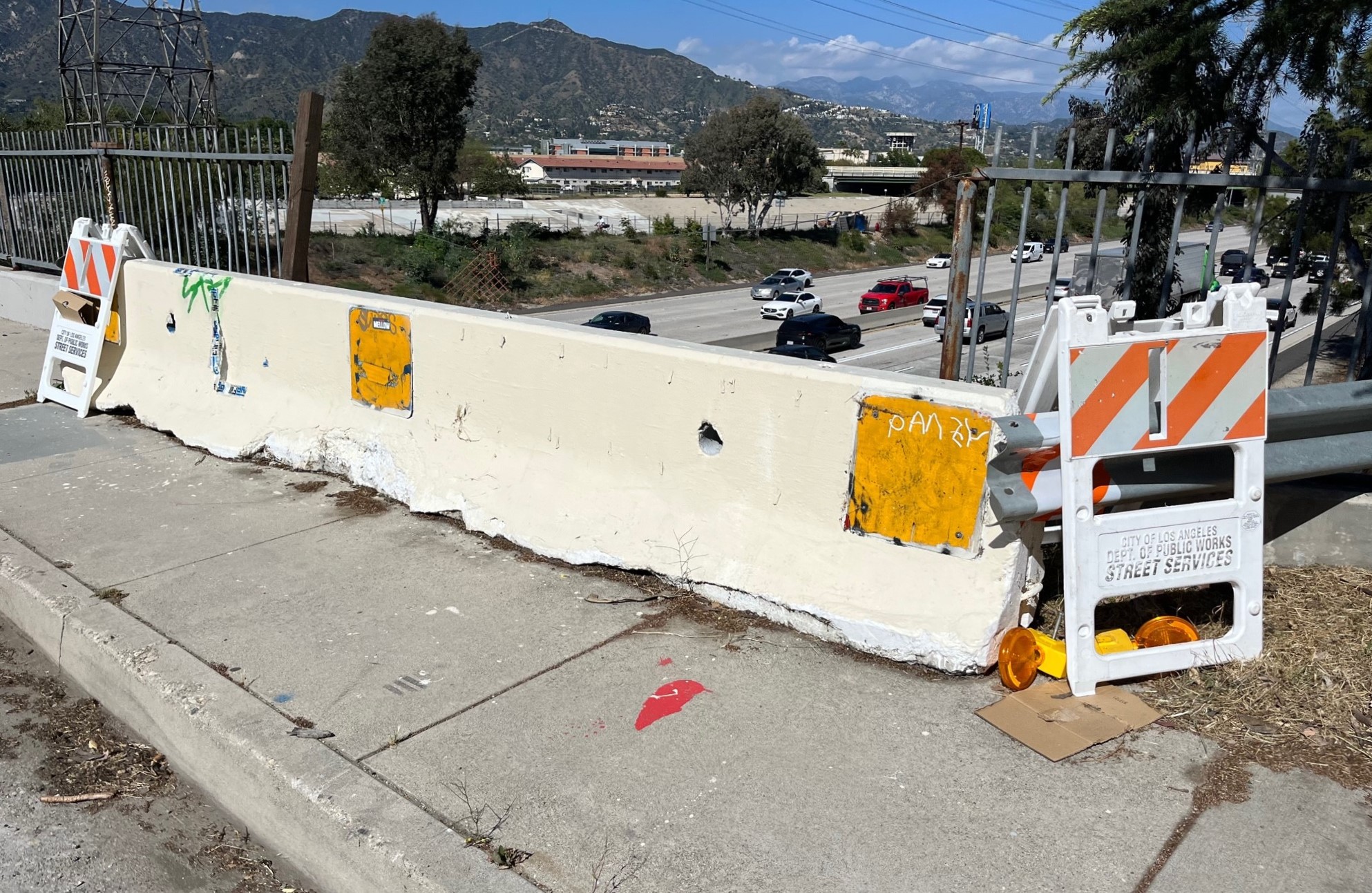
Freeway Drivers Keep Slamming into Bridge Railing in Griffith Park
Drivers keep smashing the Riverside Drive Bridge railing - plus a few other Griffith Park bike/walk updates