Huntington and Fremont to get Complete Street Redesigns in South Pasadena
South Pasadena is redesigning two of its major thoroughfares: Huntington Drive and Fremont Avenue. Engineering firm Kimley-Horn has been tapped for the project, which has a $16.6 million budget. Funding is from Metro sales taxes (Measure R – and Measure M Metro Active Transport, Transit and First/Last Mile “MAT” grant program) and federal Highway Safety Improvement Program (HSIP).
The project aims to reduce vehicle congestion through road diets (lane reductions, on Huntington specifically) and lowered speed limits, while encouraging residents to walk or bike to meet daily needs on an improved network of bike lanes and sidewalks, with lots of South Pasadena’s trademark tree cover.
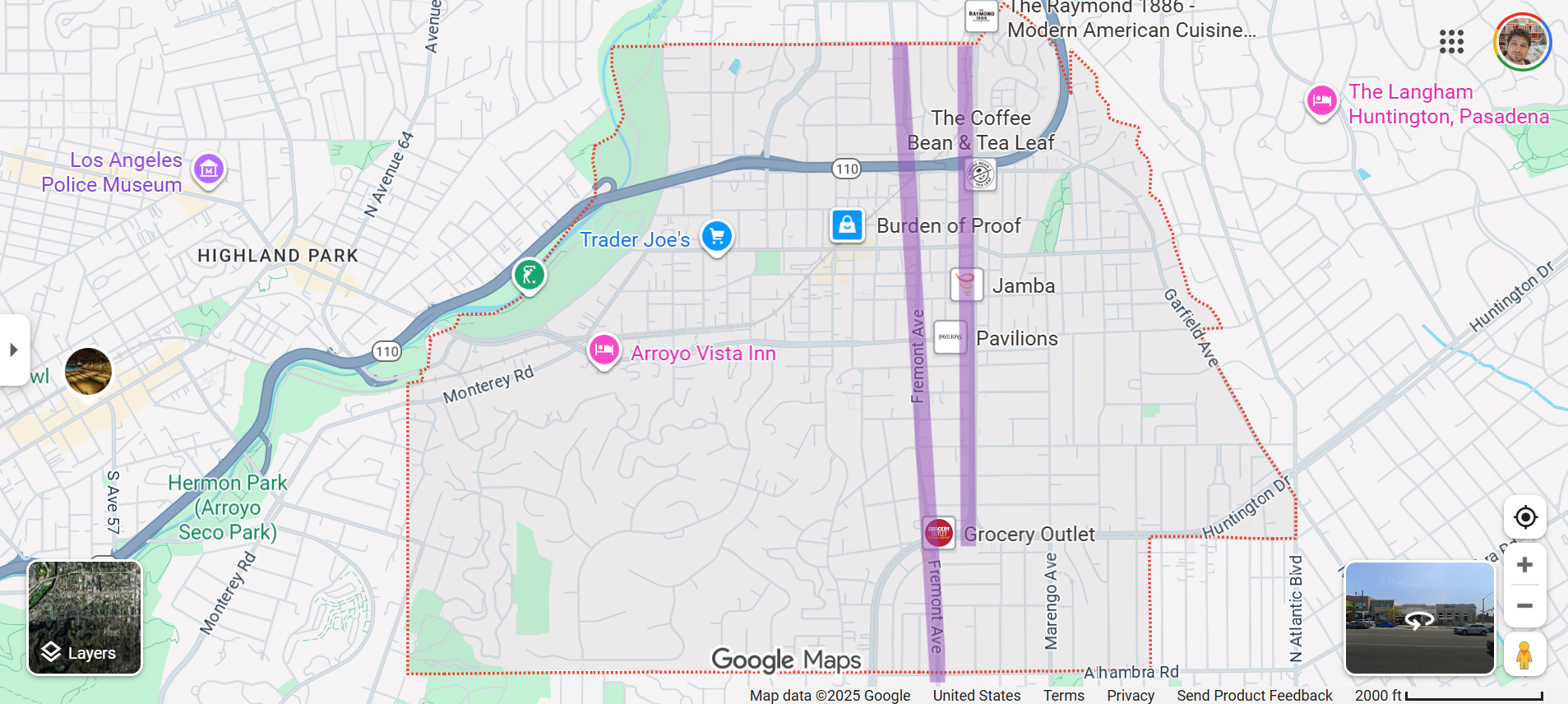
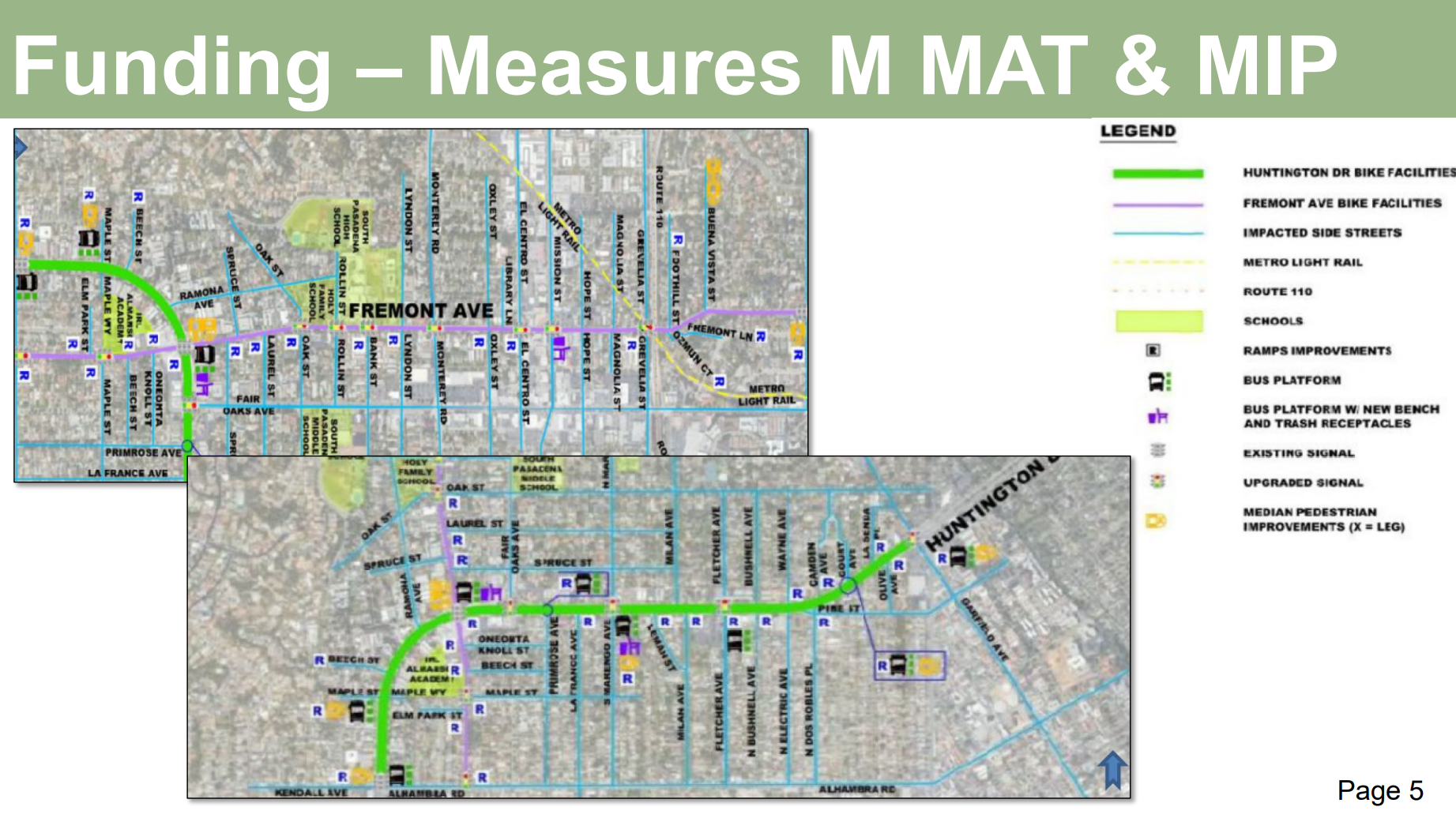
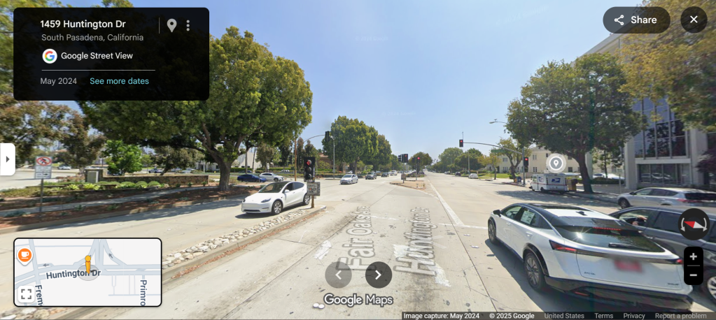
Fremont Ave. is a busy north-south artery connecting the Pasadenas, Alhambra, and Monterey Park. It runs directly parallel to Fair Oaks Avenue, but only really in South Pasadena. It is also a pretty hectic exit from the 10 Freeway, with short stubby ramps that can fluster an unfamiliar driver.
A lot of commuters use it specifically to get to Fair Oaks (via Huntington), and according to the city’s presentation, Fremont experiences significant cut through traffic and heavy truck usage, making it a pretty rough bike ride.
However, Fremont is a pretty street, with many trees and old homes. The city’s initial concepts for its redesign go heavy on bike and pedestrian infrastructure.
North of Huntington Drive, Fremont would have narrowed travel lanes, wider sidewalks, and a shared walk/bike path.
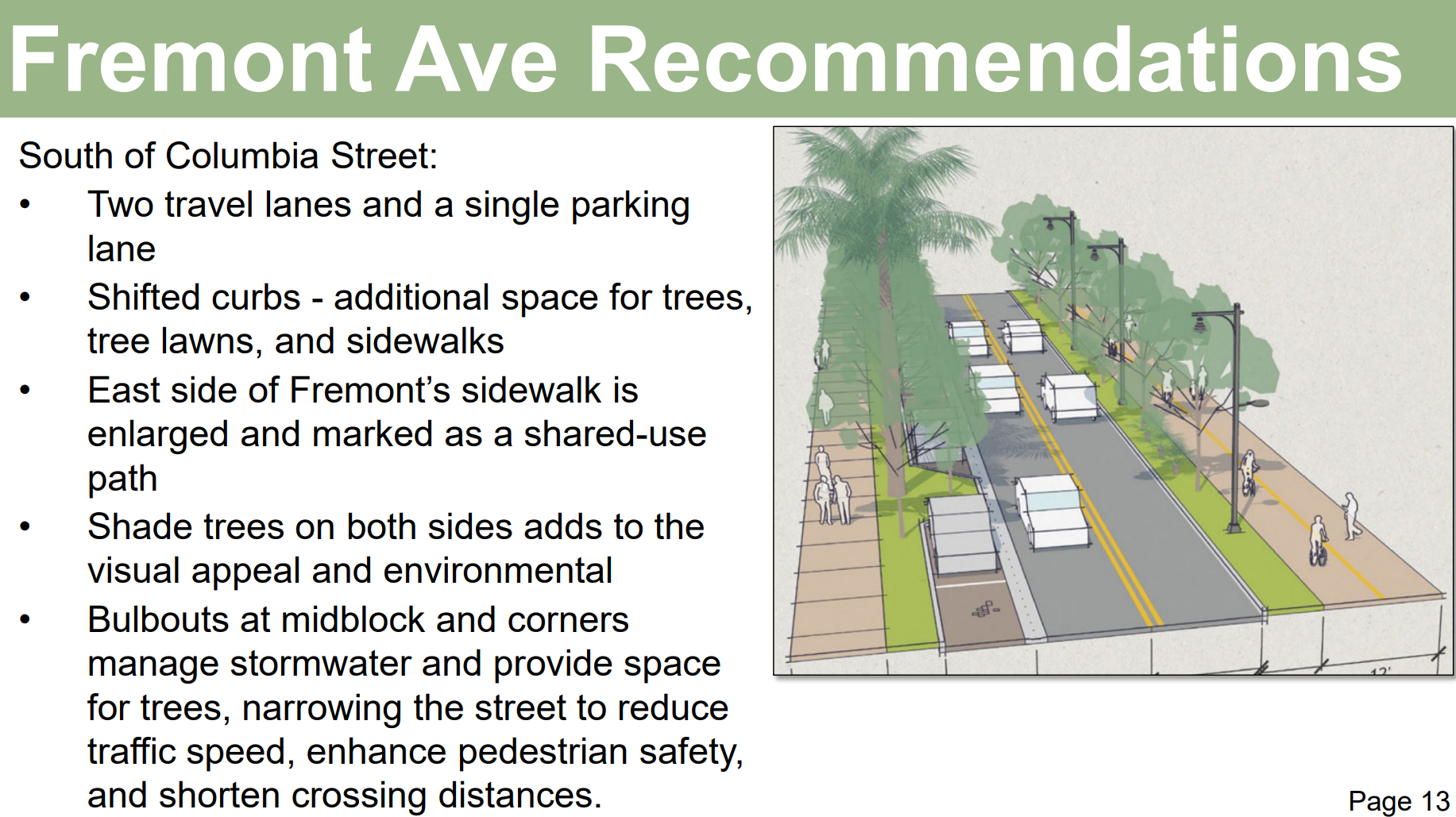
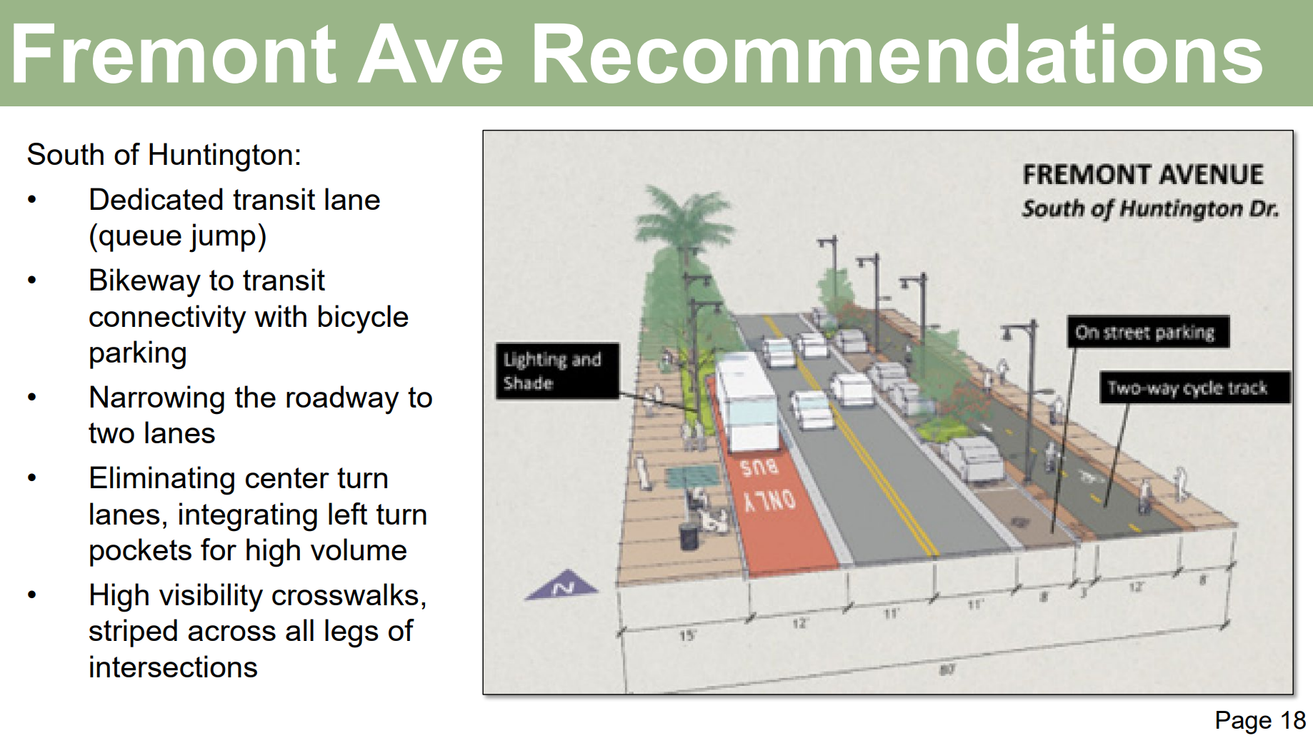
South of Huntington where Fremont is wider, the redesign would feature:
- narrowed travel lanes and only one parking lane,
- wider sidewalks,
- a dedicated cycle track,
- and a bus-only lane.
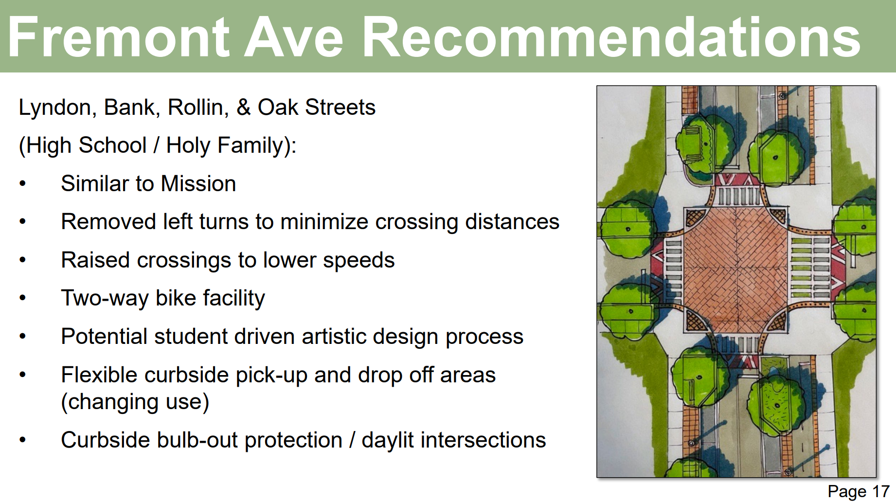
Some intersection designs are not fully developed yet, but generally they are expected to include high visibility crosswalks, bike lanes, some raised intersections to lower speeds, some bulb-outs, and more greenery, artistic elements, and hopefully open space.
Huntington is one of the major major east-west arterials for the San Gabriel Valley, and the facilities prescribed are pretty much the same as Fremont’s, just twice as many (after a reduction in Huntington’s travel lanes to incorporate parking).
Note also, portions of Huntington call for a frontage street for business access.
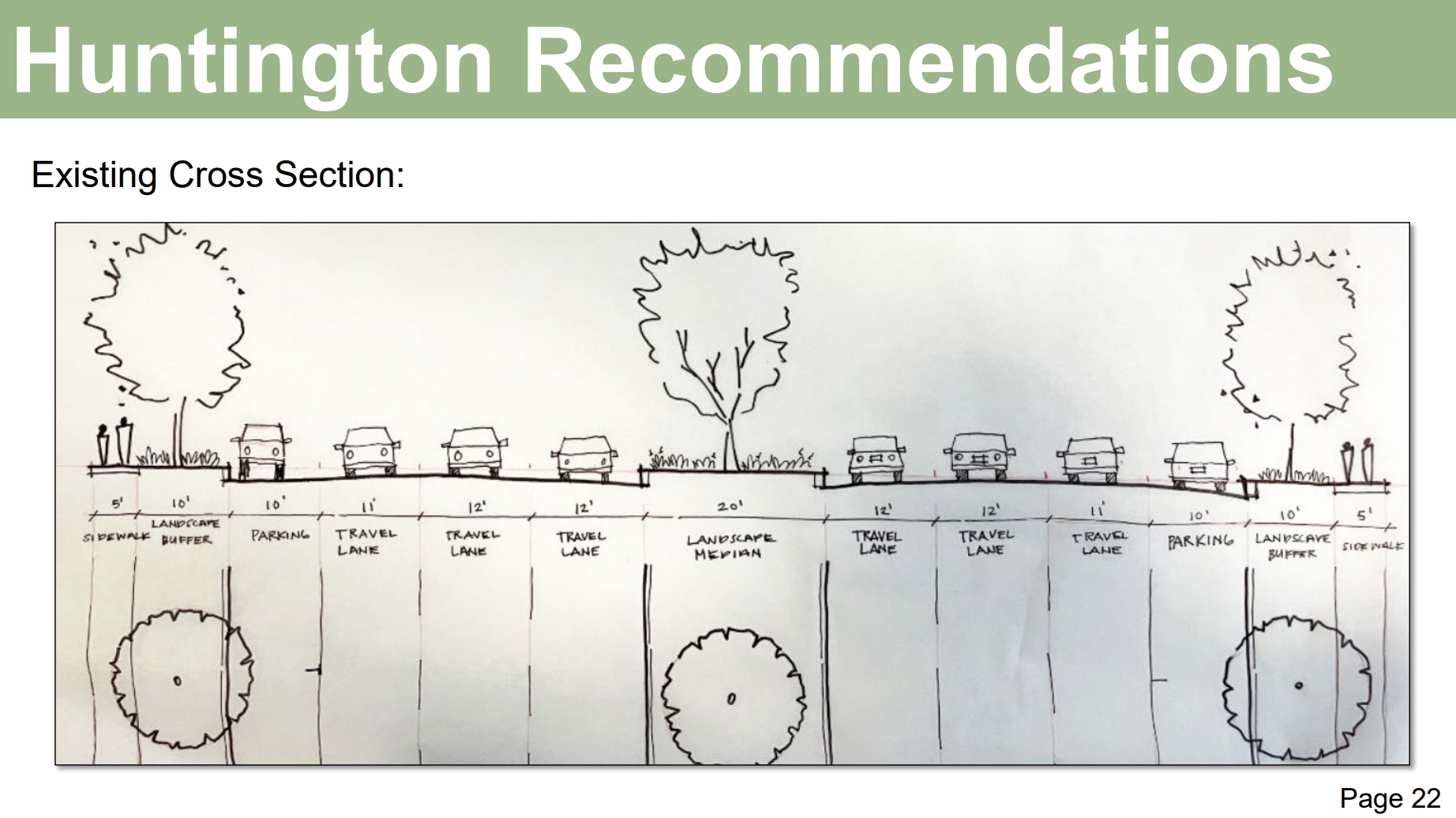
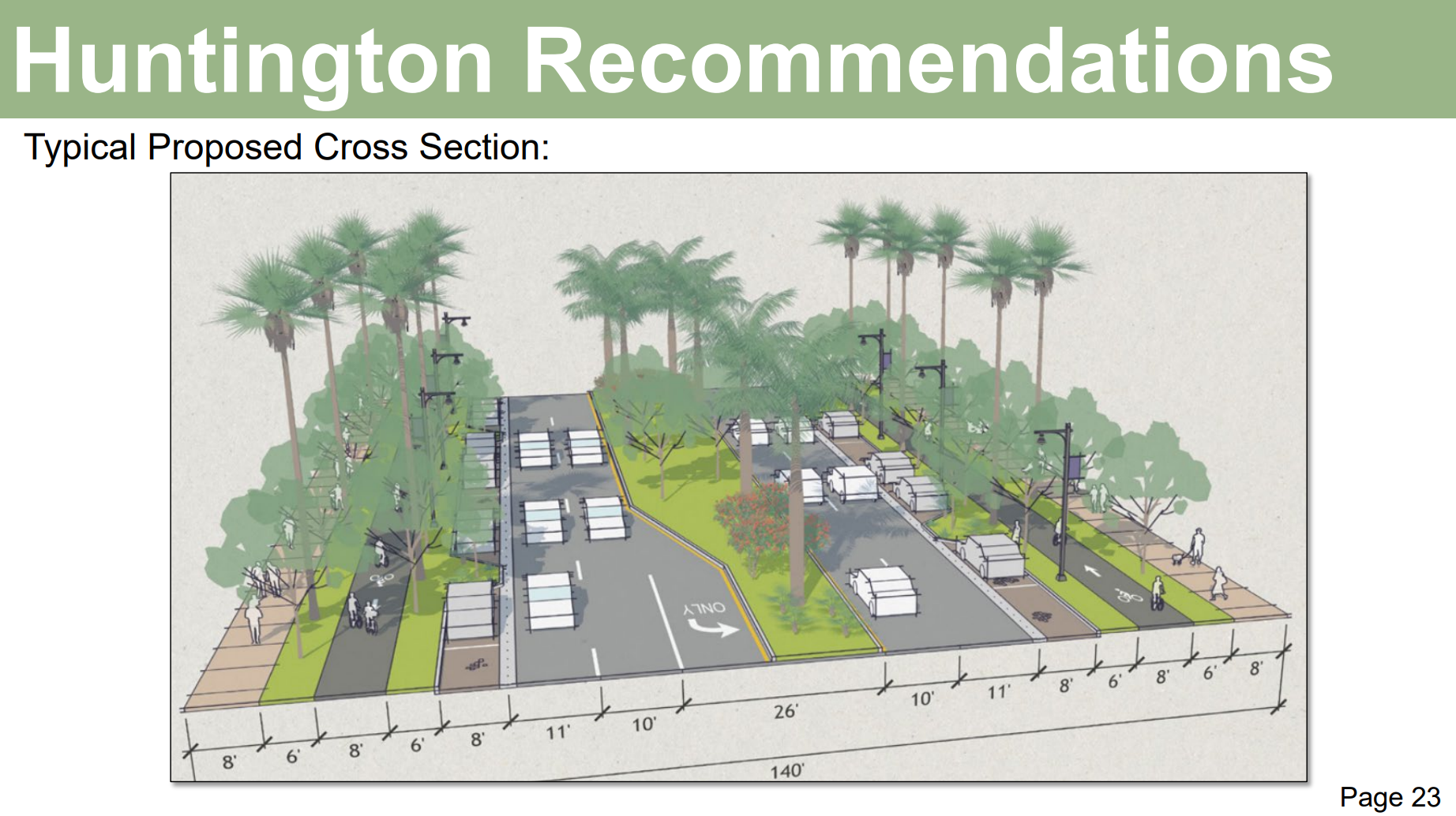
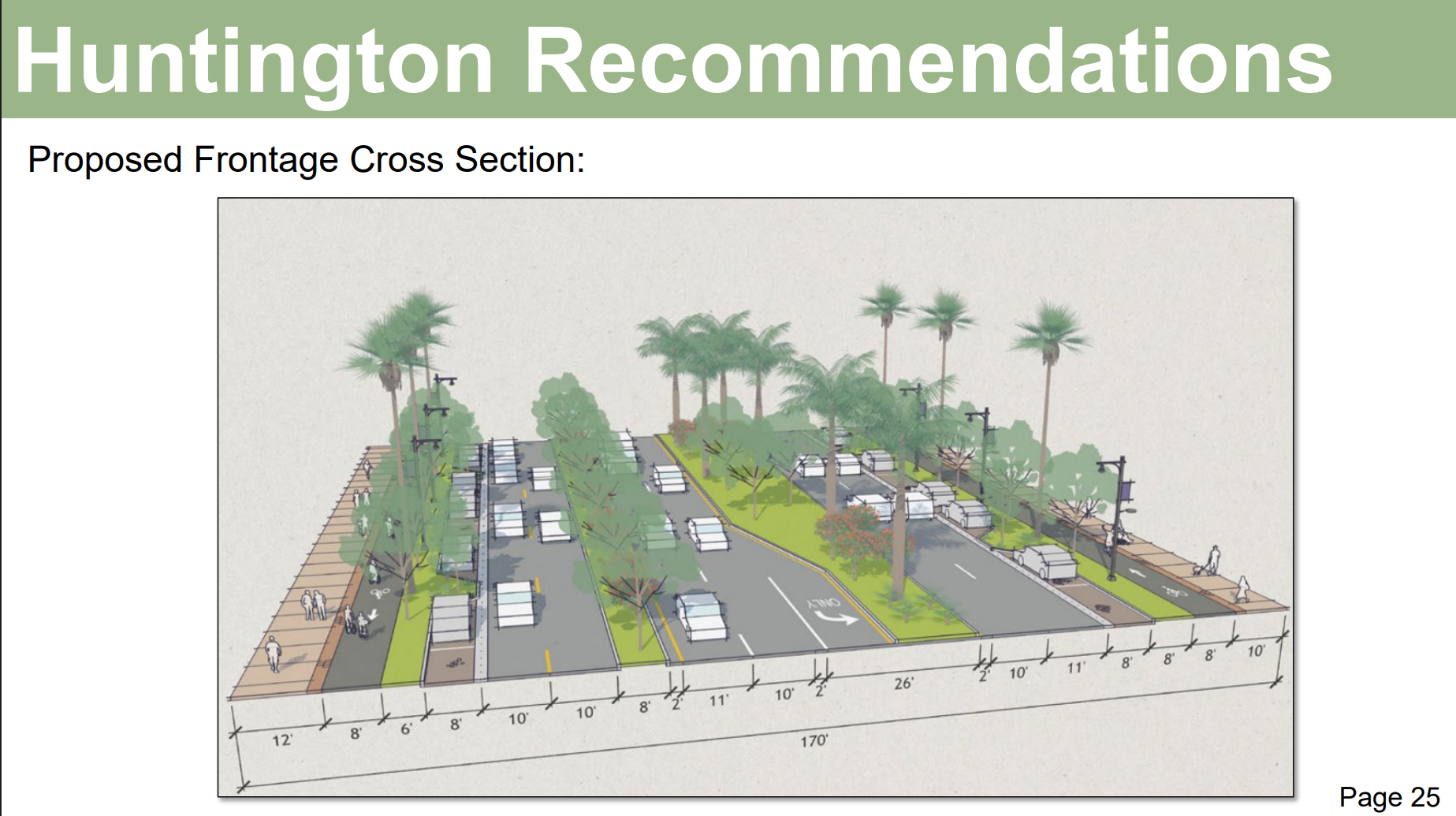
Because of its width, portions of Huntington will also likely include refuge islands/two-stage crosswalks, leading pedestrian intervals (which give people on foot a head start before the green light for cars) for safer crossing, the removal of slip lanes that allow drivers to turn in a separate lane without slowing or stopping for a signal, and the installation of new street furniture and bus shelters.
Streetsblog’s San Gabriel Valley coverage is supported by Foothill Transit, offering car-free travel throughout the San Gabriel Valley with connections to the A Line Stations across the Foothills and Commuter Express lines traveling into the heart of downtown L.A. To plan your trip, visit Foothill Transit. “Foothill Transit. Going Good Places.”Sign-up for our SGV Connect Newsletter, coming to your inbox on Fridays!

Read More:
Streetsblog has migrated to a new comment system. New commenters can register directly in the comments section of any article. Returning commenters: your previous comments and display name have been preserved, but you'll need to reclaim your account by clicking "Forgot your password?" on the sign-in form, entering your email, and following the verification link to set a new password — this is required because passwords could not be carried over during the migration. For questions, contact tips@streetsblog.org.