Multi-City 5-Mile Southwest SGV Bikeway Project Inches Closer to Construction
After delays from staffing changes and planning for signal modifications, construction on the First Street-Riggin Street-Potrero Grande Drive corridor improvements are anticipated to start construction in about a year, Monterey Park officials say.
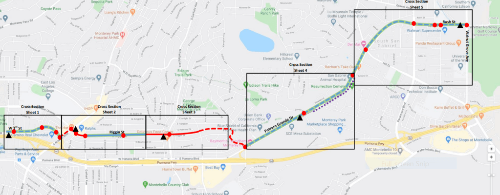
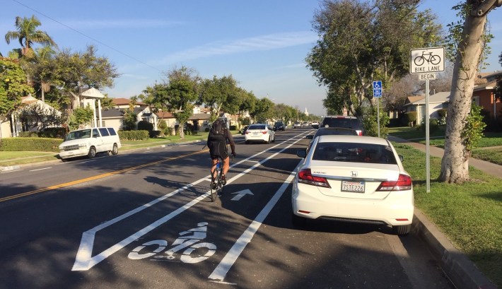
Currently a design and construction agreement needs to be finished for the project which will include about 5.3 miles of much needed bikeway, mostly bike lanes with some sharrows (shared lane markings – the dregs of bike infrastructure) spanning a couple gaps. The project also adds missing sidewalks.
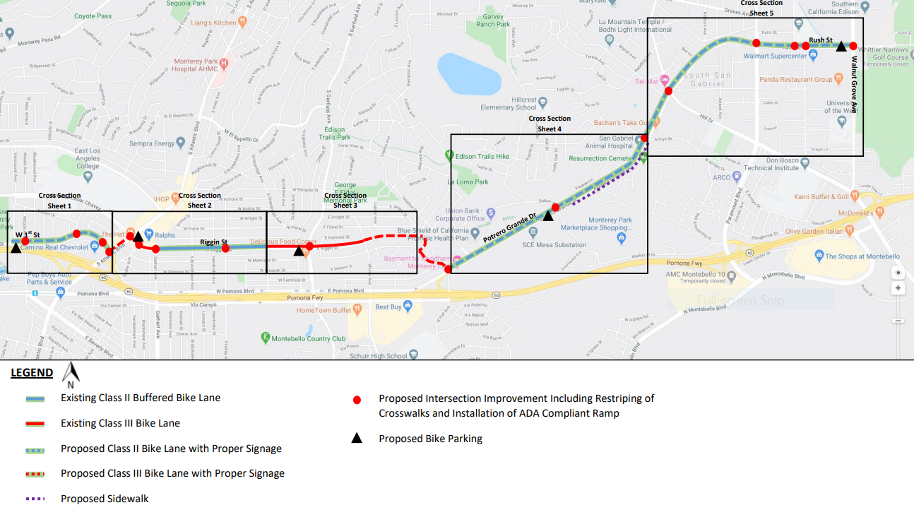
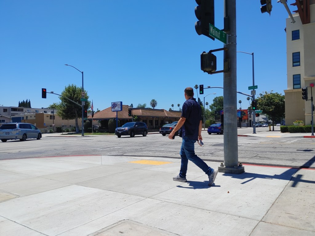
The lion’s share of facilities will be built along the very hectic Potrero Grande Drive, a diagonal that functions as a link from South El Monte to Montebello, Monterey Park, and East Los Angeles. Potrero Grande experiences fairly busy traffic from the newish Monterey Park Market Place shopping center (Costco and Home Depot); ghost bikes and others use the street to access Resurrection Cemetery. In either direction, this street connects barrios to employment centers.
At its southwest end, Potrero Grande empties onto Pomona Boulevard, basically a three-lane one-way access road along the 60. Here the bikeway pops up to parallel residential streets a couple blocks north. The facility includes a stretch of sharrows on three fairly quiet residential streets (Markland Drive, Fulton Avenue, and the east end of Riggin Street). Further west on Riggin, cyclists use existing buffered bike lanes.
A couple blocks of sharrows get the bikeway across Atlantic Boulevard onto 1st Street, where it ends at ends at Vancouver Avenue, a short bike hop from East Los Angeles College and (take Woods Avenue under the 60) the Metro E Line Atlantic Station.
Both ends of the bikeway connect to large regional parks: East L.A.’s Belvedere Park and the massive Whittier Narrows park complex, which has numerous bike paths, including the San Gabriel River and Rio Hondo trails, plus the county’s new Rosemead Boulevard bikeway.
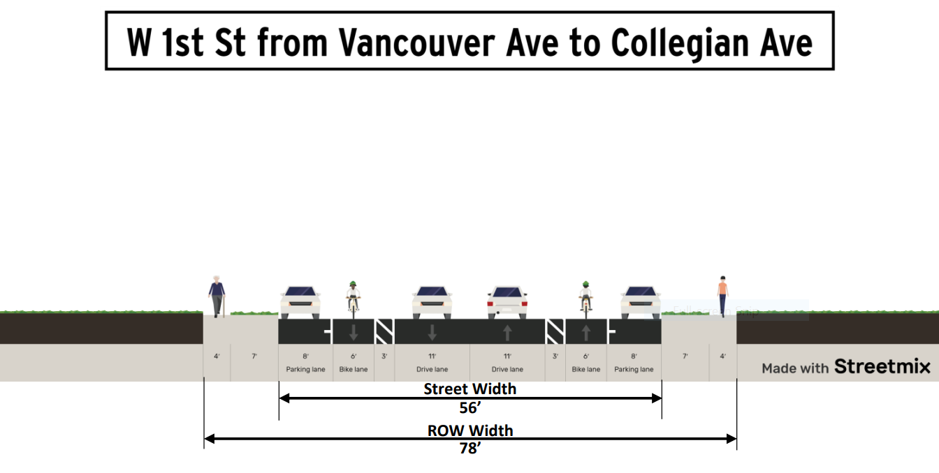
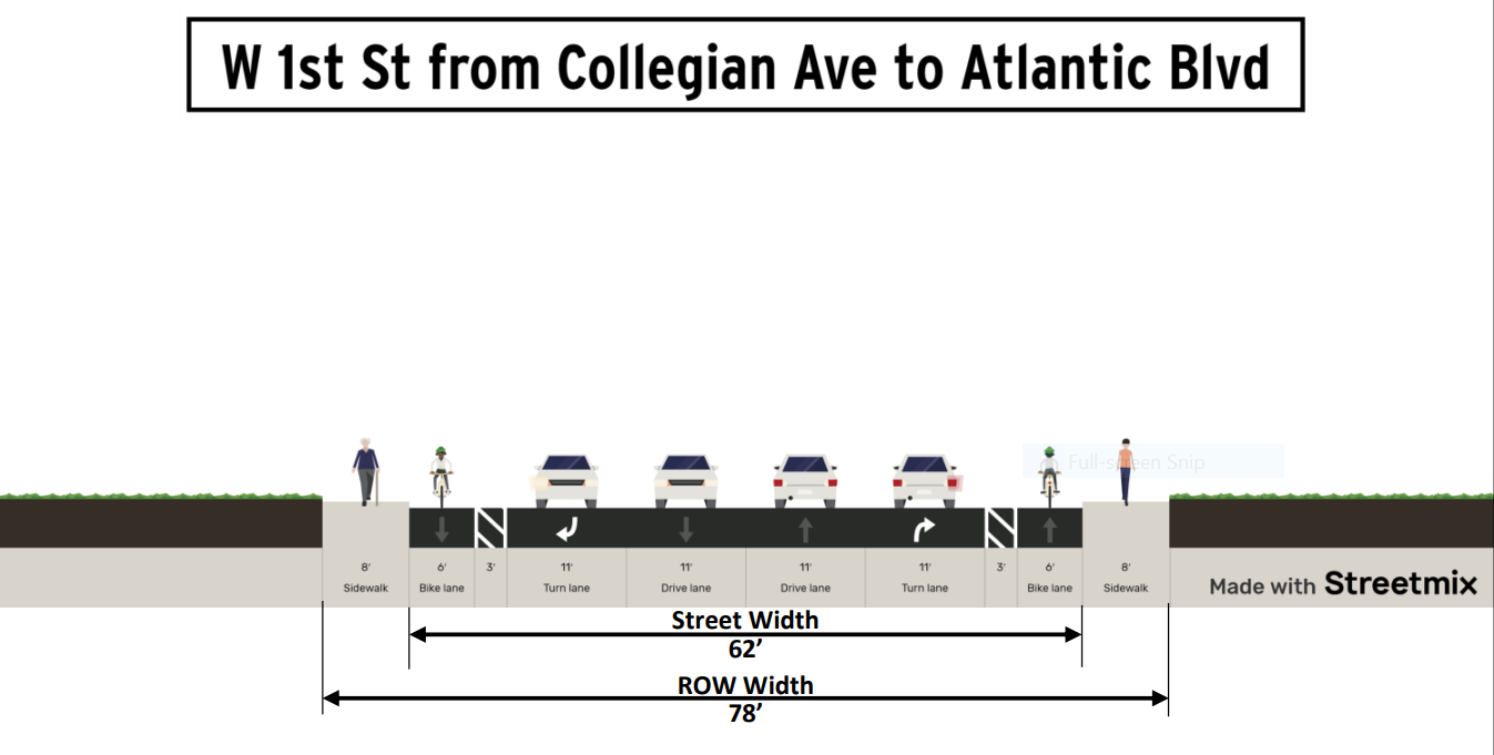
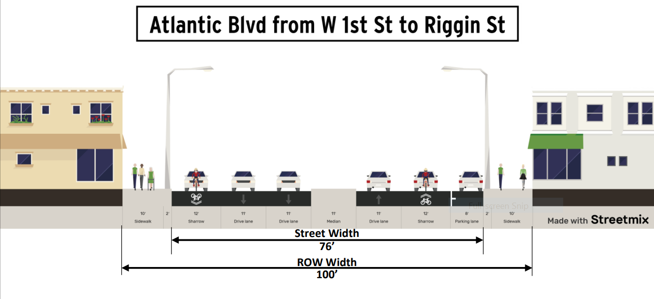
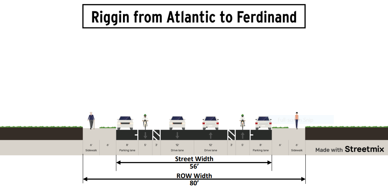
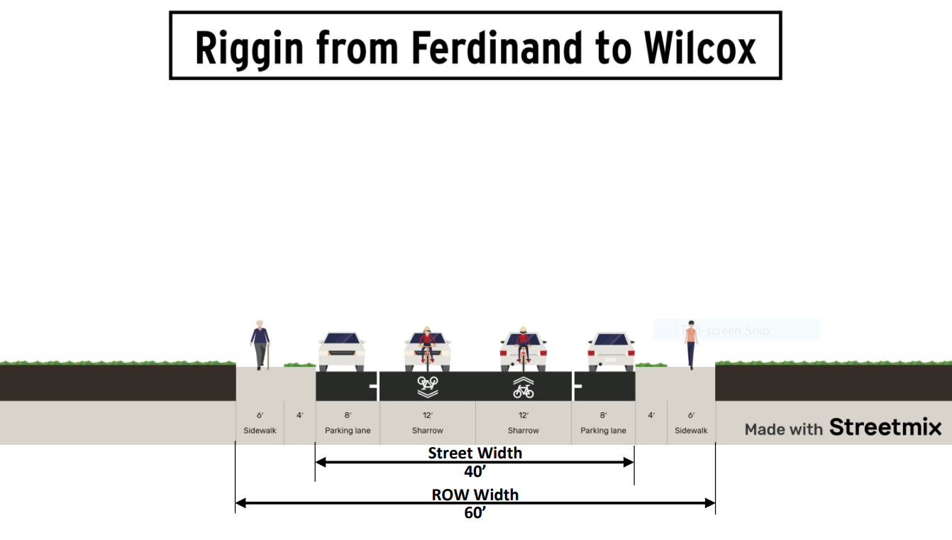
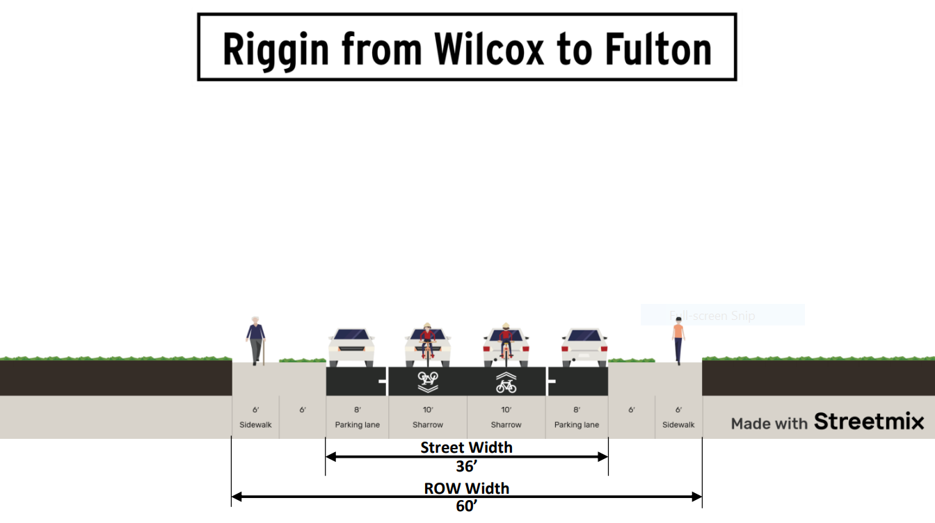
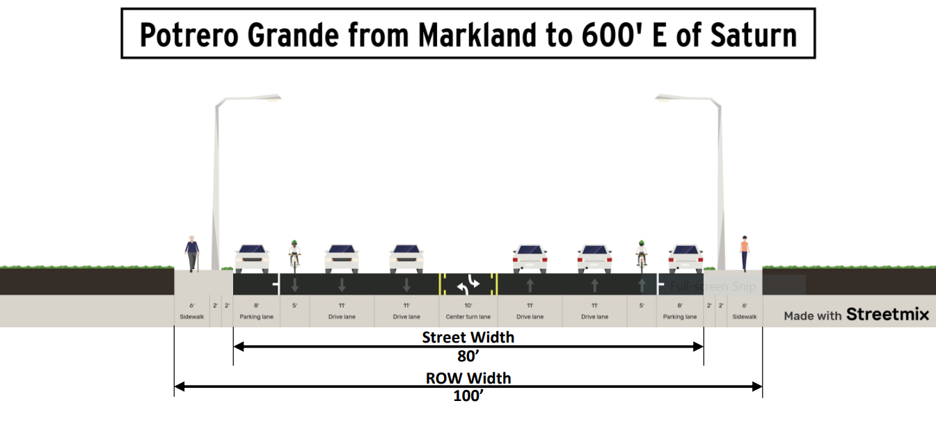
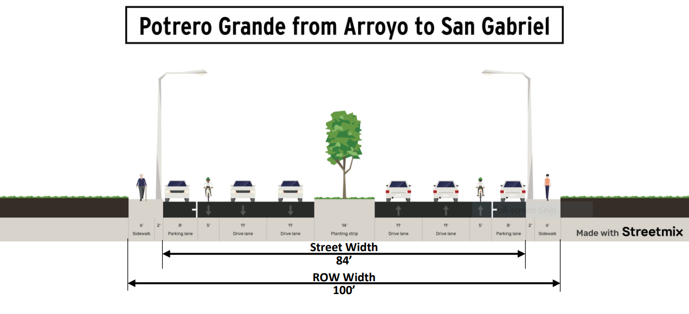
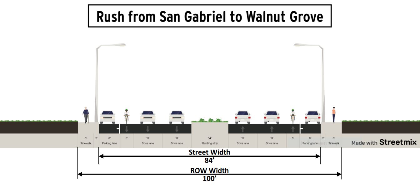
Below are the proposed cross sections for the whole facility. These orient from west to east, like the area map above.
The preliminary cost estimate was roughly $7.9 million when the cities and the Los Angeles County Department of Public Works applied for Metro’s Active Transport, Transit, First/Last Mile (MAT) grant program.
In 2021 Metro funded the bikeway via a $6.36 million MAT grant, and the city of Monterey Park supplemented that by committing $3.6 million in capital improvement funds.
SBLA editor Joe Linton contributed to this post
Streetsblog’s San Gabriel Valley coverage is supported by Foothill Transit, offering car-free travel throughout the San Gabriel Valley with connections to the Gold Line Stations across the Foothills and Commuter Express lines traveling into the heart of downtown L.A. To plan your trip, visit Foothill Transit. “Foothill Transit. Going Good Places.”Sign-up for our SGV Connect Newsletter, coming to your inbox on Fridays!

Read More:
Streetsblog has migrated to a new comment system. New commenters can register directly in the comments section of any article. Returning commenters: your previous comments and display name have been preserved, but you'll need to reclaim your account by clicking "Forgot your password?" on the sign-in form, entering your email, and following the verification link to set a new password — this is required because passwords could not be carried over during the migration. For questions, contact tips@streetsblog.org.