Eyes on the Viaducts: Streetsblog Tours Under-Construction CA High-Speed Rail
Streetsblog’s San Francisco and Los Angeles editors took a tour of some California High-Speed Rail construction earlier this week. Streetsblog has long reported on the plans, prospects, and political machinations around the state’s largest infrastructure project – now it was time for a fresh look at the structures that will carry the state’s bullet trains.
As many Streetsblog readers know, the California High-Speed Rail Authority currently has more than a hundred miles under construction in California’s Central Valley and has contributed hundreds of millions to supporting transit projects in the northern and southern ends of the state.
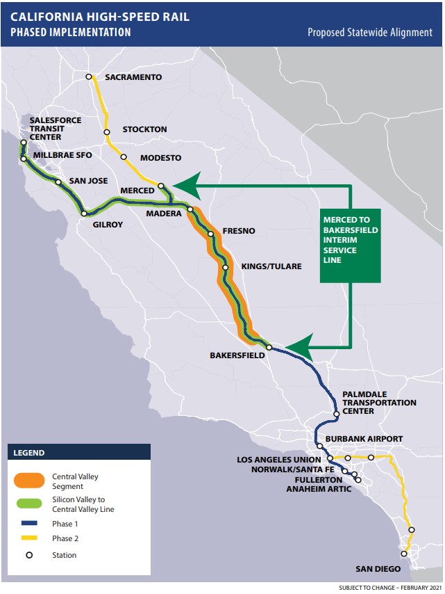
The initial phase of the system – California’s high-speed backbone – will run 171 miles between Merced and Bakersfield. Construction is already underway on 119 miles of this – essentially from Madera to Bakersfield. Construction is not quite continuous but interspersed; it is focused on the many stretches where trains must run above or below ground level – as well as places where streets have been elevated to travel over the future tracks.
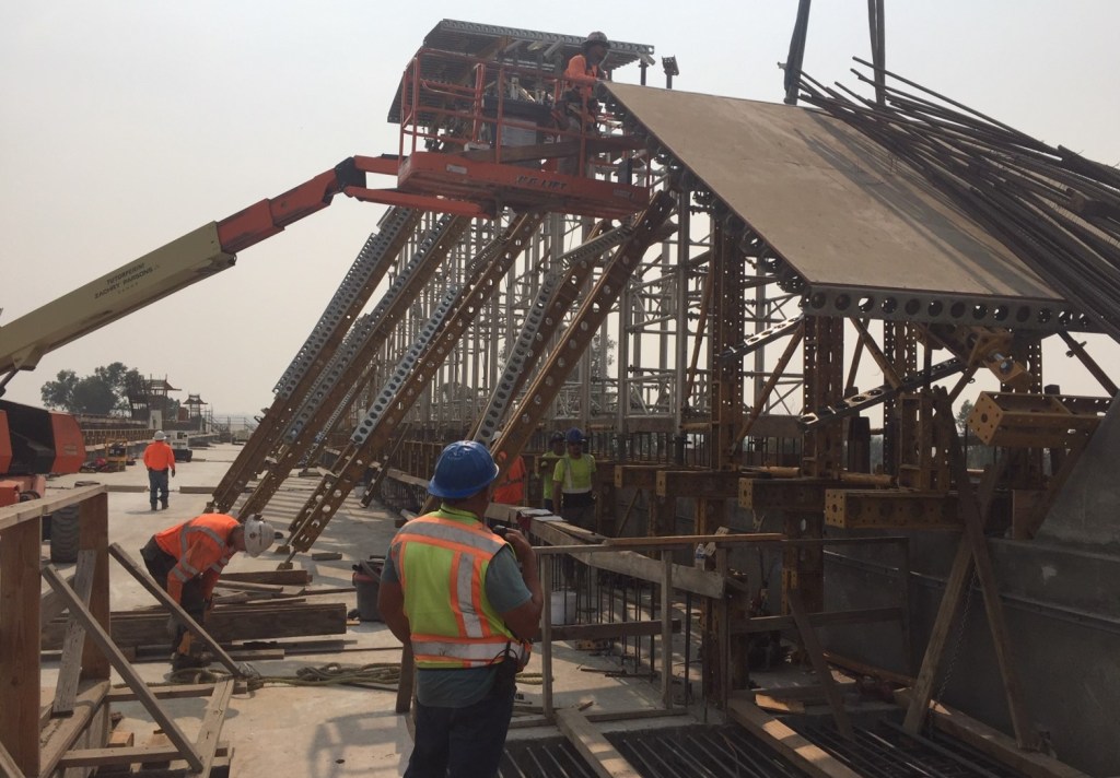
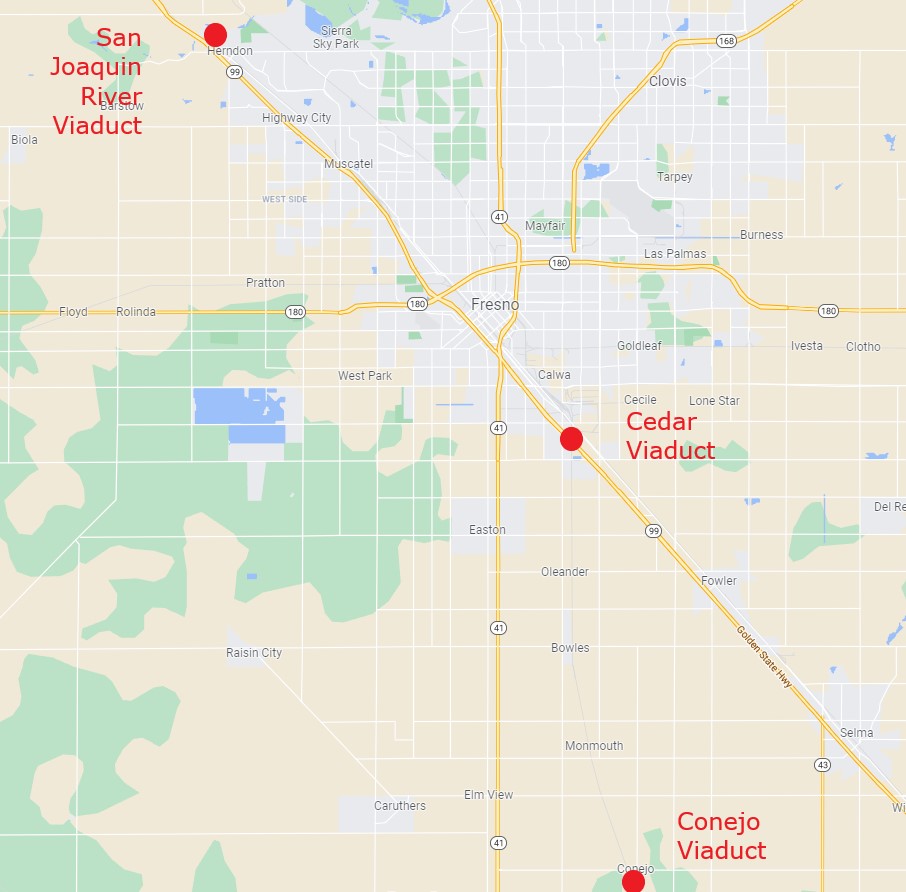
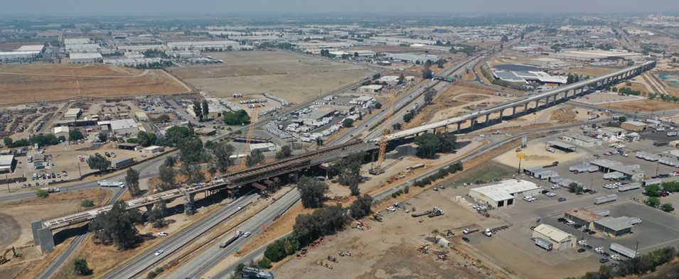
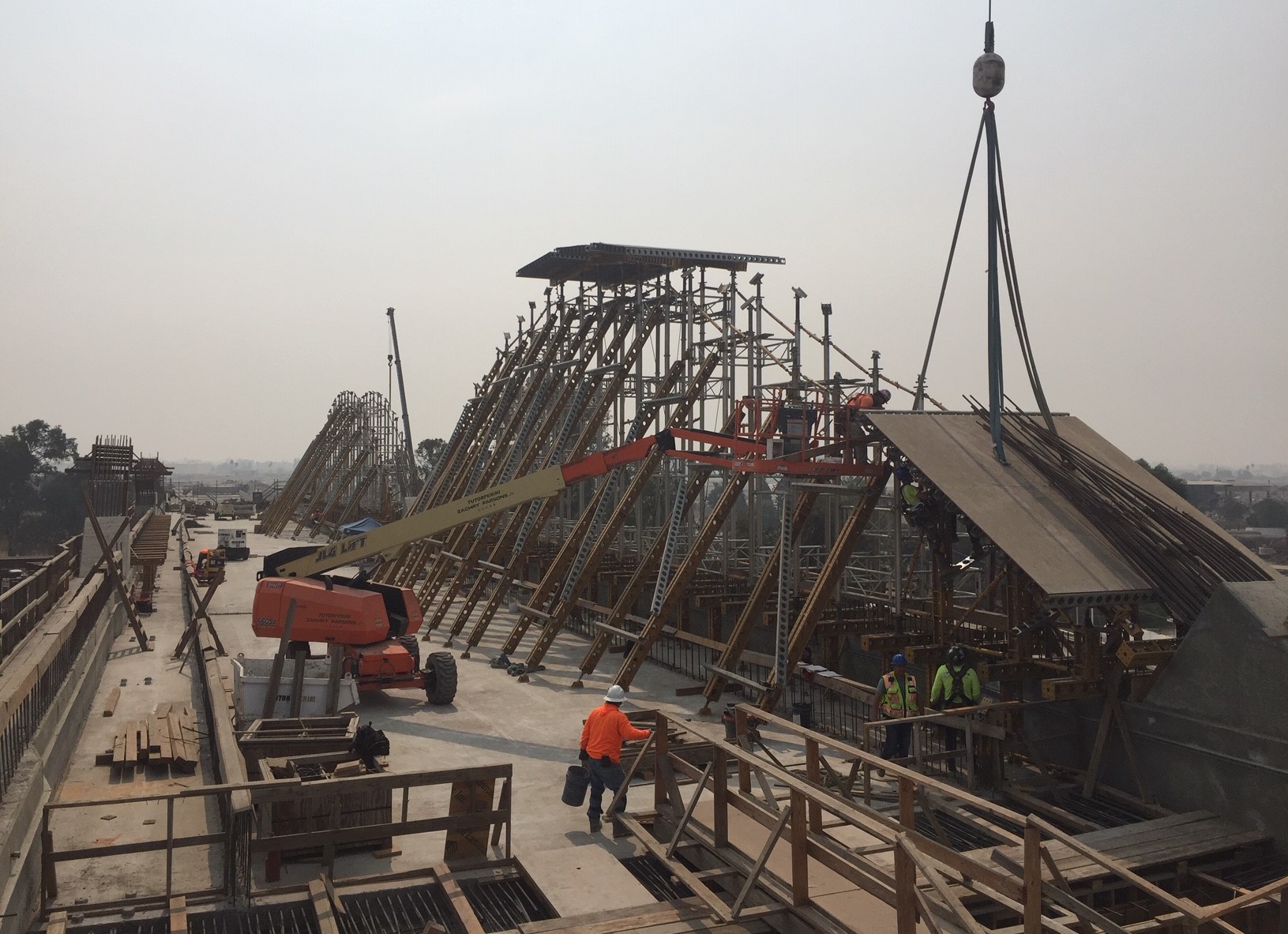
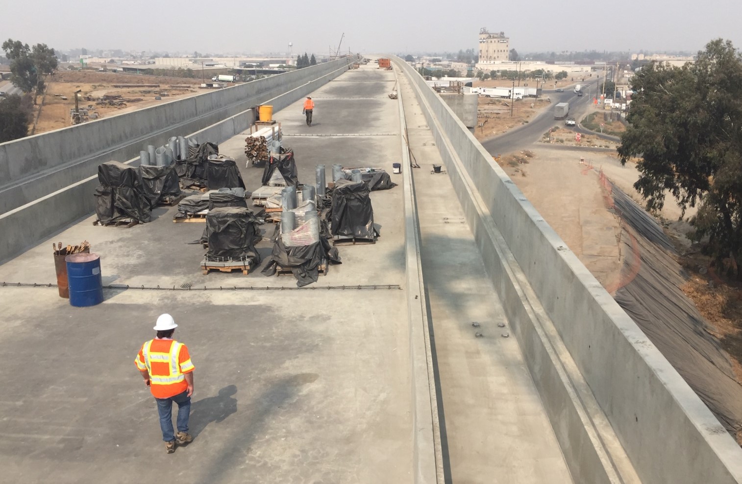
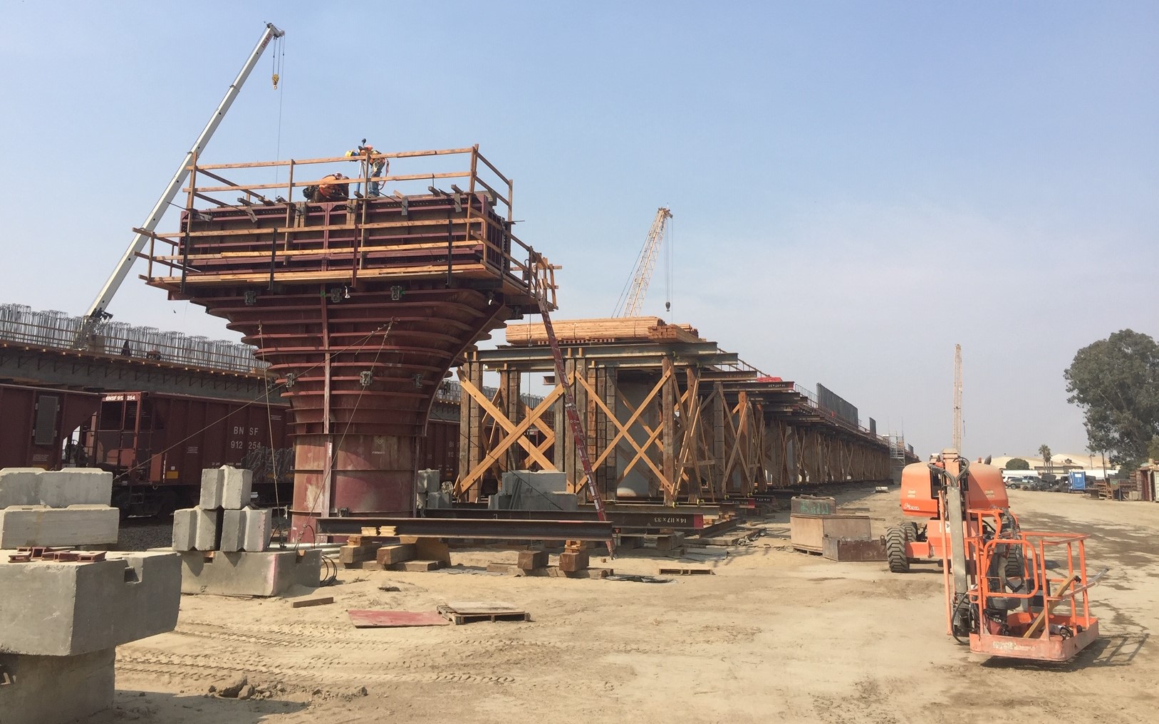
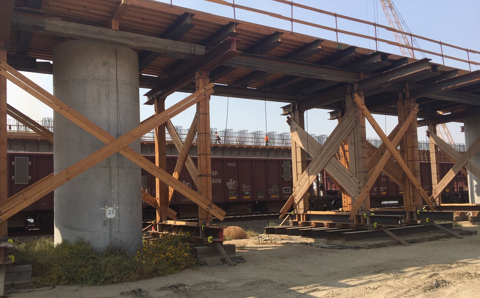
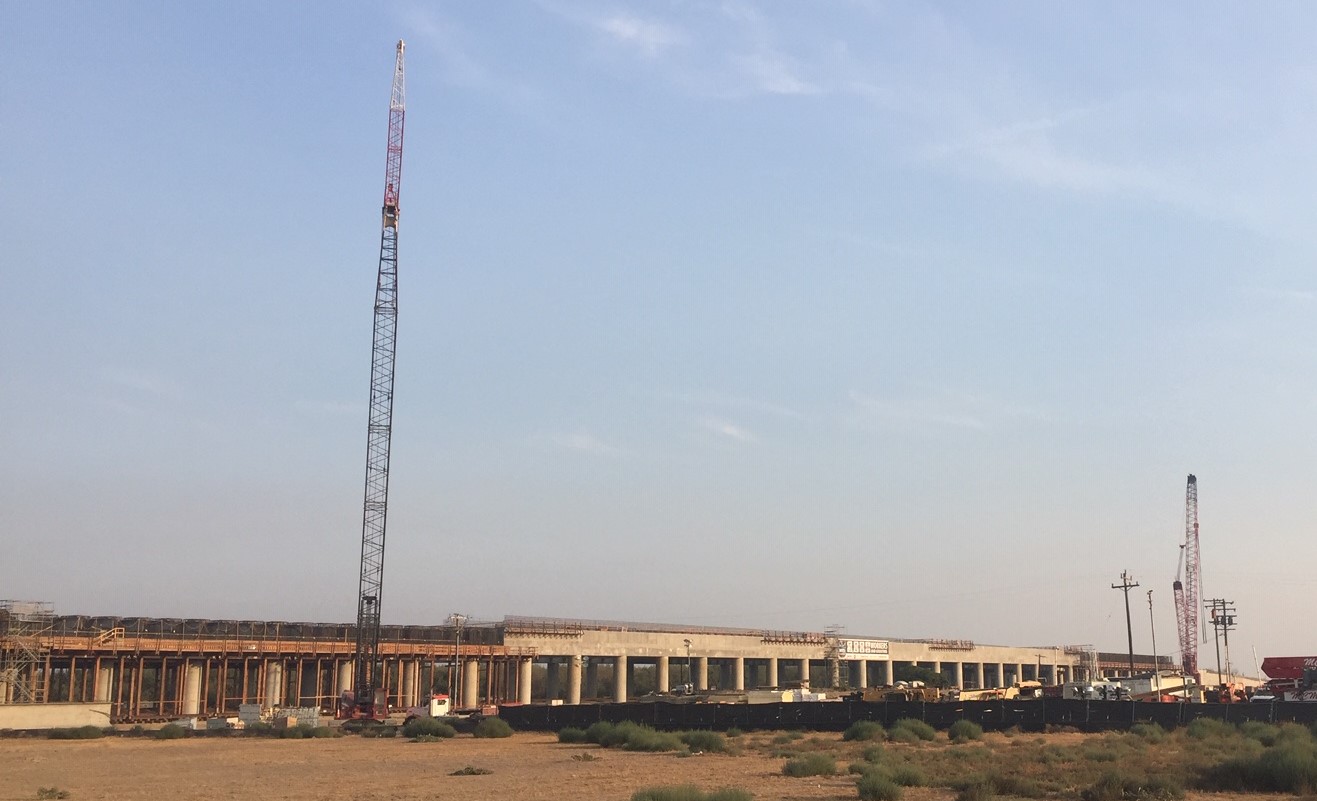
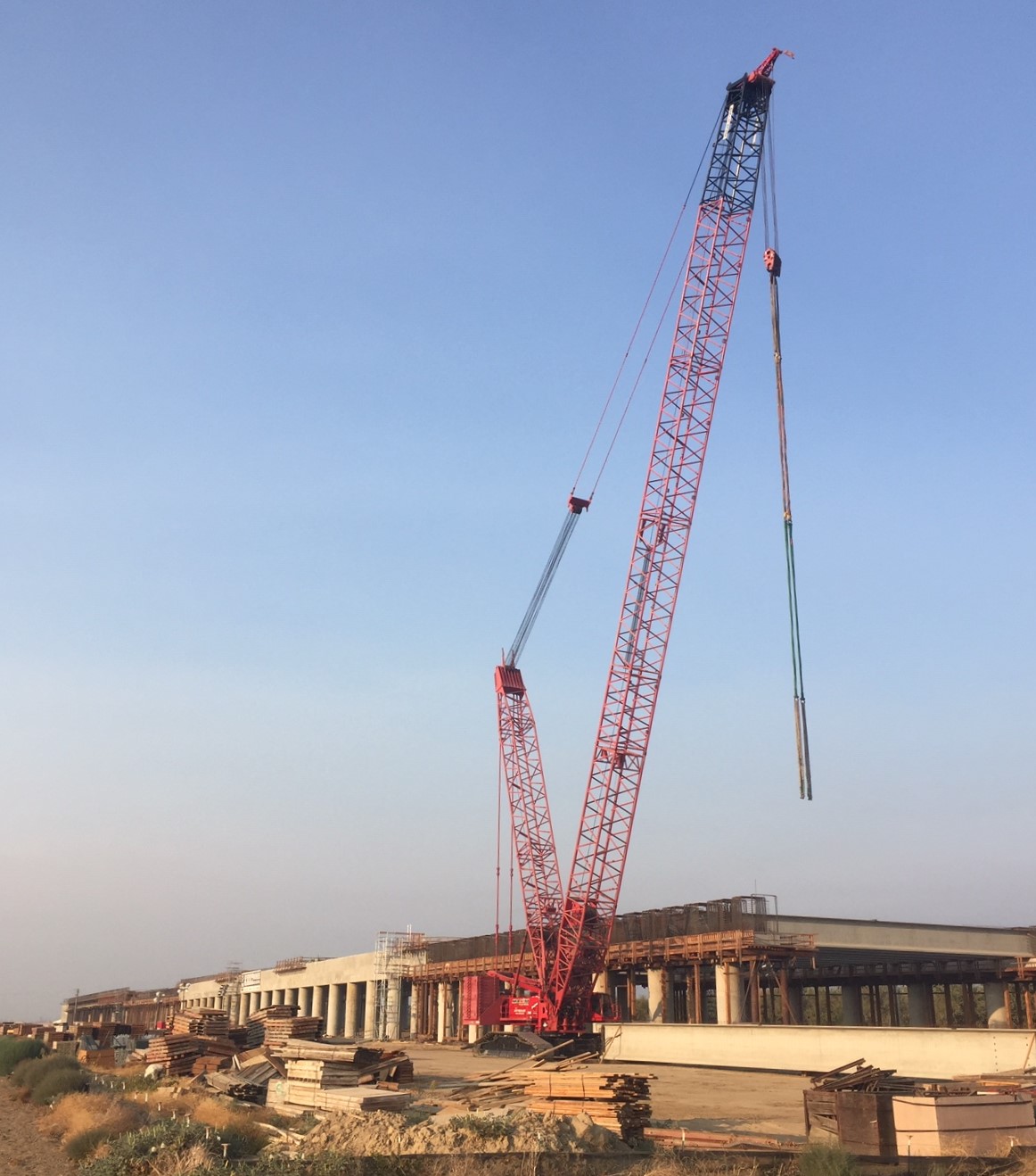
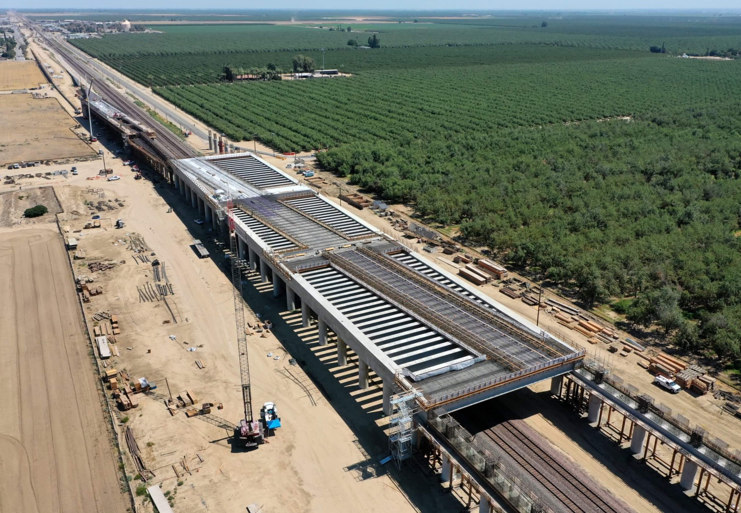
This week’s tour focused on three large-scale structures in Fresno County. From north to south, these were: the San Joaquin River Viaduct, the Cedar Viaduct, and the Conejo Viaduct. Construction is nearing completion on these structures, though their top surfaces currently look like smooth concrete roadways. Rails and electrical catenary will be added in the near future.
The skies above Fresno were smoky from forest fires burning nearby. The smoke didn’t make for the greatest photos, but was a stark reminder of why California needs to finish and extend this project. The Central Valley segment offers much-needed benefits for communities with some of the highest asthma rates and worst air quality in the nation. This zero emissions travel mode is needed to combat the global climate crisis, which is contributing to California’s worsening wildfires.
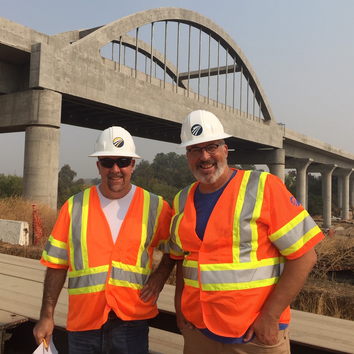
San Joaquin River Viaduct
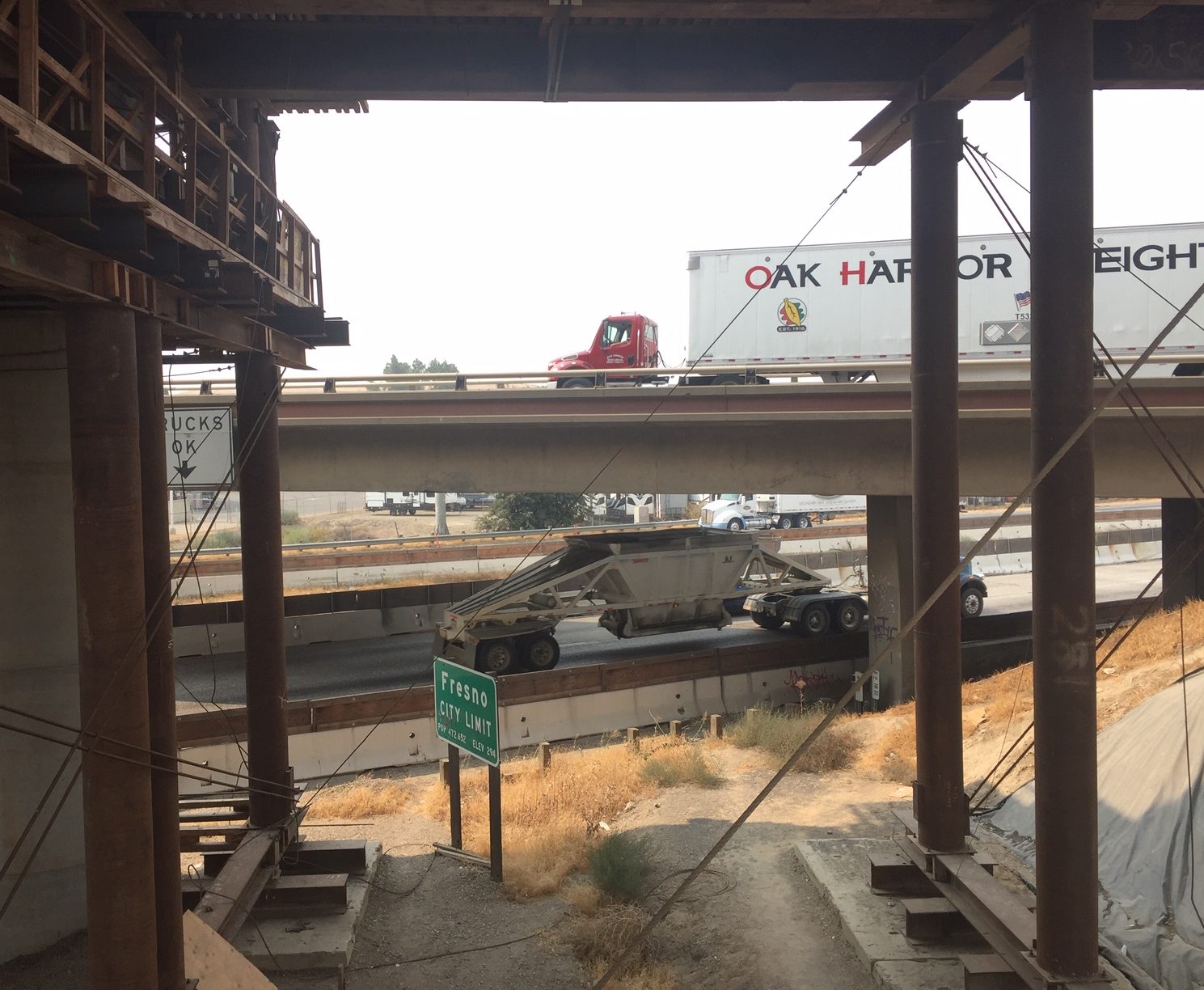
Located along Highway 99 at the northwest edge of the city of Fresno, the San Joaquin River Viaduct appears nearly complete. The new bridge features iconic arches that serve as a visual landmark for folks entering Fresno via the 99.
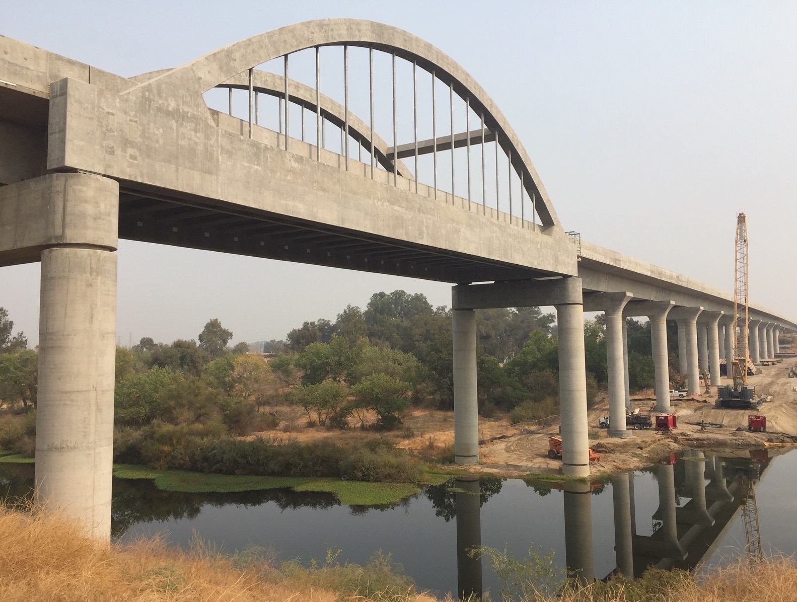
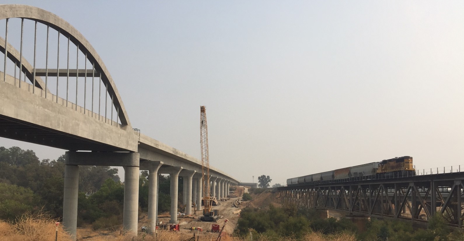
The 4,700-foot long San Joaquin River Viaduct will allow high-speed trains to cross the river and (via a pergola – a sort of elevated cross-beam structure) cross the Union Pacific tracks parallel to State Route 99.
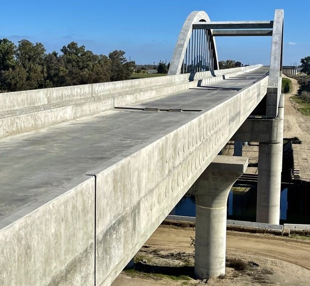
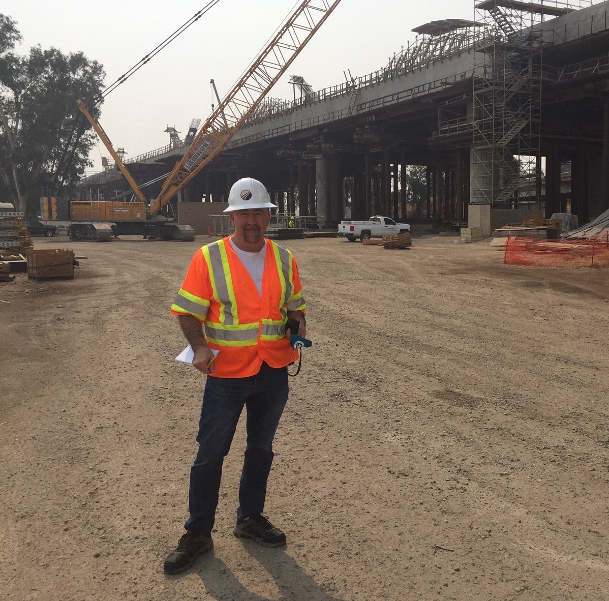
Cedar Viaduct
The Cedar Viaduct is located at the southeastern edge of the city of Fresno – along and over Highway 99. The 3,700-foot bridge will carry trains over the 99 as well as North and Cedar Avenues. Cedar will have similar arches as the San Joaquin River Viaduct (though Cedar will have two pairs), again serving as a landmark for folks entering Fresno.
At the Cedar Viaduct, Streetsblog met up with Chuck Riojas, Executive Director of the Fresno Madera Tulare Kings Building Trades Council.
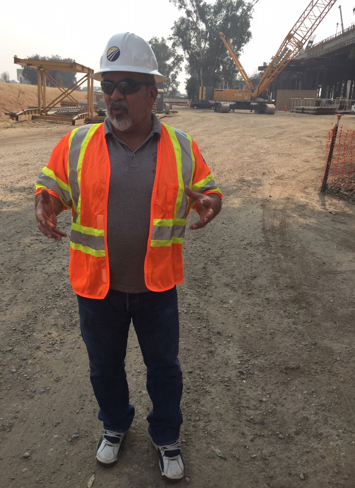
Riojas runs apprenticeship programs that train youth and help place them in construction jobs, including building high-speed rail. He called the bullet train project “a game-changer… with so many positive effects.” The CA High-Speed Rail Authority reports more than 5,000 workers have been dispatched to build rail structures. The agency has focused on engaging workers from disadvantaged communities near the project’s route.
“Its impact on the Central Valley cannot be overestimated” stated Riojas. High-speed rail construction “pretty much saved the valley.”
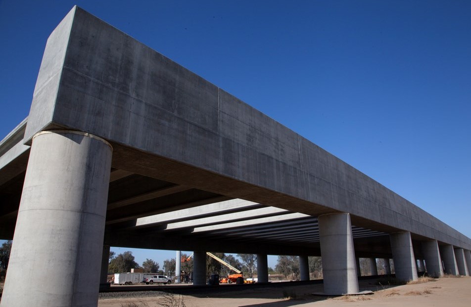
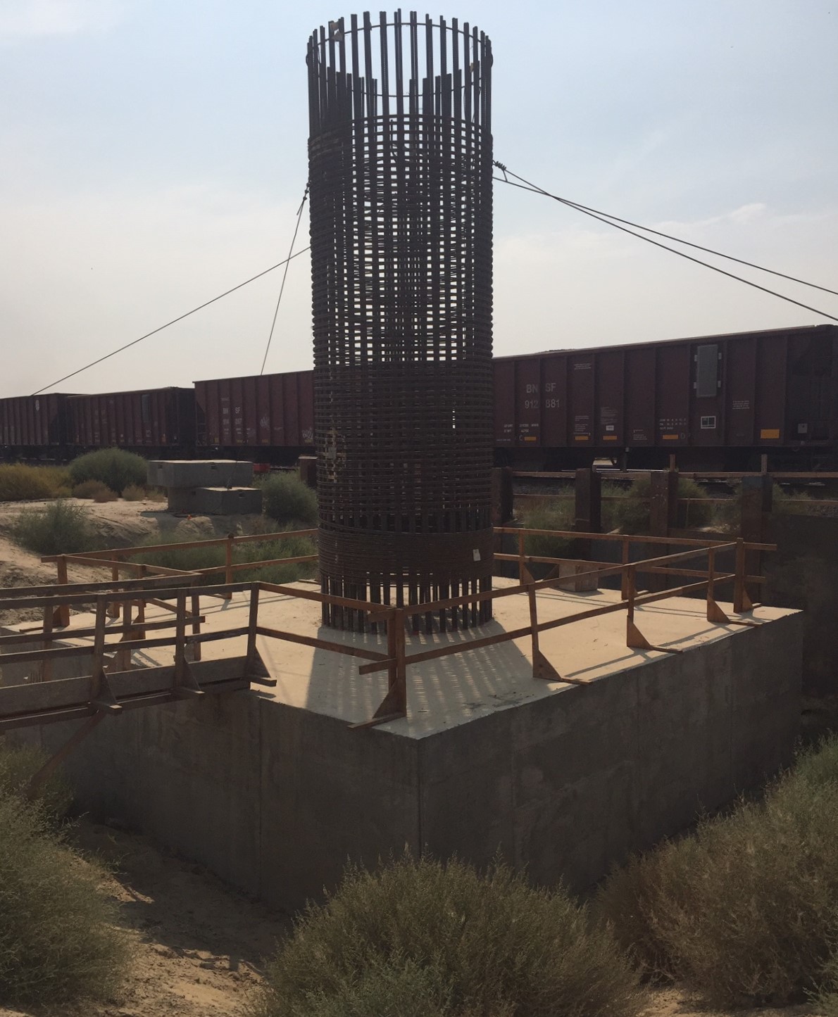
Conejo Viaduct
About twenty miles south of Fresno City, still within Fresno County, is the town of Conejo. In this location, high-speed rail tracks will ascend on to the Conejo Viaduct (another pergola) to cross over existing freight rail tracks, then veer eastward to the planned Kings/Tulare station, located along the eastern side of the city of Hanford.
The 2,000-foot long Conejo Viaduct will cross over the BNSF rail line, Conejo Avenue, and Peach Avenue.
Additional high-speed rail structures nearby
Construction has proceeded far enough that it’s fairly easy to spot the CAHSR alignment on aerials, including Google Maps Satellite layer.
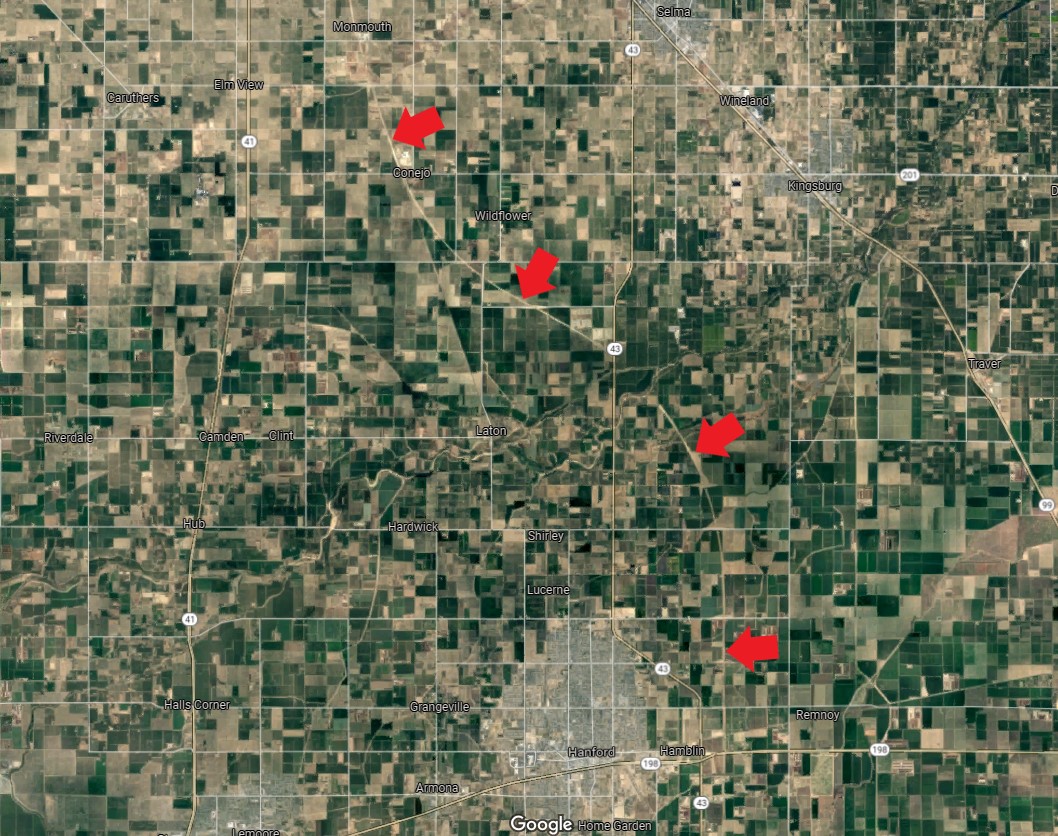
Zooming in a bit, one can spot many of the grade separation structures – mostly roads that now go over the CAHSR right-of-way.
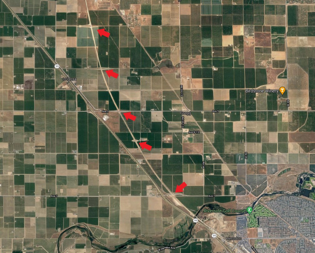
Zooming in further, many of the structures are visible.
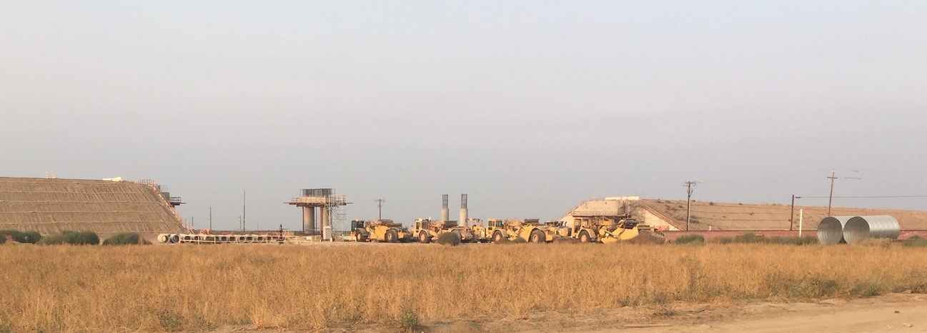
On the ground it is easy to spot the construction, which easily dwarfs the agricultural fields it traverses.
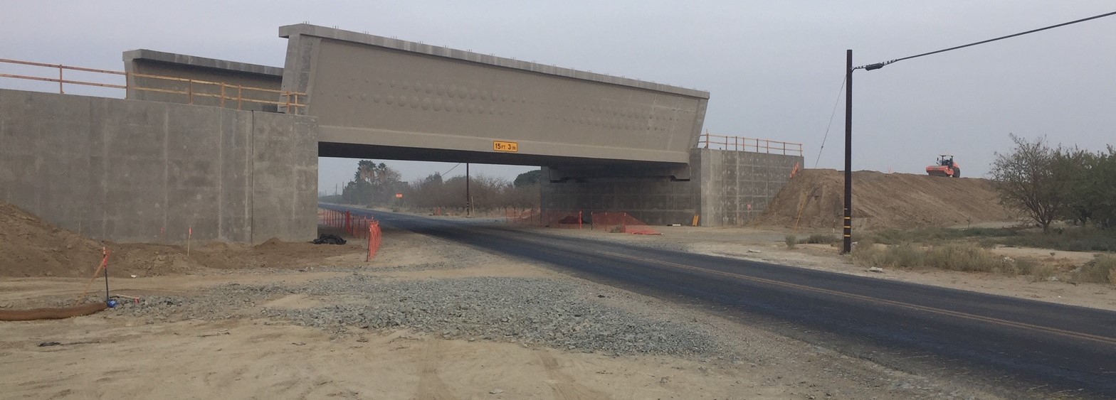
On the day before the tour, Streetsblog editor Joe Linton explored portions of high-speed rail construction west and north of the city of Bakersfield.
One very large structure in that area is the Wasco Viaduct. The nearly 2,000-foot long structure is another pergola that will carry high-speed trains over existing BNSF freight rail tracks.
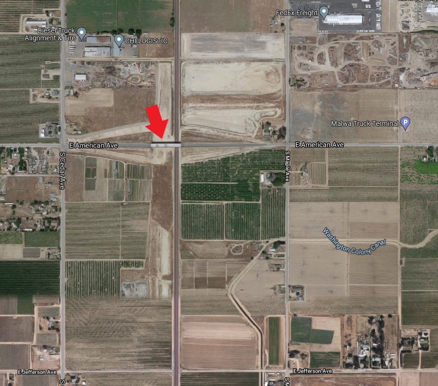
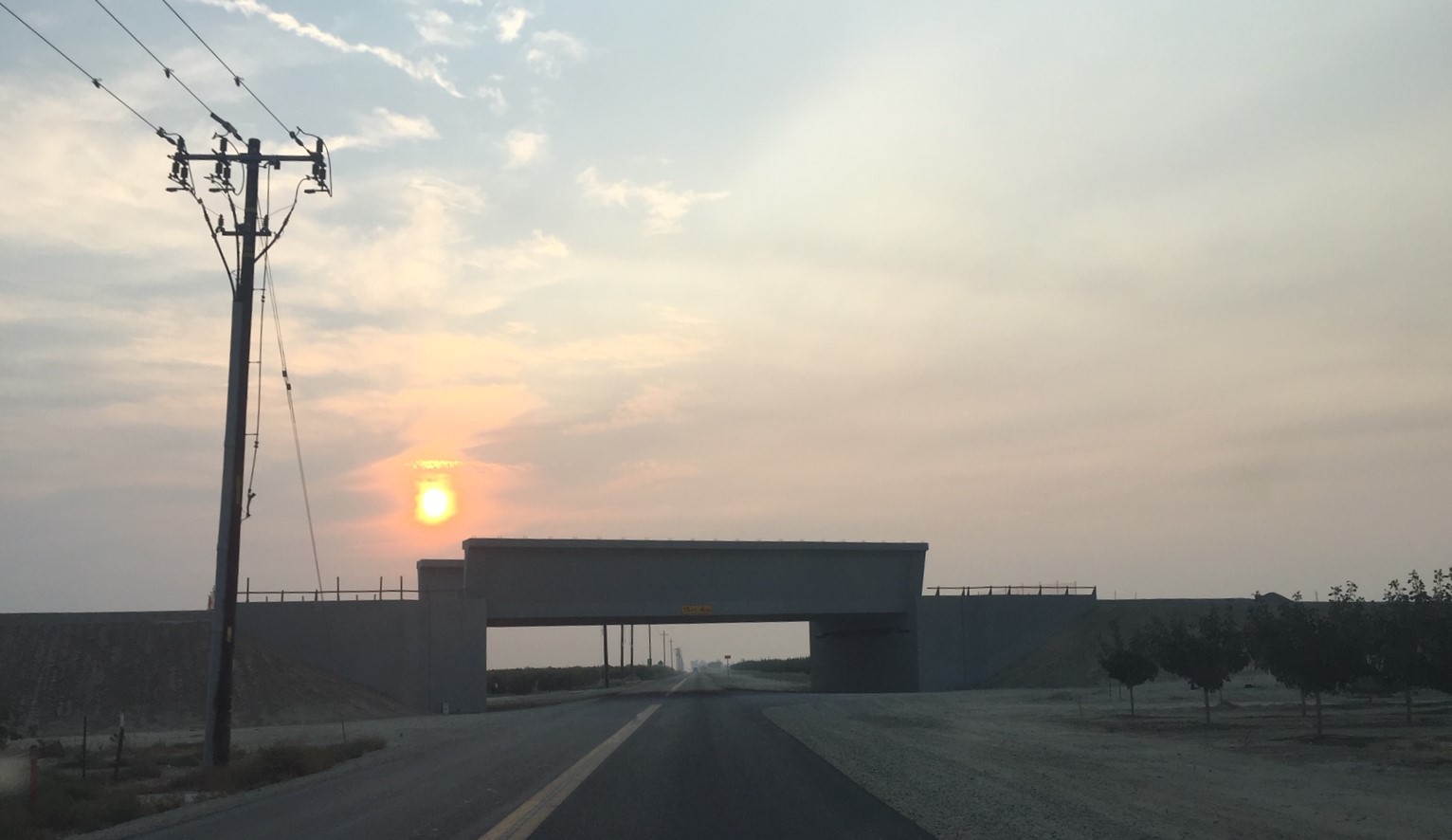
Most of the crossings are more modest. They are large compared to their surroundings, but somewhat anonymous among the many many grade separations.
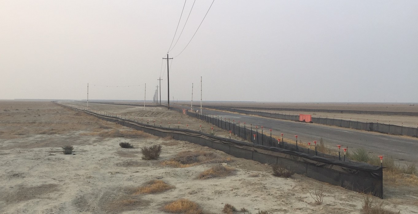
In some areas, the future rail right-of-way is marked out at ground level.
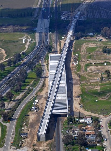
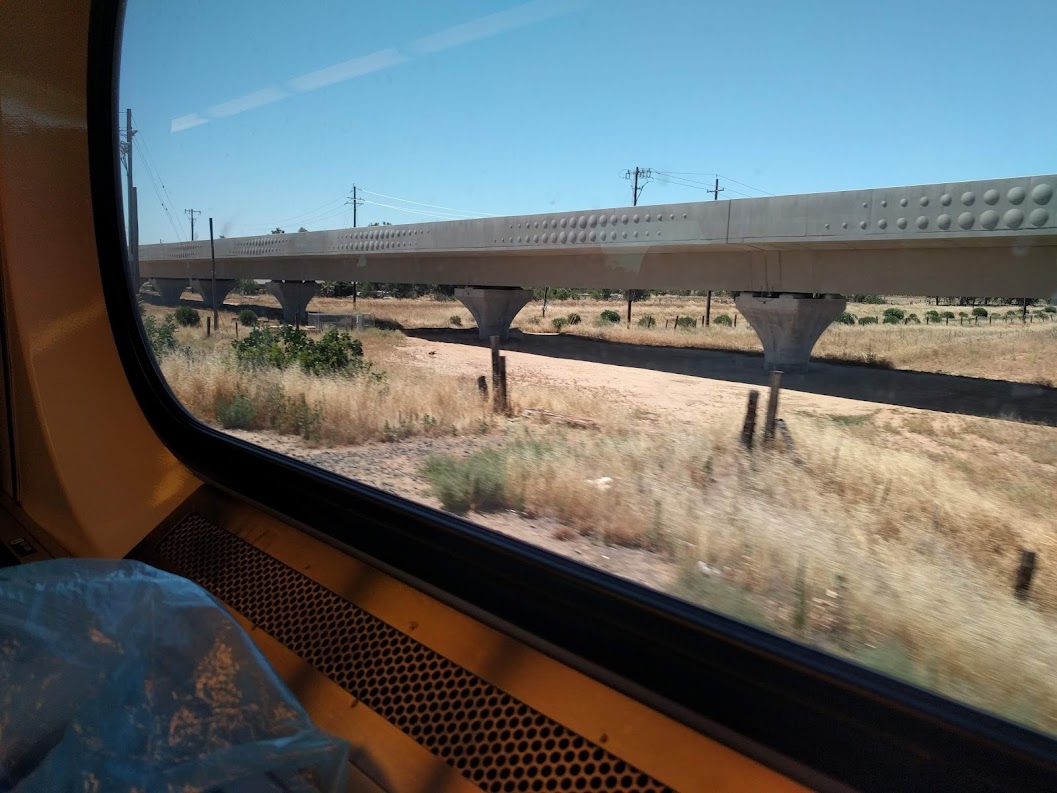
There are also crews busy finishing structures on the northernmost parts of the alignment. Below is a viaduct in Madera, spotted from Amtrak, which will provide connections to the Bay Area during early operations.
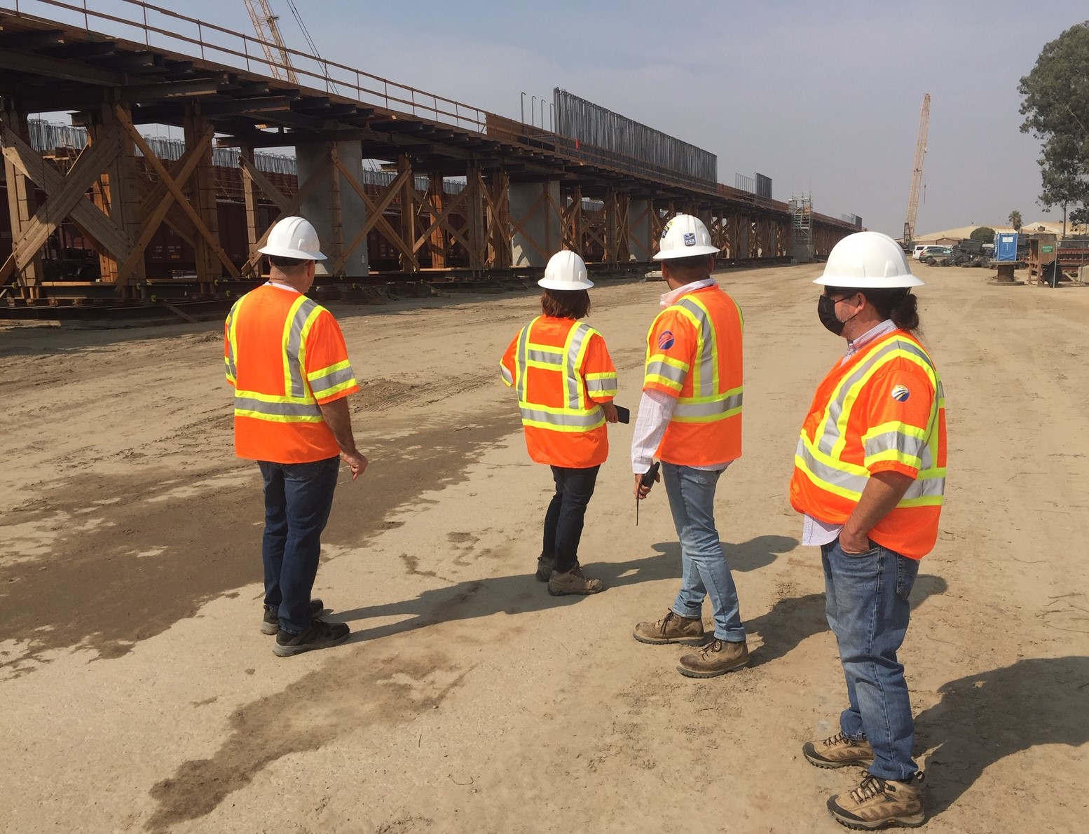
Lastly, a few photos of your Streetsblog editors alongside this important mega-project.

Streetsblog has migrated to a new comment system. New commenters can register directly in the comments section of any article. Returning commenters: your previous comments and display name have been preserved, but you'll need to reclaim your account by clicking "Forgot your password?" on the sign-in form, entering your email, and following the verification link to set a new password — this is required because passwords could not be carried over during the migration. For questions, contact tips@streetsblog.org.