Eyes on the Street: Culver City Expo Bike Path Gap
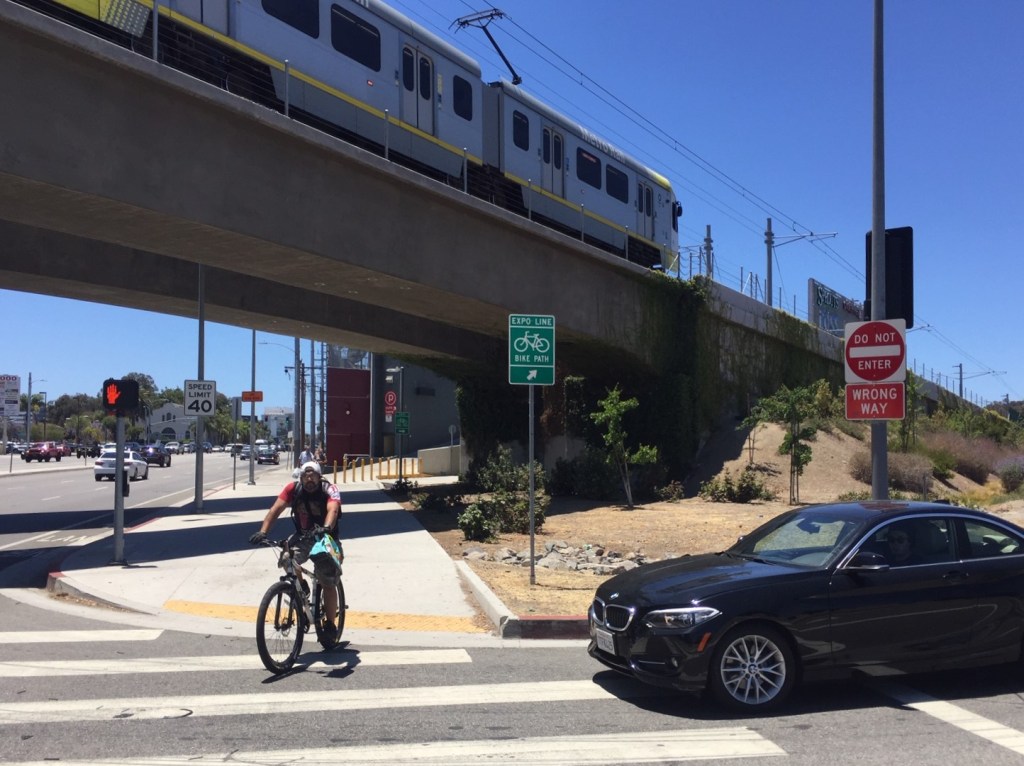
Streetsblog got a chance to ride the Expo bike path through Culver City recently. As construction is winding down on the Ivy Station transit-oriented development immediately north of the E Line Culver City Station, it is becoming more apparent how the Expo bikeway connects (or mostly doesn’t) through the station area.
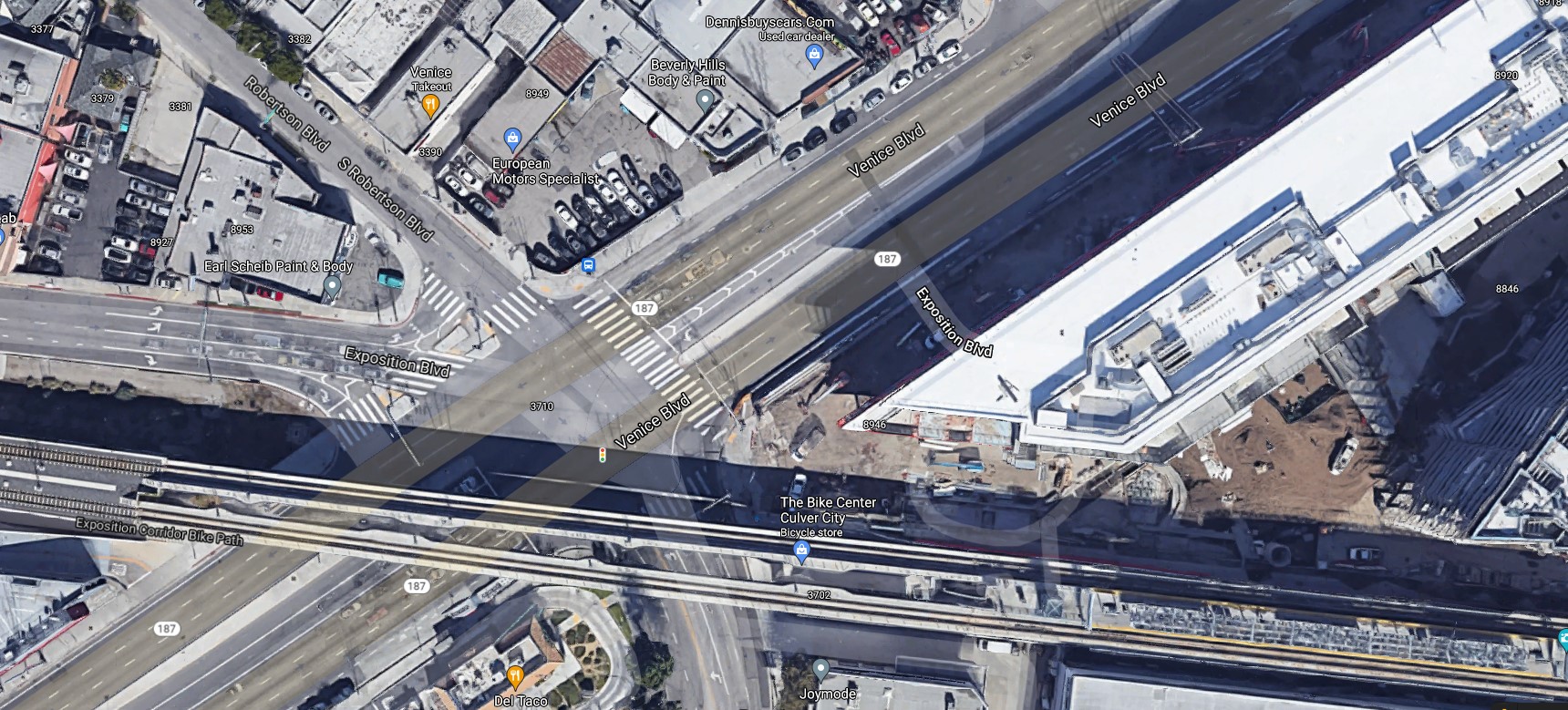
The Expo Line bikeway parallels the Metro E Line for 12 miles – from USC to Santa Monica. East of La Cienega Boulevard, the Expo bikeway is five miles of on-street bike lanes. West of La Cienega, the path is seven miles of off-street bike/walk path, except for two short gaps.
The city of L.A. has plans to complete the path through the Northvale gap in Cheviot Hills.
And then there’s a gap at the Culver City station.
This gap is mostly in Culver City, but it is partially in the city of Los Angeles. The Culver/L.A. boundary runs through the middle of Ivy Station; Venice Boulevard is all in the city of Los Angeles.
Culver City has generally been a leader in planning for walking, bicycling, transit, and open streets – including pioneering worthwhile new facilities during COVID. There are worthwhile bicycling connections in this area near downtown Culver City, including the Expo bike path connection with the Ballona Creek bike path. The negotiations between Metro’s Expo Construction Authority and Culver City were contentious in regards to teeing up the development that would become Ivy Station.
Unfortunately, Culver City’s treatment of the Expo bike path leaves something to be desired.
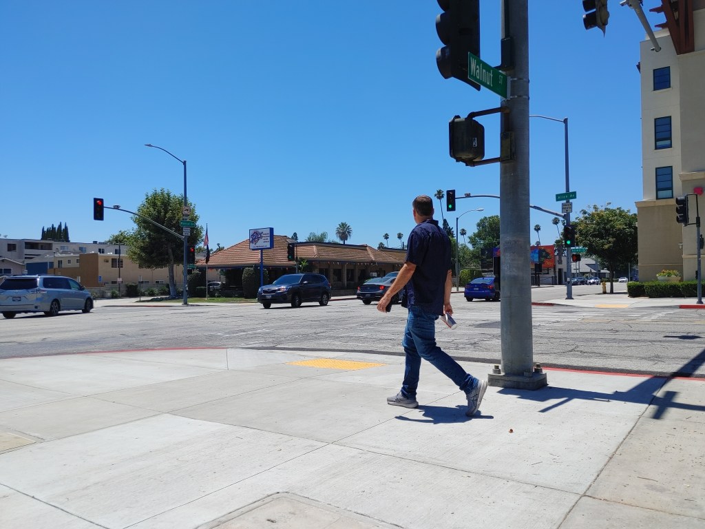
The path ends, and instead of cyclists having a fairly direct route through the ~0.3-mile gap, they are expected to ride ~0.5-mile on heavily trafficked city streets.
The bike path itself is an “8 to 80” facility – great for all ages of riders, including families and the elderly. The dogleg detour through Culver City is unprotected, mostly bike lanes. The lanes go along (and make detoured cyclists cross) four- and six-lane streets. Cyclists are expected to make right and left turns from lanes shared with cars.
What is sad is that, even in these spaces – at a light rail station, in the middle of a 7-mile bike path – Culver City and the City of L.A. are prioritizing drivers.
At this point it feels like most of the damage is already done – and set in concrete. Some engineer who probably never rides a bike signed off on these plans a long time ago.
There are ways to make this poorly-thought-out gap dogleg area better. I’ll weigh in with some recommendations, big and small, to make the Culver City station area safer and more conducive for cycling.
For both Culver City and L.A.:
- The current signage wrongly assumes that bicyclists won’t go to the E Line station. There is signage to get cyclists from the eastern part of the bike path to the western part of the bike path, but no signage showing cyclists how to get to the train station. These bike paths serve as first/last mile connections to the station. Add permanent signage to make it clear how cyclists can get to the Culver City E Line station. (Similarly there should be some signage for cyclists arriving by train looking to access the path.)
- For the pedestrian area along Ivy Station, assume that bicyclists will use this – including to access the Metro E Line, and to access Ivy Station. Instead of the circle-slash-bike signs I expect will be installed there, how about some kind of shared space notice? Let cyclists know that they are sharing the area with pedestrians. Perhaps some combination of sharrows and slow speed signage would be conducive to the ped/bike space-sharing that will take place there.
For Culver City:
- Ideally, Culver City should scrap the indirect dogleg route – and send cyclists through the area along/under the Metro station – instead of shunting them onto busy streets.
Culver City recently chose to add a right-turn-only pocket on National Boulevard (for turns onto Washington Boulevard). This wasn’t there prior to recent construction (see 2012 Google Street View). When Culver City turned this space over to drivers – all seven lanes for drivers, sidewalks for peds, and nothing for bikes – the city blocked the space needed for a direct connection for cyclists. Giving over so much space on National ended up forcing the city to shunt riders off to Wesley Street. It would not be cheap or easy at this point, but Culver City should reduce car lanes on National to allow for a more direct connection between the Expo bike path segments and the Metro station.
This big change would probably include:
– restoring the erased part of the bike path
– extending that bike path to Washington (perhaps remove a car lane and the added right-turn-only lane, and add a two-way protected bikeway along the northeast side of National)
– adding a two-way protected bikeway along the northwest side of Washington (between National and the Expo tracks).
Doing all those changes would give cyclists a fairly direct shot (crossing just two difficult intersections) instead of the indirect dogleg (where cyclists currently navigate four difficult intersections).
Assuming that the indirect dogleg remains in place (it shouldn’t), then both cities could:
- Where the Wesley Street sign says “dead end,” Culver City could add more signage that lets cyclists know that there is a bike path entrance ahead.
- Install protected bike lanes on Washington, National, and Venice (and perhaps Wesley).
– Culver City should install a two-way protected bikeway on the northwest side of Washington – from the Expo Station to Wesley.
– Culver and L.A. should protect the lanes on National. Ideally, this would probably be a two-way facility along Ivy Station. At a minimum it would be protecting the existing bike lanes.
– L.A. City should install a protected two-way bikeway along Venice Boulevard – along Ivy Station. Similar to Santa Monica’s Ocean Avenue facility, there would be a two-way facility on one side of the street, and a one-way bike lane on the other side.
– Wesley is a fairly small street; it’s a ~34-feet wide two-lane street that runs for one long block and dead-ends. It currently has sharrows. All of the businesses along Wesley have off-street parking. The street also has some on-street parking, mostly on the west side. If the parking were removed, there would be space to add a two-way protected bikeway (probably on the east side of the street, which is where the path entrance is).
For the city of Los Angeles:
- Pretty much any way one slices it, one really big part of the discomfort for cyclists in the Culver station area is the car-clotted five-way intersection of Venice Boulevard, Robertson Boulevard, and Exposition Boulevard. North of Venice, the latter two streets serve as more-or-less on/off-ramps for the 10 Freeway. Locating the station so close to the freeway makes creating a transit-oriented walkable station area difficult.
Ideally, instead of cyclists/pedestrians having to cross three streets – Venice, Robertson, and Exposition – to get between L.A.’s portion of the station and the path, people should be able to cross just Venice Boulevard. One strategy for this could be to do a scramble crossing, allowing people on foot and bike to cross diagonally. L.A. has done several of these pedestrian-priority scrambles at Metro stations: Hollywood/Highland, Hollywood/Vine, Wilshire/Alvarado, and 7th/Alvarado (and long ago announced they were coming to 7th/Flower and Aliso/Alameda). Adding a scramble at Venice/Robertson could help prioritize people using the station, instead of the current situation that prioritizes people using the freeway.

Streetsblog has migrated to a new comment system. New commenters can register directly in the comments section of any article. Returning commenters: your previous comments and display name have been preserved, but you'll need to reclaim your account by clicking "Forgot your password?" on the sign-in form, entering your email, and following the verification link to set a new password — this is required because passwords could not be carried over during the migration. For questions, contact tips@streetsblog.org.