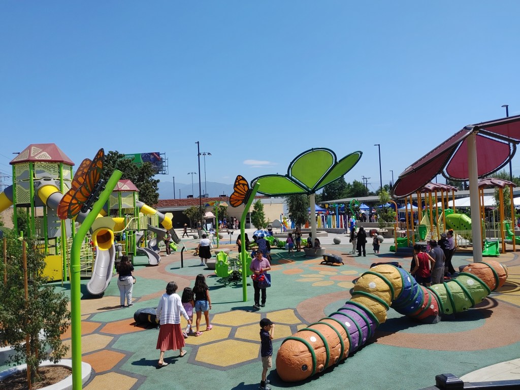
Beverly Hills Planning Complete Streets, Including Walk, Bike, Transit Improvements

Tonight, the Beverly Hills Traffic and Parking Commission will meet to receive input on and discuss the city’s proposed Complete Streets Plan and Complete Streets Action Plan. The plans call for numerous policies and facilities to make it easier, safer, and more convenient to walk, bike, drive, and take transit in Beverly Hills.
Better Bike and Streets for All are encouraging the public to attend tonight’s 6 p.m. commission meeting (agenda) and speak up for complete streets. The meeting starts at 6 p.m. at the Beverly Hills City Hall Municipal Gallery at 455 N. Rexford Drive.
The two complete streets plans are neither ground-breaking nor radical, but, if implemented, would dramatically improve active transportation infrastructure in a city that has historically been slow to embrace non-car modes.
In recent years, Beverly Hills has implemented conventional and green bike lanes, sharrows, and bike-share. The city and school district fought against the Metro Purple Line subway extension, which is now under construction. While the school district has continued to fight Metro, the city itself is mostly no longer against the subway. Beverly Hills is looking to add an additional subway station entrance at Wilshire/Rodeo, and, with these complete streets plans, would improve first/last mile connections to future subway stations.
The complete streets plan spells out plenty of walk/bike/transit/car improvements, but couches them in wiggle language:
As a long-range policy document, the Complete Streets Plan does not prescribe specific locations for upgrades or design details. For example, the plan identifies the recommended bikeway network and types of bikeways for the City to pursue; however, because the exact roadway design requires many transparent conversations with adjacent neighbors and property owners the plan cannot dictate the specific changes that would be made. Instead, it provides a menu of recommended design features that should be explored and discussed with community stakeholders to find the best option for each unique street.
Nonetheless, to get improvements on the ground, one important early step is including facilities in a plan. Having an up-to-date city-approved mobility plan would make Beverly Hills more competitive in seeking outside funding – such as from the state’s Active Transportation Program (ATP).
Bicycling Improvements
The plan calls for “a holistic [bikeway] network… to provide access to schools, parks, commercial areas, Metro Purple Line stations, and existing bikeways.”
Currently, Beverly Hills has very few bikeways. There are no bike paths, three bike lanes (Burton Way, Crescent Drive, and Santa Monica Boulevard), and a handful of sharrow-ed bike routes connecting those lanes.
The complete streets plan proposes a network including six protected bike lanes (on Sunset Boulevard, Beverly Boulevard, Burton Way, Charleville Boulevard, Gregory Way, and Beverly Drive), a dozen conventional bike lanes, and about a dozen bike boulevards.
The plan also calls for bike parking as well as bicycle encouragement programs including Safe Routes to School and CicLAvia-type open streets events.
Pedestrian Improvements
The plan calls for “expand[ing] the walkability of Beverly Hills citywide by beautifying streets, improving safety, and enhancing crossings.” The focus for pedestrian improvements would primarily be “streets with destinations that attract pedestrian activity, like retail and office space.”
Walking improvements would include a variety of crosswalk types – mid-block, scramble, raised, and enhanced safety features – plus landscaping, pedestrian lighting, transit shelters, curb extensions, and outdoor gathering spaces (including parklets) plus programs/events to encourage walking.
Transit Improvements
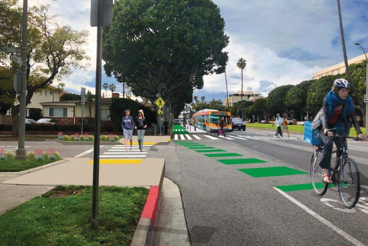
The plan calls for transit improvements primarily focused on making first/last mile connections to future Purple Line subway stations. These improvements would include a mobility hub at the Wilshire/La Cienega station, a northern entrance to the Wilshire/Rodeo station, and an autonomous shuttle (long championed by councilmember John Mirisch) that would provide station access.
Suggest transit improvements include floating bus islands (image at top), bus-only lanes, and programs to incentivize transit ridership.
Driving Improvements
The plan also calls for better management of curbsides, appropriate parking prices, neighborhood car-share, a Transportation Demand Management ordinance, and new collision management software for better tracking and reporting.

Read More:
Streetsblog has migrated to a new comment system. New commenters can register directly in the comments section of any article. Returning commenters: your previous comments and display name have been preserved, but you'll need to reclaim your account by clicking "Forgot your password?" on the sign-in form, entering your email, and following the verification link to set a new password — this is required because passwords could not be carried over during the migration. For questions, contact tips@streetsblog.org.