Metro Committee OKs Moving Forward with DTLA L.A. River Path Environmental Studies

Note: Metropolitan Shuttle, a leader in bus shuttle rentals, regularly sponsors coverage on Streetsblog San Francisco and Streetsblog Los Angeles. Unless noted in the story, Metropolitan Shuttle is not consulted for the content or editorial direction of the sponsored content.
This afternoon, the Metro board Planning and Programming Committee approved proceeding with the next steps on the L.A. River bike/walk path through central Los Angeles. The committee approved receiving the project’s conceptual design report and initiating the Draft Environmental Impact Report (DEIR) process. The action is subject to full board approval next week.
This river path project will be located in the cities of Los Angeles and Vernon. It will serve communities including Boyle Heights, Lincoln Heights, Chinatown, and downtown L.A. The project is a roughly 8-mile gap closure that will create a 30+mile continuous bikeway from Griffith Park to Long Beach.
The central L.A. River path has $365 million in Measure M funding. Measure M specifies a completion date in fiscal year 2025-2027.
Metro has hosted several rounds of public input meetings for the project.
The conceptual design report (executive summary) includes three alternatives.
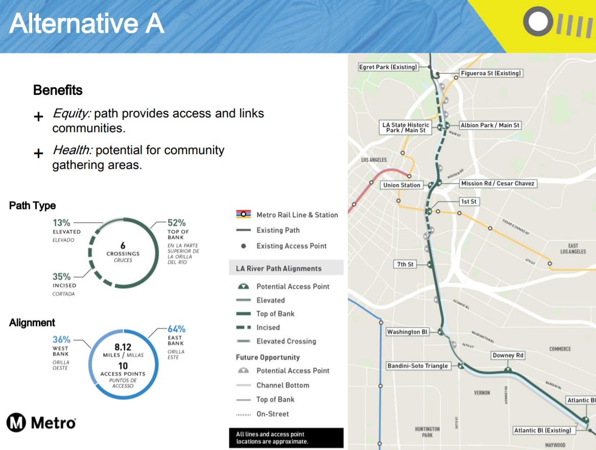
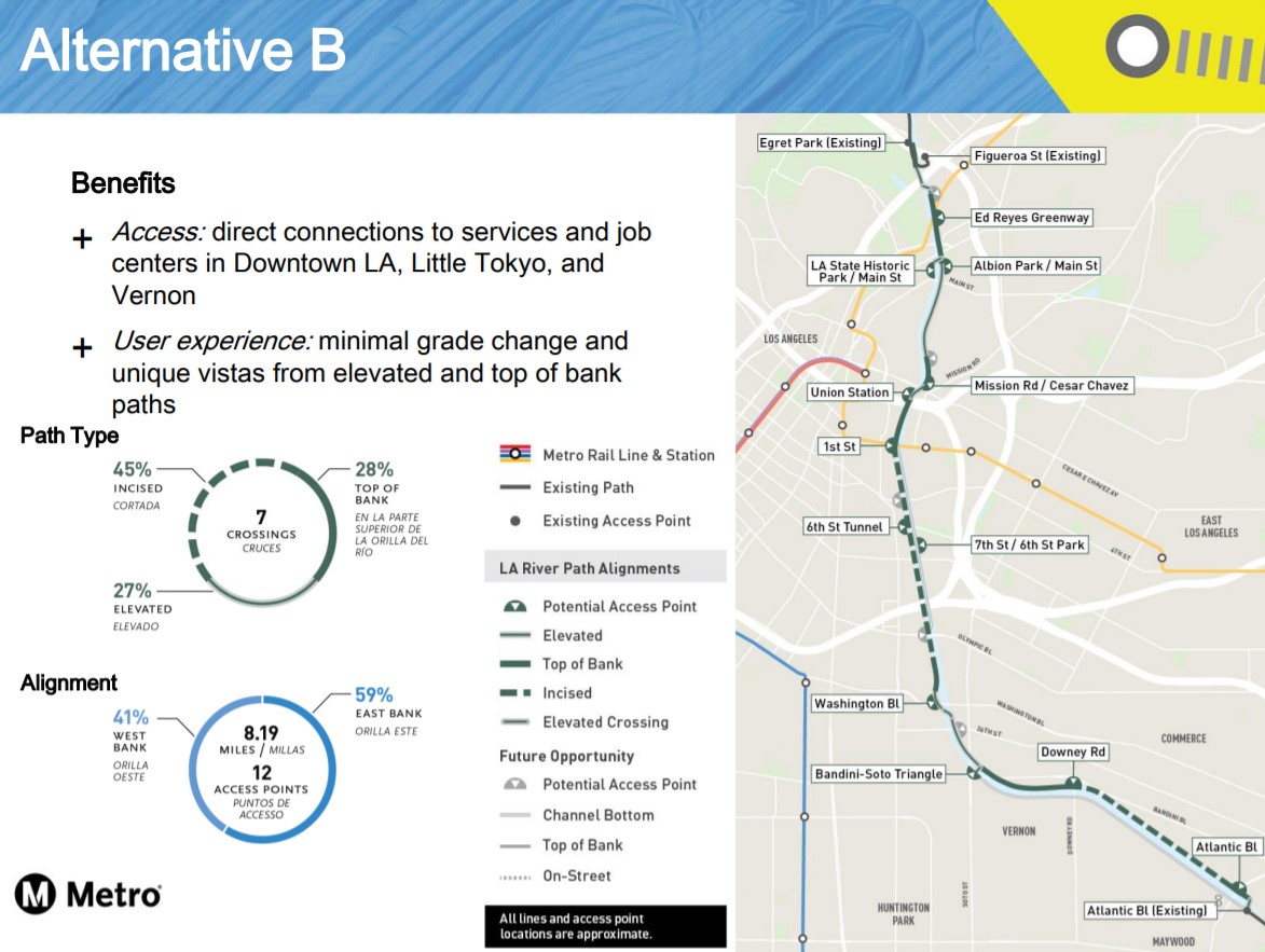
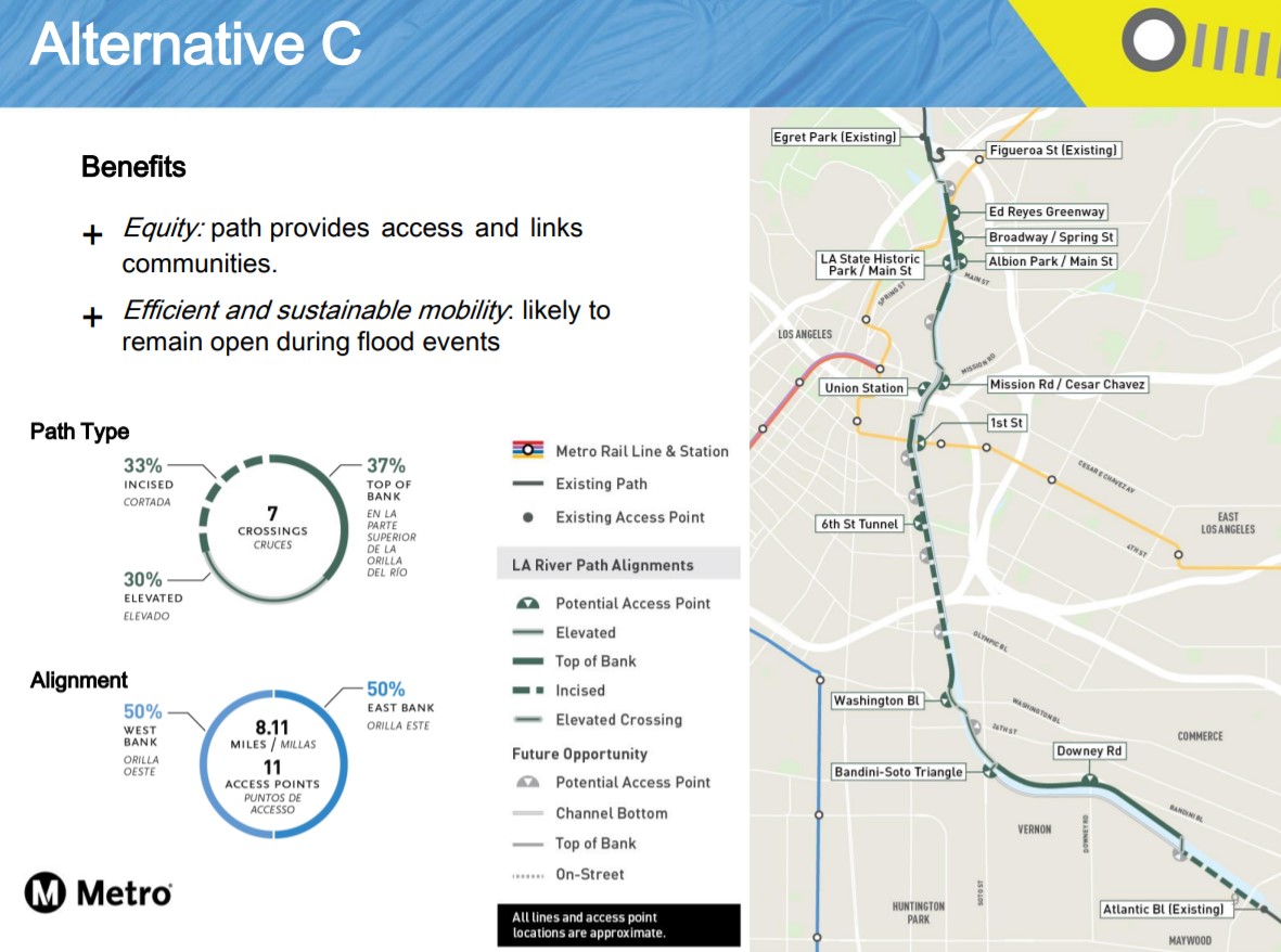
The alternatives have plenty in common. They all include entrances on both east and west sides, with about half of the entrances on each side. They all include 6-7 new bike/ped bridge crossings.
Unfortunately, they are all expensive – likely to require more money than the $365 million in hand. Elevated sections tend to drive up the cost; channel-top sections tend to be somewhat less expensive. Metro’s current rough cost estimates are:
- Alternative A – $329-$443M – 48% channel top, 15% elevated
- Alternative B – $393-$523M – 23% channel top, 31% elevated
- Alternative C – $332-$446M – 26% channel top, 33% elevated
More expensive elevated sections are positive for year-round access, though they also mean hills/grades and can mean structures that block views and potential future access to a revitalized river down the line.
At today’s committee meeting, public comment was strongly in favor of the project. Commenters included representatives of the Anahuak Youth Sports Association, L.A. County Bicycle Coalition, ActiveSGV, and Climate Resolve. Several advocates urged Metro to focus on alternatives that would remain open during rain events.

Read More:
Streetsblog has migrated to a new comment system. New commenters can register directly in the comments section of any article. Returning commenters: your previous comments and display name have been preserved, but you'll need to reclaim your account by clicking "Forgot your password?" on the sign-in form, entering your email, and following the verification link to set a new password — this is required because passwords could not be carried over during the migration. For questions, contact tips@streetsblog.org.