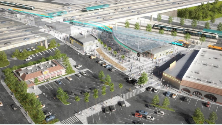
If you've ever tried to navigate the Rosa Parks/Willowbrook station, either to transfer between the Blue and Green Lines or to catch one of the nearly dozen buses that connect with the station, you know it isn't the most user-friendly place.
Not only do the narrow stairs connecting the two platforms (used by 78% of all 30,000+ passengers that pass through the station daily) create a natural bottleneck, in combination with impatient Sheriffs, families with strollers, cyclists with bikes, and glitchy TAP validators, they can facilitate human traffic jams that inhibit people's ability to transfer to transit.
Moreover, the narrow Blue Line platform can be quite crowded and uncomfortable in the heat of the day.
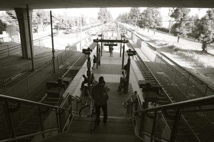
Metro is aiming to change all that with the (proposed) construction of a more open and welcoming community-oriented transit center it believes will be an asset to the neighborhood.
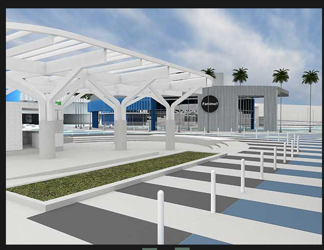
The revamped station will better connect transit riders to nearby education, cultural, health, commercial, and recreational resources via a Mobility Hub (and Bike Hub), more comfortable waiting areas and more sheltering canopies, improved pedestrian circulation via a new Transit Hall, a reconfiguration of the bus depot area, a new southern at-grade entrance to the Blue Line, and upgrades to the lighting, signage, landscaping, stairs, elevators, and escalators (see the project fact sheet here).
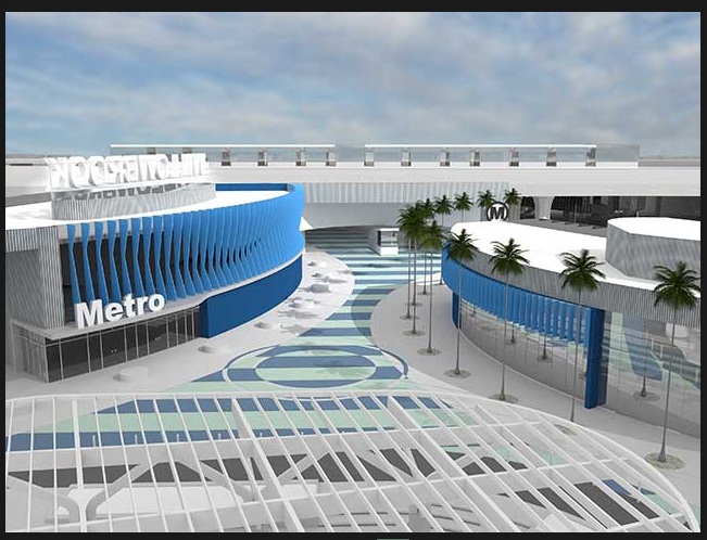
The station will also feature a Sheriff's facility, Metro Customer Service Center (to better serve lower-income riders), better integration with the Kenneth Hahn Plaza (KHP) shopping center to the south, and possibly a cafe.
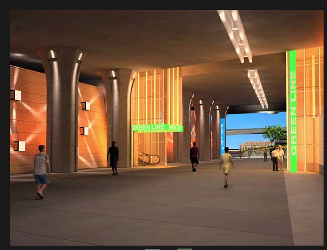
Via a rendering from Jenkins/Gales & Martinez, Inc. and design architects Hodgetts + Fung, it appears passengers will also enjoy a much more enticing, well-lit, and well-signaled connection to the Green Line under the 105 freeway (below).
The Rosa Parks Station Master Plan was initially adopted by the Metro Board of Directors in 2011 (the original Title VI analysis of the site, complete with community aspirations/concerns, can be found in Attachment D, here).
In the notice of preparation for the initial environmental study, staff describe the estimated $66 million renovation as necessary, given that "much of the existing transit infrastructure has reached economic and functional obsolescence as a result of the increasing levels of patronage and over more than two decades of service life" and that "features typical to a 'Gateway Station' are lacking, such as customer amenities, attractive pedestrian connections, modern bicycle infrastructure and enhancements, and elements that would support station area transit oriented development (TOD) opportunities being planned by the Los Angeles County Regional Planning Department."
Most notable among these "TOD opportunities" are the upgraded Martin Luther King, Jr., Community Hospital (featuring an Outpatient Center, Mental Health Urgent Care Center and a Center for Public Health, scheduled to open August 7), and the construction of a new library and senior housing at 118th and Wilmington, both of which are located adjacent to the station.
The project is partially funded via a TIGER grant for $10.25 million in September of last year. And Metro is currently seeking two state grants to cover the remaining costs of the renovation.
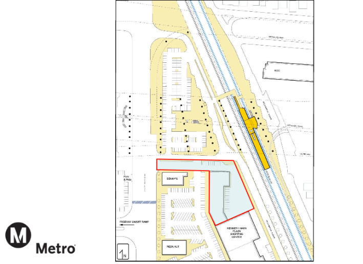
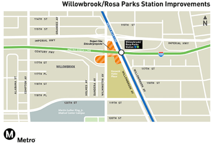
To create the expanded station, the project will require the acquisition of approximately a 1.5 acre section of the north end of KHP, currently owned by the Los Angeles County Community Development Commission (below). Existing tenants in that section -- a nail salon, Planned Parenthood, and a dentist office -- Metro believes, could be relocated to vacant storefronts within the shopping center.
The upgrades to the station seem truly promising.
Unfortunately, they will not cover some of the more uncomfortable crossings surrounding the station area, including the disaster that is the intersection of Wilmington and Willowbrook, just to the north (top center of map, below).
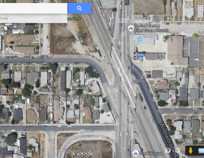
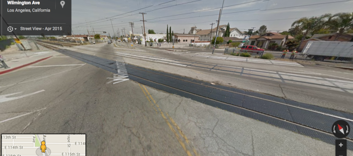
And while I understand why the intersection is not included in the plans for the station (nor likely to benefit from the $1.2 billion in upgrades the Blue Line is receiving over the next several years), I do hope that Metro and other powers that be will look at ways to make that intersection less terrifying for all road users to move through. If Metro's goal of connecting transit riders to the community is genuine, working with LADOT and the city to make it safe for people to actually leave the new station will surely be an important component of that effort.
The draft initial study of the environmental impact of the station project, published on May 8, found no real negative consequences for the environment and is available for public review [PDF]. Should you wish to send comments on the study to Metro before the June 8 deadline, please contact Susan Chivaratanond, Environmental Project Manager, ChivaratanondS@metro.net.
According to a recent presentation, Metro expects to seek public input on the final design later this year and begin construction in 2017. For more information on this and other Blue Line upgrades, please see Metro's dedicated web page, here.

