It is no secret that in America, and especially in Greater Los Angeles, too many children do not walk around their own neighborhoods. Whether it is fear of "stranger danger," safety in the neighborhood, or the allure of electronic babysitting, many of today's youth spend too much time indoors, and not enough doing something as simple as walking.

Today is the day that changes. For a couple of hours, children everywhere will be laughing and playing on the sidewalks. Meeting their neighbors. Extorting them for candy. For some children, this will be a unique experience. For others, it is just like every other day, except their clothes are cooler.
In an effort to combat this trend, Los Angeles is beginning to take the first steps, pardon the pun, to get children walking by encouraging more parents to have their children walk to school. After years of underperfoming when it came to earning state and federal Safe Routes to Schools' grants, the city used a portion of its Measure R Local Return funds to modernize the city's process of earning and delivering on these grants.
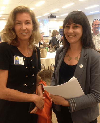
Earlier this year, the City of Los Angeles hired Margot Ocanas and Valerie Watson to be the city's first official "pedestrian coordinator" and "assistant pedestrian coordinator."
Both women come prepared for their new role with experiences from their professional and personal lives.
Ocanas, a former grant manager with the RENEW Program at the L.A. County Department of Public Health, was planning "open-street" block parties and organizing walking and bicycling school buses for her kids before pedestrian access became a profession. Watson, who previously worked as an urban planner at Melendrez and spent her free time advocating for the burgeoning Downtown Bike Network as a member of the Downtown Neighborhood Council.
While Ocanas and Watson started at LADOT when the issue of the city's poor sidewalk repair was front page news, the focus of their positions is on improving the city's Safe Routes to Schools Program. By rebuilding LADOT's data gathering, review, and pedestrian toolbox for children, Ocanas and Watson believe they can make the city more responsive to the needs of all pedestrians.
"Our primary focus is on a Safe Routes to School Strategic Plan," explains Ocanas. "It's very much an umbrella strategic plan that forces a data driven prioritization process." Previously, the city's Safe Routes' applications contained some data on recent crash history, estimates on the number and percentage of students who walk and bike to school, and anecdotal reports from parents and administrators.
"As we put that in place in the first year...we can leverage those processes and data gathering and methodologies to a more universal pedestrian segment," she continues.
The updated processes would contain that information and more data on where students are beginning their journey, more data on sidewalk and road conditions, and would propose solutions from a larger toolbox of options. In fact, Ocanas hinted that a closer relationship with the Bureau of Streets Services (BSS) is already making for better conditions. As the BSS works on the backlog of funded projects, the city is updating and improving old plans before implementing in the street.
Previously, the city was trying to create applications based on political boundaries so that each Council District received a similar number of applications. Today, Ocanas and Watson are talking of slimming the number of applications. A smaller number of applications will allow the city to spend more time on each one, bringing in more data, more local outreach and a better narrative. Instead of just looking at "hot spots" such as a dangerous intersection near a school, LADOT will focus on a "corridor perspective" where a wider look is taken between areas where students begin and end their days and the schools they attend.
For example, a signalized crosswalk at an intersection may make a crossing safer, but it will not help encourage more people to walk if the sidewalk is crumbling on both sides of the street.
Behind the scenes, both Ocanas and Watson report a new "synergy" inside and outside the department. When looking at projects to improve walking and bicycling access to schools, the team is able to bring in partners within LADOT including planners, the bicycle team and the pedestrian team. Outside the Department, community groups, pedestrian and cycling advocacy groups, the LAPD, City Planning, the Bureau of Engineering and BSS all need to be involved in creating a quality application that leads to safer streets.
"From the initial get-go, once the data is pointing us in a certain area, we are meeting with our ped. team, with our bike group, with design to make it a richer package," explains Ocanas.
The long-term task facing Ocanas and Watson is a daunting one. "Pedestrians are ubiquitous...Everyone is a first mile, last mile customer," explains Ocanas. But if anyone can make the city a safer one to walk for children, and eventually everyone else, it is a determined mother who made a safe street for her children and an urban planner who envisioned and helped create a bike network in Downtown Los Angeles.
(Note: The interview actually occurred in late September and was planned for Walk and Bike to School Day. Instead, we had a baby.)


