Metro Plans to Take Out 200+ Downey Homes to Widen 5 and 605 Freeways
The full details are not yet entirely clear, but Metro and Caltrans are finalizing plans to widen portions of the 605 and 5 Freeways – and the project will destroy hundreds of homes, primarily in the city of Downey.
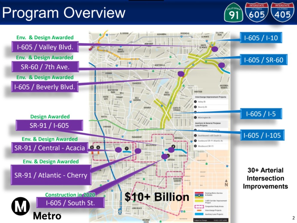
Metro calls the project the “I-605 Corridor Improvement Project” (605 CIP) though the project includes portions of other freeways: the 5, 10, 60, and 105. The project would touch on nine San Gabriel Valley cities – Baldwin Park, Downey, City of Industry, El Monte, Norwalk, Pico Rivera, Santa Fe Springs, South El Monte, and Whittier, as well the unincorporated county areas Avocado Heights, Rose Hills, West Whittier/Los Nietos.
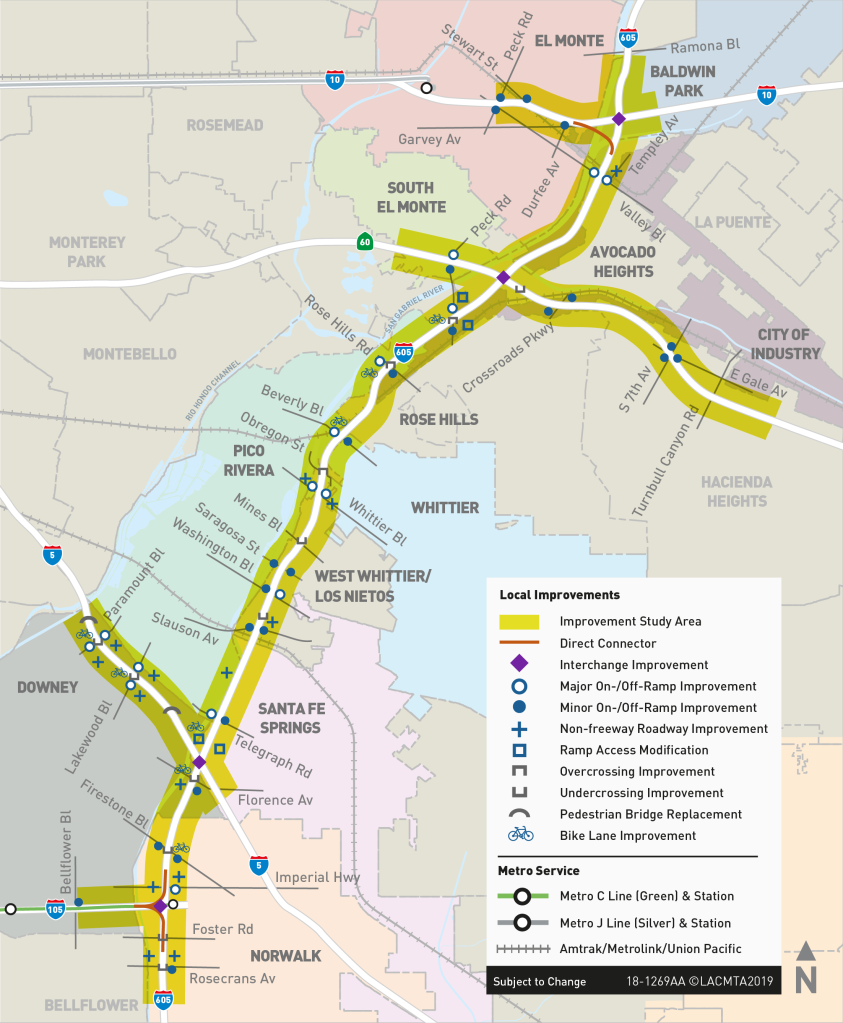
Parts of the 605 CIP are already being designed as part of Metro’s $10 billion SR-91/I-605/I-405 “Hot Spots” Program, which includes additional SGV cities and freeways south of the main 605 CIP.
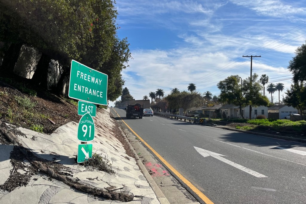
Metro is considering three build alternatives, all of which would add two additional lanes to each side of the 605 Freeway.
An August 2020 Metro presentation outlines the “right-of-way impacts” of the 605 CIP project, meaning the number of homes, schools, parks, businesses, etc. that will be torn down to make space for the widening.
The chart above lists the number of parcels that Metro/Caltrans would purchase – including 360+ full acquisitions, 320+ partial acquisitions, and 540+ easements. Though there are impacts throughout the project, the lion’s share of the sites torn down are concentrated in the city of Downey. About two-thirds of full acquisitions would be in Downey, as well as about half of partial acquisitions.
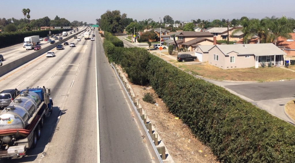
The main source of the 605 CIP planned destruction through Downey is not actually along the 605 Freeway, but is more focused along the 5 Freeway.
In September, Downey resident Alexandria Contreras raised the alarm – via Twitter – about the 605 CIP and the harm that it would do to Downey’s homes, schools, parks, and more. Contreras works as an organizer for California YIMBY and is currently running for Downey City Council. Contreras grew up in Downey; her childhood home where her parents still live is two blocks north of the 5 Freeway. Contreras describes the Downey sliver north of the 5 as “Downey but not Downey” noting that the area has smaller lots, lower property values, less infrastructure (no parks – few schools), more working class homeowners, and more Latinos. Like much of Downey, the area is largely single-family homes.
Contreras relates that her grandparents had been displaced from their home in Boyle Heights – for a freeway project there. Her parents, a school bus driver and a teacher’s aide, moved to Downey because they could afford it.
Contreras points out that Metro’s 5 Freeway widening plans appear to target more demolition on the north side of the 5 than on the south. She describes the area on the south side of the freeway as “Downey Estates,” where many homes are valued at a million dollars.
Metro has not posted current maps showing exactly which Downey homes will be demolished for the 605 CIP project (Streetsblog requested this from Metro but has not received it yet – see note below), but Metro’s 2014 project maps do show more destruction on the north side than on the south. The 2014 maps do not appear to correspond to the numbers listed in the right-of-way impacts chart above.
Contreras points out Metro-targeted homes where her friends lived and where she played in the backyard as a kid. Her nearest park while growing up – Dennis the Menace Park (located immediately south of the 5 Freeway) – is slated to be trimmed to make way for freeway widening.
Standing in front of Unsworth Elementary School, which she attended and which is targeted to lose part of its playground, Contreras said she wished Metro people would visit and see “this project is not an improvement, it’s destruction, state sanctioned violence.” “It hurts so many people,” she lamented, further calling the project “immoral and unjust.”
Tearing down homes in these Downey neighborhoods, according to Contreras, “isn’t so much an environmental issue as much as a racial justice issue.” For families like hers, these homes represent “generational wealth” that working class parents strived for and accomplished and proudly hope to pass along to their children.
After learning about Metro’s plans, Contreras urged people to submit input to Metro. Per Metro’s presentation, the 605 CIP plans (Environmental Impact Report – EIR) public comment period had started on September 18th. Metro tweeted dismissive responses that “these are very early studies… nothing has been decided and nothing is imminent.”
It turned out that Metro had postponed the announced EIR, but has yet to actually announce this anywhere publicly. Metro’s spokesperson Brian Haas responded to Streetsblog that the 605 CIP is now expected to go to public comment in early 2021. On September 30, Haas wrote that new information will be posted at the project webpage in a few days. Today the webpage still does not appear to have been updated since around 2018. It currently states that “Public hearings are planned for summer 2020.”
At a time when Metro has been proclaiming its “commitment to fighting racial injustice” and reckoning with its past racist practices including admitting that freeways “were built through minority communities while more affluent, whiter communities were spared,” Metro’s 605 CIP plans openly conflict with the agency’s adopted equity platform. Demolishing homes and apartments during a housing crisis is inexcusable. So is adding highway lanes that increase emissions during a global climate emergency that is contributing to record wildfires throughout the state.
As Contreras urges, Metro needs to visit the neighborhoods it plans to raze, and to listen to the families whose homes it plans to demolish, and to rethink its freeway “improvements.”
Note – added 3 October: Streetsblog received a vague response regarding where Metro’s announced 1,200+ impacted parcels are actually located. Metro’s spokesperson Haas responded that “At this time we don’t have anything we can provide as that is all still under development for the Draft EIR” and stated the details “will be made public for review with the circulation of the Draft EIR, which will be released in 2021.” So, at this time, Metro has announced its 605 CIP plans to acquire 360+ parcels, of which 250+ are in Downey, but is not making public the specifics of which actual parcels are threatened.
Streetsblog L.A. San Gabriel Valley coverage, including this article and SGV Connect is supported by Foothill Transit, offering car-free travel throughout the San Gabriel Valley with connections to the new Gold Line Stations across the Foothills and Commuter Express lines traveling into the heart of downtown L.A. To plan your trip, visit Foothill Transit. “Foothill Transit. Going Good Places.”
Sign-up for our SGV Connect Newsletter, coming to your inbox on Fridays.

Read More:
Streetsblog has migrated to a new comment system. New commenters can register directly in the comments section of any article. Returning commenters: your previous comments and display name have been preserved, but you'll need to reclaim your account by clicking "Forgot your password?" on the sign-in form, entering your email, and following the verification link to set a new password — this is required because passwords could not be carried over during the migration. For questions, contact tips@streetsblog.org.