South Park Renovation to Enter Next Phase this Month
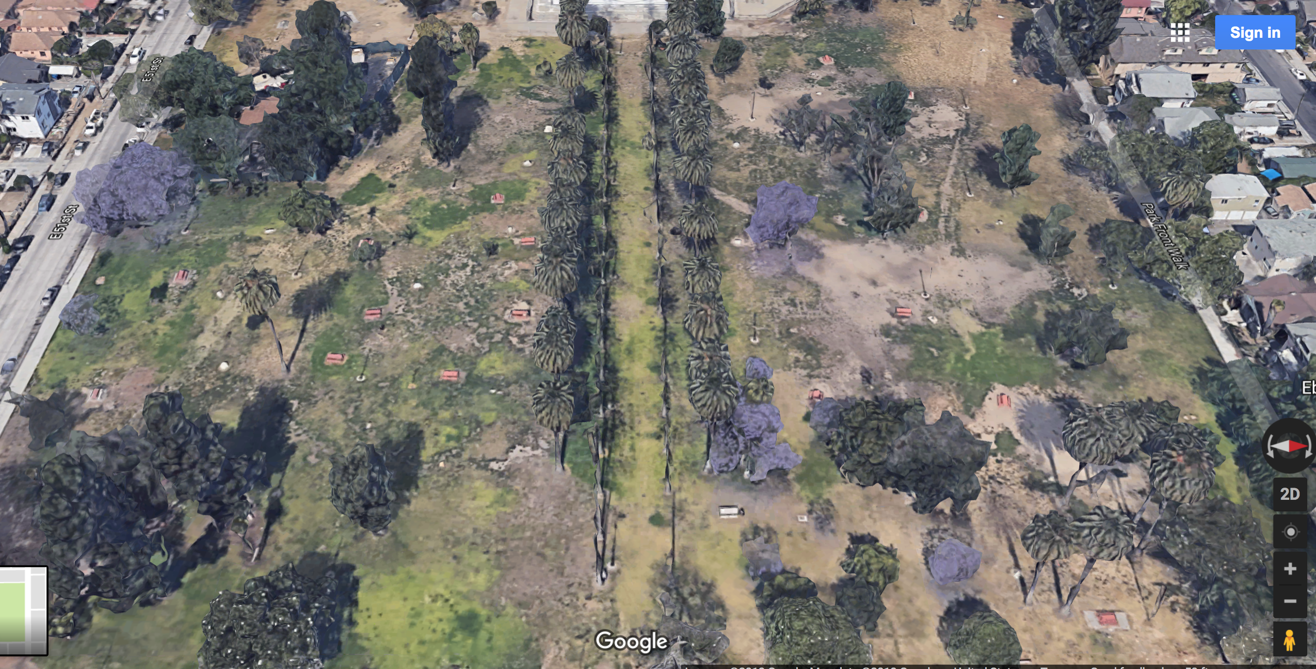
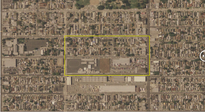
The eastern section of South Park will undergo a major renovation beginning this month. (Google maps)
Next week Monday (April 9), from 5 to 7 p.m. at the South Park Rec Center, the community is invited to discuss the major renovations planned for South Park set to begin later this month.
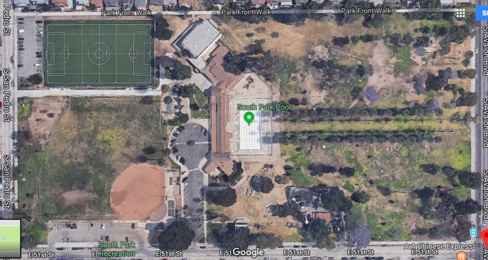
The $12 million effort to renovate the 18.25-acre park at 51st and Avalon has been underway for several years.
The park already featured a gym, a swimming pool, basketball and tennis courts, a baseball diamond, an outdoor stage, a fitness area, picnic tables, and a children's play area, but many of the facilities were run down. Years of disinvestment and neglect had meant that by the time the early aughts rolled around, the grassy and picnic areas appeared permanently trashed while other facilities buckled under wear and tear and lack of maintenance.
A 2003 dedication (and 2007 re-dedication) of the park to R&B singer Barry White, who had grown up blocks from it, sadly meant little in the way of tangible improvements for the space. Area gangs, some of whose history with the park dated back to the pre-Crip days of the Businessmen, had held sway there for too long, limiting residents' access to it and giving the city yet another excuse to write it off.
Cameras put up there in the mid-2000s finally succeeded in suppressing some of the worst of the violence. Or, at least, pushing it to the park's perimeters. But the lack of sustained complementary programming and investment in the youth of the area - especially for the members of the various gangs that now called the neighborhood home - has meant that the community was largely left to forge its own ways forward.
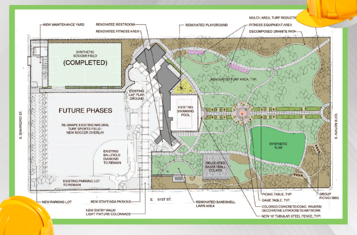
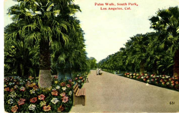
The new and improved version of the park will feature a synthetic soccer field (completed two years ago as part of phase 1), a restored Palm Alley (below), new basketball courts (to replace the ones removed to make way for the soccer field), improvements to the restrooms, an outdoor fitness area, walking/fitness paths, a splash pad and/or skate park, improvements to the baseball diamond, new lighting, group picnic areas and game tables, a synthetic turf meadow, a renovated band shell, drinking fountains, and improved ADA compliance.
Achieving the makeover of the eastern section of the park will require it being fenced off through December. Monday's meeting at the recreation center will address that process and more.
Other changes around the neighborhood
The makeover is one of several major changes that are remaking the landscape of the South Park neighborhood.
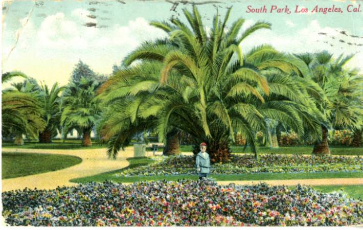
The park itself is one of Los Angeles' oldest - created in 1899 and viewed by the whites that lived in the area at the time as the "the Monte Carlo of Los Angeles, minus the wicked jingle of the coin," thanks to the constant presence of horsehoe pitchers and enthusiasts of checkers, pinochle, and "tiddle-dee-winks" (a variation on horseshoes said to have been invented by South Park patrons).
As whites moved out and the area became predominantly African American, the park first became a site of celebration of the jazz culture spilling out of Central Avenue before being host to anti-war and other protests in later years. [See KCET's write-up on the history of the park for more details and images.] Even as recently as 2002, Barry White joined members of the community to protest the razing of 70 homes a block away to make way for Maya Angelou High School.
Barry White notwithstanding, the new high school would be completed in 2011 (see RentCafe's before/after here).
The transformation of a former bus maintenance yard next door to the school into the South Los Angeles Wetland Park would follow suit in 2012.
The Los Angeles County Museum of Art was recently granted permission to convert the structure on the wetlands lot into a satellite site that intends to offer access to art and community-serving programs to a neighborhood that has been long deprived of them.
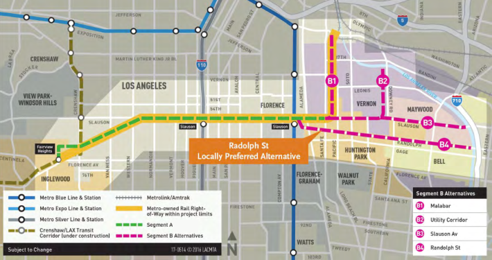
And a few blocks further south, at Slauson, the city is preparing to transform a rail right-of-way into a six-plus mile bike and pedestrian path connecting the Blue and the Crenshaw Lines (before eventually extending to the L.A. River through some of the Southeast Cities).
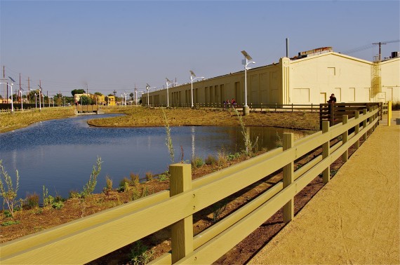
Construction is expected to begin on Segment A of that project (below) later this year and should be completed some time in 2019.
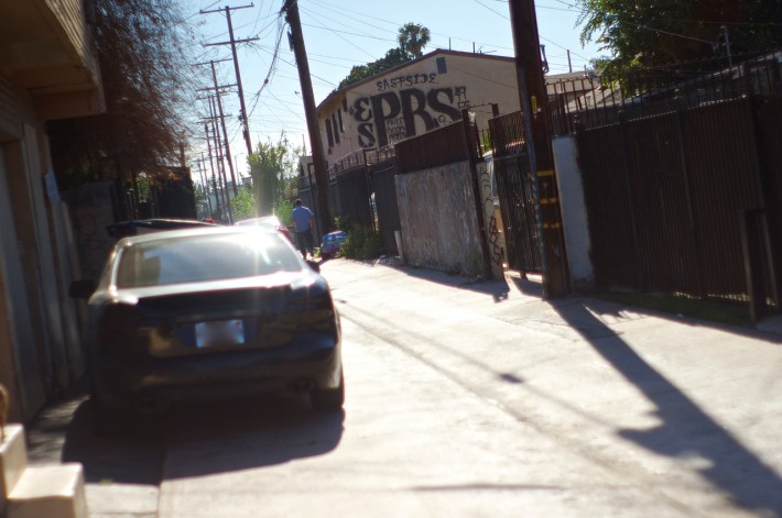
A green alleys pilot project helmed by the Trust for Public Land has already completed two segments of the alley network meant to connect Maya Angelou students to South Park, a neighborhood shopping center, and their homes.
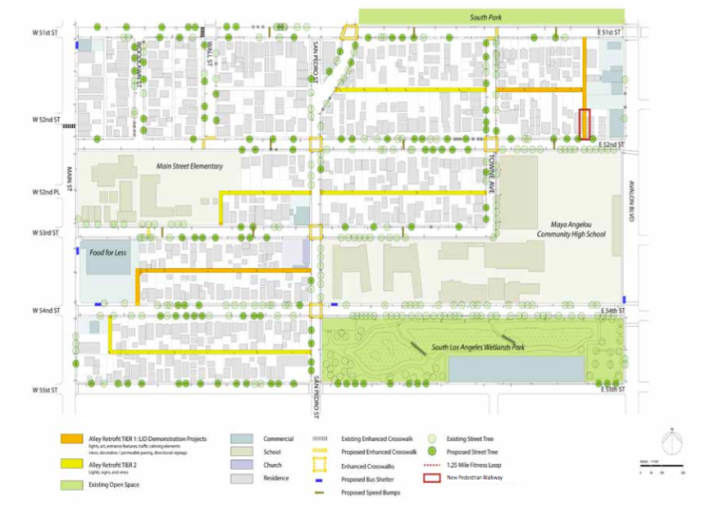
The project, aimed at both improving mobility for youth (many alleys throughout South L.A. have long been gated because of their tendency to attract unhealthy activities) and capturing and filtering the dirty runoff water that can collect in the alleys, has been in the works for some time.
The launch of the project actually dates back to 2010, when the local Community Redevelopment Agency (CRA) was funded to develop the South Los Angeles Green Alley Master Plan. The plan was to include a more extensive network of green alleys, streets, and community connections beyond the Avalon network. But when the CRA was dissolved in 2012, stewardship over the program was transferred to the Bureau of Sanitation and seemed to lose much of its momentum.
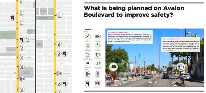
Finally, Great Streets and Vision Zero treatments aimed at slowing Avalon and making it safer for all users along the length of the boulevard should begin to appear over the next year. The planned improvements include a road diet for the street (reducing travel lanes to one lane each way and putting a center turn lane in the middle), fully protected bike lanes south of the park (from 56th to Manchester instead of between Vernon and Adams, as the lane was originally intended to run on Central), speed feedback signs, leading pedestrian intervals, flash beacons at crosswalks, curb extensions, designated spaces for left turns, new traffic signals, and bus stop relocations. [See the full map here]
So many major changes happening at once can be unnerving for residents.
"Why now?" is a question often heard where folks have been denied resources and amenities for too long.
South Park's makeover, it appears, is intended for the area's long-time residents.
First proposed several years ago, the current renovations are possible now, in great part, because funds for these projects have grown in the last few years. The recent increase in Quimby fees (collected from developers for investment in green space within a few miles' radius of the new development) and the availability of $35 million from the Housing-Related Parks Program (which rewards the development or rehabilitation of affordable housing by dedicating funds to the creation or rehabilitation of park and recreational facilities for low-income residents) both aided in finally moving this project forward. Over the last several years, both of these sources of funding have been behind things like the new synthetic soccer fields popping up around South Central, the overhaul of the 109th Street rec center, the universally accessible playground at Vermont and Gage, the major upgrades at Harvard Park, and also some of the newer pocket parks spotted around the community.
Other projects, like the Rail-to-River bike and pedestrian path and the green alleys projects may appear to be coinciding with the makeover, but have been in the works for six years or more and are part of the effort to carve out more green space for the otherwise park-poor community. Or, in the case of the Rail-to-River project, they are also part of an effort to make a transit investment (the Crenshaw Line) work for area residents. More recent campaigns to fix up streets, like Vision Zero, are part of larger city-wide efforts to change the culture around driving and safety. And LACMA's arrival is due, in part, to the fact that the museum's own pending makeover will downsize it, forcing it to stake out the space it is losing at its main campus in the communities it should have been serving all along.
Hopefully, the city will consider greater investment in programming for at-risk youth so that the new facilities at South Park are genuinely accessible to all and to ensure the community feels it has ownership of such a historic space. Either way, a makeover of this scale is a very good start.
The next phase of improvements to South Park are scheduled to begin this month. Join the community at the rec center at 345 E. 51st St. this coming Monday, April 9, from 5 to 7 p.m. for more information about the project.
Stay in touch
Sign up for our free newsletter
More from Streetsblog Los Angeles
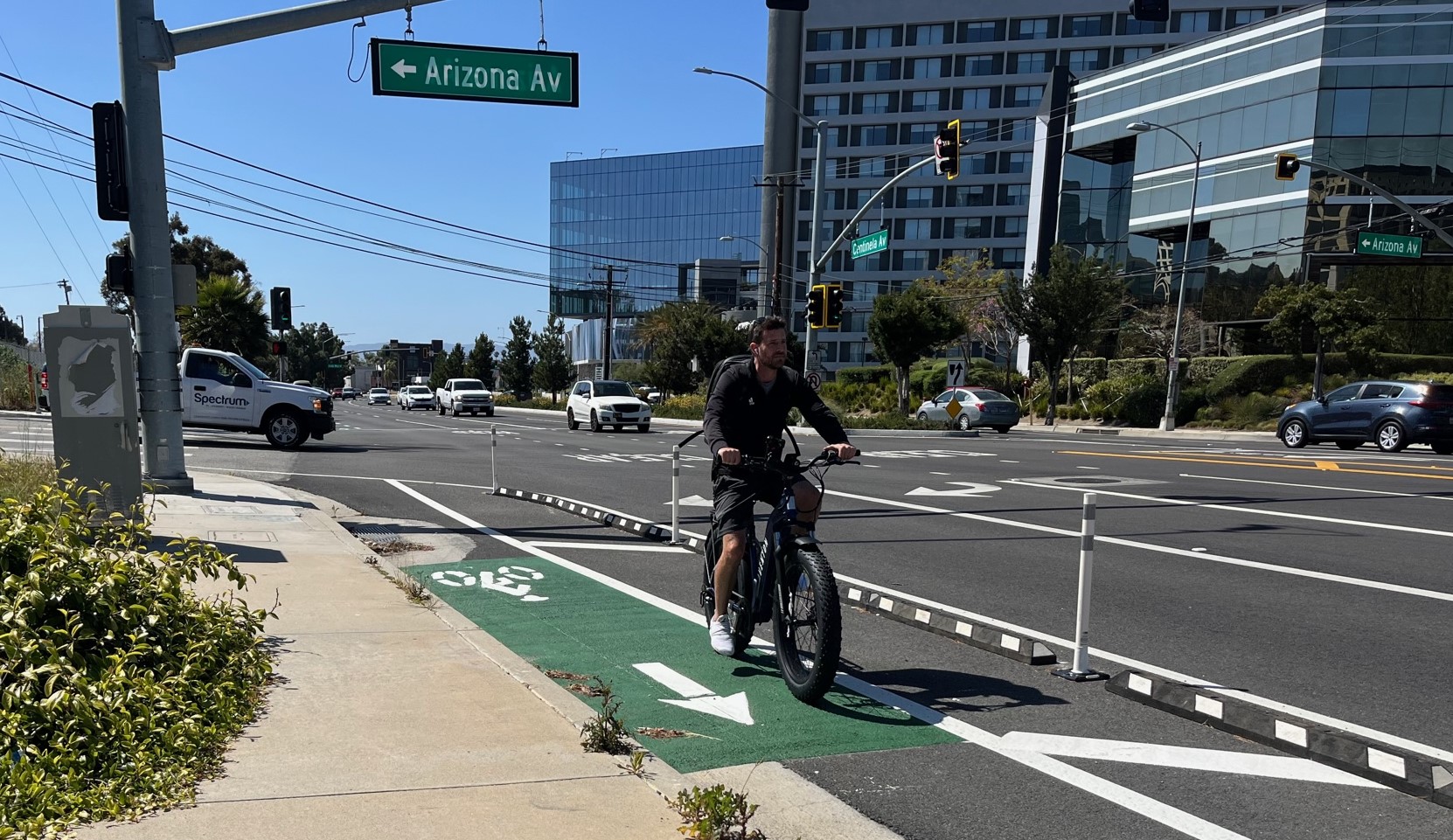
Eyes on the Street: Recent Centinela Bike Lanes in Culver City
The new partially-protected Centinela facility is a welcome safety upgrade for a stretch that long lacked any type of bikeway, but the area remains not all that bike-friendly

This Week In Livable Streets
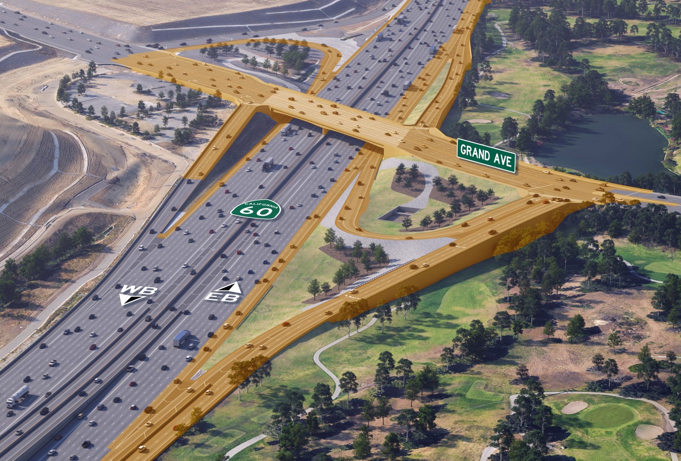
Bike Month continues, Metro 91 Freeway widening, Destination Crenshaw, Culver City Bus, Santa Monica MANGo, Metro bike lockers, Metro Sepulveda Transit, and more