To Restore Walkability, Cities Like Akron Need to Look Beyond Sidewalks
Akron’s new planning director Jason Segedy is on a mission to make the city walkable again. Among his signature initiatives is an effort to restart the market for new housing. He’s also rethinking street design, with a protected bike lane on Main Street now a permanent fixture, following a short-term reimagining in 2015. The city is even moving forward with a teardown of the Innerbelt freeway.
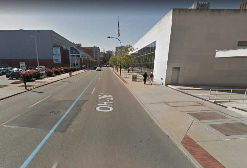
But as Segedy wrote in a recent Twitter thread, walkability in Akron suffers not just from wide streets but from car-centric, “monolithic land use” that deadens street life. Using High Street through downtown as an example, Segedy explains how the preponderance of parking lots and gaps in the street wall disrupt the walking environment.
On the west side of this 3,500-foot stretch of High Street, Segedy explains, someone on foot would spend most of the time walking past 2,266 feet of parking, and just a few seconds going by 108 feet of retail frontage.
On the east side, you would walk by 1,125 feet of parking. Most of the street frontage is public buildings and offices — no retail.
So on two-thirds of a mile of this downtown street, Segedy notes, there’s just one restaurant and one store. And no one lives there.
“We’re working hard to improve the streetscapes and physical infrastructure, but the real obstacle to overcome is the monolithic land use,” he writes. “For this corridor to be activated, appealing, and attractive, that surface parking has to evolve into mixed-use residential.”
The challenge for Akron, he says, is to pair its “great civic assets” with housing and retail — “the mortar that holds the bricks together.”
More recommended reading today: The Urban Edge considers the causes of the national decline in bus ridership. Pedestrian Observations says American transit agencies slow down bus service by spacing stops much closer together than their European and Asian counterparts. And Slow Roll Chicago looks at how Chicago’s Vision Zero efforts might further, rather than set back, racial justice.

Read More:
Streetsblog has migrated to a new comment system. New commenters can register directly in the comments section of any article. Returning commenters: your previous comments and display name have been preserved, but you'll need to reclaim your account by clicking "Forgot your password?" on the sign-in form, entering your email, and following the verification link to set a new password — this is required because passwords could not be carried over during the migration. For questions, contact tips@streetsblog.org.