A Visual Representation of L.A.’s Rail Growth Under Measure M
We’re working on a couple of larger stories for later in the week, but in the meantime we thought readers would appreciate this map by Adam Linder.
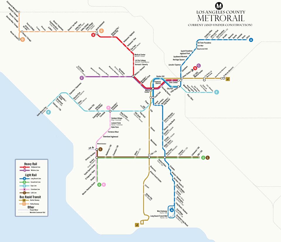
Linder’s map shows how Metro Rail and Metro Rapid Bus will grow in the coming years from where it is now (including lines under construction) to where it would be, assuming a Measure M build-out.
The Southern California Streets Initiative has not taken a position on Measure M. SCSI publishes not just the three California-based Streetsblogs, but also LongBeachize and Santa Monica Next.
If you like Adam’s map feel free to drop him a line at Infinite3Ent@gmail.com or find him on Instagram at adamglinder.

Streetsblog has migrated to a new comment system. New commenters can register directly in the comments section of any article. Returning commenters: your previous comments and display name have been preserved, but you'll need to reclaim your account by clicking "Forgot your password?" on the sign-in form, entering your email, and following the verification link to set a new password — this is required because passwords could not be carried over during the migration. For questions, contact tips@streetsblog.org.