America’s Sorriest Bus Stop: San Francisco vs. Hillsboro, Oregon
Oh, the terrible places you’ll go to catch a bus. So far this week in our hunt for the Sorriest Bus Stop in America, a bus stop in Boston knocked off a real catastrophe in Nassau County to advance to the second round. Meanwhile, voting remains open until midnight in a tight contest between Maryland and Delaware.
Help narrow the field of 16 dangerous, uncomfortable bus stops down to eight by voting on these two West Coast competitors.
Hillsboro, Oregon

This sad space comes to us from Sameer Moudgil. People really do wait for the bus here — notice the human being on the left side of the Google Street View. Moudgil writes:
It has no bench, no shelter, no sidewalk and no crosswalk access within 0.3 miles. It sits sandwiched between the edge of a 50mph 7-lane stroad (including 2 bike lanes) and a heavy railroad track. The cherry on the cake is the Ford car/truck dealership on the other side of the stroad. I wanted to get a better angle from near the bus-stop but I couldn’t muster up the courage to cross this freeway-like behemoth. I wonder how the lady in the Google street view image managed to do it.
Here’s an alternate view that better captures the atmosphere:

Agencies in charge: Oregon DOT, Tri-Met.
San Francisco

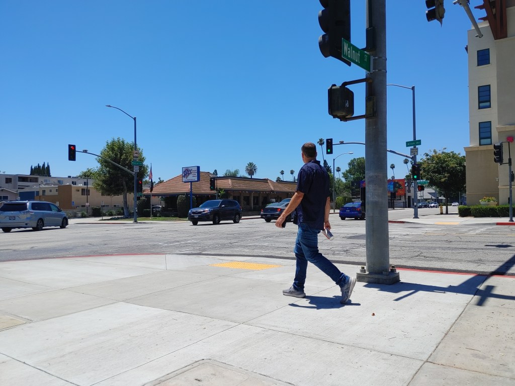
This stop on Lincoln Way, outside Golden Gate Park, comes to us from Janice Li, who writes:
I know this is probably not the nation’s most compelling example because of San Francisco’s dense urban landscape (“how bad can it be?”, I imagine people would say) but there were 3 pedestrian deaths on this corridor in five years. This location remains on San Francisco’s high-injury network, as designated by the city’s Department of Public Health.
Lincoln Way forms the southern border of SF’s premiere park, Golden Gate Park. It has a 35 mph speed limit but is a known speed corridor (and I can confirm speeds tomorrow when I’m at work).
The 29-Sunset outbound drops you off on a patch of sidewalk. You notice that there is actually no sidewalk on that side of the street, despite that being the edge of the park. So, for example, if you want to take the bus to go the park, you have to cross the street, walk a block or two to wherever the next park entrance is, then cross again.
There are zero traffic controls at nearly every crossing along Lincoln Way (no stop signs, traffic signals, etc.). You hope for the goodness of people, who are driving 40-45 mph, to see you in time and stop.
Agency in charge: SFMTA.
An interesting choice today — the suburban stroad bus stop without much besides a stick in the ground vs. the urban bus stop with minimal pedestrian infrastructure that exposes more people to dangerous conditions.
Here’s the map of all the contestants so far, with today’s matchup in green.

Read More:
Streetsblog has migrated to a new comment system. New commenters can register directly in the comments section of any article. Returning commenters: your previous comments and display name have been preserved, but you'll need to reclaim your account by clicking "Forgot your password?" on the sign-in form, entering your email, and following the verification link to set a new password — this is required because passwords could not be carried over during the migration. For questions, contact tips@streetsblog.org.