Lancaster’s Livability: An Interview with Planning Director Brian Ludicke
The city of Lancaster, population 160,000, is the fifth most populous city in L.A. County. It occupies about one hundred square miles in the Antelope Valley, separated from the L.A. Basin by the San Gabriel Mountains. Lancaster is at the northern terminus of Metrolink’s Antelope Valley line, a two-hour train ride from downtown Los Angeles.
Though it is arguably more commonly associated with people getting out of the city into the suburbs, Lancaster is among a handful of Los Angeles County cities that are leading efforts to re-imagine and retrofit car-oriented streets to be safer, healthier, livable, and multi-modal.
Brian Ludicke is the city of Lancaster’s Planning Director, a position he has held since 2001. Prior to that he served in various Lancaster planning positions since 1984. Ludicke’s Lancaster roots go back to 1958, when he and his parents moved there. He graduated from Antelope Valley High School and Antelope Valley Community College, and holds a BS in Urban Planning from Cal Poly Pomona.
This interview took place at Lancaster City Hall on June 2, 2016.
SBLA: We met at Chuck Marohn’s talk in Pasadena. What appeals to you about Strong Towns’ outlook?
Brian Ludicke: Several years back we had a person in the city who was working on his master’s degree. He asked if I had information on how much sprawl costs. Instinctively, we know that it’s more expensive to maintain sprawl. The city had tried several years earlier to come up with a way of clarifying this. In the attempt to help him on that, the search engine kicked up one of Chuck’s blogs. That led me to the site and I was absolutely enthralled.
Here was a guy who I felt I could relate to. I’ve only had that experience a couple times in my professional career. One was when I heard [Congress for New Urbanism founder] Andrés Duany talk back in 1991.
Reading Chuck’s stuff, I said, “this guy is talking about the very things we’re dealing with.” We’re talking about 2010-2011 here. The city had just gone through its downtown revitalization effort. We had done a lot of work trying to understand street design. We had just focused on what made a better environment.
What Chuck brought into the discussion was: what’s the real purpose of a street? If the purpose of a street is to be a platform for wealth, what you’re doing here is more than just making a nice place to be. What is the benefit of that to the surrounding property and to the city?
There are more now, but at that time, Chuck was one of the few people who said that there’s a very real municipal revenue issue here. You have a lot of municipalities that are going broke. They’re going broke because [of] the very things that you’ve intuitively understood, which is that this infrastructure is far too expensive to maintain for what you’re getting back for it.
That tied to something that Dan Burden had said when we were doing our Master Plan of Trails and Bikeways. He made a statement that you as a city should never make an investment that doesn’t return you a high yield. You can no longer afford to just make poor investments. You can never again invest in infrastructure that degrades the property around it.
I can look at where we’ve done that. Where we’ve widened streets, where the whole idea was to save people 30 seconds of time, but what it did is it started just degrading the property along it.
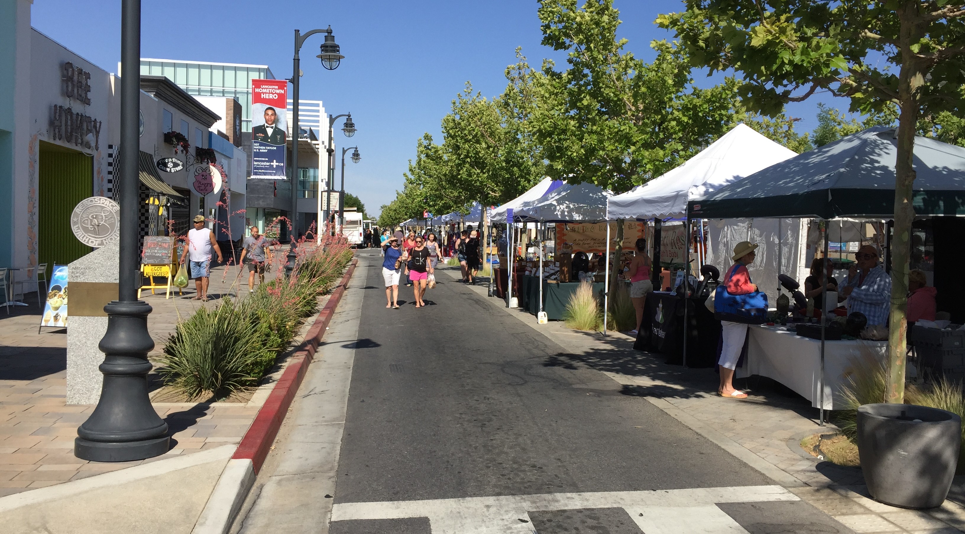
On Lancaster Boulevard you can see the results of widening. Lancaster Boulevard, west of here, was a street that went from a two-lane street to a four-lane street. The city made it better, easier to drive down. Speeds slowly picked up. What you can see there today are places where, slowly, not everybody, but slowly over time they’ve erected walls and fences and things to separate their front yards from that street.
The city is going to right-size that street back to two lanes, one lane in each direction. It’s going to be interesting to see if this process reverses. But you can see the loss of the value. That’s a specific example where, in the attempt to design a street for the sole purpose of moving as much traffic as fast as possible, we ended up degrading perfectly good areas along either side of it.
Along with that, what are some of the issues that the city of Lancaster is facing?
I think the biggest issue is that we have a development pattern that is dominated by low density, scattered, single-family residential development. Unlike a denser, more developed city that may have single-family that connects to other stuff, we tend to have these isolated, separate-from-each-other areas. The infrastructure [needed] to string that together is expensive to maintain.
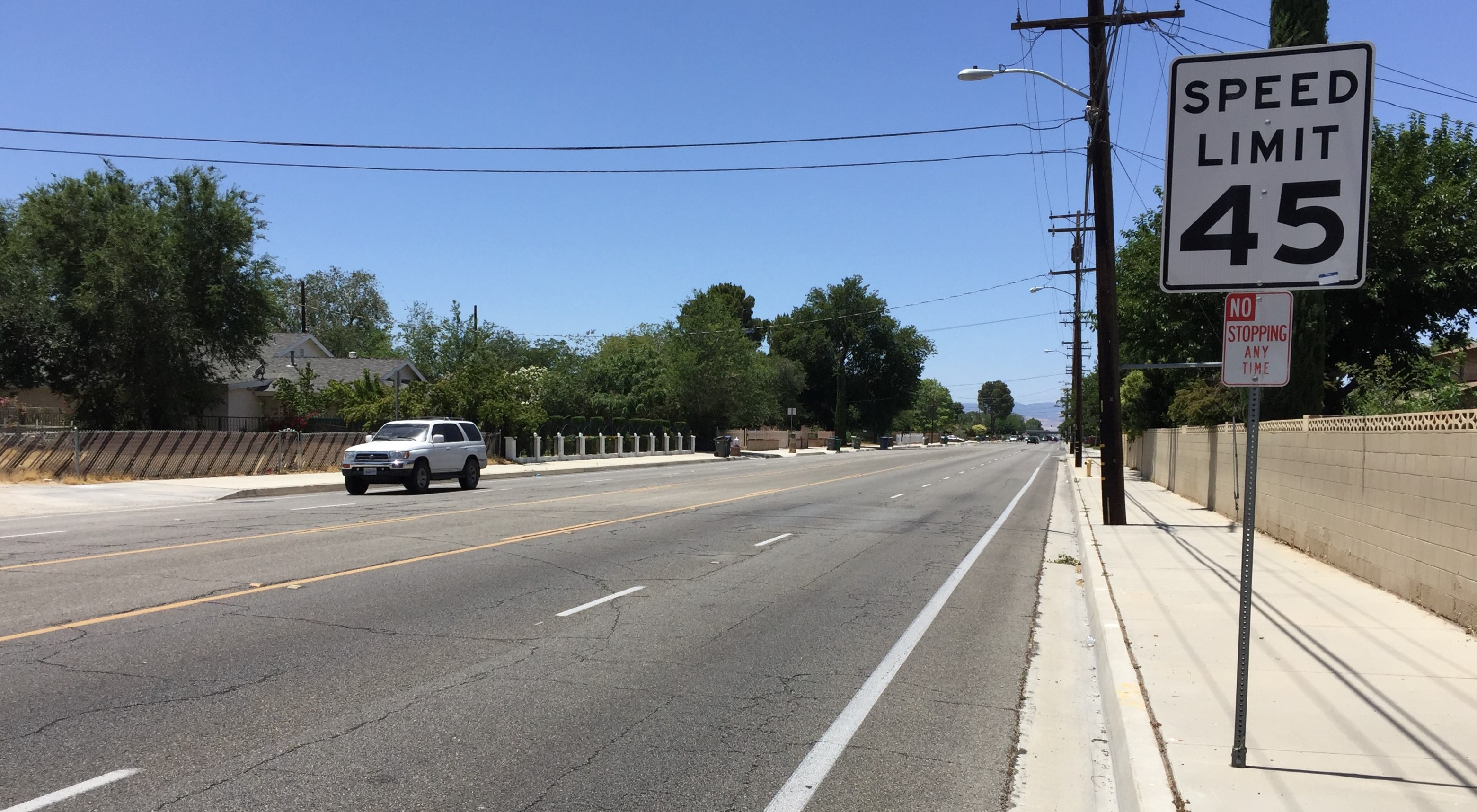
We inherited the county of Los Angeles’ master plan of highways. Their master plan is very simple. You’ve seen it in the San Fernando Valley with more development in it. It’s basically every mile street is a hundred foot right of way, and every half-mile street is eighty, or we made it eighty-four.
The goal of that was to create this large-scale grid. Then everything would develop inside it. You can see that pattern out on the outlying areas to the east and west of the city. That’s what we thought was the proper way to be doing things because, as a former city manager once said, that’s what every planned community does, so that’s what we should be doing. We did it with the best of intentions. You don’t want people to have to sit in congestion. They didn’t come here to live in congestion. You wanted to be able to get quickly safely everywhere.
That street pattern not only carries with it a long term financial burden, but we are reaping the rewards in terms of what I would call outright carnage on our streets.
We had, last year, 23 people killed in vehicle collisions. That’s a combination of people killed in cars, pedestrians, people on bikes. That may not sound like a large number, but on a basis of how many people per 100,000 in your city are getting killed every year, our number is like 14. Compare that to other major cities. I have a son in San Francisco; theirs is 3.5. Las Vegas, no walker’s paradise, is only seven. Atlanta, which is a pretty sprawled metropolitan area, is like nine. Even L.A.’s is [6.27] and the mayor said this was too many.
A lot of the reason for that goes back to speed and the perception that it’s safe to go fast. We’ve tried to design that for years through all parts of our city.
I talked with one of the traffic people from the sheriff’s department who patrols here. He told us that, of all the the cities that they patrol, ours has the highest rate of fatalities. I asked what’s the major cause of these collisions. He said it’s always speed plus something. Speed plus poor judgment, speed plus impairment, speed plus [Ludicke gestures texting] I feel so safe on this street I have time to be doing this with my cell phone.
There’s a definite physical cost. There’s a fiscal cost. There’s a health and wellness cost.
The city has been engaged in, in the last two years, a citywide Safe Routes to School Master Plan. There are areas of our city where there are a lot of kids that walk to school. Stunningly a lot, when you think about a place where most people just put their kids in the car to go somewhere. We’re finding that if you have 100 kids walk to school in the morning (walk, bike, or roll – we don’t have as many kids on bike, but on scooters or skateboards), three times that many go home that way in the afternoon. I think what you’ve got is you’ve got parents who drop them off. They go to work. They can’t pick them up in the afternoon, so they have to find other ways to go home. A lot of kids cross four- and six-lane streets that are 40 and 50 miles an hour. In some cases they’re controlled with signals. In some cases they’re controlled with nothing but a crossing guard. Crossing guards have told me that they’ve had their toes run over. They’ve had people just outright ignore them.
So you’ve got a cultural challenge here also. I think this is best exemplified to me by a guy who called me last fall.
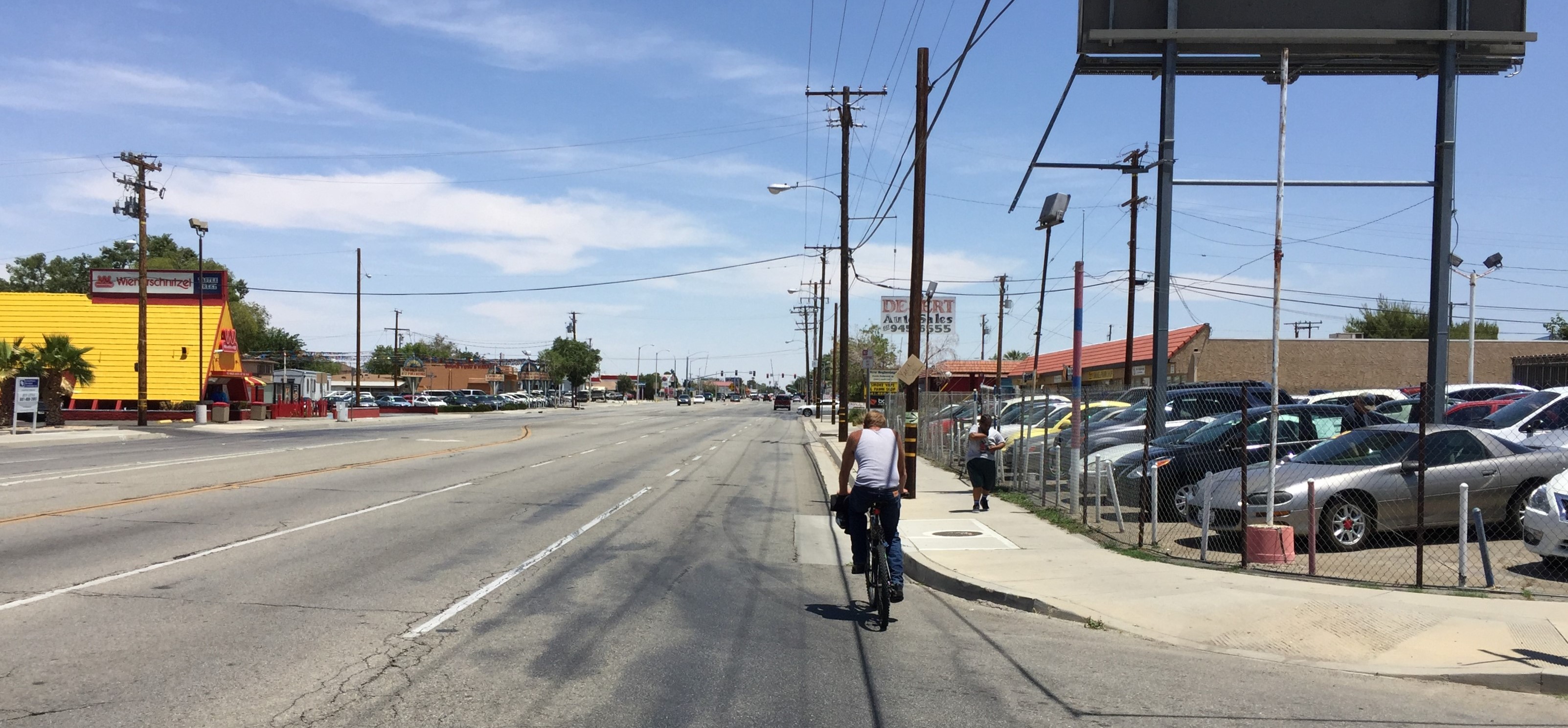
He was very upset about a particular article in one of our city publications. A couple years back, the city did a right-sizing on Valley Central Way, a four-lane commercial street, about a mile west of here. It’s a short street, a half-mile long. We didn’t have a lot of people walking or biking on it, but it somehow managed to get 70 collisions on it in a three-year time frame. We basically used paint; we put in bike lanes, narrowed it from four lanes to two. Then we watched what happened.
We saw a 75 percent reduction in collisions, and about a five to eight mile per hour reduction in speed, and, interestingly, about a 10 to 15 percent increase in the amount of traffic, which makes the owner of the adjacent shopping center happy. We put an article out saying, “We’re so happy with the results of this. We can do this in other areas of our community.”
The caller was just was livid about that. His comment to me was,”You know all those people that you care about — those people on bikes and those people walking — are non-productive people.” I said, “Really? School kids? Elderly people trying to get to the bus stop? Non-productive?” He responded, “You need to worry about people driving to work. That’s me.” So you have a cultural issue here also.
What projects has Lancaster been doing on-the-ground? Valley Central Way – any other successful projects you’ve implemented?
In line with the Strong Towns philosophy, we’ve been doing things a little bit at a time to see what happens. Valley Central is a great example because it’s paint. If it turns out to not have any good results, it’s simple enough to turn it back over to what it was.
Lancaster Boulevard [through downtown Lancaster] is the gold standard. That’s a street right-sizing, but it’s a gold-plated right-sizing.
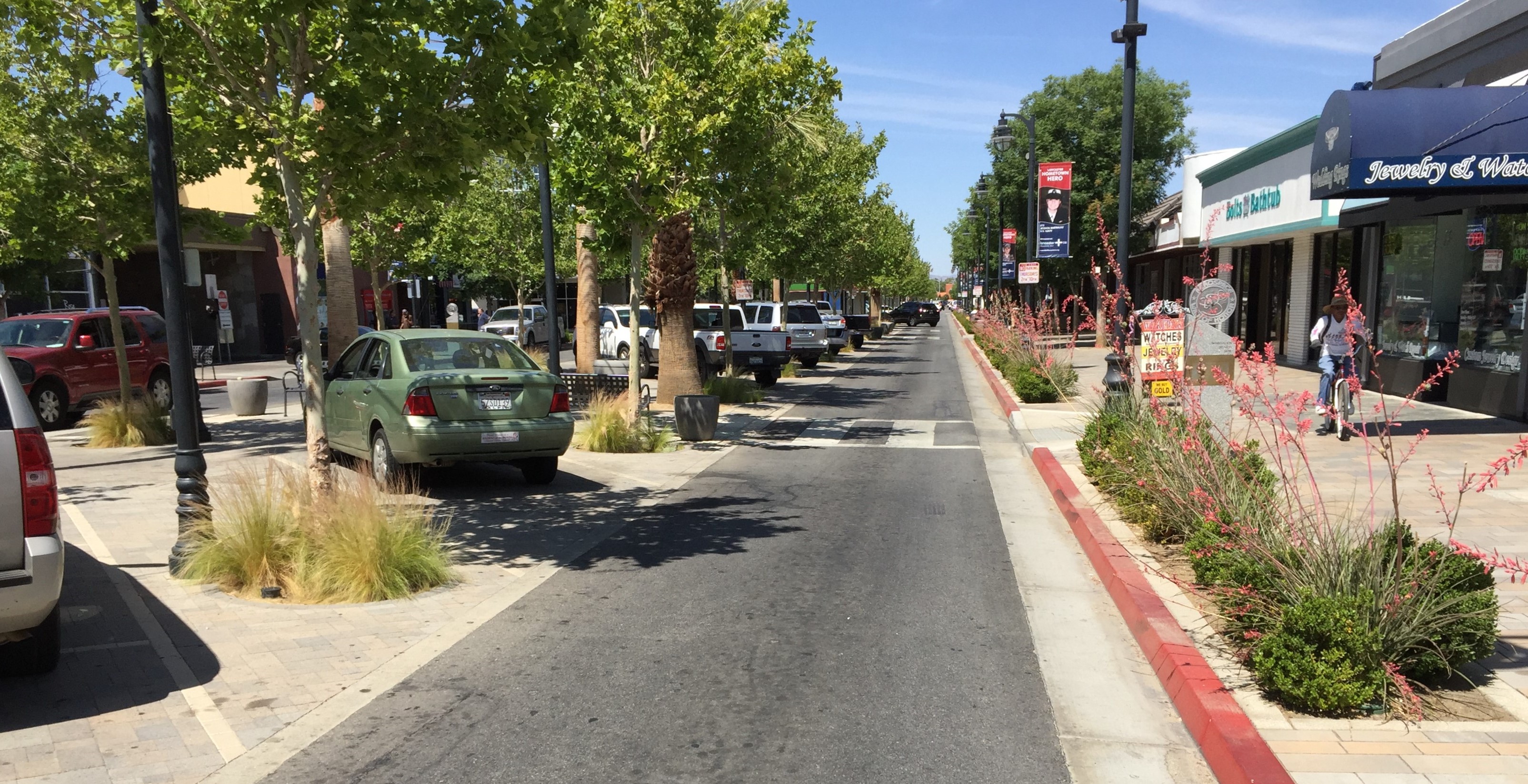
I think it’s appropriate for the core of the city. That street has achieved a lot of what we wanted. There used to be seven traffic signals on it — those are all gone. That was a major leap of faith, certainly for our city management side and our council.
Bicycling there this morning, I came to an intersection at the same time as a car. Neither of us were sure who should go, so we both slowed down, looked around. At the time, I didn’t think of it as a safety feature. The speeds there are just slow enough that you interact with others.
Late afternoon or evening, especially Thursday on a farmers market day, the more congested the street gets, the safer it gets.
Our City Engineer, a real out of the normal engineering box thinker, Michelle Cantrell argued that you can take those signals out and you’ll be OK. It took a while for people to figure it out, but the irony of it is that when people are forced to go slow and forced to pay more attention and forced to look, it’s actually safer, even though it seems like it’s not. People are negotiating; they have to negotiate the space a bit. When I’m a pedestrian, I’ll look and I’ll see people wave me across.
Lancaster Boulevard has been a major success in terms of understanding that you can create safety through things that seem counter-intuitive.
The other thing that’s happened on the boulevard is it’s attracted an enormous amount of new investment. When the city first re-did the street, you had a lot of vacant storefronts. It was a leap of faith. We had people say you shouldn’t be spending your money down there.
After the re-do, vacancy rates plummeted. We’ve had entrepreneurial businesses go in. We’ve had a micro-brewery go in. Other businesses that said this is the environment we want to be a part of. New buildings have gone in, including the new cinema; that was a parking lot. The BEX building which has these little shops in front of it was actually a grocery store turned to a furniture store with a parking lot in front of it. That now has a plaza and other things.
So the change in the street itself helped attract a change in the environment of that area. That success led us to understand that there are probably opportunities elsewhere in the community.
One of our most successful efforts, believe it or not, has been to go in and put speed humps – not bumps, humps – in existing neighborhoods. There’s one near where I live. Because I have the benefit of being at the city, I know that they did a speed survey on that street before they put the humps in. The average speed along this residential street was about 42 miles an hour. That’s the average, so you know what’s happening on a higher end there. Once they changed it, average speeds are now 22.
The only agency that complained about it was the Fire Department.
They said, “I don’t know why people would support something that increases response times” and I said, “Because you’re not on their street. You’re on their street, what, 0.001 percent of the time. But people who are driving past their house with their kids in their front yard – they’re there all the time.”
Livability advocates find that’s an issue in a lot of cities. The argument that a lot of advocates make is that fire fighters, and especially their paramedics, are busy responding to traffic collisions. The emergency responders are out there because the people are going too fast.
We made that same argument with them: if we cut by a third our traffic collisions, wouldn’t that free you up to do the other things? But I don’t want to get into a discussion about the Fire Department. They’re a different animal. While they are a part of this discussion, they can’t be the whole discussion.
We have to manage streets for the best benefit for our residents. In some cases that means you need to have a place where people can get through more quickly. But in a lot of cases, that’s not what you need. You need an environment that produces a little bit more sane behavior.
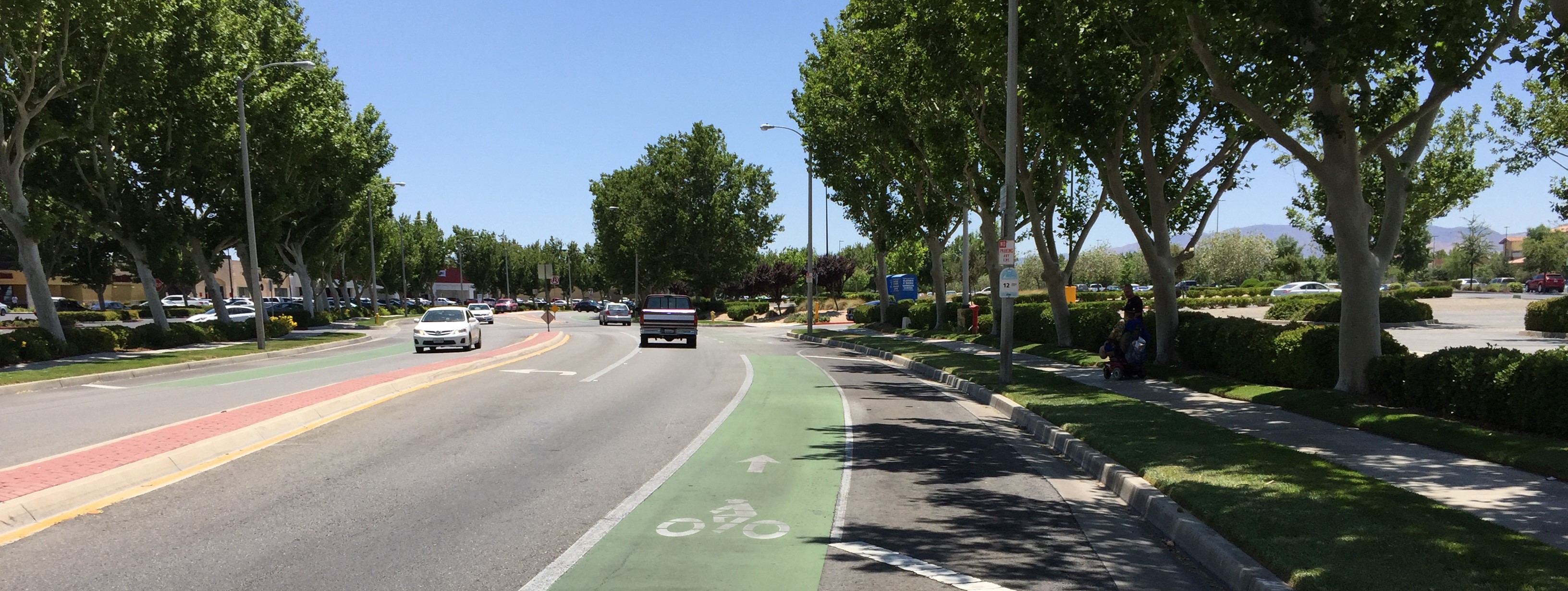
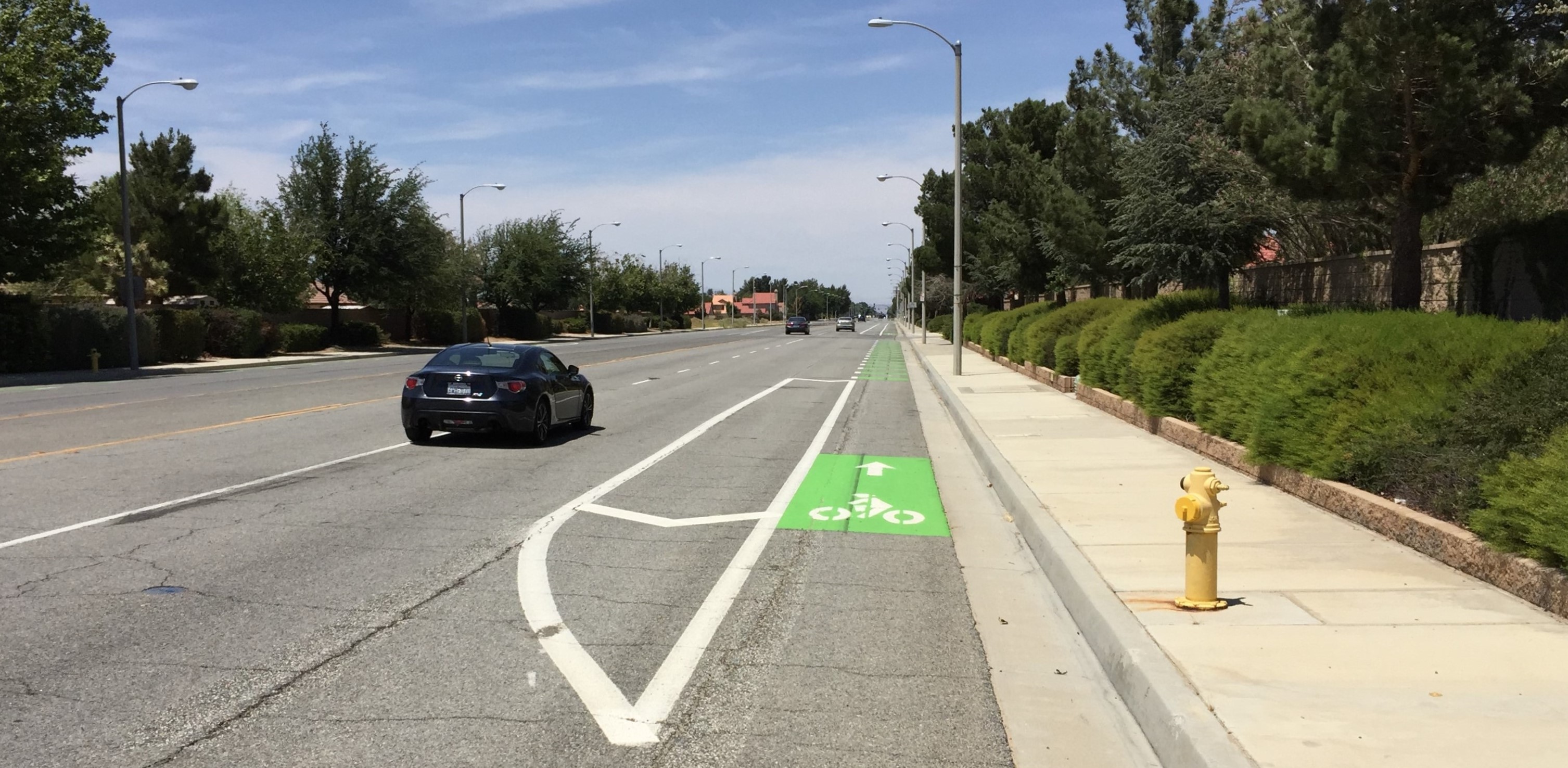
We’ve done some selected right-sizing. In many cases we’re following our adopted Master Plan for Trails and Bikeways. If we repave a street, we’ll re-stripe it.
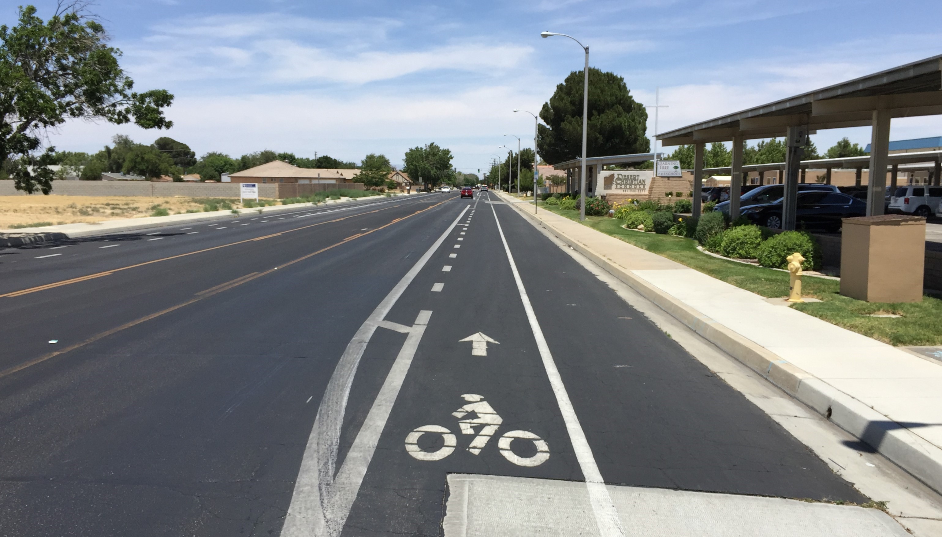
We just did that on 15th Street West for a half-mile stretch. It’s in front of a major private school in this city where you have probably a thousand-plus students who go every day. It was interesting to talk to the people who run that school. They said, “Yeah, we’re supportive of it because we have parents who are rear-ending each other on the street.” What we did by managing to take it from four lanes to two lanes is they now have that ability to move out of the traffic lane.
We’re in the middle of our citywide Complete Streets Master Plan. We are actually looking at our projected future traffic volumes and figuring out the absolute minimum necessary to accommodate them with the idea that if you can take space away from cars and you can give it to other modes of transit, that’s a positive benefit. Not only for those other modes of transit, but, to the extent that you’re able to slow traffic speed, you start to eat into some of those issues that we’re having otherwise.
People in this community intuitively know that it’s a dangerous place to drive. They talk about it all the time. But we’ll see how they feel when you start actually doing things that force that issue.
When we re-did downtown I got a call from a lady that I know. She told me she loved downtown, but didn’t love driving there. When I asked her why, she said “I have to think too much when I drive downtown.” There’s a lot of truth in that statement. We’ve made, in our culture, and our city, we’ve made it real easy to drive.
We’re also looking at eliminating our minimum parking requirements for commercial zones. We’re strategically looking at where we can put on-street parking back on, which will maybe make some of our older building areas viable again.
If you could wave a magic wand and change one thing about Lancaster – relative to streets and livability – what would it be?
I’d replace as many traffic-signal-controlled intersections as I could with roundabouts. We’ve installed one. We have two others planned. We’re great believers, at least at the staff level, in the benefits of those.
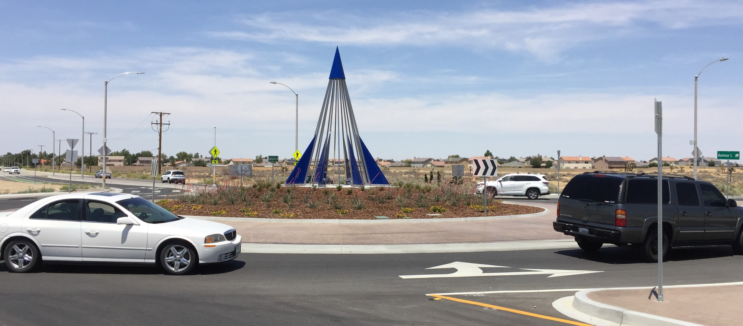
I’ll back up a little bit… As a planner, I never thought street design could be interesting. I always thought that had to be the most boring thing in the world, but I’ve learned differently. Particularly in suburban communities, you don’t need wide streets to actually carry the traffic. You need it to store vehicles at traffic signals. That’s where you get your congestion. So, in a lot of suburban cities what you’re doing is creating a wide street so you can store vehicles while you’re waiting for a signal to cycle through. Roundabouts start handling some of the flow issues at the intersections.
That’s the first thing that I would do, because that would lead to a lot of other changes. I think you would suddenly find you don’t need as much right of way.

Read More:
Streetsblog has migrated to a new comment system. New commenters can register directly in the comments section of any article. Returning commenters: your previous comments and display name have been preserved, but you'll need to reclaim your account by clicking "Forgot your password?" on the sign-in form, entering your email, and following the verification link to set a new password — this is required because passwords could not be carried over during the migration. For questions, contact tips@streetsblog.org.