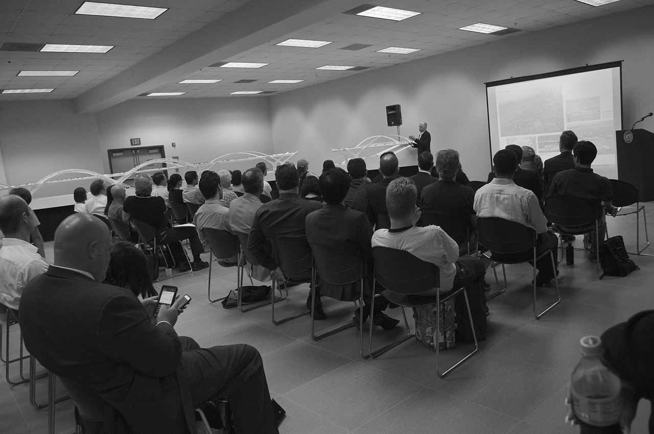
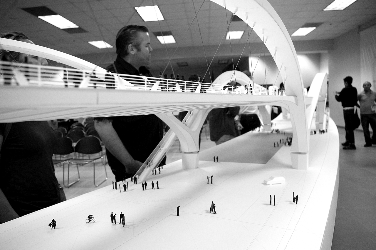
Final Sixth Street Viaduct Model Showcased at Public Briefing; Expected Completion Date, Early 2019
Cyclists ride unprotected along the reconstructed bridge. Sahra Sulaiman/Streetsblog LA
"How was the meeting?" Juan asked as I came out of the multipurpose room at the Puente Learning Center.
He was just leaving his evening English class and had missed the public briefing on the design of the Sixth Street Viaduct replacement given by Councilmember José Huizar, Architect and Principal Designer Michael Maltzan, design-build firm HNTB, the Bureau of Engineering, and Project Contractors contractors Skanska and Stacy and Witbeck.
"Have you seen it?" I asked.
"No," he shook his head.
I pulled him into the multipurpose room.
"Wow," he said, impressed. "This looks really nice!"
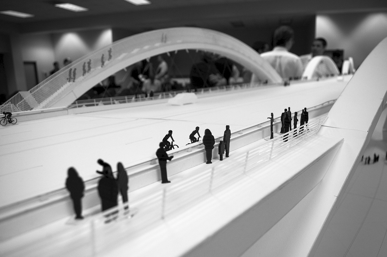
He was right -- the 47-foot model was pretty amazing.
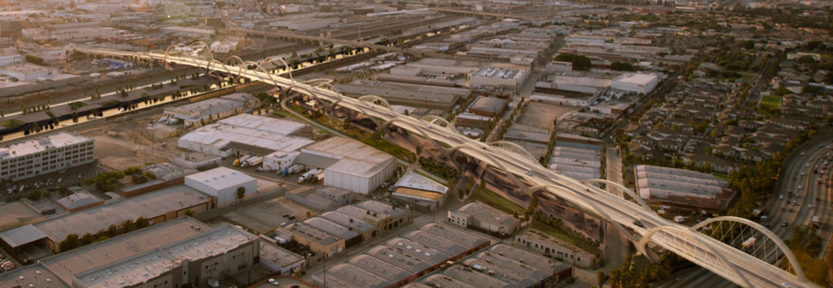
Soaring forty-foot arches book-end a "ribbon of arches" that "weave [two disparate] communities together" via a massive multi-modal structure. Thirty-foot arches run the length of the rest of the 3500 ft. span of bridge, with the exception of two sixty-five-foot arches which will be accessible to pedestrians (one is visible in the top photo, at left) looking to either climb high above the structure or access the businesses and park space (to be created as part of the project) below it.
Dedicated bike lanes run along either side of the traffic lanes. And the wide pedestrian walkway is both protected from traffic by a concrete barrier and unimpeded by light poles, thanks to the LED lighting that will be embedded in the arches and light both the street and the sidewalks.
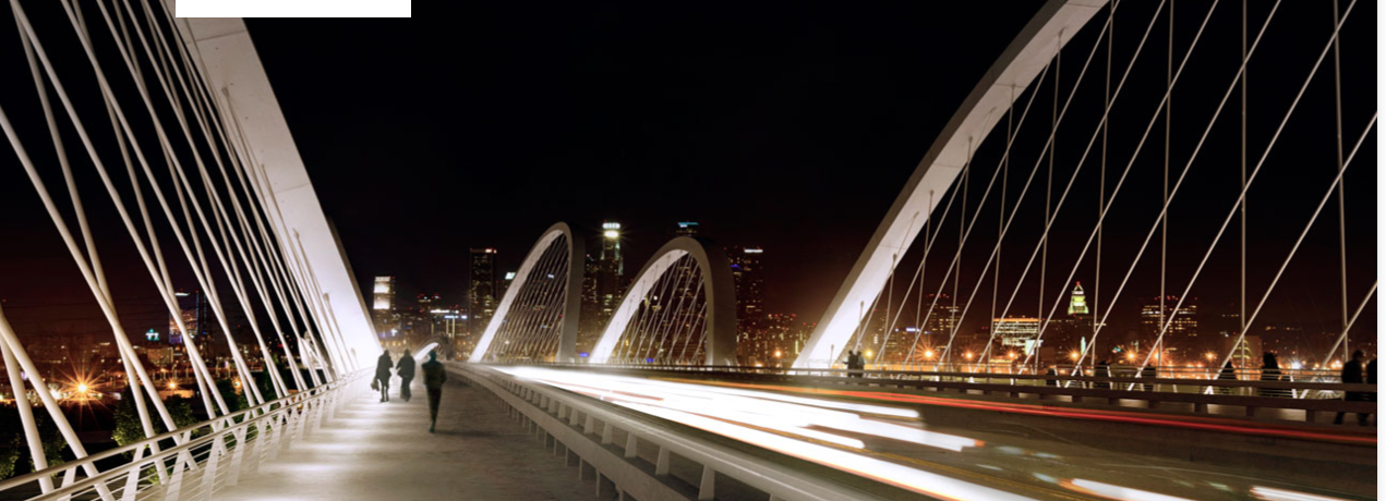
The combination of the grandiosity of the design and the accessibility of the structure, project architect Michael Maltzan said, was intended to celebrate the notion that bridges were powerful "city amenit[ies] that should not be underestimated" (please take note, Glendale-Hyperion bridge project).
Which sounds great. Except it apparently almost didn't happen.
Earlier this summer, the city received a letter from Caltrans stating that certain elements that had previously been approved for the $419 million project -- barrier lighting, the stairs to access the top of the arches and the ground below, the ADA compliant spiral bike/pedestrian ramps linking the bridge with the park space below, and the arts plaza area (slated for the west side of the river) -- were no longer eligible for Highway Bridge Program (HBP) funds.
Concerned the bike and pedestrian facilities and green space he considered "as important to [him] as the bridge itself" would be lost, Councilmember José Huizar sent district staff to Sacramento and reached out to Congressmember Xavier Becerra and State Senate President Pro Tem Kevin De León for assistance. With their help, and that of the Bureau of Engineering, nearly $20 million for those facilities was reinstated, ensuring that the new bridge will be what Huizar has deemed a "transformative space for Boyle Heights and the Arts District" and "as iconic as the original."
And, because they were able to secure the funding for the bike and pedestrian facilities, the project was then eligible to receive an additional $2.5 million in funding from the Active Transportation Program (ATP).
So, the project is now back on track, if somewhat behind schedule.
The improvements slated to be made this summer to the intersections that will bear the burden of increased traffic once the existing bridge is closed for demolition will now happen toward the end of this year. On the bright side, the improvements (crosswalks, new signals, wheelchair ramps, etc.) will be permanent, as opposed to temporary. On the not-so-bright side, improvements in the form of better pedestrian or cycling facilities on those soon-to-be-more-heavily-trafficked streets will unfortunately not be part of that package.
Demolition of the bridge will begin mid-2015 and the bridge should open in early 2019.
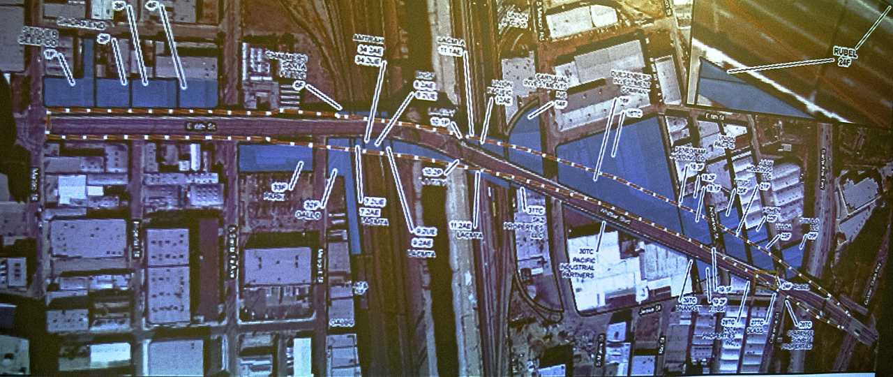
The footprint of the right-of-way under the bridge is apparently still being negotiated.
The proposed area is visible in the (hideously terrible, my apologies) photo below.
Principals on the project assured briefing attendees that they were working closely with residents and business owners who would be affected by the project, be it by the demolition of the bridge, the re-routing of traffic, or the need to relocate altogether.
This seemed to contradict the experience of a few members of the audience. One man who had a business on the west side of the bridge -- near where an arts plaza for the bridge was planned -- said he'd never been contacted by anybody from the project. Another man stood up and said he was cooperating with the process, but that he still had concerns, and was even involved in litigation with the city over the displacement of his business from the flats area.
Someone from the Para los Niños charter school located on 7th St. wondered what allotments had been made for the parents of the 400 students they serve who would need easy access to the area to be able to pick up their kids during the construction phase.
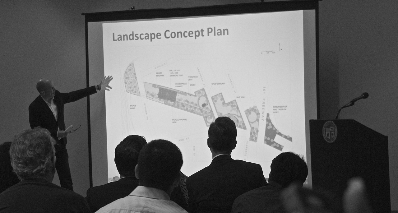
Others asked about the fact that there appeared to have been little space set aside for parking in the landscaping plans and wondered where all the people who would be drawn to the bridge for events would be expected to park.
Those elements hadn't been fully developed yet, responded one of the team members.
While they had a rough plan for the landscaping, including a pocket park between Mateo and Santa Fe streets that would connect to an arts plaza on the west side of the river, open green space in the central area, seating, a "spray area" (water feature for kids), and a soccer field made of artificial turf (the $1 million funding for which Huizar was recently able to secure), they were still working to determine the final footprint.
The construction timeline and potential impact increased traffic would have on his street seemed to surprise Juan -- he clearly hadn't been informed about those aspects of the project.
But as a resident living nearby, he was excited by the promise the project seemed to hold as a recreational site for families in the area.
Whether his perspective is representative of the larger Boyle Heights community is unclear. In the past, residents have worried about whether or not the design incorporated their needs and aspirations and about the fact that the bridge improvements stop just short of Boyle Heights (the viaduct officially ends over the 101 Freeway; a separate stretch of bridge crosses over the 5 and is thus not part of the project).
Very few Boyle Heights residents were on hand last night to take a look at the model or hear about the final design. A handful did come through at the last minute -- they had just left the same class that Juan had been in. But they floated out of the room as quickly and as quietly as they had floated in. The one resident I did speak with expressed concern about the soccer field being a potential catalyst for unspecified "negative behaviors" and worried about both the potential displacement of some of the businesses, including an important kosher food supplier, and the "no strike" clause project contractors Skanska and Stacy and Witbeck had worked into the Project Labor Agreement.
So we turn it over to you, dear readers. What say you about the project? Do you have any last minute concerns or questions? Do you want to voice your support for the project? Let us know in the comments below.
If you need more information on the reasons for the bridge renovation, see here. More background on previous public briefings can be found here and here. As mentioned above, construction is expected to be completed in early 2019. Intersection reconfiguration will begin this winter, and demolition will take place next summer. More information about the project can be found here (where they will also post better visuals in about a week), and pretty renderings can be found here.
Stay in touch
Sign up for our free newsletter
More from Streetsblog Los Angeles
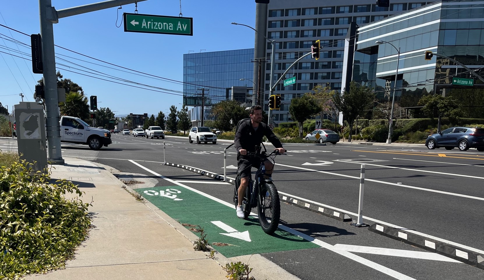
Eyes on the Street: Recent Centinela Bike Lanes in Culver City
The new partially-protected Centinela facility is a welcome safety upgrade for a stretch that long lacked any type of bikeway, but the area remains not all that bike-friendly

This Week In Livable Streets
Bike Month continues, Metro 91 Freeway widening, Destination Crenshaw, Culver City Bus, Santa Monica MANGo, Metro bike lockers, Metro Sepulveda Transit, and more

San Fernando Valley Bus/Bike Updates: G Line, Roscoe Bus Lanes, Laurel Canyon Bike Lanes
Short newly protected bike lane on Laurel Canyon Blvd, extensive NSFV bus improvements under construction this month, and scaled-back G Line plans should get that project under construction this summer