Skip to Content
Streetsblog Los Angeles home
Log In
L.A. River Bike Path

Eyes on the Street: New L.A. River Access Path

At Griffith Park Recreation Center a nearly complete new ~750-foot river access path connects to two existing footbridges, improving access to the L.A. River and its bike/walk path

New L.A. River access path at Griffith Park Recreation Center. Photos by Joe Linton/Streetsblog

Construction appears nearly complete on a new river access path at the Griffith Park Recreation Center in the L.A. City neighborhood of Los Feliz. The new ~750-foot long walk/bike path connects to two existing walk/bike bridges - over the 5 Freeway and the L.A. River.
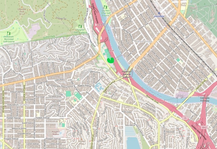
The new path (marked in green) is located at Griffith Park Recreation Center, a sort of southeast tail of the massive Griffith Park, located just across from the main park entrance - south of Los Feliz Boulevard and east of Riverside Drive
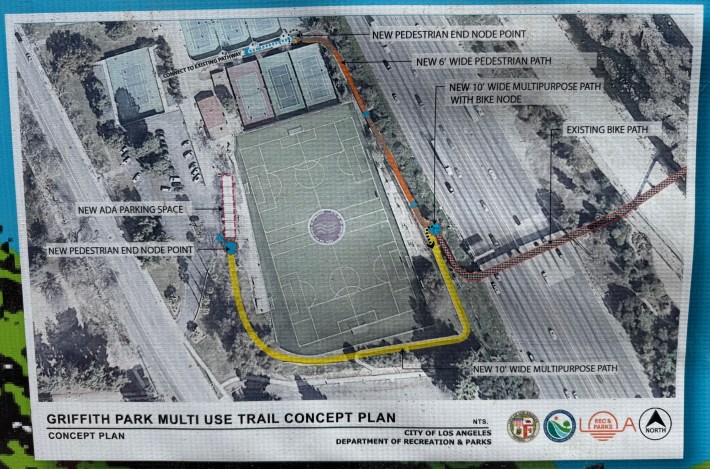
Multi-use path project map, posted on banner onsite. The new path is U-shaped, extending from a parking lot to the end of a footbridge over the 5 Freeway. Unlabeled on the upper right at the L.A. River and its bike path.

The new path formalizes a decades old river access point. To connect connecting between Atwater Village and Los Feliz, pedestrians and cyclists can use two existing pedestrian bridges over the 5 Freeway and the L.A. River. The river bridge is known as the Sunnynook Footbridge, because it aligns with Sunnynook Drive in Atwater.

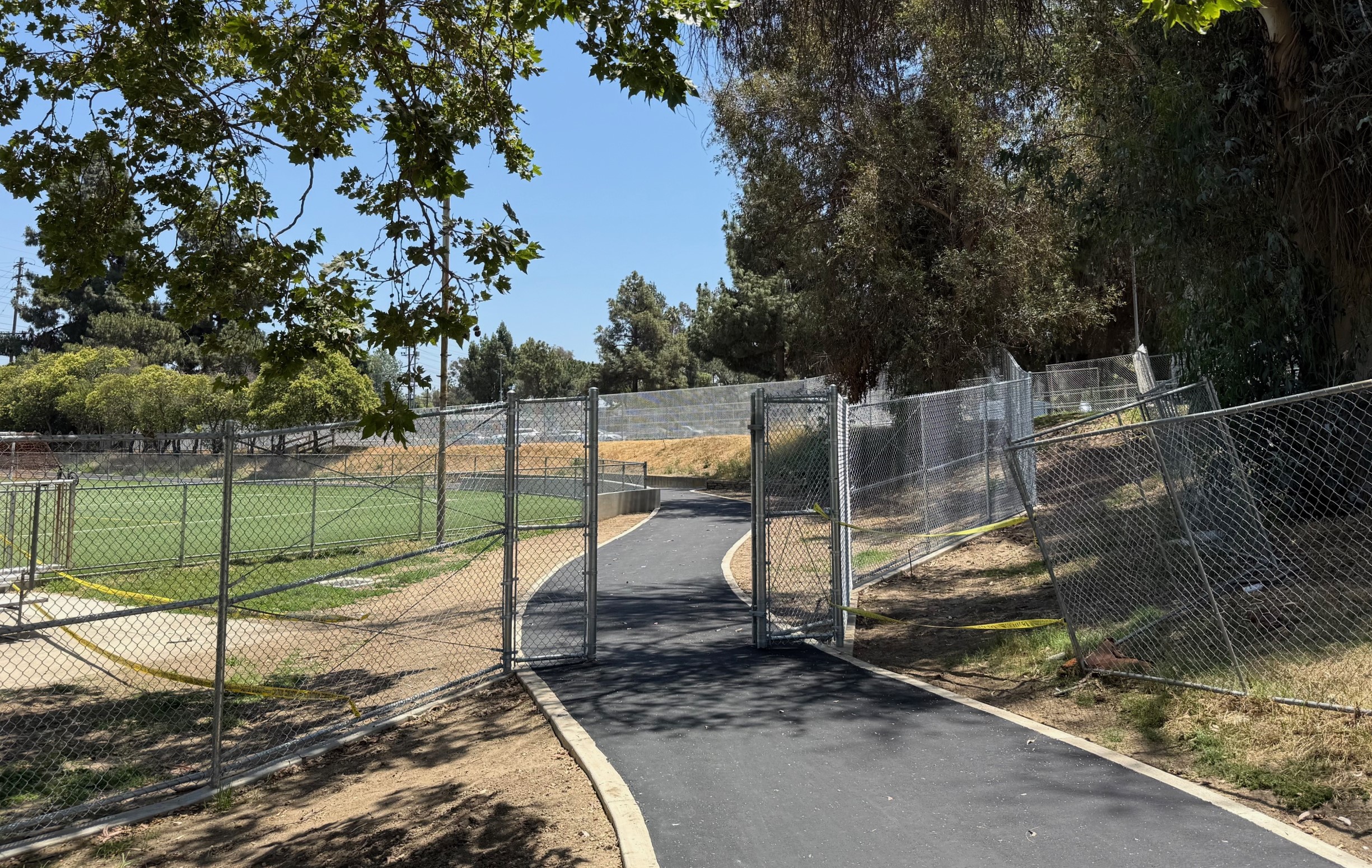
Streesblog visited the site in mid-June. Construction fences surround much of the project site, but do not prevent people on bike and foot from using the new path to access the river.
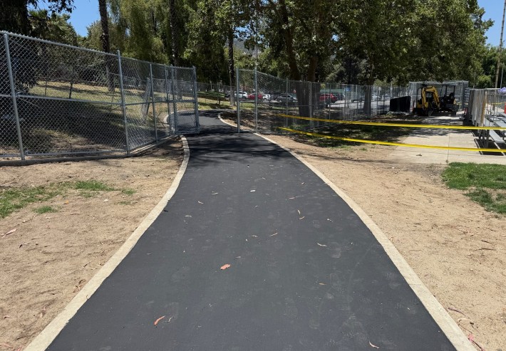
New path under construction at Griffith Park Recreation Center
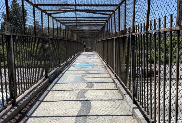
The east end of the project is at the base of the ramp to a ped/bike bridge over the 5 Freeway
The existing footbridge over the 5 Freeway - connecting from the L.A. River to Griffith Park Recreation Center
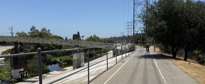
The new path is to the right (just outside of this photo) west of the L.A. River bike/walk path. On the left is the Sunnynook Footbridge.

The project is an improvement for a river access point that has long been unpaved, muddy, rutted, and hidden to the point of being difficult to find.

Nonetheless, this Streetsblog editor has some criticisms. Some of the paved shared-use path is signed "Walking Trail Only." No signs indicate that the path is how one accesses the L.A. River. (Perhaps these signs are coming?) Ultimately the design connects pedestrians and cyclists to a parking lot, when another 100-150 feet of path could have connected to Riverside Drive's sidewalk and protected bike lanes.
Stay in touch

Sign up for our free newsletter

More from Streetsblog Los Angeles

Active Streets: Mission at Twilight – Open Streets Open Thread

How was your experience at yesterday's open streets event - Mission at Twilight - through Alhambra, San Gabriel, and South Pasadena?

June 23, 2025

L.A. Press Club Awards Streetsblog First Place in Best Group Blog Category

The award acknowledges the 2024 calendar year work of SBLA Editors Sahra Sulaiman and Joe Linton, San Gabriel Valley reporters Chris Greenspon and Damien Newton, and Streetsblog California Editor Melanie Curry

June 23, 2025
See all posts