Two Bus Rapid Transit concepts announced from SGV’s Transit Feasibility Study
Phase 1 of the San Gabriel Valley Transit Feasibility Study is complete. Community workshops were held Tuesday to present concept routes for Bus Rapid Transit – and other “transit priority corridors” where BRT lanes will not be developed.
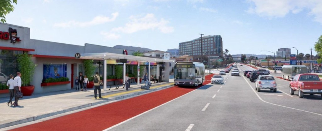
These zero emission bus routes would have traffic signal priority, use some dedicated right of way lanes, make limited stops at enhanced stations, and provide frequent service all day long in both directions. They would be situated in Metro’s “Equity-Focused Communities” in the lower San Gabriel Valley, which lack high quality transit.
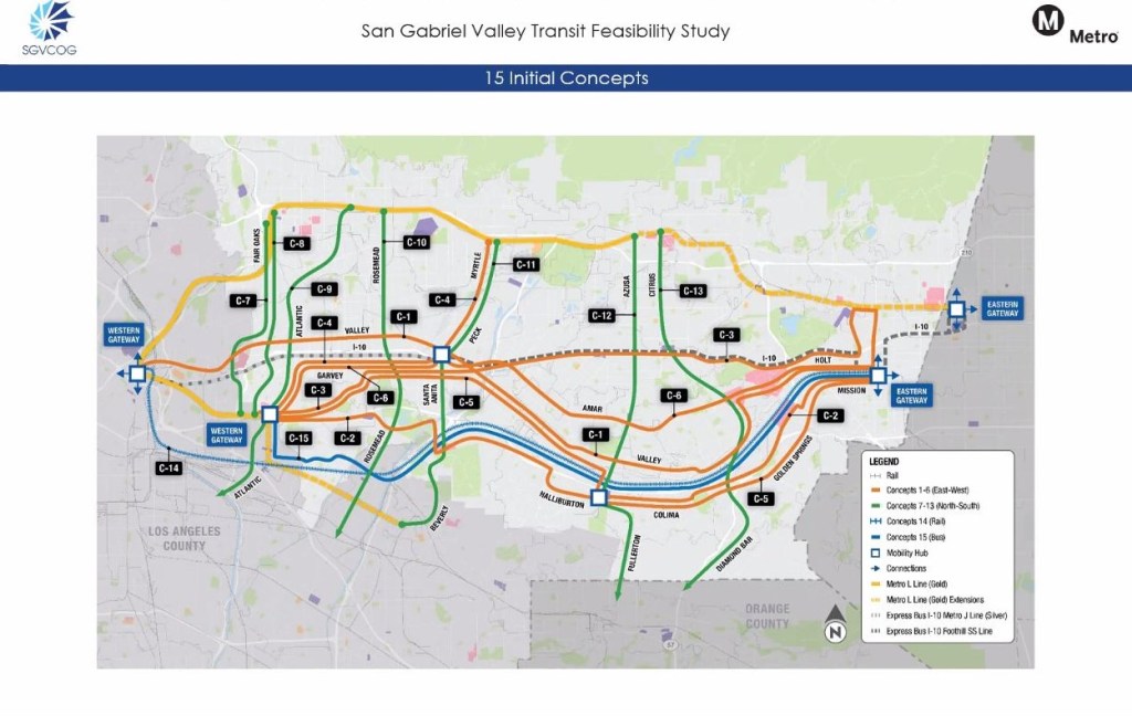
Two routes are recommended for short term implementation (within 10-15 years): Valley Boulevard and Rosemead Boulevard. See the red lines below.
East-West – Valley Boulevard
Looking at Valley Blvd’s route, from Union Station to the Pomona Transit Center, one quickly notices only the mid-section of Valley is marked red for dedicated lanes (Phase 1 BRT). West of El Monte, it’s blue (Rapid Bus Priority Corridor) meaning it won’t be getting bus lanes there. Rather, this section of Valley could have “express services with fewer stops and higher speeds.”
The study’s technical project manager, Brent Ogden, said this is because Valley Blvd in San Gabriel “is being reconfigured to handle higher levels of vehicular traffic. The improvements that are being planned in that area basically preclude bus lane conversion […] their focus is on moving cars and moving trucks.”
The Valley Blvd concept was favored out of three potential east-west concepts because of larger projected ridership (in 2042). However, parts of the other concepts weren’t scrapped entirely.
To the west of the El Monte Bus Station there are options (marked in pink) for bus lane development on the way to the Metro Gold Line’s Atlantic Station in East L.A. (near Monterey Park): either Garvey Avenue to Atlantic Boulevard, or Garvey to Potrero Grande Drive to Pomona Boulevard.
To the east, the Valley route runs up to Hacienda Boulevard in the Industry/La Puente area. It’s still undetermined if the Study will ultimately recommend one east-west path stemming from Valley and Hacienda, or multiple, but there are two options in pink (each route is on either side of the railroad tracks in City of Industry):
- The BRT stays on Valley, takes a brief detour up Grand Avenue to Temple Avenue, with stops at Mt. San Antonio College and Cal Poly Pomona, and rejoins Valley where it becomes Holt Avenue in Pomona, terminating at the Pomona Transit Center.
- At Hacienda, the BRT goes south to Colima Road (riding past the numerous malls in the Puente Hills and Rowland Heights), then to Golden Springs Drive in Diamond Bar, and back up north to Mission Boulevard, terminating at the Pomona Transit Center.
It should be noted, the Working Draft Vision Plan map also includes a Rapid Bus Priority Corridor (blue) running the length of Amar Road from Bassett to Mt. SAC.
North-South – Rosemead Boulevard
The other red line on the map is Rosemead Blvd, running a bit north, but mostly south from Garvey. North of Valley though, the concept changes from a dedicated BRT lane to a blue “transit priority corridor” extending up to the Sierra Madre Villa Gold Line Stations. The map shows four other north-south running “transit priority corridors” that terminate at Gold Line Stations near the San Gabriel Mountain foothills. At their south ends, they run to the Gateway Cities, East L.A., and North OC.
Ogden explained the reason for favoring a short term BRT project on Rosemead Blvd: “It was by far the most popular service in generating the most ridership, and then it sort of drops off as you go further to the east. [Santa Anita/Peck] coming in about two thirds of Rosemead, and then maybe 50 percent of that with Azusa and Citrus-Grand. The reason that the ridership is lower to the east is that the densities are just lower in terms of population, employment […] the land use diminishes to the east.”
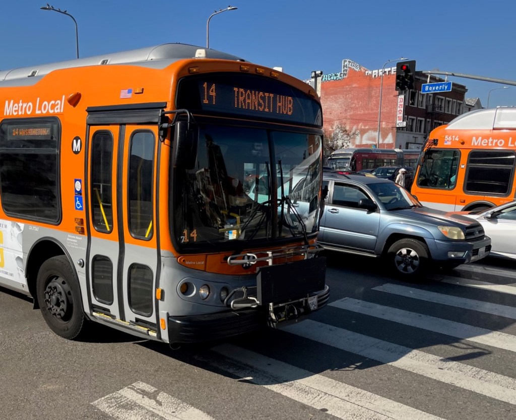
Metro or Foothill?
Some asked during the workshop how the routes would be divided up by agency. “The Metro service area is basically out to about the 605, and then the Foothill service area is essentially east of the 605.” said Ogden. “So the North South services, we would expect that the operators would operate the services that fall within their district. For the East West services, cooperation would be required. One of the two operators could elect to provide the service and the other one could potentially enter into a cost sharing agreement to provide a through service, or it’s even possible that potentially in the near term there could be a handoff of service at El Monte.”
Funding & Cost Projection
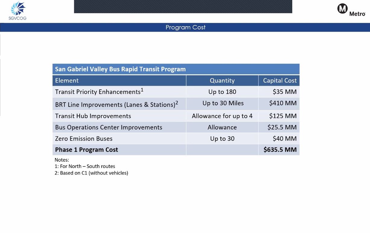
$635.5 million have been earmarked from Measure R for transit improvements arising from this Study. The SGV Council of Governments’ website says “the […] Transit Feasibility Study was initiated following the Metro Board decision in February 2020 to withdraw the State Route 60 alternative in the Eastside Transit Corridor Phase 2 project to extend the Metro L Line (Gold).”
Together, the Valley and Rosemead concepts are estimated to cost between $615 million and $905 million. That’s not counting if multiple east-west routes are built. Ogden said with the $635 million, “We can certainly do maybe some segments east-west, and some segments north-south […] we can definitely afford to develop this type of program in the San Gabriel Valley.” See the chart below of what is estimated to fit within budget.
Streetsblog’s San Gabriel Valley coverage is supported by Foothill Transit, offering car-free travel throughout the San Gabriel Valley with connections to the new Gold Line Stations across the Foothills and Commuter Express lines traveling into the heart of downtown L.A. To plan your trip, visit Foothill Transit. “Foothill Transit. Going Good Places.”
Sign-up for our SGV Connect Newsletter, coming to your inbox on Fridays!

Streetsblog has migrated to a new comment system. New commenters can register directly in the comments section of any article. Returning commenters: your previous comments and display name have been preserved, but you'll need to reclaim your account by clicking "Forgot your password?" on the sign-in form, entering your email, and following the verification link to set a new password — this is required because passwords could not be carried over during the migration. For questions, contact tips@streetsblog.org.