
LADOT Seeking Input on Low-Stress Travel Corridors in Central Los Angeles
The L.A. City Department of Transportation (LADOT) is developing a mapping tool that can help identify low-stress corridors primarily to bicycle, but also to walk, scooter, etc. LADOTs Planning for Stress Free Networks project is seeking public input on low-stress corridors – e.g. streets people already use and barriers to creating a more extended, more functional low stress bicycling network.
The project focuses on central Los Angeles, so it does not yet include the Valley, Westside, or Harbor areas.
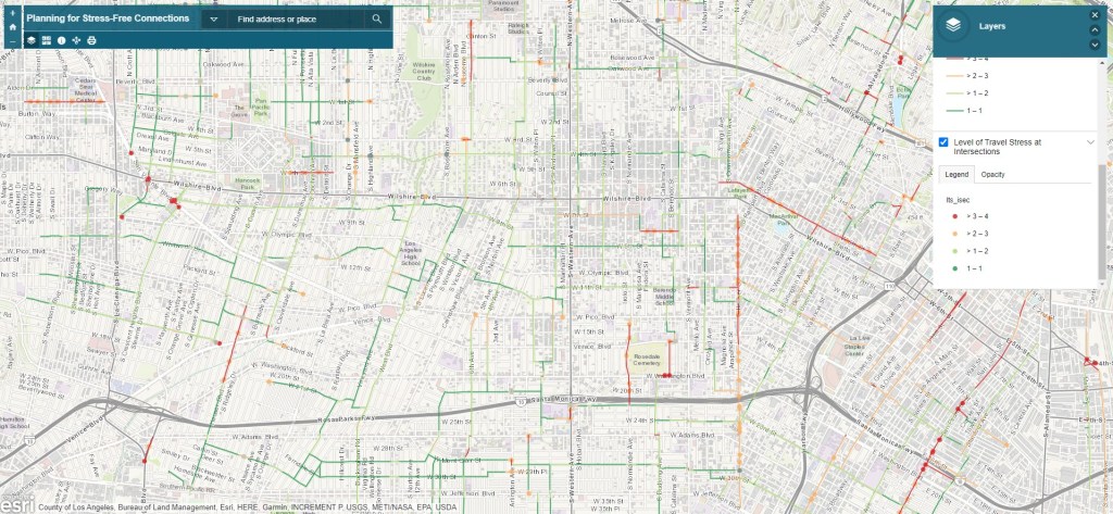
Based on community input and professional analysis, LADOT has developed its preliminary low-stress map. Generally greener colors represent lower-stress street segments and intersections; orange and red represent higher stress.
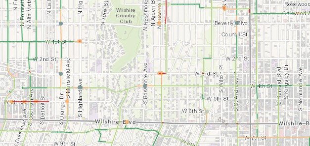
Dark blue-gray and light gray dots show high-priority intersections. Improvements to some of those seen above would significantly reduce stress on what are otherwise already low-stress corridors. Over time, the maps are intended to inform LADOT project siting, such as where fixing a short gap can complete an extended low-stress corridor.
For more information, read the project announcement or project fact sheet, view the map, or watch LADOT’s stress free connections webinar on YouTube.
Give LADOT your input on this project. Take an online survey and/or email ideas and feedback to stressfreeconnections(at)lacity.org. Feedback can include recommended informal corridors that bicyclists use and/or barriers to using low-stress corridors.

Streetsblog has migrated to a new comment system. New commenters can register directly in the comments section of any article. Returning commenters: your previous comments and display name have been preserved, but you'll need to reclaim your account by clicking "Forgot your password?" on the sign-in form, entering your email, and following the verification link to set a new password — this is required because passwords could not be carried over during the migration. For questions, contact tips@streetsblog.org.


