A New Blueprint for Streets That Put Transit Front and Center

The National Association of City Transportation Officials has released a new design guide to help cities prioritize transit on their streets.
How can cities integrate bus rapid transit with protected bike lanes? How can bus stops be improved and the boarding process sped up? How should traffic signals be optimized to prioritize buses? The Transit Street Design Guide goes into greater detail on these questions than NACTO’s Urban Street Design Guide, released in 2013.
Before the publication of this guide, city transportation officials looking to make streets work better for transit still had to hunt through a few different manuals, said NACTO’s Matthew Roe.
“The kinds of problems that the guide seeks to solve are exactly the kinds of design problems and questions that cities are trying to solve,” said Roe. “How do you get transit to get where it’s going quicker, without degrading the pedestrian environment? Some of that has to do with the details of design.”
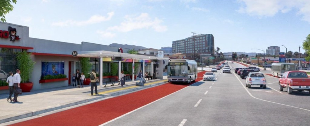
For example, the guide lays out how to design boarding areas where buses can pick up passengers without pulling over to the curb and then waiting to reenter traffic — which can slow service considerably.

Many of the finer points in the guide involve making transit-priority streets that also work well for walking and biking. The image below, for instance, shows the intersection of a sidewalk-grade two-way bike lane with the pedestrian approach to a bus stop.

“Transit has to run in the place where everyone wants to be,” said Roe. “It has to be right through where everybody wants to be. To create transit streets that are living streets and active streets is something that people really struggle with.”
He said Loop Link in Chicago “truly exemplifies” that kind of street design. “Instead of pushing bikes and transit off to the side you make them the centerpiece.”

Following the release of the guide, NACTO will be working directly with three selected cities — Denver, Indianapolis, and Oakland — on a “Transit Accelerator Program,” customized assistance to bring better transit streets to fruition.
The full Transit Street Design Guide can be purchased from Island Press.

Read More:
Streetsblog has migrated to a new comment system. New commenters can register directly in the comments section of any article. Returning commenters: your previous comments and display name have been preserved, but you'll need to reclaim your account by clicking "Forgot your password?" on the sign-in form, entering your email, and following the verification link to set a new password — this is required because passwords could not be carried over during the migration. For questions, contact tips@streetsblog.org.