When is a roundabout not a roundabout?
Evidently, when it’s located roundabout the beach in Santa Monica.
It’s not that the city by the sea hasn’t made great strides in recent years, particularly in justifying its designation as a Bicycle Friendly Community. The new Green Street on Ocean Park Blvd. shows Santa Monica’s commitment to re-imagining streets to accommodate all road users, as well as the environment.
On the other hand, some of the legacy streets could stand to see some improvement. Like tiny Bay Street between Neilson Way and the beach, for instance.
One of the problems for those of us who ride our bikes to the beach from points further inland is how to access the popular Santa Monica and Venice sections of the beachfront Marvin Braude bike path (pdf) that runs along the coast from Pacific Palisades to Palos Verdes.
The bluffs that protect the city from the sea also limit direct access to the coast, as does the dangerously high-speed traffic that careens along PCH all day and night throughout the week.
For some, the answer is the walkway that runs under the coast highway at West Channel Drive, allowing riders to walk their bikes down a flight of stairs and underneath the speeding traffic. Assuming they don’t mind traversing a dark and secluded walkway, completely hidden from public view.

Others prefer to ride across the crowded bridge over PCH to the Santa Monica Pier, then work their way down various stairs or ramps to access the beach.
And still others enter the pathway at its southern terminus at the Venice Pier, or the many parking lots between the two.
My preference, however, is to circle the traffic island on Bay Street, zip down the hill, around a second island and onto the bike path.
It’s actually very easy to find, despite being hidden from heavy traffic on nearby Nielson Way.
Riders headed south through SaMo can follow the bike path on Ocean Ave to the intersection with Pico Blvd, where Ocean Ave forks off to the right, while Nielson Way continues south (directions are relative, since Santa Monica’s curvature around the bay doesn’t allow it to adhere to a standard north/south grid).
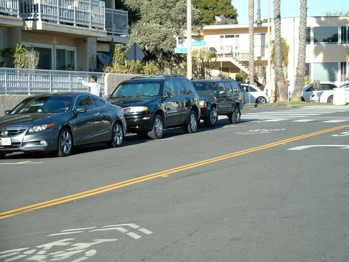
Following Ocean Way to the right leads to Bay Street one block later, where a simple right turn leads down to the beach. Sharrows installed within the past few years make it clear that the city wants to encourage cyclists to use the street.
The problem comes with the poorly designed intersection one block later at Ocean Way, barely visible in the satellite photo.
Or rather, the city’s lack of faith in their own infrastructure.
Roundabouts are designed to channel traffic in a single direction, allowing drivers to go straight, make a U-turn or turn onto a cross street in either direction without encountering cross traffic, eliminating the need for traffic signals and reducing the risk of collisions.
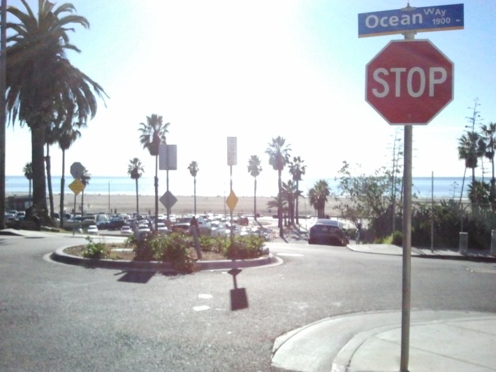
However, what you’ll encounter on Bay Street is actually a traffic circle, rather than a roundabout; traffic circles use stop signs or other traffic signals to control the flow of traffic, while roundabouts are unsignalized, using the design itself to control traffic.
The Bay Street traffic circle has a stop sign in each direction on Bay, with no traffic signs controlling vehicles entering from Ocean Way. Which means that cyclists riding along the sharrows are forced to stop where it makes no sense, or break the law by riding through the stop sign.
In practice, it only serves to confuse just about everyone.
Tourists from other countries, where roundabouts are more common, aren’t looking for a stop sign there, and may drive right through it; I’ve nearly been rear-ended more than once when I’ve stopped on my bike and the driver behind me didn’t.
It’s also where a passenger in a car entering from Ocean Way got out and threatened to beat me up because I dared to tell the confused driver of the car he was in that she didn’t have to stop for the stop sign that wasn’t there.
However, the problem is compounded going uphill, where stopping safely is difficult, if not just this side of impossible.
By placing the stop sign just before the crest of the steep hill, riders are forced to choose between running the stop sign, or risking a dangerous fall or loss of control in an attempt to obey the law. Let alone the difficulty of resuming riding on an uphill slope if they somehow manage to.
It’s the only stop sign in Southern California I run on a regular basis, because it’s significantly safer than the alternative.
In fact, I made two attempts to stop there on a recent ride.
The first time, I wasn’t able to clip out of my pedals in time, wobbling dangerously and barely avoiding a fall. In the second, I succeeded in stopping — barely — but was forced to duck walk the remaining several feet to the crest of the hill before I could get back on my pedals again.
Of course, there’s an incredibly simple solution, whether you’re riding to or from the beach on Bay.
Just remove the stop signs.
Turn the traffic circle into a genuine roundabout, where every vehicle entering — bikes included — must yield to any other vehicle in the circle.
It will eliminate — okay, reduce — the confusion, given the difficulty many drivers in this country seem to have in comprehending the relative simplicity of roundabouts. It will improve safety. And encourage more bicyclists to use Bay Street as a safe and relatively easy way to access and leave the beach.
Or if Santa Monica really feels a need for traffic signs, they can replace them with yields in each direction.
Which would be sort of like a European-style roundabout, but with American subtitles.
