Ride the City Opens Bike Mapping Page for Los Angeles
In 2008, around the same time that Streetsblog launched in Los Angeles, Ride the City launched in New York. Today, Streetsblog is happy to announce that the volunteer mapping effort is launching in Los Angeles. At worst, the program provides another alternative to the popular "bikes" feature on Google Maps. But because Ride the City is created in the mold of Open Street Map, all of the data entered into the map is available to the general public. Ride the City is also accessible by iPhone.
Unlike Google Maps and other commercial mapping programs, the data entered by users is available to download with an open license. Data users are permitted to make a commercial profit, but Open Street Map itself is a not-for-profit open data organization. I don't mean to sound like I'm running down Google, I use their services regularly and appreciate them, but it's a different ball game to be contributing data to a publicly available database.
Programming junkies might also like this 2008 article by NYC Streetsblog which shows what the original maps looked like as compared to the more slick ones available today.
But enough with this "up with the people" stuff. On to the maps!
I took a pair of regularly traveled routes and punched in the addresses to both Google Maps and Ride the City. There are some obvious differences just with the interface. Google Maps has you enter the addresses then select bicycling then you are presented a favored route and a selection of other routes to choose from. With Ride the City, you put in the addresses and select between "safe," "safer" and "quickest."
Once the maps are up, Google maps shows bike infrastructure with green lines as does Ride the City. The difference here is Ride the City tells you what kind of infrastructure you're going to ride on in the directions. Last, Ride the City lists, to the best of its knowledge, the bike shops near your route with little orange cones. If the map is missing your favorite bike shop, and our South L.A. reporter Sahra Sulaiman noted that almost all of her favorite shops in South L.A. were missing, you can get the shop added by emailing the name, location and contact info to info@ridethecity.com.
Personally, I prefer routing based on safety rather than speed and distance, so I already had a preference for Ride the City before I started typing in addresses into either.
First Test: St. Andrew's West L.A. (Where we did our re-launch in August 2010) to the Library Alehouse in Santa Monica (where we're doing a fundraiser on March 27).
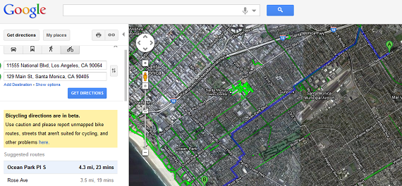
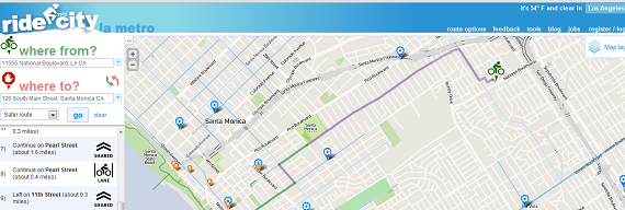
In my first test, Ride the City had a couple of advantages visually over the Google Maps map. First, the marking of bike infrastructure is a lot clearer on Ride the City, as Google Maps is just sort of a confusing mess of bright green. Second, Ride the City's icons in the directions bar make everything very clear. That being said, I was surprised when Google Maps showed the exact same route, cutting through the airport then down to Rose Ave., that I usually take until I remembered that I got that route from Google Maps in the first place.
So off to test out the Ride the City route I went. Yes, it was indeed a safer route than my usual "Google" route and I knew what to expect the entire time. Yes, the route was longer. When I went back to the website and selected "most direct" I got a route similar to my planned route except it cut out a little of the North-South travel.
Second test: Eco-Village to City Hall
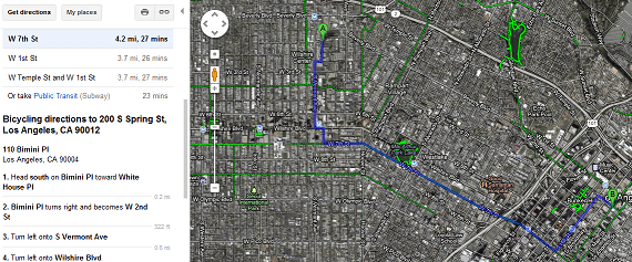
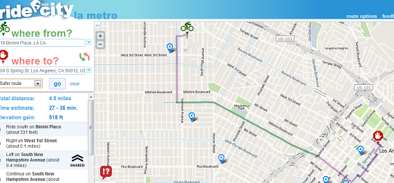
Here we see similar routing between the two map programs. Ride the City has you going a little out of your way to avoid Vermont Boulevard in favor of New Hampshire Avenue, then has you doing a little hook at the end so that you approach City Hall from the east instead of the west. The route looks a little longer than the one proposed by Google, but again it keeps you off some of the yuckier streets.
Switching to "Most Direct" route, you see a sprint down Beverly Boulevard, the Second Street Tunnel before a straight shot through Downtown. I've ridden this route to City Hall exactly once in my life and it was both quick and uncomfortable...exactly what Ride the City communicates to mid-level riders.
In conclusion, for veteran riders there will probably be a period of map testing before deciding which route creator they like best. However, for beginners to mid-level riders, Ride the City is clearly superior because of the option to choose routes based on safety. If you like open data, then you're also going to prefer Ride the City.
But don't take my word for it. Try finding routes to your favorite destinations and let us know which mapping program you prefer in the comments section.
Stay in touch
Sign up for our free newsletter
More from Streetsblog Los Angeles
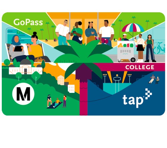
Metro Board Funds Free Student Transit Pass Program through July 2025
Metro student free passes funded another year - plus other updates from today's Metro board meeting
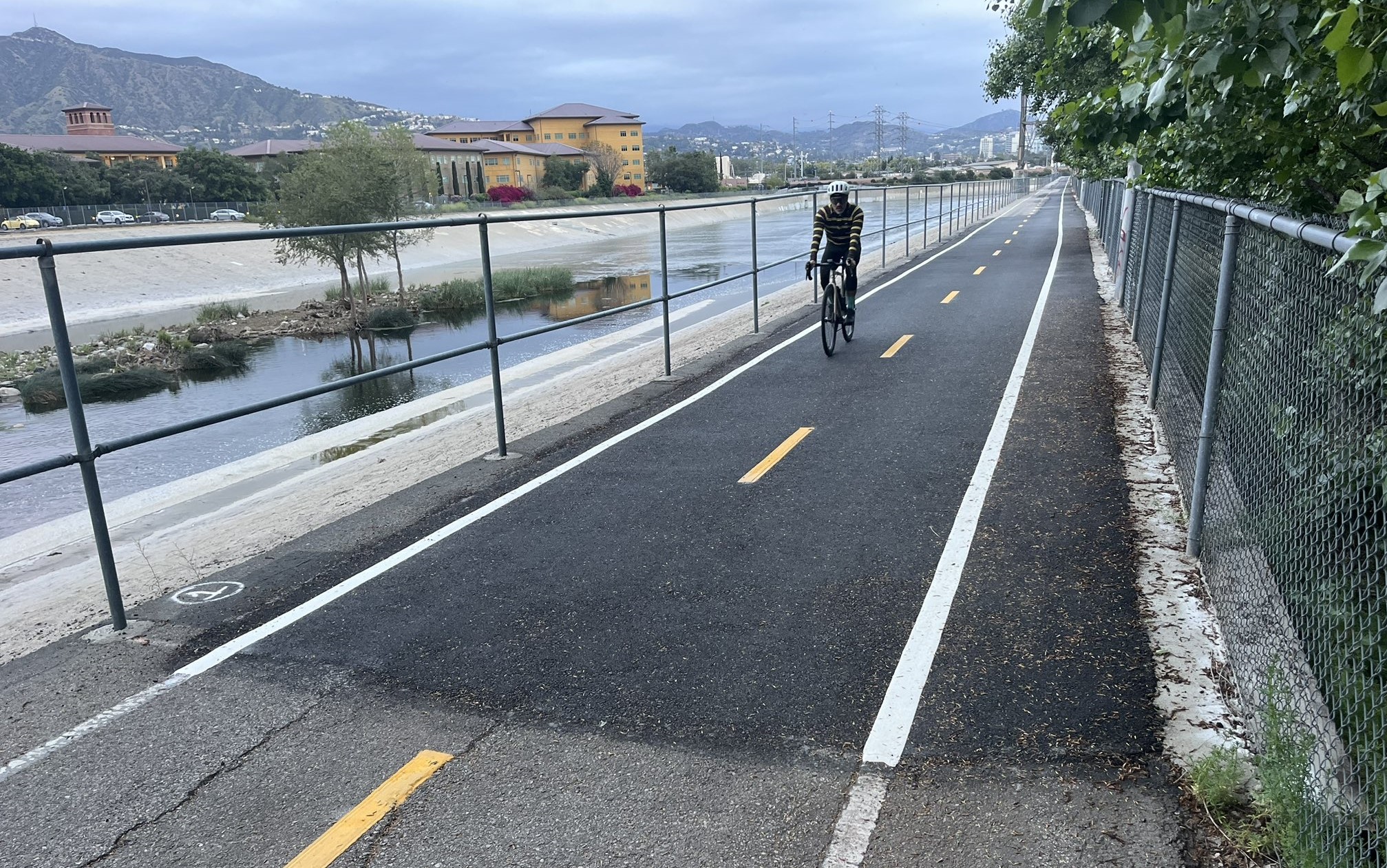

Eyes on the Street: New Lincoln Park Avenue Bike Lanes
The recently installed 1.25-mile long bikeway spans Lincoln Park Avenue, Flora Avenue, and Sierra Street - it's arguably the first new bike facility of the Measure HLA era


Brightline West Breaks Ground on Vegas to SoCal High-Speed Rail
Brightline West will be a 218-mile 186-mile-per-hour rail line from Vegas to Rancho Cucamonga - about 40 miles east of downtown L.A. - expected to open in 2028