Model Streets Manual on Its Way — Move Over Old Traffic Handbook
On Tuesday night, a group of urban planners, transportation engineers, and public health advocates convened at Metro headquarters to preview the fruits of an intensive two-day labor. Led by design consultant Ryan Snyder, this team of local and national experts had been working in Los Angeles to create a new and visionary streets manual for the streets of Los Angeles County.
Their effort was backed by a grant from the Los Angeles County Department of Public Health, through its RENEW initiative. Standing for “Renewing Environments for Nutrition, Exercise and Wellness,” the program aims to improve public health by making our neighborhoods more conducive to healthy and active lifestyles.
The presentation kicked off with an introduction from Ryan Snyder. He quickly got to the fundamental question: “Why do we need a new streets manual?” According to Snyder, the manual is the DNA of our streets, and it defines everything from where to place bike lanes to how wide a roundabout should be.
Seasoned Streetsblog readers know all too well that our current manuals make it hard to create road treatments that encourage safety and access for all road users. Snyder described those old manuals has creating streets that are “ugly and difficult to cross,” and “not something my grandmother could cross easily, nor an elementary school child.”
The goal of this committee was, therefore, to tear down the old design standards that require such inhospitable streets, and in their place, create standards that encourage the designing of great streets.
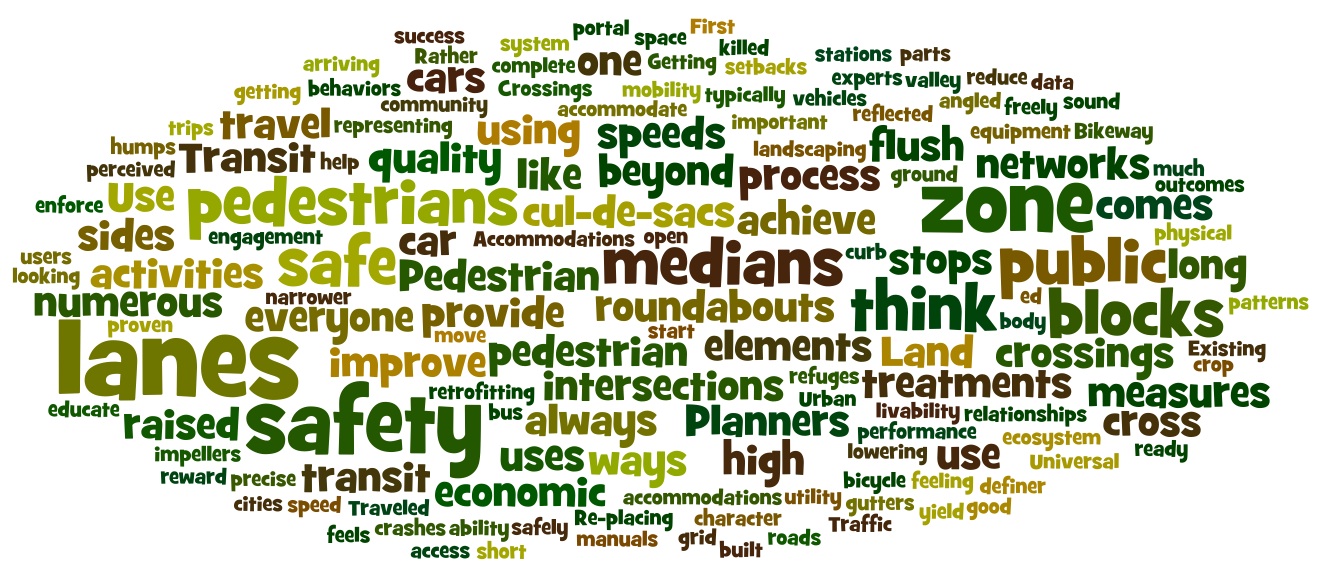
The new manual considers the full gamut of street design issues from the neighborhood scale right down to the material of the streets themselves. The following is a list of the new manual’s twelve chapters, which were previewed in three-minute presentations during Tuesday’s event. I’ve added just a few highlights from each speaker in attempt to capture a slice of what each chapter has to offer.
- Street Network Design: In terms of safety and livability, networks with numerous short blocks in a grid achieve much better outcomes than street networks with long blocks and numerous cul-de-sacs.
- Traveled Way and Intersection Design: Bike lanes and narrower car lanes can improve safety and “modern roundabouts” improve the comfort of intersections. Streets should be physically designed for slower speeds.
- Universal Pedestrian Access: Without precise design guidelines, obstacles to mobility, like utility boxes, start to crop up. A four-zone system — representing the curb zone, furniture zone, pedestrian zone, and frontage zone — can ensure that there’s always a passable sidewalk.
- Pedestrian Crossings: Simply put, pedestrians must have the ability to safely cross the street. Real and perceived safety is important and is not well reflected by crash data, i.e. “maybe no body gets killed here, because no one feels safe enough to cross.” Planners should use treatments that are proven to reduce crashes. Transit stops should always have good crossings, because trips typically begin and end on opposite sides of the street. Above all, evaluate the success of new crossings using performance measures.
- Bikeway Design: All streets are bicycle streets, and so all should be safe for bicyclists. Existing manuals tell us how to design roads for cars; this one will accommodate all users.
- Traffic Calming: “Design streets that self-enforce the behaviors that you’re looking to enforce.” Some of the physical measures that can achieve “self-enforcement” include: lane reductions, medians, refuges for pedestrians, bulbouts, curbless flush streets, flush medians, streets trees, lateral shifts, shared spaces, bike lanes, textured surfaces, back-in angled parking, valley gutters, roundabouts, mini-roundabouts, impellers, chicanes, medians, yield streets, pinch points, raised intersections, raised pedestrian crossing, and speed humps.
- Transit Accommodations: Planners should think beyond the station as merely being a portal to the service. Rather, transit should be integrated further into the community, using stops to anchor local activity. Use street treatments to enhance access to transit vehicles and provide accommodations for everyone arriving at stations. When it comes to travel lanes, think beyond the car to bus lanes, BRT, and streetcars.
- Streetscape Ecosystem: Utilize street features to help irrigate landscaping. Make irrigation equipment highly visible to educate everyone about the relationships between all the parts of the ecosystem.
- Re-placing Streets: Streets should be more than just a conduit for goods and people. Designs should “support activities and destinations in the streets” with design elements built at the human scale; provide a feeling of safety; invite activities on both sides of the street; and reward slow movement by lowering speeds.
- Land Use & Urban Design: Land use is “the great definer of street character and influences travel patterns.” Key design elements should focus on things like setbacks and ways that land uses can complete the public space — ground floor uses.
- Retrofitting Suburbia: The goal of retrofitting suburbia is to “suggest ways that existing cities can think about getting ready for a different economic and demographic future.” In neighborhoods with poor connectivity, break open sound walls and cul-de-sacs so that pedestrians can move more freely. Break through long blocks with additional and safe crosswalks. Above all, “high quality economic development comes to high quality streets.”
- Getting It Built: First, the public engagement process should become an authentic two-way process, in which the public are experts.
Seeing all those amazing plans, goals, and strategies, you may be asking yourself, “okay, but is any of it legally feasible?” In the past, so many great street designs have been rejected out of hand by traffic engineers, because of fears that municipalities would incur legal liability for not doing things “by the book.” Snyder, however, assured all in attendance that the designs in the new manual would all pass legal muster.
To wrap up the presentation, Snyder invited the audience to think of their favorite cities and the design features that make those places unique. To drive the point home, he asked, “when you go on vacation, do you go to a suburban strip mall? No, we go to great walkable places!” And that is precisely what this manual will help planners and engineers create.
And now, just a few final details on the manual: Everything will be professionally edited and laid out and should be available by this summer. The manual will be published digitally on the LA County website in two formats — as a Microsoft Word Document and an Adobe InDesign format — so that, in Snyder’s words, cities can “use it, adopt it, steal it, and plagiarize it.”

Streetsblog has migrated to a new comment system. New commenters can register directly in the comments section of any article. Returning commenters: your previous comments and display name have been preserved, but you'll need to reclaim your account by clicking "Forgot your password?" on the sign-in form, entering your email, and following the verification link to set a new password — this is required because passwords could not be carried over during the migration. For questions, contact tips@streetsblog.org.