Parts of San Gabriel River and Rio Hondo Bike Paths Closing for Dam Construction
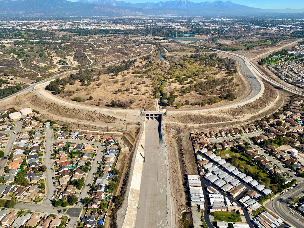
The United States Army Corps of Engineers is about to begin “high urgency” renovations on the Whittier Narrows Dam. The Dam is located southwest of the 60/605 Freeway interchange, and between the Rio Hondo and San Gabriel Rivers. It protects over a million Southern Californians from flooding. Construction will begin around this October, and is expected to last until 2033. The dam will remain fully operational during construction.
USACE Public Affairs Chief Dena O’Dell tells SBLA that the $735 million dam project entails “critical embankment and outlet structure modifications, including hard-fill armoring and soil cement steps to safely handle potential overtopping flows.” O’Dell also shared this video which elaborates on the science behind the improvements planned for Whittier Narrows.
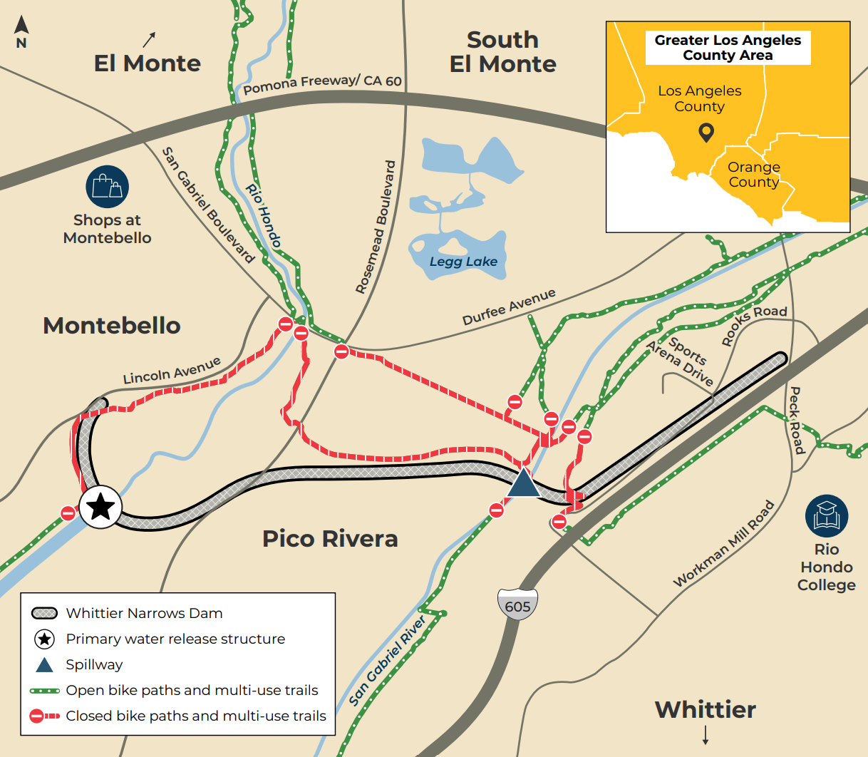
With this critical infrastructure work comes a variety of road, path, and trail closures. San Gabriel and Rio Hondo river path cyclists are on the lookout for detours to get construction and back onto these very popular bikeways. The following areas will be closed as of October 1st.
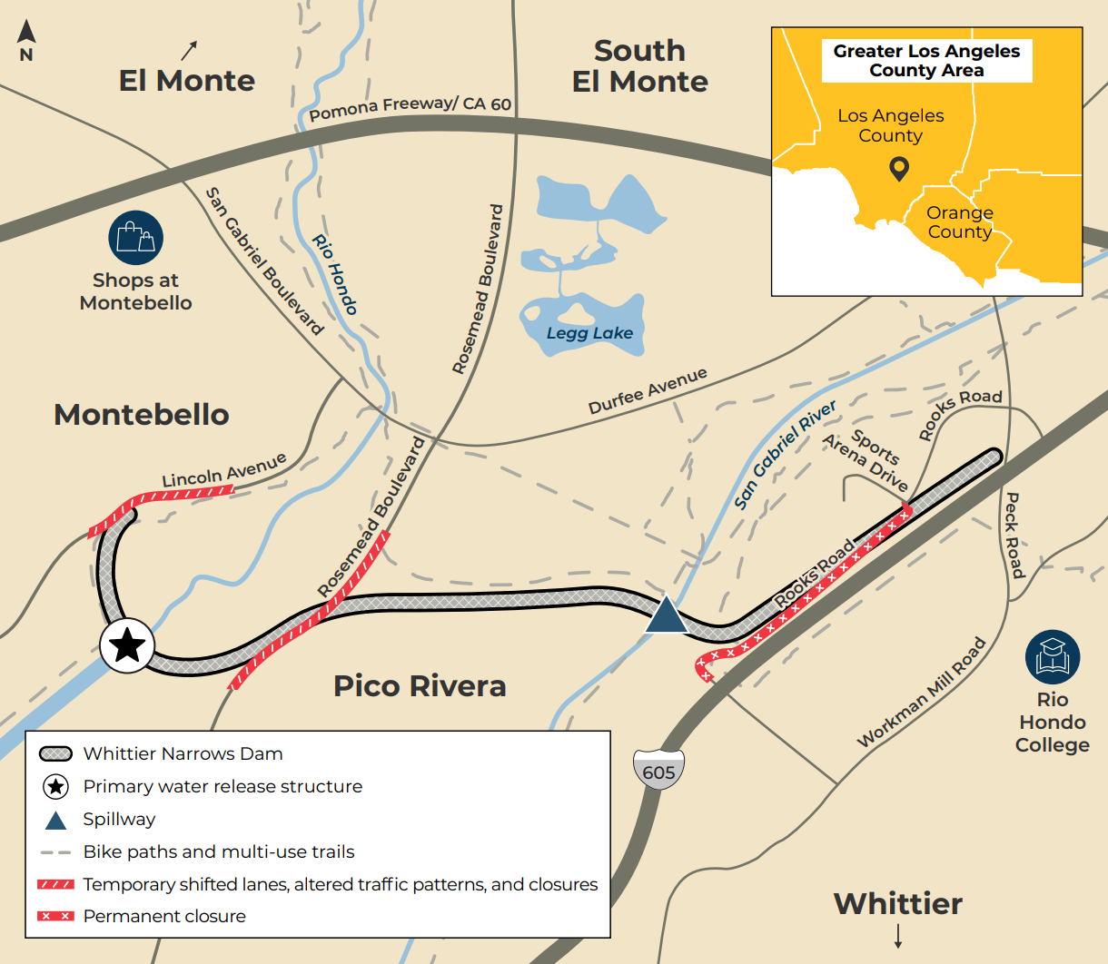
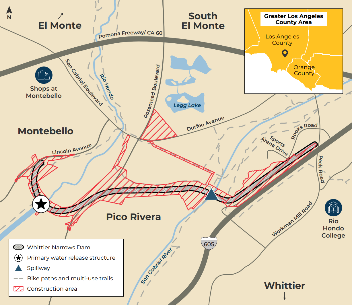
Starting with the road closures, Rosemead Boulevard and Lincoln Avenue will see a variety of partial closures, while Rooks Road will be totally closed for the duration of the project from Sports Arena Drive southbound. Sports Arena Dr. will be closed too.
While the closures on the San Gabriel and Rio Hondo river walk/bike paths will be relatively short in distance, detouring is slightly complicated because the connector paths between the two trails will be closed.
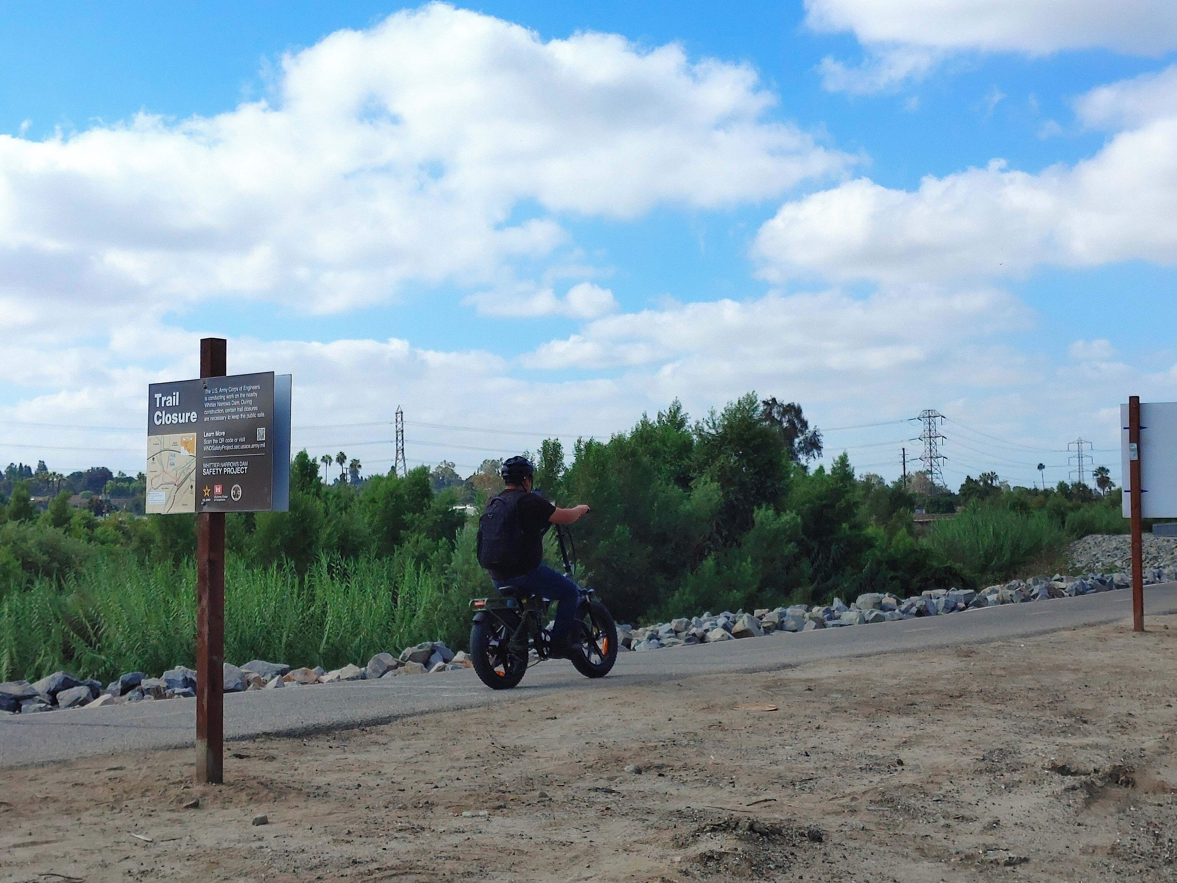
SBLA reached out to Los Angeles County Public Works to inquire about any possible detour plans, but did not receive a response by publishing time. So the following is a set of possible detours for going southbound, which should be approached carefully.
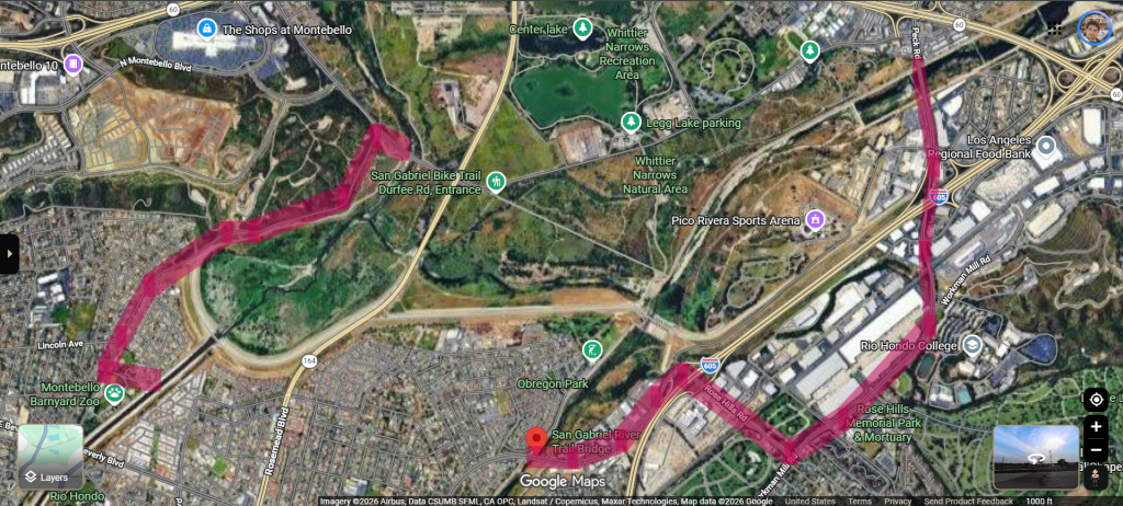
For the Rio Hondo path, Lincoln Avenue and Rea Drive might be able to offer a detour. Lincoln runs roughly parallel to the Rio Hondo bike path, and can be ridden down to a left turn at Rea, and the path can be rejoined by crossing through Rea Park. However, Lincoln is a narrow street as it is, and getting through during partial closures will likely take patience and caution.
For the San Gabriel River path, it looks best to exit a ways before the closure, at Peck Road which becomes Workman Mill Road going south. Workman Mill has no bike lanes, but is fairly wide and has decent sidewalks. It can be taken down to a right at Rose Hills Road. There are active freight crossings here, so be aware. Then a left at San Gabriel River Parkway would be the way to go, though this street is initially quite rough, there is a bike lane here. Re-enter the bike path on the south side of the street.
Streetsblog’s San Gabriel Valley coverage is supported by Foothill Transit, offering car-free travel throughout the San Gabriel Valley with connections to the A Line Stations across the Foothills and Commuter Express lines traveling into the heart of downtown L.A. To plan your trip, visit Foothill Transit. “Foothill Transit. Going Good Places.”Sign-up for our SGV Connect Newsletter, coming to your inbox on Fridays!

Read More:
Streetsblog has migrated to a new comment system. New commenters can register directly in the comments section of any article. Returning commenters: your previous comments and display name have been preserved, but you'll need to reclaim your account by clicking "Forgot your password?" on the sign-in form, entering your email, and following the verification link to set a new password — this is required because passwords could not be carried over during the migration. For questions, contact tips@streetsblog.org.