Pasadena Moves Closer to Adopting 710 Stub Vision Plan
On Monday, the city of Pasadena held the first of two public workshops on the 710 Stub’s vision plan called “Reconnecting Pasadena.”
This document outlines an idealized redevelopment of the land where the northern terminus was built for the cancelled 710 Freeway, and acknowledges the painful history behind it.
Background
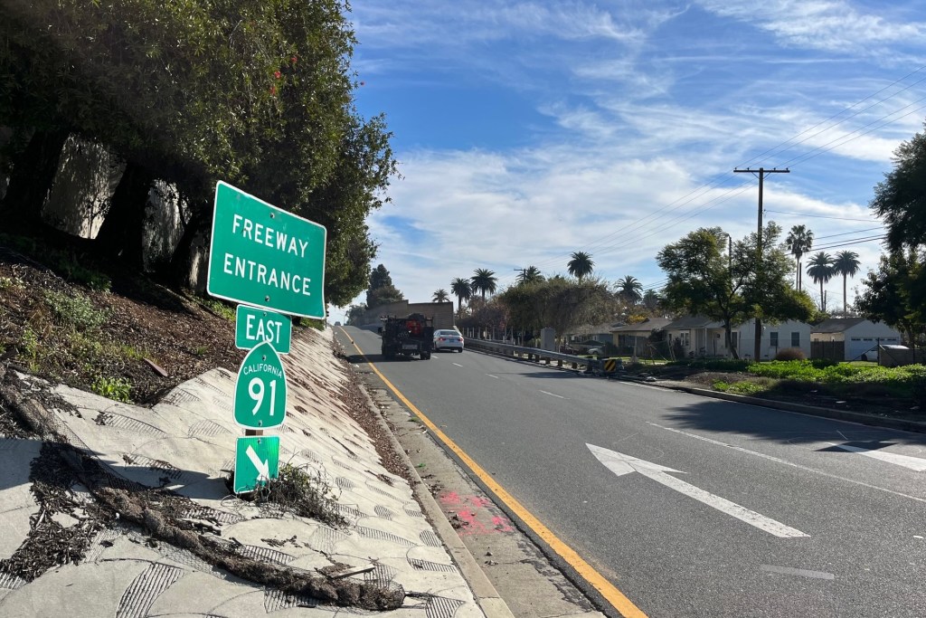
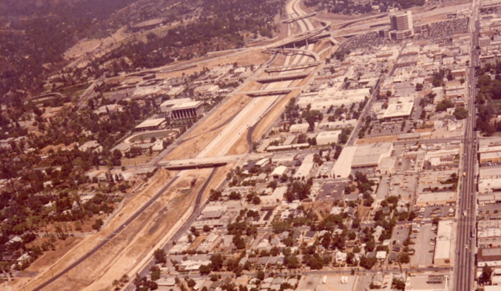
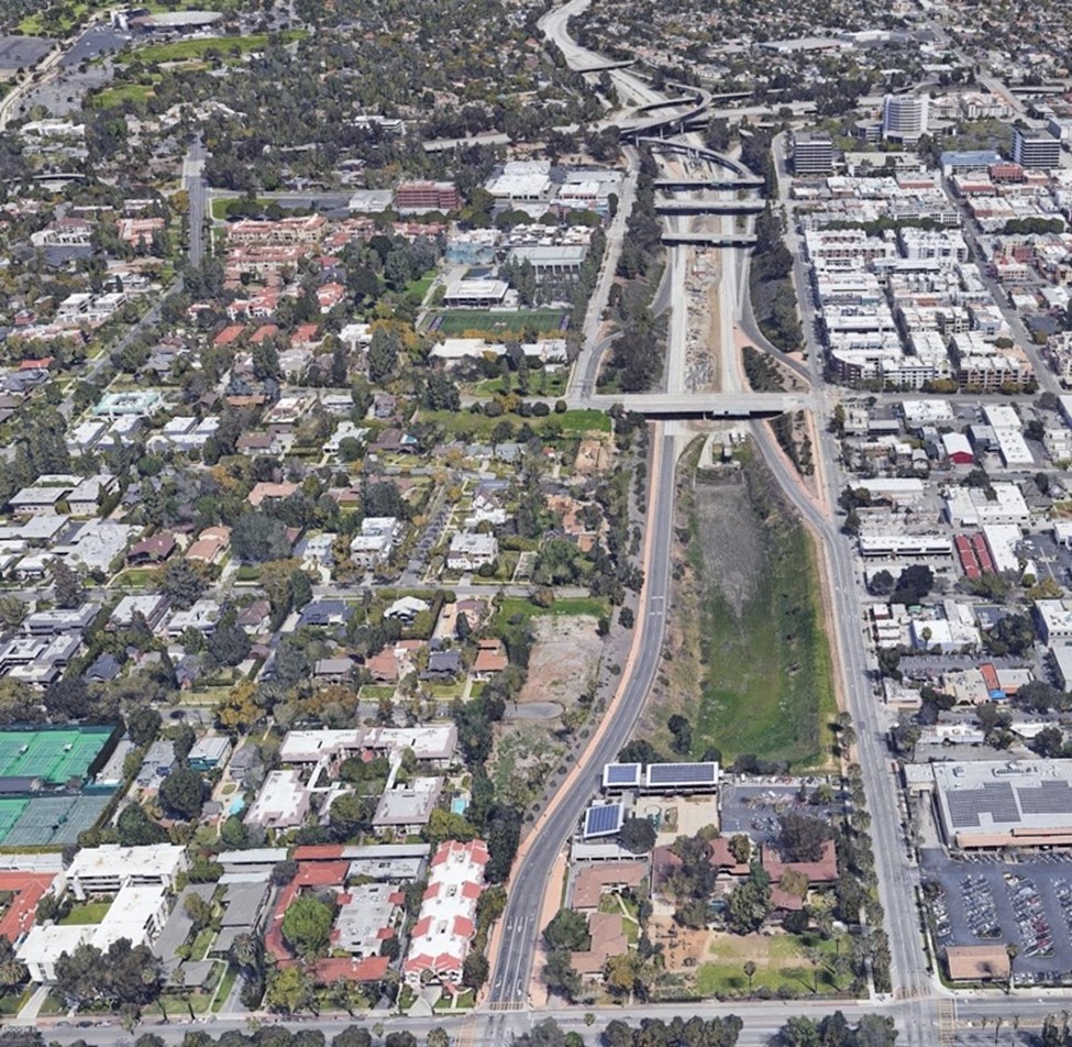
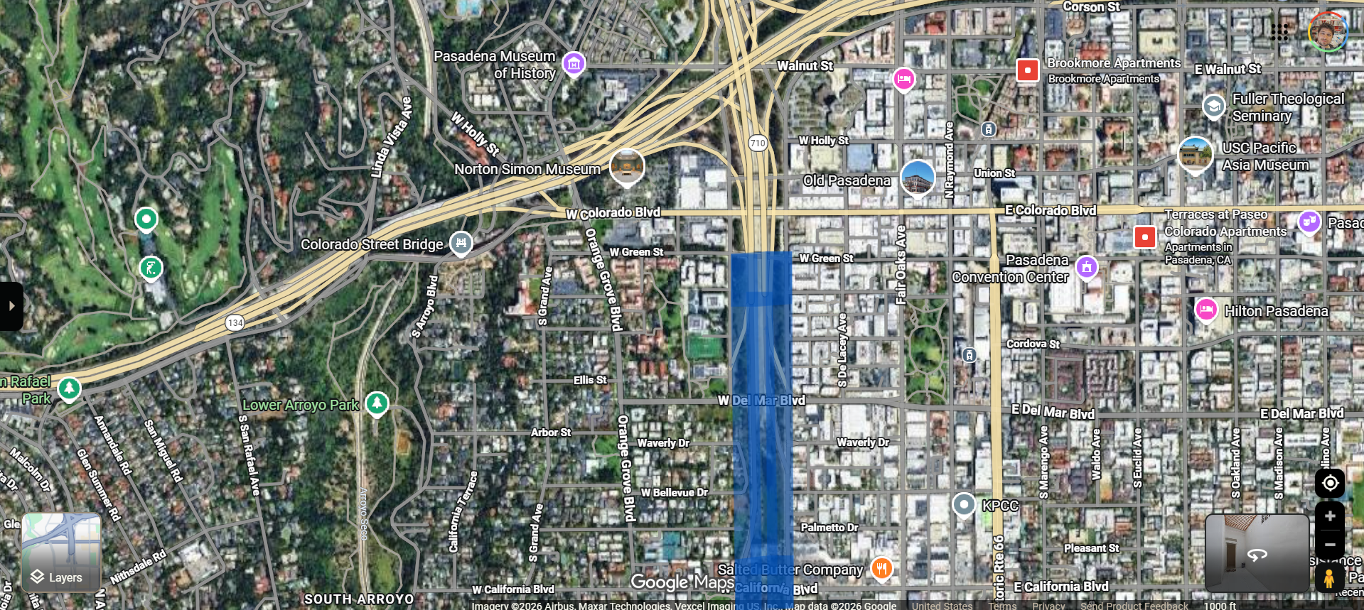
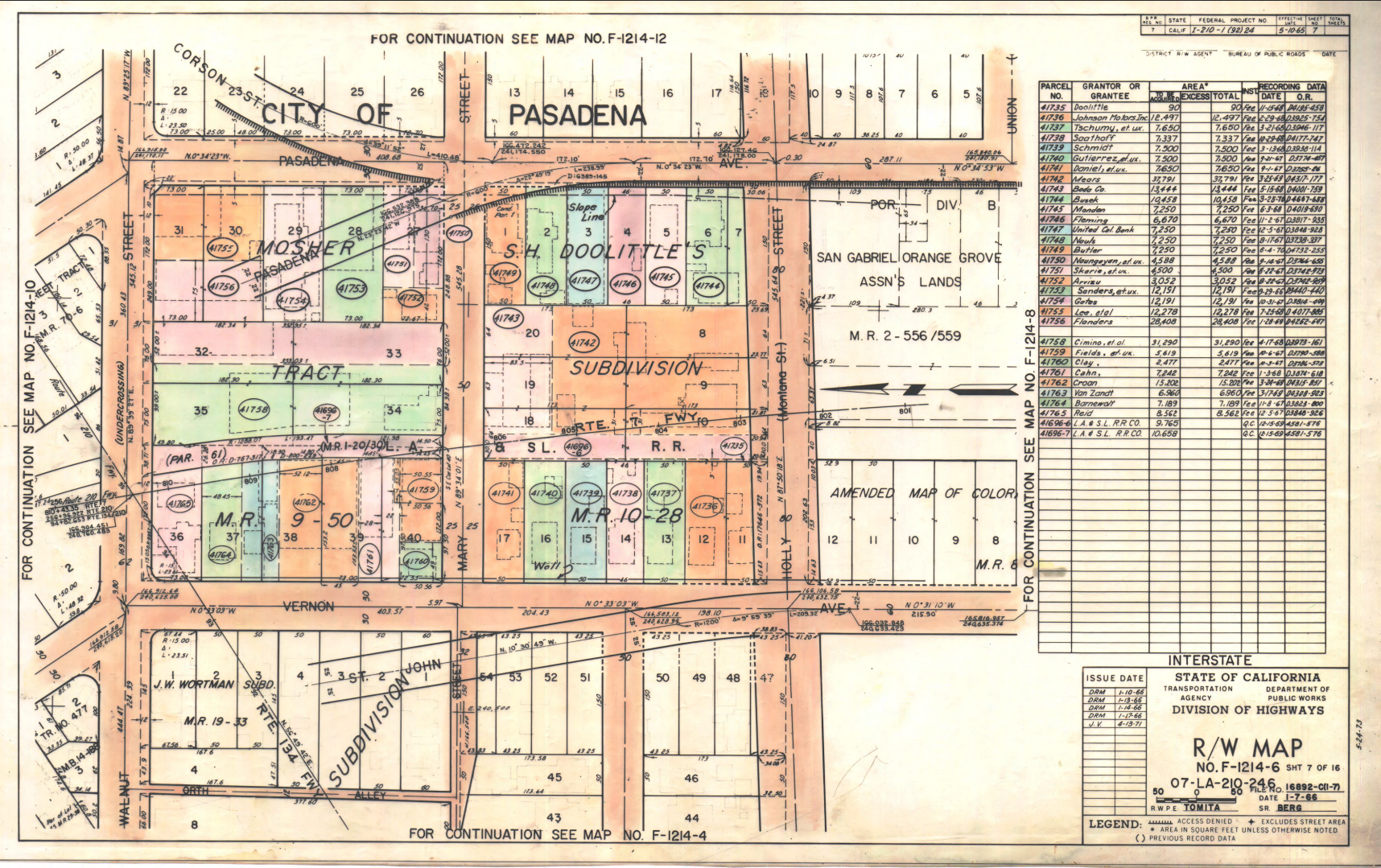
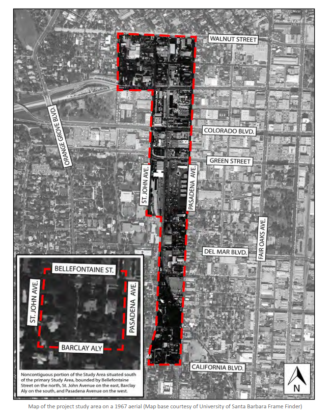
In 1964, the California Highway Commission decided that the then unfinished 710 would conclude its alignment in El Sereno, South Pasadena, and Pasadena. An interchange to the 210 Freeway was built in the early 1970s. A dirt trench was left open immediately to the south of this, to accommodate later connection. This is known as “the Stub.”
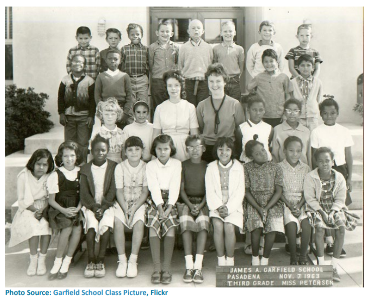
Like many freeway projects of the time, its construction displaced hundreds of working class people of color through eminent domain and other means of property acquisition.
In 1999, construction on the 710 was halted by community opposition. The project was defunded in 2017 when Metro rejected a plan by Caltrans to finish the freeway as a tunnel. The corridor was relinquished to the city in 2022.
Human Impact
The nearly three hour workshop began with a presentation from an oral history documentary about the communities displaced by the freeway. Assistant City Manager Brenda Harvey Williams shared an excerpt of Amplify by Allegra Consulting. It was commissioned by the city at the request of the Reconnecting Communities 710 Advisory Group.
The clip featured a roundtable discussion with descendants of Black families who lived on the now gone Vernon Avenue, like Barbara J. Richardson.
“We had a wonderful neighborhood where we walked to conveniences, we walked to churches, we walked to stores, we felt safe, and we knew each other,” Richardson said. “And after the 710 came, I can remember my grandfather – he had to go back – and he sat there in his car and cried like a baby when they tore his house down.”
“This was the most segregated city in probably all of Southern California, definitely the most segregated city in the San Gabriel Valley,” Robert Grant III added, saying that the freeways played an instrumental role in that.
“If you look at how they engineered it, it was only to go through the black and poor neighborhoods. When they got over here to the top of the Arroyo Seco, they hung a hard right to make sure that this new development was coming just in the Black neighborhoods, because if you look at the natural direction of where the 210 should have continued, it should have gone right through the middle of Pasadena – white Pasadena – the Pasadena that Black folk before 1955 couldn’t even walk over into,” Grant told interviewers.
The Plan
Now, the vision for the 50-acre/10 block area is to reintegrate it so that anyone can “walk over,” on its 17 acres of existing roadways and bridges (with perhaps a few more in the works).
The guiding principle, according to city documents, is to serve multimodal local traffic, rather than regional “through traffic” to and from the 210 and 110 (via the 710 Stub’s on- and off-ramps).
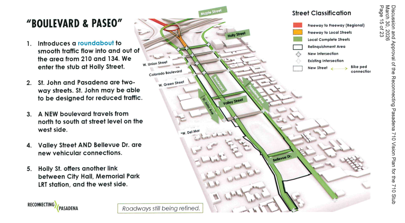
Two very basic concepts have been proposed for remaking the Stub’s roads: “Gardens & Terraces” and “Boulevards & Paseos.”
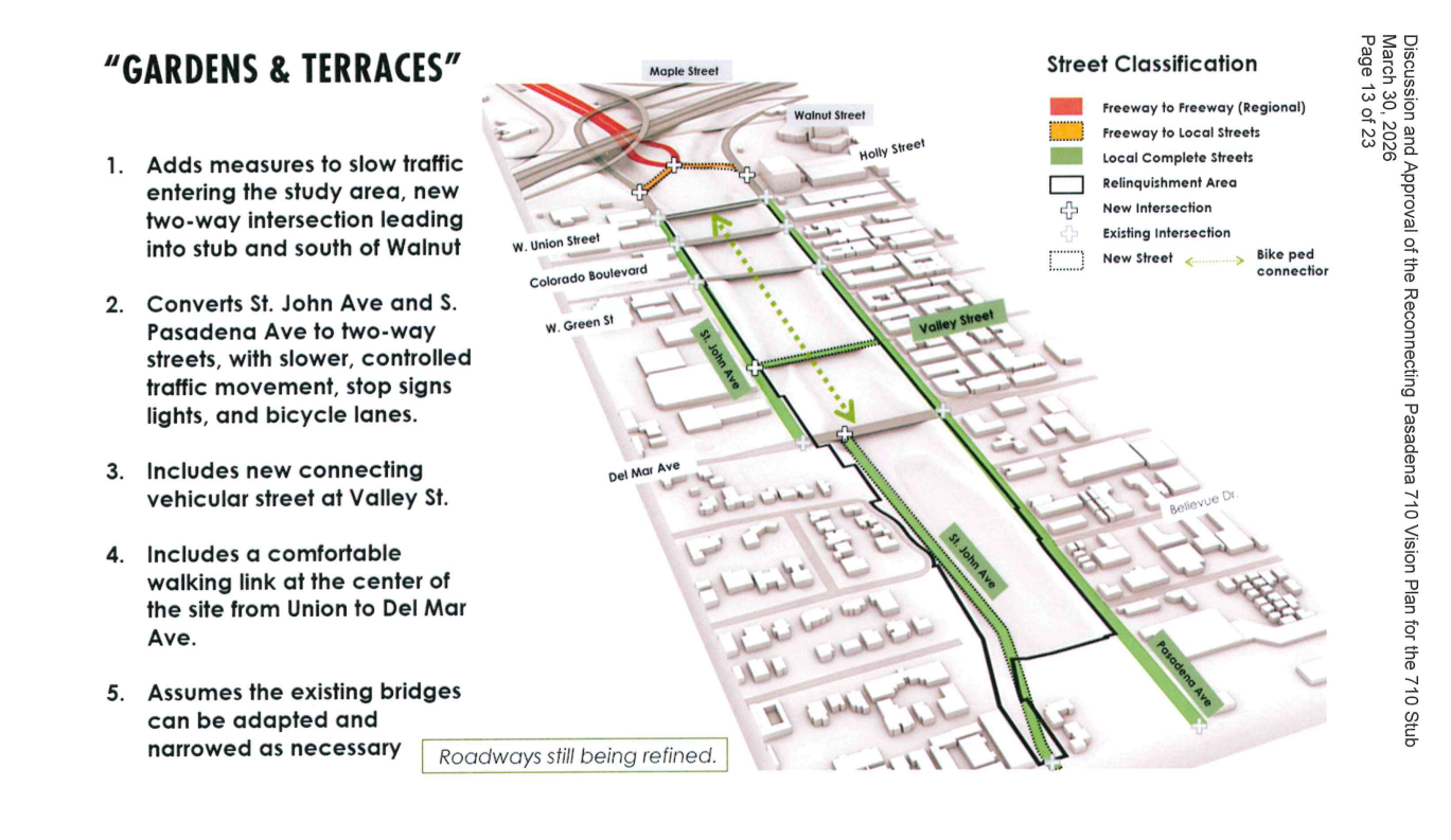
“Gardens & Terraces” would slow traffic entering the area from the 210 with a stop light, and convert St. John Avenue and Pasadena Avenue into two-way streets to handle north-south traffic. The existing bridges (previously Caltrans assets) would be maintained as they are, and a proposed walk-bike path would run below them in the middle of the Stub.
“Boulevards & Paseos” would be more development intensive. Freeway traffic would be slowed by a roundabout at the north end of the site, and this would connect to a new Boulevard running north-south. Bridges would likely be affected. This option would also convert St. John and Pasadena to two-way streets, but with the intention of carrying less vehicle traffic on them.
Both the 710 Advisory Group and the design consultants, Perkins-Eastman, stated that “Boulevards & Paseos” is their preferred concept for traffic circulation.
The plan also calls for at least 1800 residential units, open green space including a linear park on the western boundary and another park (likely at the southern boundary), and a restorative justice element to make restitution payments of $150,000 to those harmed.
Though no mechanism exists yet for remuneration, the 710 Advisory Group’s Tina Williams said that all restorative justice elements are required parts of the plan. The 710 Advisory Group’s Wayne Brandt said that development should favor housing first, with 30 percent of homes built being made affordable.
The Response
Public commenters mentioned the plan’s restorative justice elements several times. Pasadena Church’s Pastor Kerwin Manning leaned pretty hard on the council to see these through.
“As a gatekeeper of our beloved Pasadena, my principal request is that you use this moment in time to make amends by doing what’s right by the families and descendants of those who were disregarded and overlooked in the initial project,” Manning asked. “I’m confident that you will show other communities and cities what it looks like to turn our historic scars into auspicious stars.”
Others were concerned with what hasn’t been discussed in detail yet: traffic studies and housing density. Wes Hampton, a member of several local advocacy groups, mentioned both.
“We’d love to see what you’ve got so far in terms of your traffic simulation study,” Hampton said, suggesting Caltrans could provide it for free. He continued, “we want two things to start off with. We want cameras for speeding citations, and cameras for noise violations.”
Such a study is probably premature without detailed street designs finished, and unsettled zoning and future development.
He added a thought on housing in his last few seconds at the lectern. “As we continue to increase the density, we continue to lose the beauty of Pasadena,” Hampton claimed.
More speakers circled around housing, with some asking for artist live-work lofts, ownership interest for the displaced, and perhaps conversely, more public space.
Next Steps
The second workshop will take place on Monday April 13, 2026 at 6 p.m. From there, the city council will vote on how to proceed with the plan, with conversations on traffic, construction phasing, density, and restorative justice to continue.
Streetsblog’s San Gabriel Valley coverage is supported by Foothill Transit, offering car-free travel throughout the San Gabriel Valley with connections to the A Line Stations across the Foothills and Commuter Express lines traveling into the heart of downtown L.A. To plan your trip, visit Foothill Transit. “Foothill Transit. Going Good Places.”Sign-up for our SGV Connect Newsletter, coming to your inbox on Fridays!

Streetsblog has migrated to a new comment system. New commenters can register directly in the comments section of any article. Returning commenters: your previous comments and display name have been preserved, but you'll need to reclaim your account by clicking "Forgot your password?" on the sign-in form, entering your email, and following the verification link to set a new password — this is required because passwords could not be carried over during the migration. For questions, contact tips@streetsblog.org.