Some Questions About Metro’s Proposed North Hollywood Station Development
I really do want to be supportive of Metro’s plans to redevelop its North Hollywood Station park-and-ride lots.
The massive parking crater there today has more than 1,100 surface parking spaces. Converting that space into any kind of transit-oriented development has to be a step in the right direction. But I do have questions and concerns at this point.
Metro recently posted a new overview presentation on NoHo Station joint development plans. There is also a slick NoHo’s Next Act website from the developer Trammell Crow Company. Urbanize has a good summary of the latest “District NoHo” proposal.
Here are some basic aspects of the proposal:
- 1527 units of new housing, 311 of them (20 percent) affordable
- 105,000 square feet of retail space and up to 580,000 square feet of office space
- The existing bus plaza would be relocated to the west side of Lankershim Boulevard
What’s up with so much parking??
For many years, Metro has been flirting with large-scale redevelopment at NoHo. Back in 2015, Metro professed its desire for joint development at the site, while noting that the agency was saddling any development there with a massive parking expansion – from 1,151 spaces to 2,000 spaces. That parking expansion would have been a $45+million concession from any developer. And that’s just the parking for Metro riders – not all the parking at the site.
It has been a while since I wrote about the equity and environmental consequences of Metro park-and-ride. Here are a few points/links:
- A very small percentage of transit riders use park-and-ride. Overall more than eighty percent of Metro bus/rail riders arrive by walking; less than four percent drive. Even specifically for rail riders, only about fifteen percent drive. Metro has spent hundreds of millions on parking to support very little ridership.
- Park-and-Ride is bad for equity. Per Metro surveys, 41 percent of Metro rail riders are in poverty, but only one percent of Metro rail park-and-ride users are.
- Park-and-Ride is bad for the environment. Plentiful car parking encourages riders to drive the first/last mile instead of busing, biking, or walking. This car trip negates much of the environmental benefits of the transit trip.
The current proposal for District NoHo includes 3,313 car parking spaces. 750 of those are reserved for Metro park-and-ride. It is a step in the right direction that Metro ratcheted down its 2015 requirement for 2,000 spaces to just 750 spaces. Whew. But more than 3,000 spaces overall still feels to me excessive for transit-oriented development.
I get that this is the San Fernando Valley, and there needs to be some parking. But this is also the most transit-rich place in the Valley. North Hollywood is where it is because this is where rail historically dropped you off in the Valley. If you can’t prioritize people on transit and on foot there, you’re not doing it right.
How about aiming for something more like one parking space per unit: about 1500 spaces?
One of the minimum steps toward right-sizing the parking would be to de-couple parking from the housing, which would make the development much more affordable for no-car and one-car households.
Then spend the 50+million capital dollars thus saved on an ambitious program to make it really easy for residents of the new housing to use other modes (called transportation demand management – TDM.) Everyone gets a transit pass, a bike-share pass, and bike-share gets expanded. (Yes – I know that taking the parking space away from the housing makes the housing worth a bit less… but it also saves the developer a lot of money. There’s a sweet profitable spot in there somewhere well below 3,000 spaces. There probably needs to be some retail parking, too – but that can be minimized as well, via TDM for workers and even patrons.)
Perhaps Metro could show some leadership on this – based on the agency’s commit to equity and the environment, maybe? How about reducing park-and-ride even further? 750 parking-structure spaces will effectively cost Metro tens of millions of dollars, which will never be recouped in parking fees – hence Metro is subsiding relatively well-off riders at the expense of low-income ones. Metro is betting on people driving, instead of taking its own buses. How about between 100 and 200 park-and-ride spaces? Or less? The money saved could instead go a long way toward capital expenses supporting transit, first-last mile, and bike-share.
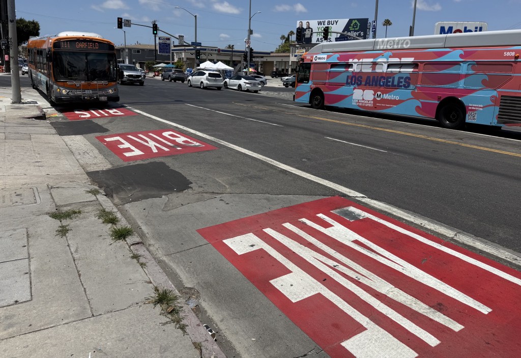
What’s up with bikeways?
Alarm bells went off for me when Metro released a fourteen-page overview that failed to mention or show any bikeways. The presentation does show a proposed “shared street” where drivers are supposed to be nice to people on foot and bikes – and it mentions bike-share and a bike hub (location not included). But where would people actually ride bikes in the area?
The NoHo site sits on the one great bikeway that actually goes across the whole San Fernando Valley: the Burbank-Chandler / Orange Line paths running on a rare former rail right-of-way. This is where my daughter and I often go to bike. Why was bike circulation not a top priority – as high as, say, all that parking?
I tweeted out my concern. City Councilmember and Metro boardmember Paul Krekorian (yes – the guy who killed the Lankershim protected bike lane project that would have made it safer and easier for people to get to NoHo Station) responded that “a continuous Chandler bicycle backbone has been one of my biggest active transportation priorities” and touted how he got funding for that bikeway back in 2015.
Streetsblog inquired to Metro, and they responded that the bikeway stuff for District NoHo isn’t actually part of District NoHo. No, it’s part of the city Transportation Department’s (LADOT) Chandler Bicycle Connection. Remember that long-stalled project – funded back in 2015 – that was supposed to add protection to the unprotected parts of the Chandler bike lanes, but the city couldn’t remove any parking so they’re now instead planning a precarious left-side median bike lane that nobody really wants? Yep – that project. (And, I don’t know how to say this respectfully, but, Honorable Councilmember Krekorian, if that flawed bikeway – which has languished since 2015 – is one of your biggest active transportation priorities, then you’re failing the active transportation stuff. Your transportation priorities for that corridor are not “active” – they are pretty clearly car parking and car throughput.)
LADOT’s latest Chandler Bicycle Connection presentation shows the planned bikeway circulation at NoHo Station.
The bike circulation isn’t as bad as I feared. It’s not entirely absent from the project, like it was from the Metro presentation. It’s not great though, and it’s a step down from what’s on the ground today.
Currently cyclists – including me and my daughter – heading from NoHo Station toward Burbank utilize the existing bus plaza sidewalk (which is going away) to get to Metro’s bike path (which is going away) that runs along the north side of Chandler Boulevard between Fair Avenue and Vineland Avenue.
LADOT expects eastbound bicyclists to go out of their way to cross four to five lanes of traffic on Chandler, then to make an uncomfortable left turn onto Vineland (where lots of drivers are turning right) to get to the Burbank-Chandler path. Cyclists will likely choose to salmon-ride against traffic in the westbound bike lane (or on the sidewalk), because that will be more direct and faster. (Similarly ridiculous circulation is shown on North Chandler west of Lankershim. LADOT somehow expects cyclists to cross to the north side of Chandler at the station, then cross Chandler again in 500 feet to go to a median bikeway on the south side of Chandler. Overall the bikeway plans seem to assume that no bicyclists will arrive by train – which is how I get there.)
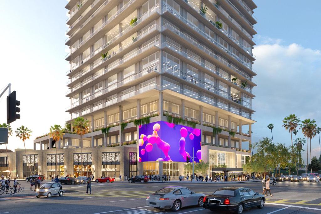
But, hey, today’s well-used bike path is being removed to make way for important things, right?
Affordable housing? A promenade? Community-serving retail?
Nope. According to the rendering (above – detail on the right) that bike path will soon make way for a multi-story parking structure. It looks like three above-ground stories.
Why wasn’t this path, a big active transportation priority, part of Metro’s site requirements? It sure looks like bike circulation was a non-priority – an afterthought – something to be half-assedly shoehorned in after cars took up lots of space.
(And, frankly, this is how Metro treats stations, bikeways, and transit-oriented development. With no public notice or input, Metro yanked an approved bikeway from its Rosa Parks Station revamp, while allowing drivers to speed through the middle of the station complex. The Expo Line bike path has an awful, dangerous gap at Culver City Station where cyclists are dumped out to onto busy streets just before they reach the station. It becomes a self-fulfilling prophecy: “Nobody bikes to these stations anyway” because Metro makes them inhospitable to bicycling.)
The Chandler Bicycle Connection plans do include a bike lane along Chandler Boulevard. For about 300 feet. One way, northbound. Really.
Lankershim Boulevard is eighty feet wide, and about to become home to “an inspired urban village,” but somehow there isn’t enough space for cyclists to ride southbound along it. Apparently, LADOT and Krekorian don’t expect any southbound riders on this stretch of Lankershim – or just don’t think that the existing cyclists there deserve to be safe.
What can be done for North Hollywood at this point?
The project really should be re-worked to include a continuous bike path from Vineland to at least Tujunga Avenue. Ideally the path would bridge over Lankershim and Vineland. That continuous path was shown in renderings circulated in 2016. If Metro and Krekorian are serious about passing a habitable climate along to the next generation, this feature should be put back in.
Given that Metro and Krekorian aren’t all that serious about the habitable climate thing, there are some half-measures that could make bike circulation tolerable. These won’t cost all that much – especially in comparison to all those parking spaces.
Start with these modest upgrades:
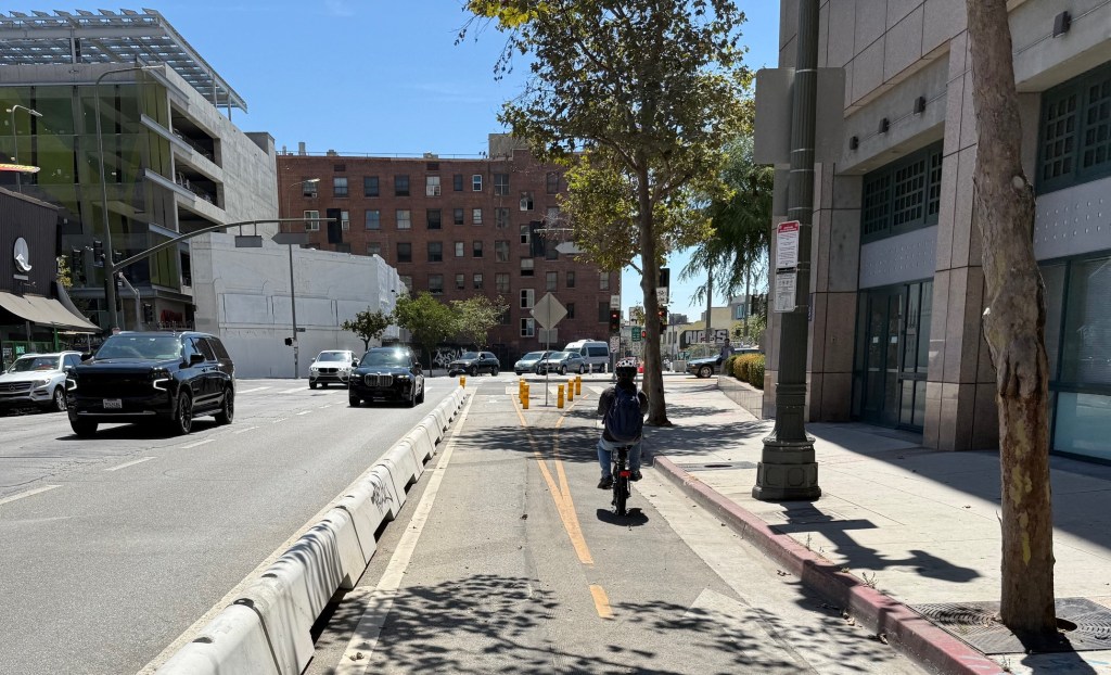
- On the north side of Chandler Boulevard, there should be a two-way protected bikeway. At a minimum the two-way protected bikeway should go from Fair to Vineland (though probably better to extend it to Lankershim, or further to Tujunga Avenue.) This would allow cyclists to travel to and from the Burbank-Chandler path easily, directly, and safely. The existing eastbound bike lane (on the south side of Chandler Blvd.) should be preserved, ideally upgraded to protected, too. The configuration could be somewhat like much of Ocean Avenue in Santa Monica. This probably would require removing some on-street parking – on the north side of Chandler Blvd. – but if the plan is to add 3,313 off-street spaces there, a couple dozen on-street spaces may not be essential.
- Add a two-way protected bikeway on Fair Avenue between Chandler Blvd. and the planned “shared street” through District NoHo.
- If the left-side median Chandler Blvd. bikeway proceeds, then expect cyclists disembarking from the NoHo station to ride on the left side of North Chandler between Lankershim and Tujunga. This could take the form of a two-way protected bikeway alongside the station there.
- Add a southbound bikeway on Lankershim from North Chandler to South Chandler – if only to keep southbound cyclists from clogging up the narrow one-way northbound bikeway there. A protected bikeway there – with bus boarding island – would be great. A one-block bus-only lane, with those “bikes OK” signs would do the trick, too.
- I know that Krekorian canceled the Lankershim bikeway, but it may be possible to do the first/last blocks of it – without removing any through travel lanes or parking. On Lankershim, between Weddington Street and Chandler (or, ideally, between Magnolia Boulevard and Chandler) there is a an extra northbound lane that functions as a really long right turn pocket. That short stretch should be converted to a two way protected bikeway, too.
What’s wrong with lots of people walking??
The Metro presentation (that one that doesn’t have bikeways) has a ridiculous slide focused on “Pedestrian Activity Modeling” as if somehow lots of people walking would be less than optimal for North Hollywood’s new urban village. Really.
It’s as if some consultant traffic engineer misses their level of service (LOS) calculations so much that they decided to incorrectly apply the same (already dubious for cars) logic to walking. But walking doesn’t work that way. Great places for walking – think Florence or New York City or Santa Monica’s promenade – are great because lots of people walk there. People like to walk where other people are walking. It is decidedly not a benefit to spread pedestrians out more thinly the way LOS does (badly) for cars. What every “inspired urban village” needs is lots of pedestrians. What most of L.A. needs is more pedestrian congestion.
It’s not that pedestrians shouldn’t be allotted more space (like the proposed District NoHo does for cars and parking) but the notion that it’s a benefit to spread them out is fundamentally anti-urban.
My advice: fire any consultant who doesn’t welcome lots of people walking.
What’s up with affordable housing??
The current proposal is for 311 affordable units out of 1527 total housing units. That’s 20.4 percent.
As of 2014 – well before this project was planned – Metro’s overall target was that thirty percent of all its joint development housing would be affordable. That was the target before the housing crisis really blew up. If Metro wants people who actually ride transit to live in places where transit is plentiful, then this NoHo development should meet or exceed Metro’s stated thirty percent affordable housing. Metro has recently updated this policy – theoretically to encourage even more affordable housing – setting the minimum affordable at 25 percent.
So 20 percent is just too low for NoHo.
The affordability levels interact with all that parking. So much parking drives up the unit cost. More affordable units would mean less need for parking.

Read More:
Streetsblog has migrated to a new comment system. New commenters can register directly in the comments section of any article. Returning commenters: your previous comments and display name have been preserved, but you'll need to reclaim your account by clicking "Forgot your password?" on the sign-in form, entering your email, and following the verification link to set a new password — this is required because passwords could not be carried over during the migration. For questions, contact tips@streetsblog.org.