Two New CicLAvia Routes Announced For October and December 2014
Earlier this week, CicLAvia released new route maps for the final two CicLAvia events coming up in 2014.
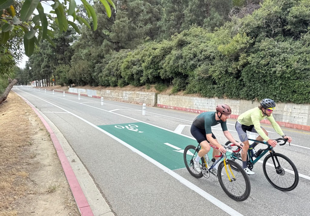
Just in case readers are unfamiliar with CicLAvia, it is a free open streets event that takes place a few times each year. Streets are closed to car traffic, and open for walking, bicycling, skating, and wheelchairs. Past events have drawn more than 100,000 participants. Watch this Streetfilm to get an idea for just how fun and how inclusive these events can be.
Here is a quick overview of the upcoming routes.

The Sunday, October 5, 2014, CicLAvia is called “Heart of Los Angeles.”
Though it is similarly anchored in Downtown Los Angeles, the October 2014 route will be quite a bit different from past Heart of L.A. events. The new route does not include some past highlights: Hollenbeck Park, Spring Street, 7th Street, or MacArthur Park.
There are lots of great new highlights not seen on CicLAvia before:
- Echo Park – newly refurbished and reopened
- Second Street Tunnel – arguably an L.A. bike culture landmark: featured on frequent midnight rides, site of Wolfpack Hustle’s Drag Races, and the city’s first more-or-less protected bike lanes
- Second Street through Little Tokyo – past routes included First Street there
- Broadway – featuring some of the L.A.’s very best historic architecture
- Cesar Chavez Avenue – one of the main commercial corridors through Boyle Heights and into Unincorporated East L.A.
- Evergreen Cemetery – one of L.A.’s great old graveyards, surrounded by an innovative rubber-sidewalk jogging path
- East L.A. Civic Center – including its handsome park with large lake feature
This will be the first CicLAvia to extend east into unincorporated L.A. County territory. The route remains very accessible from the Metro Red, Purple, and Gold Lines and a very short walk or ride from Union Station and Metro’s Expo and Blue Lines.
Though Metro has supported past CicLAvias, this will be the first event funded though Metro’s new open streets program.
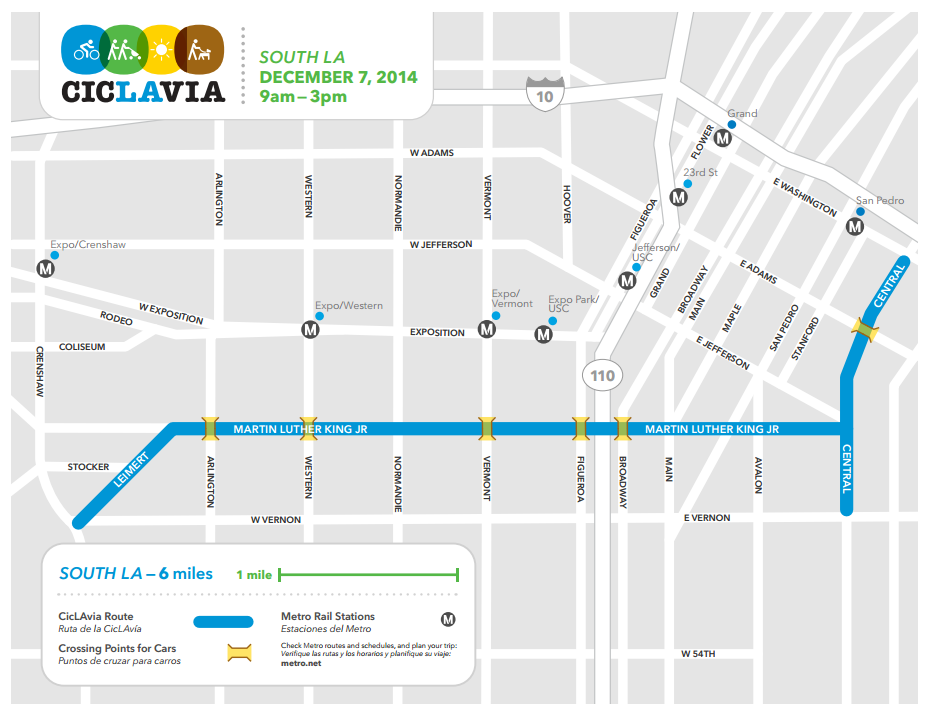
The Sunday, December 7, 2014, CicLAvia is called simply “South Los Angeles.”
Though some CicLAvia routes have made connections into the northern portions of South L.A., this will be first route entirely in South Los Angeles. The route announced earlier this week is still somewhat in flux; it had included a short stretch of Crenshaw Boulevard, but will now include Leimert Boulevard instead.
The route spans a number of sites that are culturally and historically significant:
- Leimert Park – one of the most important hubs for African-American culture, both historically and today
- Exposition Park – very large park, home to the Natural History Museum, African American Museum, Science Center, the Coliseum, and more.
- Central Avenue – the heart of L.A.’s jazz music scene for much of the 20th Century
The route is entirely inside the city of Los Angeles. It mostly parallels the Metro Expo Line, with easy access from stations from Crenshaw to Exposition Park. The east end of the route, on Central Avenue, is easy to access from the Metro Blue Line San Pedro or Washington Stations.

Streetsblog has migrated to a new comment system. New commenters can register directly in the comments section of any article. Returning commenters: your previous comments and display name have been preserved, but you'll need to reclaim your account by clicking "Forgot your password?" on the sign-in form, entering your email, and following the verification link to set a new password — this is required because passwords could not be carried over during the migration. For questions, contact tips@streetsblog.org.